Mouse Mat > Europe > United Kingdom > England > South Yorkshire > Sheffield
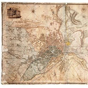
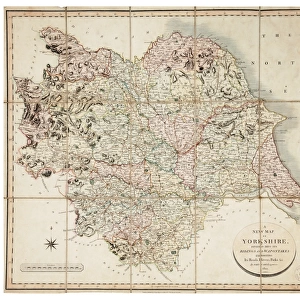
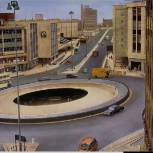
Mouse Mat : South Yorkshire Coalfield, c. 1925


![]()
Home Decor from Sheffield City Archives
South Yorkshire Coalfield, c. 1925
Scale 2 inches : 1 mile.Size 40 x 33 cm.Original at Local Studies E49S
Sheffield City Archives and Local Studies Library has an unrivalled collection of images of Sheffield, England
Media ID 14047828
© Sheffield City Council
Mouse Pad
Bring some life into your office, or create a heartfelt gift, with a personalised deluxe Mouse Mat. Made of high-density black foam with a tough, stain-resistant inter-woven cloth cover they will brighten up any home or corporate office.
Archive quality photographic print in a durable wipe clean mouse mat with non slip backing. Works with all computer mice
Estimated Product Size is 24.2cm x 19.7cm (9.5" x 7.8")
These are individually made so all sizes are approximate
Artwork printed orientated as per the preview above, with landscape (horizontal) or portrait (vertical) orientation to match the source image.
FEATURES IN THESE COLLECTIONS
> Europe
> United Kingdom
> England
> South Yorkshire
> Related Images
> Europe
> United Kingdom
> England
> South Yorkshire
> Sheffield
> Europe
> United Kingdom
> England
> Yorkshire
> Related Images
> Europe
> United Kingdom
> England
> Yorkshire
> Sheffield
> Maps and Charts
> Related Images
> Sheffield City Archives
> Maps and Plans
EDITORS COMMENTS
This print from the Sheffield City Archives showcases the South Yorkshire Coalfield circa 1925, offering a glimpse into the rich history of coal mining in the region. The scale of 2 inches to 1 mile allows for intricate details to be captured, providing an accurate representation of this vast industrial landscape. Measuring at 40 x 33 cm, this print is a testament to the meticulous work put into documenting and preserving our heritage. The image portrays a sprawling network of collieries that once dotted the South Yorkshire countryside, serving as pillars of industry and sources of livelihood for countless communities. Each dot on the map represents a thriving coal mine that fueled not only local economies but also played a significant role in powering Britain's industrial revolution. As we examine this historical artifact, it becomes evident that every inch tells a story - stories of hardworking miners who toiled underground day after day, extracting black gold from beneath their feet; stories of families whose lives were intricately intertwined with these mines; and stories that shed light on how coal shaped society during this era. While we cannot mention commercial use due to restrictions placed upon us by copyright laws, it is important to acknowledge that this print serves as more than just an archival record. It stands as a reminder of our collective past and prompts us to reflect upon how industries like coal mining have shaped our present-day world.
MADE IN AUSTRALIA
Safe Shipping with 30 Day Money Back Guarantee
FREE PERSONALISATION*
We are proud to offer a range of customisation features including Personalised Captions, Color Filters and Picture Zoom Tools
SECURE PAYMENTS
We happily accept a wide range of payment options so you can pay for the things you need in the way that is most convenient for you
* Options may vary by product and licensing agreement. Zoomed Pictures can be adjusted in the Cart.