Fraud Blocker Skip to main content

Home > North America > Cuba > Related Images

Related Images Collection (page 10)

6,214 items

Background imageRelated Images Collection: The capture of the Spanish ship Pomona by the British ships Anson and Arethusa

The capture of the Spanish ship Pomona by the British ships Anson and Arethusa, off the coast of Havana (Cuba)
MMM5480744 The capture of the Spanish ship Pomona by the British ships Anson and Arethusa, off the coast of Havana (Cuba), 23 August 1806; National Maritime Museum, London

Background imageRelated Images Collection: Geography: Map of Saint Kitts and Nevis Island in the West Indies

Geography: Map of Saint Kitts and Nevis Island in the West Indies. Map from an Atlas by Bryan Edwards (1743-1800)
VEN5031320 Geography: Map of Saint Kitts and Nevis Island in the West Indies. Map from an Atlas by Bryan Edwards (1743-1800) from 1791

Background imageRelated Images Collection: Geography: map showing the Gulf of Mexico, the Caribbean Islands, Central America (Mexico)

Geography: map showing the Gulf of Mexico, the Caribbean Islands, Central America (Mexico, Yucatan, Salvador, Honduras)
VEN5031242 Geography: map showing the Gulf of Mexico, the Caribbean Islands, Central America (Mexico, Yucatan, Salvador, Honduras, Nicaragua, Costarica) and northern South America (Venezuela)

Background imageRelated Images Collection: Geography Atlas: frontispiece of 'Atlantis contracti' (Atlas)

Geography Atlas: frontispiece of "Atlantis contracti" (Atlas) by geographer Johann Janssonius (or Jan Jansson)
VEN5031166 Geography Atlas: frontispiece of "Atlantis contracti" (Atlas) by geographer Johann Janssonius (or Jan Jansson) (1588-1664), 1666

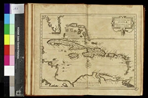
Background imageRelated Images Collection: Geography map: representation of the islands of the Greater Antilles (Cuba, Hispaniola)

Geography map: representation of the islands of the Greater Antilles (Cuba, Hispaniola)
VEN5030434 Geography map: representation of the islands of the Greater Antilles (Cuba, Hispaniola, Jamaica and Puerto Rico) and the Lesser Antilles in the Caribbean Sea

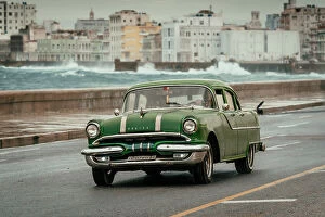
Background imageRelated Images Collection: Old Car, new Phone

Old Car, new Phone
Andy Bauer

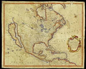
Background imageRelated Images Collection: Geography Atlas: representation of North America and the Caribbean Sea region, Caribbean (Cuba)

Geography Atlas: representation of North America and the Caribbean Sea region, Caribbean (Cuba, Jamaica, Hispaniola)
VEN5030056 Geography Atlas: representation of North America and the Caribbean Sea region, Caribbean (Cuba, Jamaica, Hispaniola, Jamaica). Map from an Atlas of 1785

Background imageRelated Images Collection: Geography Atlas: representation of South America and the Caribbean Sea region, Caribbean (Cuba)

Geography Atlas: representation of South America and the Caribbean Sea region, Caribbean (Cuba, Jamaica, Hispaniola)
VEN5030051 Geography Atlas: representation of South America and the Caribbean Sea region, Caribbean (Cuba, Jamaica, Hispaniola)

Background imageRelated Images Collection: Geography Atlas: representation of the island of Jamaica in the Caribbean archipelago

Geography Atlas: representation of the island of Jamaica in the Caribbean archipelago
VEN5029993 Geography Atlas: representation of the island of Jamaica in the Caribbean archipelago. Map taken from "The west indian atlas or general description of west indies" by Thomas

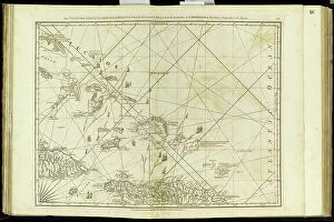
Background imageRelated Images Collection: Geography Atlas: representation of the Bahamas islands, northern Hispaniola (Santo Domingo)

Geography Atlas: representation of the Bahamas islands, northern Hispaniola (Santo Domingo)
VEN5029631 Geography Atlas: representation of the Bahamas islands, northern Hispaniola (Santo Domingo) and the Leewind Passage between Cuba and Hispaniola in the West Indies

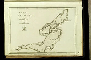
Background imageRelated Images Collection: Geography Atlas: representation of the Bequia or Becouya Islands in the North of the Grenadines in

Geography Atlas: representation of the Bequia or Becouya Islands in the North of the Grenadines in the Caribbean Sea
VEN5029628 Geography Atlas: representation of the Bequia or Becouya Islands in the North of the Grenadines in the Caribbean Sea

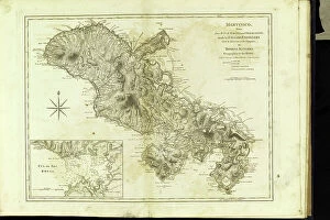
Background imageRelated Images Collection: Geography Atlas: representation of the island of Martinique in the West Indies

Geography Atlas: representation of the island of Martinique in the West Indies
VEN5029597 Geography Atlas: representation of the island of Martinique in the West Indies. Map taken from "The west indian atlas or general description of west indies" by Thomas Jefferys

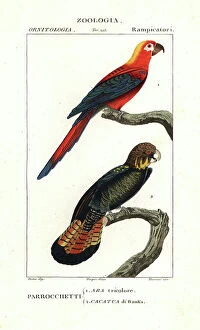
Background imageRelated Images Collection: Ara tricolore et cacatoes banksien - Lithography, illustration by Jean Gabriel Pretre (1780-1885)

Ara tricolore et cacatoes banksien - Lithography, illustration by Jean Gabriel Pretre (1780-1885)
FLO4611063 Ara tricolore et cacatoes banksien - Lithography, illustration by Jean Gabriel Pretre (1780-1885) edited by Pierre Jean Francois Turpin (1775-1840)

Background imageRelated Images Collection: ALBARRAN Y DOMINGEZ, Joaquin (1860 - 1912). Spanish urologist born in Cuba. (engraving)

ALBARRAN Y DOMINGEZ, Joaquin (1860 - 1912). Spanish urologist born in Cuba. (engraving)
CUL4940061 ALBARRAN Y DOMINGEZ, Joaquin (1860 - 1912). Spanish urologist born in Cuba. (engraving) by Unknown Artist; (add.info.: ALBARRAN Y DOMINGEZ, Joaquin (1860 - 1912)

Background imageRelated Images Collection: American warship 'Maine', just before leaving for Cuba during the Spanish-American War or Cuban

American warship "Maine", just before leaving for Cuba during the Spanish-American War or Cuban Independence
NWI4835209 American warship "Maine", just before leaving for Cuba during the Spanish-American War or Cuban Independence War (1868-1898) between Spain and North America, 1898

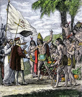
Background imageRelated Images Collection: Christopher Columbus (1451-1506) received by the Indians. Engraving

Christopher Columbus (1451-1506) received by the Indians. Engraving. Cuban natives greet landing party; chief addresses
NWI4900759 Christopher Columbus (1451-1506) received by the Indians. Engraving. Cuban natives greet landing party; chief addresses Columbus on the immortality of the soul.; (add.info)

Background imageRelated Images Collection: Geographic map of North America (United States, Canada) and Central America (Mexico, Caribbean)

Geographic map of North America (United States, Canada) and Central America (Mexico, Caribbean, Cuba)
ELD4924647 Geographic map of North America (United States, Canada) and Central America (Mexico, Caribbean, Cuba, Guatemala) in 1849 (Map of North america and central america in 1849)

Background imageRelated Images Collection: View of Havana (Cuba). Lithography for the book: ' Galerie complete en tableaux fideles des

View of Havana (Cuba). Lithography for the book: " Galerie complete en tableaux fideles des peuples d'Amerique
FLO4635975 View of Havana (Cuba). Lithography for the book: " Galerie complete en tableaux fideles des peuples d'Amerique et d'Australie" by Friedrich Wilhelm Goedsche (1785-1863)

Background imageRelated Images Collection: Desmarest's hutia or Cuban hutia, Capromys pilorides (Capromys furnieri)

Desmarest's hutia or Cuban hutia, Capromys pilorides (Capromys furnieri)
FLO4660147 Desmarest's hutia or Cuban hutia, Capromys pilorides (Capromys furnieri). Handcoloured copperplate engraving from Rene Primevere Lesson's Complements de Buffon, Pourrat Freres, Paris

Background imageRelated Images Collection: Map of the Caribbean Sea with the island of Cuba, Jamaica, Haiti

Map of the Caribbean Sea with the island of Cuba, Jamaica, Haiti, Central America (detail of the Panama Canal)
1761635 Map of the Caribbean Sea with the island of Cuba, Jamaica, Haiti, Central America (detail of the Panama Canal) and North South America

Background imageRelated Images Collection: The capture of Havana, 1762 (line engraving)

The capture of Havana, 1762 (line engraving)
1579726 The capture of Havana, 1762 (line engraving); (add.info.: Line engraving of the capture of Havana. Admiral Pocock and Commodore Keppel with the first half of the transports making for Havana)

Background imageRelated Images Collection: The World's International and Cotton Centennial Exposition, 1884

The World's International and Cotton Centennial Exposition, 1884
1577309 The World's International and Cotton Centennial Exposition, 1884; (add.info.: The World's International and Cotton Centennial Exposition)

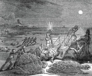
Background imageRelated Images Collection: Green (Edible) turtles - Chelonia mydas - and Loggerhead turtles captured on coast of Cuba as

Green (Edible) turtles - Chelonia mydas - and Loggerhead turtles captured on coast of Cuba as the females came ashore
530274 Green (Edible) turtles - Chelonia mydas - and Loggerhead turtles captured on coast of Cuba as the females came ashore to lay their eggs

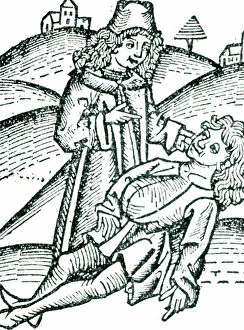
Background imageRelated Images Collection: Physician applying a Bezoar stone to a victim of poisoning. The stone was extracted from

Physician applying a Bezoar stone to a victim of poisoning. The stone was extracted from the gall-bladder or stomach of
527500 Physician applying a Bezoar stone to a victim of poisoning. The stone was extracted from the gall-bladder or stomach of an animal such as a goat or an antelope

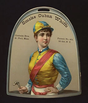
Background imageRelated Images Collection: Advertising card for Conhaim Bros Cuban Whiffs cigars, St Paul, Minnesota (chromolitho)

Advertising card for Conhaim Bros Cuban Whiffs cigars, St Paul, Minnesota (chromolitho)
8677795 Advertising card for Conhaim Bros Cuban Whiffs cigars, St Paul, Minnesota (chromolitho) by American School, (19th century); Private Collection; (add.info)

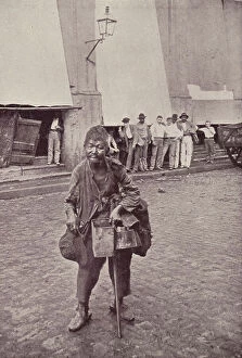
Background imageRelated Images Collection: A Cuban tramp (b/w photo)

A Cuban tramp (b/w photo)
8652907 A Cuban tramp (b/w photo) by American Photographer, (19th century); Private Collection; (add.info.: A Cuban tramp)

Background imageRelated Images Collection: The Havana milkman (b/w photo)

The Havana milkman (b/w photo)
8652903 The Havana milkman (b/w photo) by American Photographer, (19th century); Private Collection; (add.info.: The Havana milkman)

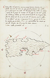
Background imageRelated Images Collection: Chrso, 1590 (Manuscript)

Chrso, 1590 (Manuscript)
7339637 Chrso, 1590 (Manuscript) by Antonio, Millo (16th century); 31x205 cm; National Maritime Museum, London, UK; (add.info.: Creator: Millo, Antonio Bound sheet. Ms. Additional Places: Cres)

Background imageRelated Images Collection: World map, 1508 (paper - printed/hand coloured, leather covered boards)

World map, 1508 (paper - printed/hand coloured, leather covered boards)
7339116 World map, 1508 (paper - printed/hand coloured, leather covered boards) by Rosselli, Francesco (1445-c.1513); 42x37 cm; National Maritime Museum, London

Background imageRelated Images Collection: Capron's battery in action at The Battle of Las Guasimas, Spanish-American War of 1898 publ

Capron's battery in action at The Battle of Las Guasimas, Spanish-American War of 1898 publ. 1900 (print)
2967888 Capron's battery in action at The Battle of Las Guasimas, Spanish-American War of 1898 publ. 1900 (print) by American School

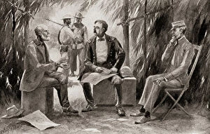
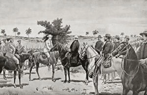
Background imageRelated Images Collection: Generals Garcia, Shafter and Admiral Sampson in Conference during the Spanish-American War of

Generals Garcia, Shafter and Admiral Sampson in Conference during the Spanish-American War of 1898, publ. 1900 (print)
2967883 Generals Garcia, Shafter and Admiral Sampson in Conference during the Spanish-American War of 1898, publ. 1900 (print) by American School

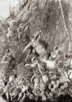
Background imageRelated Images Collection: The Rough Riders, members of 1st United States Volunteer Cavalry, at The Battle of Las Guasimas

The Rough Riders, members of 1st United States Volunteer Cavalry, at The Battle of Las Guasimas
2967887 The Rough Riders, members of 1st United States Volunteer Cavalry, at The Battle of Las Guasimas, The Spanish-American of 1898 War, publ

Background imageRelated Images Collection: A skirmish between United States and Spanish troops, during the Spanish-American war of 1898

A skirmish between United States and Spanish troops, during the Spanish-American war of 1898, publ. 1900 (print)
2967885 A skirmish between United States and Spanish troops, during the Spanish-American war of 1898, publ. 1900 (print) by American School

Background imageRelated Images Collection: The surrender of Santiago de Cuba by General Toral to General Shafter in 1898 during

The surrender of Santiago de Cuba by General Toral to General Shafter in 1898 during the Spanish-American war
492374 The surrender of Santiago de Cuba by General Toral to General Shafter in 1898 during the Spanish-American war. From Famous Men and Great Events of the 19th century. ; Private Collection

Background imageRelated Images Collection: Portrait of Jose Marti (1853-1895), Cuban poet and politician

Portrait of Jose Marti (1853-1895), Cuban poet and politician, in "My command in Cuba" by General Valeriano
AIS5372618 Portrait of Jose Marti (1853-1895), Cuban poet and politician, in "My command in Cuba" by General Valeriano Weiler y Nicolau (1838-1930) (engraving); Academia General Militar

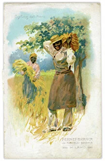
Background imageRelated Images Collection: Anthropology: costume of workers from a banana and wheat crop Havana (Cuba)

Anthropology: costume of workers from a banana and wheat crop Havana (Cuba)
FGL5475250 Anthropology: costume of workers from a banana and wheat crop Havana (Cuba). Chromolithography taken from an atlas around 1905.; Fototeca Gilardi

Background imageRelated Images Collection: The surrender of the city of Santiago de Cuba on July 17, 1898, after the Siege of Santiago

The surrender of the city of Santiago de Cuba on July 17, 1898, after the Siege of Santiago
UIG5419662 The surrender of the city of Santiago de Cuba on July 17, 1898, after the Siege of Santiago, by General Toral (left) to General Shafter (right). Jose Toral y Vazquez, 1832 - 1904

Background imageRelated Images Collection: The Rough Riders, members of 1st United States Volunteer Cavalry, at The Battle of Las Guasimas

The Rough Riders, members of 1st United States Volunteer Cavalry, at The Battle of Las Guasimas, Cuba, June 24, 1898
UIG5419649 The Rough Riders, members of 1st United States Volunteer Cavalry, at The Battle of Las Guasimas, Cuba, June 24, 1898, the first land engagement of the Spanish-American War

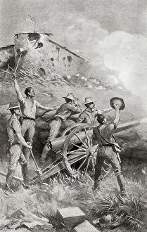
Background imageRelated Images Collection: Capron's battery in action at The Battle of Las Guasimas, Cuba, June 24, 1898

Capron's battery in action at The Battle of Las Guasimas, Cuba, June 24, 1898
UIG5419648 Capron's battery in action at The Battle of Las Guasimas, Cuba, June 24, 1898, the first land engagement of the Spanish-American War. Captain Allyn K. Capron, 1871-1898

Background imageRelated Images Collection: Havana Cathedral (Cuba), August and September 1762. Oil on canvas

Havana Cathedral (Cuba), August and September 1762. Oil on canvas, made shortly after the capture of the city by
MMM5458454 Havana Cathedral (Cuba), August and September 1762. Oil on canvas, made shortly after the capture of the city by the British in 1762, by Dominic Serres (1722-1793)

Background imageRelated Images Collection: Havana harbor, Havana, Cuba, 1884 (engraving)

Havana harbor, Havana, Cuba, 1884 (engraving)
6116611 Havana harbor, Havana, Cuba, 1884 (engraving); (add.info.: Havana harbor, port of Havana, Cuba, seen here in the 19th century)

Background imageRelated Images Collection: Antilles (colour litho)

Antilles (colour litho)
5213930 Antilles (colour litho) by Pinchon, Joseph Porphyre (1871-1953); Private Collection; (add.info.: Antilles. Illustration for L'Epanouissement du Monde (Blonder La Rougery)

Background imageRelated Images Collection: Geography Atlas: representation of the Caribbean Sea region, the Greater Antilles (Cuba, Jamaica)

Geography Atlas: representation of the Caribbean Sea region, the Greater Antilles (Cuba, Jamaica)
VEN5030072 Geography Atlas: representation of the Caribbean Sea region, the Greater Antilles (Cuba, Jamaica, Hispaniola) and the Lesser Antilles. Map from an Atlas of 1857

Background imageRelated Images Collection: Geography Atlas: representation of the Caribbean Sea region, the Caribbean (Cuba, Jamaica)

Geography Atlas: representation of the Caribbean Sea region, the Caribbean (Cuba, Jamaica, Hispaniola)
VEN5030063 Geography Atlas: representation of the Caribbean Sea region, the Caribbean (Cuba, Jamaica, Hispaniola, Jamaica) of the small Antilles of Honduras

Background imageRelated Images Collection: Geography Atlas: representation of Dominica Island (West Indies)

Geography Atlas: representation of Dominica Island (West Indies). Map taken from "The west indian atlas or general
VEN5030020 Geography Atlas: representation of Dominica Island (West Indies). Map taken from "The west indian atlas or general description of west indies" by Thomas Jefferys

Background imageRelated Images Collection: Geographic Atlas: representation of the Caribbean Sea and the Greater Antilles (Cuba, Hispaniola)

Geographic Atlas: representation of the Caribbean Sea and the Greater Antilles (Cuba, Hispaniola)
VEN5029600 Geographic Atlas: representation of the Caribbean Sea and the Greater Antilles (Cuba, Hispaniola, Puerto Rico and Jamaica), the Bahamas Islands, the South of the United States

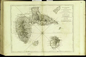
Background imageRelated Images Collection: Geography Atlas: representation of the archipelago of Guadeloupe

Geography Atlas: representation of the archipelago of Guadeloupe. Map taken from "The west indian atlas or general
VEN5029635 Geography Atlas: representation of the archipelago of Guadeloupe. Map taken from "The west indian atlas or general description of west indies" by Thomas Jefferys

Background imageRelated Images Collection: Geography Atlas: representation of the island of Santo Domingo in the West Indies

Geography Atlas: representation of the island of Santo Domingo in the West Indies
VEN5031371 Geography Atlas: representation of the island of Santo Domingo in the West Indies. Map from an atlas by Antonio del Monte y Tejada (1783-1861), 1860


All Professionally Made to Order for Quick Shipping


-

Why Choose Us?

We are a leading provider of Art Prints and Photo Gifts since 2003, working in partnership with a range of Sporting Clubs, Charities, Museums and Picture Libraries. A large share of profits from any of their images will go directly towards supporting that charity or club. Our archive of images is carefully curated to bring you a wide range of subjects, including landscapes, wildlife, architecture, and more. We ship from our partner labs in the UK, USA, EU (Netherlands) and Australia.
+

How do I place an order?

Ordering is quick & easy - Just follow 5 Simple Steps:
  1. Find your image: Use our search box or browse our online photo Collections to find the image you want.

  2. Choose your print format: Select your desired product and add it to your cart.

  3. Enter your details: If you're a returning customer, simply enter your email address and password, and we'll fill in your billing and shipping address details. All personal details are held securely and are fully GDPR compliant. As standard, we remove all Personally Identifiable Information after 12 months.

  4. Pay for your purchase: We use state-of-the-art security for online shopping and do not have access to your card details.

  5. Sit back and relax: We'll email you confirmation of your order and when it's dispatched. Registered customers can also track orders in the 'My Account' area.

+

How do I pay for an order?

You can pay for your order with most of the major credit and debit cards, or PayPal. For added security, major financial institutions process payment details separately and securely on our behalf. We do not have access to your online payment card details. Online payments are preferred however we do take phone orders. For UK customers only we accept cheques issued against a UK bank.
+

Is my data safe?

We take data security very seriously. We do not have access to your full card details and all payments are requested over a fully secure connection. Additionally, we fully comply with current European and GDPR legislation, and automatically remove all personal data after at most 12 months (unless you have an account with us and have signed in recently). We also have a strict opt-in policy and would never sell your personal details. Your data is only used to fulfill your order promptly and efficiently.
+

Is wall art ready to hang?

For quick and easy installation all wall art, including framed prints, canvas prints and metal prints are supplied with a ready to hang solution on the back. Generally, saw tooth hangers are applied as they allow wall art to hang flush against the wall. The serrated edge of the hanger prevents the frame from shifting or tilting when hung.
+

Are the photo prints fade resistant?

Yes, we use archival quality photo paper photographic paper for vivid reproduction Prints are an accurate representations of the original artwork, which is preserved for artistic character and authenticity. We guarantee they match previews shown on our web site