Photo Mug > North America > Canada > Maps
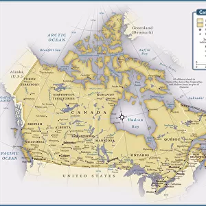
Photo Mug : Cartoon map of Canada


![]()
Home Decor from Fine Art Storehouse
Cartoon map of Canada
Unleash your creativity and transform your space into a visual masterpiece!
Media ID 14637273
Photo Mug
Introducing the Media Storehouse Photo Mug featuring a charming cartoon map of Canada from our Fine Art Storehouse collection. This mug is not just a beverage container, but a work of art that adds a touch of whimsy to your morning routine. The vibrant and intricately detailed cartoon map design brings the beauty of Canada right to your table. Each mug is carefully crafted with high-quality materials for a durable and long-lasting finish. Whether you're sipping on your favorite coffee or tea, or using it as a decorative piece, this mug is sure to bring a smile to your face. Order yours today and make every sip an adventure!
A personalised photo mug blends sentimentality with functionality, making an ideal gift for cherished loved ones, close friends, or valued colleagues. Preview may show both sides of the same mug.
Elevate your coffee or tea experience with our premium white ceramic mug. Its wide, comfortable handle makes drinking easy, and you can rely on it to be both microwave and dishwasher safe. Sold in single units, preview may show both sides of the same mug so you can see how the picture wraps around.
Mug Size is 9.6cm high x 8.1cm diameter (3.8" x 3.2")
These are individually made so all sizes are approximate
FEATURES IN THESE COLLECTIONS
> Fine Art Storehouse
> Map
> Cartoon Maps
> Maps and Charts
> Related Images
> North America
> Canada
> Maps
> North America
> Canada
> Related Images
EDITORS COMMENTS
This vibrant and whimsical cartoon map of Canada is a delightful piece that captures the essence of this vast and diverse country. Bursting with color, it brings to life the unique characteristics and landmarks that define each province and territory. From coast to coast, this playful illustration showcases iconic symbols such as the majestic Rocky Mountains in Alberta, the stunning Niagara Falls in Ontario, and the picturesque fishing villages of Newfoundland. Each region is depicted with its own distinct charm, highlighting cultural references like hockey players in Quebec or maple syrup production in New Brunswick. The artist's attention to detail is evident throughout this print, as they have carefully crafted every element to create an engaging visual narrative. Whether you're a Canadian proud of your heritage or simply fascinated by our northern neighbor's beauty, this artwork will undoubtedly bring joy and spark conversations. Perfect for any space seeking a touch of lightheartedness or educational flair, this cartoon map invites viewers young and old to explore Canada's rich geography while embracing its playful spirit. Hang it on your wall at home or display it proudly in a classroom setting; either way, it promises endless hours of discovery and appreciation for all things Canadian.
MADE IN AUSTRALIA
Safe Shipping with 30 Day Money Back Guarantee
FREE PERSONALISATION*
We are proud to offer a range of customisation features including Personalised Captions, Color Filters and Picture Zoom Tools
SECURE PAYMENTS
We happily accept a wide range of payment options so you can pay for the things you need in the way that is most convenient for you
* Options may vary by product and licensing agreement. Zoomed Pictures can be adjusted in the Cart.