Photo Mug > Europe > United Kingdom > England > Maps
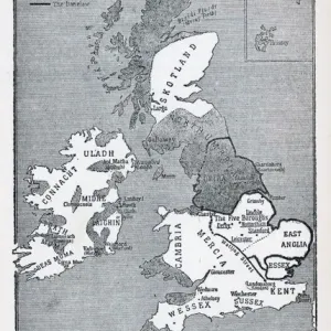
Photo Mug : MAP / LONDON 1878


![]()
Home Decor from Mary Evans Picture Library
MAP / LONDON 1878
Map of London and its suburbs
Mary Evans Picture Library makes available wonderful images created for people to enjoy over the centuries
Media ID 608786
© Mary Evans Picture Library 2015 - https://copyrighthub.org/s0/hub1/creation/maryevans/MaryEvansPictureID/10113947
Photo Mug
Introducing the Media Storehouse Photo Mug, a perfect blend of functionality and style. This mug is not just an everyday essential, but also a canvas for your favorite memories and inspirations. Feast your eyes on the captivating image of "MAP / LONDON 1878" gracing the surface of this mug. Courtesy of Mary Evans Picture Library from Mary Evans Prints Online, this map of London and its suburbs takes you on a journey through time. The intricate details and rich history of the map are beautifully preserved, making each sip from this mug an adventure. Embrace the charm of this unique mug, as it adds a touch of personality to your daily routine. Whether you're at home or on the go, this sturdy and durable mug is ready to keep you company and serve up your favorite beverage. Experience the joy of sipping from a mug that tells a story, with every sip taking you on a journey through time.
A personalised photo mug blends sentimentality with functionality, making an ideal gift for cherished loved ones, close friends, or valued colleagues. Preview may show both sides of the same mug.
Elevate your coffee or tea experience with our premium white ceramic mug. Its wide, comfortable handle makes drinking easy, and you can rely on it to be both microwave and dishwasher safe. Sold in single units, preview may show both sides of the same mug so you can see how the picture wraps around.
Mug Size is 8.1cm high x 9.6cm diameter (3.2" x 3.8")
These are individually made so all sizes are approximate
FEATURES IN THESE COLLECTIONS
> Europe
> United Kingdom
> England
> London
> Related Images
> Europe
> United Kingdom
> England
> Maps
> Europe
> United Kingdom
> England
> Posters
> Europe
> United Kingdom
> England
> Related Images
> Maps and Charts
> Early Maps
> Maps and Charts
> Related Images
EDITORS COMMENTS
This stunning print of a Map of London and its suburbs from 1878 offers a fascinating glimpse into the history and development of England's capital city. The intricate details captured in this map provide a snapshot of London during a time when it was rapidly expanding and evolving.
As we study the various neighborhoods, streets, and landmarks depicted on this historical map, we can't help but marvel at how much has changed over the years. From bustling city centers to quaint suburban villages, each area tells its own unique story about life in Victorian-era London.
The craftsmanship and attention to detail that went into creating this map are truly remarkable. Every street corner, park, and building is meticulously illustrated, giving us an insight into what life was like for Londoners more than a century ago.
Whether you're a history buff or simply appreciate beautiful works of art, this Map of London from 1878 is sure to captivate your imagination. It serves as a reminder of how far London has come since then while also preserving the charm and character that have made it one of the world's most iconic cities.
Mary Evans Picture Library has once again curated an exceptional piece that not only educates but also inspires us to explore the rich tapestry of London's past.
MADE IN AUSTRALIA
Safe Shipping with 30 Day Money Back Guarantee
FREE PERSONALISATION*
We are proud to offer a range of customisation features including Personalised Captions, Color Filters and Picture Zoom Tools
SECURE PAYMENTS
We happily accept a wide range of payment options so you can pay for the things you need in the way that is most convenient for you
* Options may vary by product and licensing agreement. Zoomed Pictures can be adjusted in the Cart.