Poster Print > Fine Art Storehouse > Map
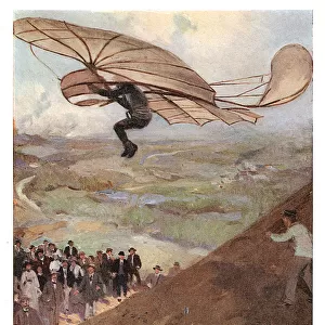
Poster Print : Map of Europe and asia 1883


![]()
Poster Prints from Fine Art Storehouse
Map of Europe and asia 1883
Warrens Common School Geography
Unleash your creativity and transform your space into a visual masterpiece!
THEPALMER
Media ID 13669367
© This content is subject to copyright
Austria Denmark Norway Paper Portugal Russia Sweden
A3 (42 x 29.7cm) Poster Print
Step back in time with our exquisite Map of Europe and Asia 1883 print from THEPALMER's Warrens Common School Geography collection, available at Media Storehouse's Fine Art Storehouse. This captivating vintage map offers a fascinating glimpse into the geographical knowledge of the late 19th century. Bring history into your home or office with this beautifully detailed and intricately designed poster print, perfect for any room that values the richness of the past.
Premium quality poster prints are printed on luxurious semi-gloss satin 270 gsm paper. Our meticulously crafted poster prints offer an affordable option for decorating any space, making them ideal for living rooms, bedrooms, offices and beyond. To ensure your poster arrives in good condition, we roll and send them in strong mailing tubes.
Poster prints are budget friendly enlarged prints in standard poster paper sizes (A0, A1, A2, A3 etc). Whilst poster paper is sometimes thinner and less durable than our other paper types, they are still ok for framing and should last many years. Our Archival Quality Photo Prints and Fine Art Paper Prints are printed on higher quality paper and the choice of which largely depends on your budget.
Estimated Product Size is 30.6cm x 42.6cm (12" x 16.8")
These are individually made so all sizes are approximate
Artwork printed orientated as per the preview above, with portrait (vertical) orientation to match the source image.
FEATURES IN THESE COLLECTIONS
> Fine Art Storehouse
> The Magical World of Illustration
> Palmer Illustrated Collection
> Fine Art Storehouse
> Map
> Denmark Maps
> Fine Art Storehouse
> Map
> Historical Maps
> Fine Art Storehouse
> Map
> Italian Maps
EDITORS COMMENTS
In this vintage print titled "Map of Europe and Asia 1883" we are transported back in time to an era when cartography was a true art form. The intricate details and exquisite craftsmanship of this engraving, created by THEPALMER, invite us to explore the geopolitical landscape of the late 19th century. The map showcases the vast territories of Europe and Asia, stretching from Russia in the east to France in the west. As our eyes wander across its yellowed paper surface, we encounter familiar names like Denmark, Norway, Sweden, Austria, Germany, Italy, Portugal, Spain - each country represented with delicate precision. This piece not only serves as a visual representation but also offers insights into historical events that shaped these regions during that period. It reminds us of a time when borders were different and nations had distinct identities yet interconnected through trade routes and diplomatic relations. The aged appearance adds a sense of nostalgia to this engraved image; it feels like holding a treasure from another era. Through its physical geography depiction and attention to detail on landforms such as mountains and rivers, one can almost imagine explorers tracing their paths along these ancient terrains. "The Map of Europe and Asia 1883" is more than just an antique artifact; it is a testament to human curiosity about our world's past. It invites us on an enchanting journey through time while reminding us how far we have come in understanding our planet's rich history.
MADE IN AUSTRALIA
Safe Shipping with 30 Day Money Back Guarantee
FREE PERSONALISATION*
We are proud to offer a range of customisation features including Personalised Captions, Color Filters and Picture Zoom Tools
SECURE PAYMENTS
We happily accept a wide range of payment options so you can pay for the things you need in the way that is most convenient for you
* Options may vary by product and licensing agreement. Zoomed Pictures can be adjusted in the Cart.