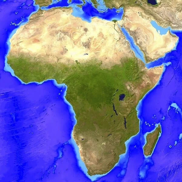
Africa. Computer artwork, based on a satellite image, of Africa
![]()

Wall Art and Photo Gifts from Science Photo Library
Africa. Computer artwork, based on a satellite image, of Africa
Africa. Computer artwork, based on a satellite image, of Africa. North is at top. Water is blue, vegetation is green and desert is yellow. There are extensive deserts spread across northern Africa and the Arabian peninsula (upper right). The three largest lakes at right are (from north to south) Lake Victoria, Lake Tanganyika and Lake Nyasa. The island at lower right, in the Indian Ocean, is Madagascar. The Atlantic Ocean is at left, the Mediterranean Sea is at top, and the Red Sea separates Africa and the Arabian Peninsula. The topography of the ocean floor is shown by varying shades of blue
Science Photo Library features Science and Medical images including photos and illustrations
Media ID 6348995
© FRIEDRICH SAURER/SCIENCE PHOTO LIBRARY
Africa Arabian Peninsula Continent Depth Depths Desert Deserts Earth Observation Earth Science From Space Island Lakes Madagascar Sahara Desert Satellite Image Sciences Topographical Computer Artwork Lake Nyasa Lake Tanganyika Lake Victoria
EDITORS COMMENTS
This print showcases the breathtaking beauty of Africa from a unique perspective. Created through computer artwork based on a satellite image, this illustration provides an intricate view of the continent's geography and topography. With North positioned at the top, one can easily identify various features that make Africa truly remarkable. The vibrant blue hues represent the vast bodies of water surrounding Africa, including the Atlantic Ocean on the left and the Indian Ocean towards the lower right. Three prominent lakes steal attention on the right side: Lake Victoria, Lake Tanganyika, and Lake Nyasa - each contributing to Africa's rich biodiversity. The contrasting colors reveal extensive deserts stretching across northern Africa and into the Arabian Peninsula in shades of yellow. The Sahara Desert dominates this region with its awe-inspiring vastness. Atop these sandy landscapes lies Madagascar, an island nestled in the Indian Ocean like a hidden gem. Beyond its aesthetic appeal, this image also offers insights into oceanic depths as varying shades of blue depict underwater topography. From space observation to earth sciences and geographical studies, this comprehensive visual encapsulates numerous fields of scientific exploration. With no commercial intentions behind it but rather serving as an educational tool for enthusiasts worldwide, Science Photo Library presents yet another masterpiece that invites us to appreciate Earth's wonders from above.
MADE IN AUSTRALIA
Safe Shipping with 30 Day Money Back Guarantee
FREE PERSONALISATION*
We are proud to offer a range of customisation features including Personalised Captions, Color Filters and Picture Zoom Tools
SECURE PAYMENTS
We happily accept a wide range of payment options so you can pay for the things you need in the way that is most convenient for you
* Options may vary by product and licensing agreement. Zoomed Pictures can be adjusted in the Cart.

