Fraud Blocker Skip to main content

Home > South America > Argentina > Maps

Maps Collection

Argentina is a country located in South America, bordered by Chile to the west and south, Bolivia and Paraguay to the north

Choose a picture from our Maps Collection for your Wall Art and Photo Gifts

161 items

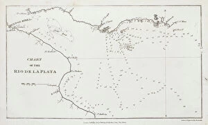
Background imageMaps Collection: Chart of the Rio de la Plata (river Plate), 1806 (engraving)

Chart of the Rio de la Plata (river Plate), 1806 (engraving)
7342111 Chart of the Rio de la Plata (river Plate), 1806 (engraving) by Arrowsmith (19th century); 14.2x23.1 cm; National Maritime Museum, London

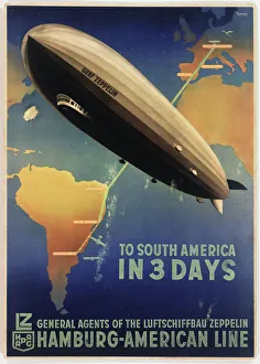
Background imageMaps Collection: Poster, Zeppelin to South America

Poster, Zeppelin to South America
Poster advertising the German Zeppelin Hamburg-American Line, LZ 127 Graf Zeppelin airship service from Friedrichshafen, Germany, to Buenos Aires, Argentina. circa 1934

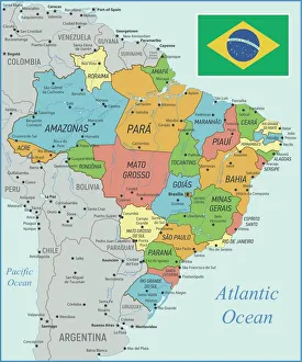
Background imageMaps Collection: Brazil Map with Rivers and National Flag

Brazil Map with Rivers and National Flag
Vintage Map of Brazil. Vector Illustration with Rivers and National Flag

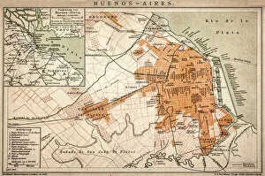
Background imageMaps Collection: Buenos Aires map

Buenos Aires map
Antique engraving map of Buenos Aires

Background imageMaps Collection: Map of Argentina - Vector

Map of Argentina - Vector illustration

Background imageMaps Collection: South America 1852 Map

South America 1852 Map

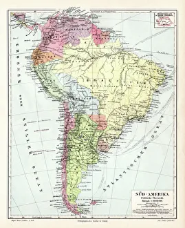
Background imageMaps Collection: South America political map 1895

South America political map 1895
Meyers Konversations-Lexikon. Ein Nachschlagewerk des allgemeinen Wissens, 5th edition 17 volumes Bibliographisches Institut - Leipzig 1895-1897

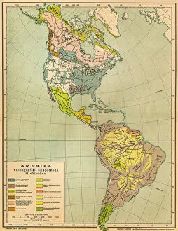
Background imageMaps Collection: American ethnographic map

American ethnographic map
Illutration of American ethnographic map

Background imageMaps Collection: Geography map: representation of Tierra de fuego and Patagonia (Argentina, Chile)

Geography map: representation of Tierra de fuego and Patagonia (Argentina, Chile)
VEN5030138 Geography map: representation of Tierra de fuego and Patagonia (Argentina, Chile), made by Dutch cartographer Gerard van Keulen (1678-1726) 1709-1713

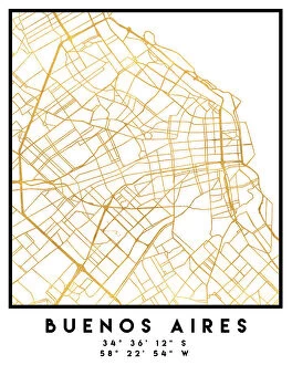
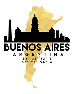
Background imageMaps Collection: BUENOS AIRES

BUENOS AIRES
StudioSix

Background imageMaps Collection: Map of the southern part of South America, c.1900 (engraving)

Map of the southern part of South America, c.1900 (engraving)
533267 Map of the southern part of South America, c.1900 (engraving); (add.info.: Map of southern South America, with inset maps of Buenos Aires, Montevideo, Valparaiso, and Santiago, circa 1902)

Background imageMaps Collection: Black Maps Earth Tones 17

Black Maps Earth Tones 17
Emiliano Deificus

Background imageMaps Collection: 1 Maps 06

1 Maps 06
Emiliano Deificus

Background imageMaps Collection: City Love Maps 17

City Love Maps 17
Emiliano Deificus

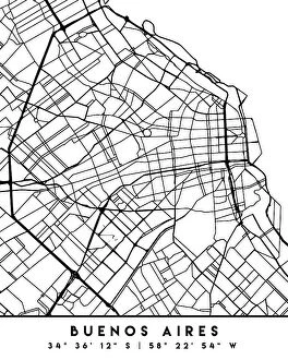
Background imageMaps Collection: Black Maps 17

Black Maps 17
Emiliano Deificus

Background imageMaps Collection: 0006 City

0006 City
Emiliano Deificus

Background imageMaps Collection: City Heart Maps 17

City Heart Maps 17
Emiliano Deificus

Background imageMaps Collection: Argentina country map

Argentina country map
2011 edition

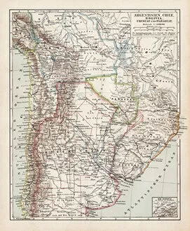
Background imageMaps Collection: Map of Argentine, Chile and Bolivia 1900

Map of Argentine, Chile and Bolivia 1900
Meyers hand-Atlas Leipzig und Wien Verlag des Bibliographischen Instituts 1900

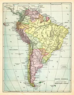
Background imageMaps Collection: Map of South America 1895

Map of South America 1895
The Rand-McNally Grammar School Geography 1895 - Chicago & New York

Background imageMaps Collection: Map of South America 1877

Map of South America 1877
Warrens Common School Geography 1877

Background imageMaps Collection: 13881229

13881229

Background imageMaps Collection: 13873501

13873501

Background imageMaps Collection: 13849201

13849201

Background imageMaps Collection: 13834794

13834794

Background imageMaps Collection: 13825176

13825176

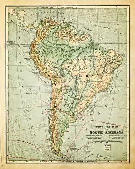
Background imageMaps Collection: Map of South America 19th Century

Map of South America 19th Century
Vintage map of South America from the 19th Century

Background imageMaps Collection: old map of south america

old map of south america
an old south american map (1881)

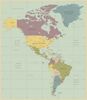
Background imageMaps Collection: Vintage Map of North and South America

Vintage Map of North and South America
534055040

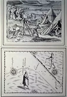
Background imageMaps Collection: Hunger in Buenos Aires - settlers cutting human flesh and a map with two indians (engraving)

Hunger in Buenos Aires - settlers cutting human flesh and a map with two indians (engraving)
IND388208 Hunger in Buenos Aires - settlers cutting human flesh and a map with two indians (engraving) by Argentinian School, (16th century); Biblioteca Nacional, Buenos Aires

Background imageMaps Collection: Planisphere showing the different climatic zones (manuscript, 16th century)

Planisphere showing the different climatic zones (manuscript, 16th century)
LRI4649065 Planisphere showing the different climatic zones (manuscript, 16th century) by Homen, Lopo (16th century); Istituto e Museo di Storia della Scienza, Florence

Background imageMaps Collection: An 'Enfant Prodigue': satire on Barings Banks overexposure to Argentinian

An "Enfant Prodigue": satire on Barings Banks overexposure to Argentinian
7173247 An " Enfant Prodigue" : satire on Barings Banks overexposure to Argentinian and Uruguayan debt in the late 1880s and early 1890s (engraving) by English School

Background imageMaps Collection: Sir Home Riggs Popham, British rear-admiral (engraving)

Sir Home Riggs Popham, British rear-admiral (engraving)
7150332 Sir Home Riggs Popham, British rear-admiral (engraving) by Brown, Mather (1761-1831) (after); Private Collection; (add.info.: Sir Home Riggs Popham (1762-1820)

Background imageMaps Collection: Relative Values and Comparisons, 1 Comparative Areas (colour litho)

Relative Values and Comparisons, 1 Comparative Areas (colour litho)
7169526 Relative Values and Comparisons, 1 Comparative Areas (colour litho) by English School, (20th century); Private Collection; (add.info.: Relative Values and Comparisons, 1 Comparative Areas)

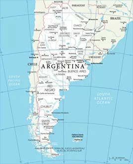
Background imageMaps Collection: Agentina Refernce Map

Agentina Refernce Map
Officially the Argentine Republic, Agentina is a country of South America, which covers most of the southern portion of the continent. It is the second largest country in South America after Brazil

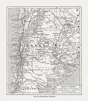
Background imageMaps Collection: Historical map of Argentina, wood engraving, published in 1893

Historical map of Argentina, wood engraving, published in 1893
Historical map of Argentina. Wood engraving, published in 1893

Background imageMaps Collection: Antique Map of the East Coast of Patagonia

Antique Map of the East Coast of Patagonia in the 16th Century

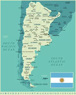
Background imageMaps Collection: Map of Agentina with Flag

Map of Agentina with Flag
Agentina, a country of South America, covers most of the southern portion of the continent. It is the second largest country in South America after Brazil

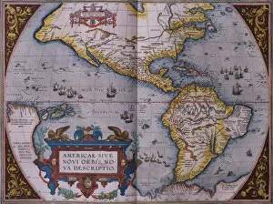
Background imageMaps Collection: Orteliuss map of The New World, 1603 (engraving)

Orteliuss map of The New World, 1603 (engraving)
7074479 Orteliuss map of The New World, 1603 (engraving) by Ortelius, Abraham (1527-98); Private Collection; (add.info.: This map of the Americas is from the 1603 edition of Theatrum orbis terrarum)

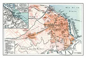
Background imageMaps Collection: Antique map of Buenos Aires Argentina 1898

Antique map of Buenos Aires Argentina 1898
Map of Buenos Aires Argentina 1898 Original edition from my own archives Source : Brockhaus 1898

Background imageMaps Collection: Bernardino Rivadavia, Argentinian revolutionary and politician (chromolitho)

Bernardino Rivadavia, Argentinian revolutionary and politician (chromolitho)
1093553 Bernardino Rivadavia, Argentinian revolutionary and politician (chromolitho) by French School, (19th century); Private Collection; (add.info.: Bernardino Rivadavia (1780-1845)

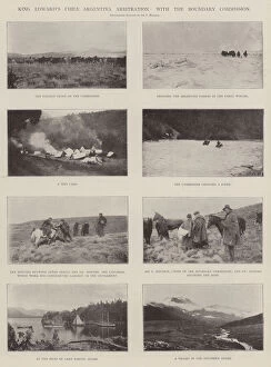
Background imageMaps Collection: King Edwards Chile Argentina Arbitration, with the Boundary Commission (b / w photo)

King Edwards Chile Argentina Arbitration, with the Boundary Commission (b / w photo)
1601331 King Edwards Chile Argentina Arbitration, with the Boundary Commission (b/w photo) by English Photographer, (20th century); Private Collection; (add.info)

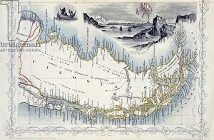
Background imageMaps Collection: Patagonia, from a Series of World Maps published by John Tallis & Co

Patagonia, from a Series of World Maps published by John Tallis & Co
STC190608 Patagonia, from a Series of World Maps published by John Tallis & Co. New York & London, 1850s (engraving) by Rapkin

Background imageMaps Collection: Map of Paraguay, Chile and Magellan Land (Argentina) (etching, 1730)

Map of Paraguay, Chile and Magellan Land (Argentina) (etching, 1730)
LRI4707078 Map of Paraguay, Chile and Magellan Land (Argentina) (etching, 1730) by Delisle, Guillaume (1675-1726); Private Collection; (add.info.: Map of Paraguay)

Background imageMaps Collection: Map of the Paraguayan War 1868

Map of the Paraguayan War 1868
A map of allies positions along the Parana river, up until the capture of Humayta. Date: 1868

Background imageMaps Collection: City map of Buenos Aires, 1763 (engraving)

City map of Buenos Aires, 1763 (engraving)
AIS5349497 City map of Buenos Aires, 1763 (engraving) by French School, (18th century); (add.info.: City map of Buenos Aires)

Background imageMaps Collection: South America (colour litho)

South America (colour litho)
5996925 South America (colour litho) by English School, (20th century); Private Collection; (add.info.: South America. Illustration from The Modern World Encyclopedia)

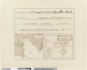
Background imageMaps Collection: ii. (a) Four profiles of the coast of Terra del Fuego (b

ii. (a) Four profiles of the coast of Terra del Fuego (b
5670247 ii. (a) Four profiles of the coast of Terra del Fuego (b) A plan of Success Bay in Strait le Maire (c) A chart of the S.E. part of Terra del Fuego, engraved by T. Borven and J


All Professionally Made to Order for Quick Shipping


-

Maps Collection

Argentina is a country located in South America, bordered by Chile to the west and south, Bolivia and Paraguay to the north, and Brazil and Uruguay to the northeast. Maps ofprovide an overview of its geography, showing its provinces, major cities, rivers, lakes and mountain ranges. The country has a wide variety of climates ranging from subtropical in the north to temperate in the south. Its terrain is mostly flat with some areas of low hills or mountains. Argentina's economy is one of Latin America's most developed with a strong agricultural sector as well as manufacturing industries such as automobiles and electronics. It also has abundant natural resources including oil reserves which have made it an important player on the global energy market. Maps ofare essential for anyone looking to explore this fascinating country with its unique culture and history.
+

Our beautiful pictures are available as Framed Prints, Photos, Wall Art and Photo Gifts

The Maps of Argentina South America collection from Media Storehouse is a stunning compilation of vintage and contemporary maps that showcase the beauty and diversity of this fascinating country. Our collection features a wide range of maps, including topographical, political, geological, historical, and cultural maps that provide an in-depth look at Argentina's geography, history, culture, and economy. Each map is carefully selected for its accuracy and aesthetic appeal and is available as wall art or framed prints to suit any decor style. Whether you're looking to decorate your home or office with a unique piece of art or want to give someone special a thoughtful gift that celebrates their love for travel or geography, the Maps of Argentina South America collection has something for everyone. With its rich history and diverse landscapes ranging from snow-capped mountains to tropical rainforests to arid deserts and bustling cities like Buenos Aires, Argentina is truly one-of-a-kind. And with the Maps of Argentina South America collection from Media Storehouse at your fingertips, you can explore this amazing country without ever leaving your home.
+

What are Maps of Argentina South America art prints?

Maps of Argentina South America art prints are high-quality reproductions of vintage and contemporary maps depicting the geography, topography, and landmarks of Argentina. These prints showcase the beauty and diversity of this vast country, from its snow-capped Andean peaks to its lush rainforests and arid deserts. These art prints are perfect for anyone who loves travel, history or geography. They make great gifts for those who have visited or plan to visit Argentina, as well as for collectors interested in cartography or cultural heritage. We offer a wide range of Maps of Argentina South America art prints in various sizes and formats such as canvas print or framed print. The collection includes antique maps dating back to the 16th century as well as modern-day satellite imagery. All our prints are produced using state-of-the-art printing technology ensuring that they capture every detail with stunning clarity.
+

What Maps of Argentina South America art prints can I buy from Media Storehouse?

We offer a wide range of Maps of Argentina South America art prints that are perfect for anyone who loves geography or wants to decorate their home with unique and interesting artwork. These maps showcase the beautiful landscapes, cities, and regions of Argentina in stunning detail, allowing you to explore this fascinating country from the comfort of your own home. Whether you're looking for vintage-style maps that capture the history and culture of Argentina or more modern designs that highlight its natural beauty and landmarks, we have something for everyone. You can choose from a variety of sizes and formats to suit your needs, including framed prints, canvas prints, posters, and more. So if you're interested in adding some Maps of Argentina South America art prints to your collection or want to give a thoughtful gift to someone who loves travel or geography, be sure to check out our selection today.
+

How do I buy Maps of Argentina South America art prints?

To purchase Maps of Argentina South America art prints, you can visit our online gallery. Once there, you can browse through the available options and select the print that best suits your needs. The prints are available in various sizes and formats, including framed or unframed options. To make a purchase, simply add the desired print to your cart and proceed to checkout. You will be prompted to enter your shipping information and payment details before completing the transaction. We offer high-quality art prints that are perfect for adding a touch of sophistication to any space. Whether you're looking for a unique piece of wall decor or a thoughtful gift for someone special, their selection of Maps of Argentina South America art prints is sure to impress. So why wait? Start exploring our collection today.
+

How much do Maps of Argentina South America art prints cost?

We offer a wide range of Maps of Argentina South America art prints at varying prices. Our selection includes vintage and modern maps, as well as detailed topographical maps that showcase the diverse geography of this beautiful region. The cost of our art prints depends on several factors such as size, framing options, and paper quality. We strive to provide affordable options for all budgets while maintaining high-quality standards in our products. Our art prints are perfect for decorating your home or office with unique and eye-catching pieces that celebrate the beauty and history of Argentina South America. Whether you're looking for a small print to add to your collection or a large statement piece to make an impact in any room, we have something for everyone at Media Storehouse.
+

How will my Maps of Argentina South America art prints be delivered to me?

We take great care in delivering your Maps of Argentina South America art prints to you. We use a reliable and trusted courier service that ensures the safe delivery of your order. Your print will be carefully packaged to prevent any damage during transit. We offer a range of delivery options depending on your location and urgency, including standard and express shipping. Once your order has been dispatched, you will receive an email with tracking information so you can keep track of its progress. If for any reason there is an issue with your delivery or if you have any questions about our delivery process, please do not hesitate to contact our customer service team who are always happy to help. We want you to enjoy your Maps of Argentina South America art prints as soon as possible, which is why we aim to deliver them promptly and securely.