Fraud Blocker Skip to main content

Home > Universal Images Group (UIG) > Images Dated > 2012 > March > 1 Mar 2012

Images Dated 1st March 2012

Choose a picture from our collection for your Wall Art and Photo Gifts

164 Items

We are proud to offer this selection in partnership with Universal Images Group (UIG)

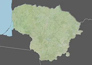
Background imageImages Dated 1st March 2012: Lithuania, Relief Map With Border and Mask

Lithuania, Relief Map With Border and Mask
Relief map of Lithuania (with border and mask). This image was compiled from data acquired by landsat 5 & 7 satellites combined with elevation data
Background imageImages Dated 1st March 2012: Candles in La Madeleine church

Candles in La Madeleine church

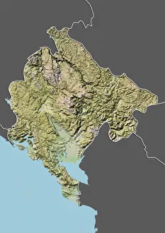
Background imageImages Dated 1st March 2012: Montenegro, Relief Map With Border and Mask

Montenegro, Relief Map With Border and Mask
Relief map of Montenegro (with border and mask). This image was compiled from data acquired by landsat 5 & 7 satellites combined with elevation data

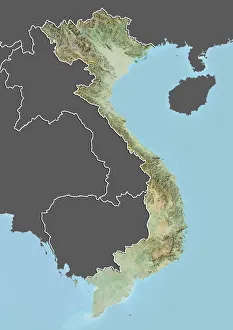
Background imageImages Dated 1st March 2012: Vietnam, Relief Map with Border and Mask

Vietnam, Relief Map with Border and Mask
Relief map of Vietnam (with border and mask). This image was compiled from data acquired by landsat 5 & 7 satellites combined with elevation data

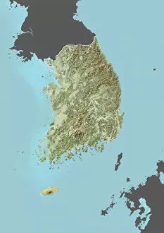
Background imageImages Dated 1st March 2012: South Korea, Relief Map with Border and Mask

South Korea, Relief Map with Border and Mask
Relief map of South Korea (with border and mask). This image was compiled from data acquired by landsat 5 & 7 satellites combined with elevation data

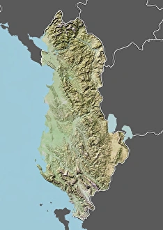
Background imageImages Dated 1st March 2012: Albania, Relief Map With Border and Mask

Albania, Relief Map With Border and Mask
Relief map of Albania (with border and mask). This image was compiled from data acquired by landsat 5 & 7 satellites combined with elevation data

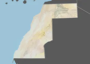
Background imageImages Dated 1st March 2012: Western Sahara, Relief Map with Border and Mask

Western Sahara, Relief Map with Border and Mask
Relief map of Western Sahara (with border and mask). This image was compiled from data acquired by landsat 5 & 7 satellites combined with elevation data

Background imageImages Dated 1st March 2012: Equatorial Guinea, Relief Map With Border and Mask

Equatorial Guinea, Relief Map With Border and Mask
Relief map of Equatorial Guinea (with border and mask). This image was compiled from data acquired by landsat 5 & 7 satellites combined with elevation data

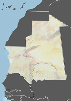
Background imageImages Dated 1st March 2012: Mauritania, Relief Map With Border and Mask

Mauritania, Relief Map With Border and Mask
Relief map of Mauritania (with border and mask). This image was compiled from data acquired by landsat 5 & 7 satellites combined with elevation data

Background imageImages Dated 1st March 2012: Lampang Louang temple

Lampang Louang temple

Background imageImages Dated 1st March 2012: La Madeleine church

La Madeleine church

Background imageImages Dated 1st March 2012: Sculpture in Lampang Louang temple

Sculpture in Lampang Louang temple

Background imageImages Dated 1st March 2012: Guard temple in Lampang Louang temple

Guard temple in Lampang Louang temple

Background imageImages Dated 1st March 2012: Day of forgiveness

Day of forgiveness

Background imageImages Dated 1st March 2012: Sculpture in La Madeleine church

Sculpture in La Madeleine church

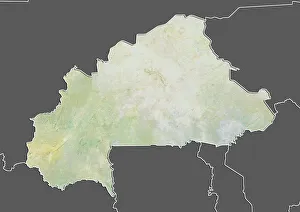
Background imageImages Dated 1st March 2012: Burkina Faso, Relief Map With Border and Mask

Burkina Faso, Relief Map With Border and Mask
Relief map of Burkina Faso (with border and mask). This image was compiled from data acquired by landsat 5 & 7 satellites combined with elevation data

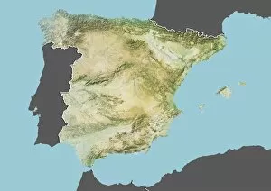
Background imageImages Dated 1st March 2012: Spain, Relief Map With Border and Mask

Spain, Relief Map With Border and Mask
Relief map of Spain (with border and mask). This image was compiled from data acquired by landsat 5 & 7 satellites combined with elevation data

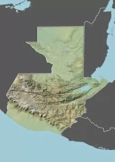
Background imageImages Dated 1st March 2012: Guatemala, Relief Map With Border and Mask

Guatemala, Relief Map With Border and Mask
Relief map of Guatemala (with border and mask). This image was compiled from data acquired by landsat 5 & 7 satellites combined with elevation data

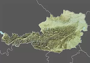
Background imageImages Dated 1st March 2012: Austria, Relief Map With Border and Mask

Austria, Relief Map With Border and Mask
Relief map of Austria (with border and mask). This image was compiled from data acquired by landsat 5 & 7 satellites combined with elevation data

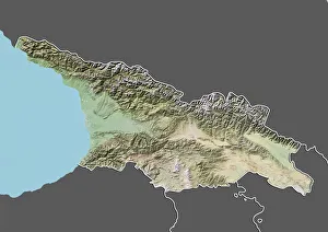
Background imageImages Dated 1st March 2012: Georgia, Relief Map With Border and Mask

Georgia, Relief Map With Border and Mask
Relief map of Georgia (with border and mask). This image was compiled from data acquired by landsat 5 & 7 satellites combined with elevation data

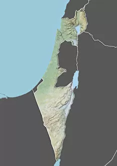
Background imageImages Dated 1st March 2012: Israel, Relief Map With Border and Mask

Israel, Relief Map With Border and Mask
Relief map of Israel (with border and mask). This image was compiled from data acquired by landsat 5 & 7 satellites combined with elevation data

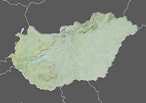
Background imageImages Dated 1st March 2012: Hungary, Relief Map With Border and Mask

Hungary, Relief Map With Border and Mask
Relief map of Hungary (with border and mask). This image was compiled from data acquired by landsat 5 & 7 satellites combined with elevation data

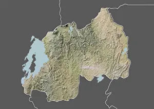
Background imageImages Dated 1st March 2012: Rwanda, Relief Map with Border and Mask

Rwanda, Relief Map with Border and Mask
Relief map of Rwanda (with border and mask). This image was compiled from data acquired by landsat 5 & 7 satellites combined with elevation data

Background imageImages Dated 1st March 2012: United States, Relief Map with Border and Mask

United States, Relief Map with Border and Mask
Relief map of the United States (with border and mask). This image was compiled from data acquired by landsat 5 & 7 satellites combined with elevation data

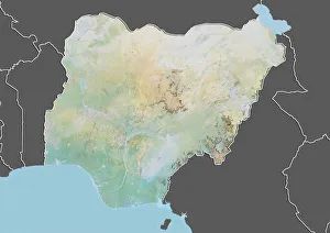
Background imageImages Dated 1st March 2012: Nigeria, Relief Map With Border and Mask

Nigeria, Relief Map With Border and Mask
Relief map of Nigeria (with border and mask). This image was compiled from data acquired by landsat 5 & 7 satellites combined with elevation data

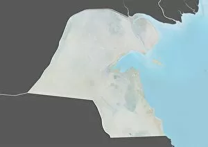
Background imageImages Dated 1st March 2012: Kuwait, Relief Map With Border and Mask

Kuwait, Relief Map With Border and Mask
Relief map of Kuwait (with border and mask). This image was compiled from data acquired by landsat 5 & 7 satellites combined with elevation data

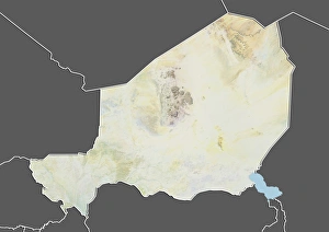
Background imageImages Dated 1st March 2012: Niger, Relief Map With Border and Mask

Niger, Relief Map With Border and Mask
Relief map of Niger (with border and mask). This image was compiled from data acquired by landsat 5 & 7 satellites combined with elevation data

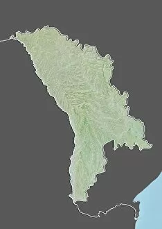
Background imageImages Dated 1st March 2012: Moldova, Relief Map with Border and Mask

Moldova, Relief Map with Border and Mask
Relief map of Moldova (with border and mask). This image was compiled from data acquired by landsat 5 & 7 satellites combined with elevation data

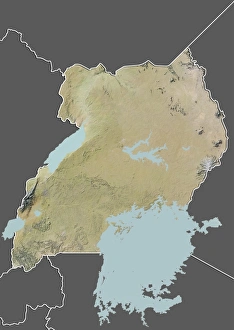
Background imageImages Dated 1st March 2012: Uganda, Relief Map with Border and Mask

Uganda, Relief Map with Border and Mask
Relief map of Uganda (with border and mask). This image was compiled from data acquired by landsat 5 & 7 satellites combined with elevation data

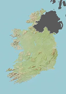
Background imageImages Dated 1st March 2012: Ireland, Relief Map With Border and Mask

Ireland, Relief Map With Border and Mask
Relief map of Ireland (with border and mask). This image was compiled from data acquired by landsat 5 & 7 satellites combined with elevation data

Background imageImages Dated 1st March 2012: Suriname, Relief Map with Border and Mask

Suriname, Relief Map with Border and Mask
Relief map of Suriname (with border and mask). This image was compiled from data acquired by landsat 5 & 7 satellites combined with elevation data

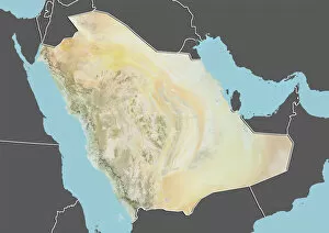
Background imageImages Dated 1st March 2012: Saudi Arabia, Relief Map with Border and Mask

Saudi Arabia, Relief Map with Border and Mask
Relief map of Saudi Arabia (with border and mask). This image was compiled from data acquired by landsat 5 & 7 satellites combined with elevation data

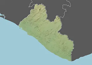
Background imageImages Dated 1st March 2012: Liberia, Relief Map With Border and Mask

Liberia, Relief Map With Border and Mask
Relief map of Liberia (with border and mask). This image was compiled from data acquired by landsat 5 & 7 satellites combined with elevation data

Background imageImages Dated 1st March 2012: China, Relief Map With Border and Mask

China, Relief Map With Border and Mask
Relief map of China (with border and mask). This image was compiled from data acquired by landsat 5 & 7 satellites combined with elevation data

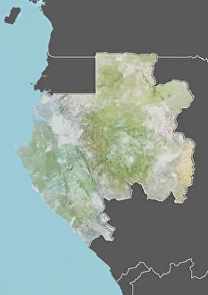
Background imageImages Dated 1st March 2012: Gabon, Relief Map With Border and Mask

Gabon, Relief Map With Border and Mask
Relief map of Gabon (with border and mask). This image was compiled from data acquired by landsat 5 & 7 satellites combined with elevation data

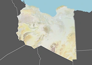
Background imageImages Dated 1st March 2012: Libya, Relief Map With Border and Mask

Libya, Relief Map With Border and Mask
Relief map of Libya (with border and mask). This image was compiled from data acquired by landsat 5 & 7 satellites combined with elevation data

Background imageImages Dated 1st March 2012: Venezuela, Relief Map with Border and Mask

Venezuela, Relief Map with Border and Mask
Relief map of Venezuela (with border and mask). This image was compiled from data acquired by landsat 5 & 7 satellites combined with elevation data

Background imageImages Dated 1st March 2012: Belize, Relief map, With Border and Mask

Belize, Relief map, With Border and Mask
Relief map of Belize (with border and mask). This image was compiled from data acquired by landsat 5 & 7 satellites combined with elevation data

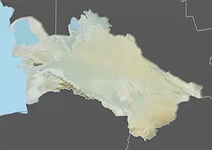
Background imageImages Dated 1st March 2012: Turkmenistan, Relief Map with Border and Mask

Turkmenistan, Relief Map with Border and Mask
Relief map of Turkmenistan (with border and mask). This image was compiled from data acquired by landsat 5 & 7 satellites combined with elevation data

Background imageImages Dated 1st March 2012: Belgium, Relief Map With Border and Mask

Belgium, Relief Map With Border and Mask
Relief map of Belgium (with border and mask). This image was compiled from data acquired by landsat 5 & 7 satellites combined with elevation data

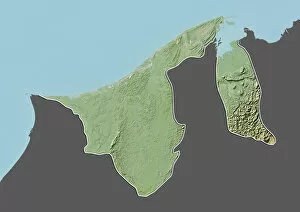
Background imageImages Dated 1st March 2012: Brunei, Relief Map With Border and Mask

Brunei, Relief Map With Border and Mask
Relief map of Brunei (with border and mask). This image was compiled from data acquired by landsat 5 & 7 satellites combined with elevation data

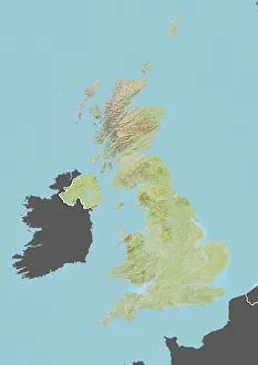
Background imageImages Dated 1st March 2012: United Kingdom, Relief Map with Border and Mask

United Kingdom, Relief Map with Border and Mask
Relief map of the United Kingdom (with border and mask). This image was compiled from data acquired by landsat 5 & 7 satellites combined with elevation data

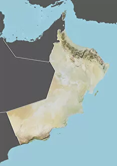
Background imageImages Dated 1st March 2012: Oman, Relief Map With Border and Mask

Oman, Relief Map With Border and Mask
Relief map of Oman (with border and mask). This image was compiled from data acquired by landsat 5 & 7 satellites combined with elevation data

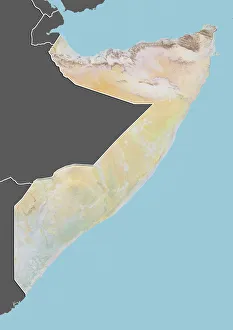
Background imageImages Dated 1st March 2012: Somalia, Relief Map with Border and Mask

Somalia, Relief Map with Border and Mask
Relief map of Somalia (with border and mask). This image was compiled from data acquired by landsat 5 & 7 satellites combined with elevation data

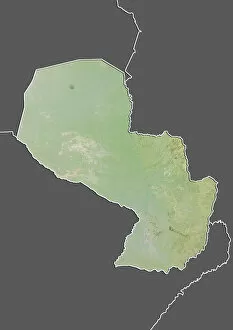
Background imageImages Dated 1st March 2012: Paraguay, Relief Map With Border and Mask

Paraguay, Relief Map With Border and Mask
Relief map of Paraguay (with border and mask). This image was compiled from data acquired by landsat 5 & 7 satellites combined with elevation data

Background imageImages Dated 1st March 2012: Germany, Relief Map With Border and Mask

Germany, Relief Map With Border and Mask
Relief map of Germany (with border and mask). This image was compiled from data acquired by landsat 5 & 7 satellites combined with elevation data

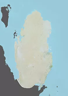
Background imageImages Dated 1st March 2012: Qatar, Relief Map With Border and Mask

Qatar, Relief Map With Border and Mask
Relief map of Qatar (with border and mask). This image was compiled from data acquired by landsat 5 & 7 satellites combined with elevation data

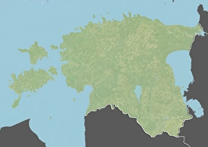
Background imageImages Dated 1st March 2012: Estonia, Relief Map With Border and Mask

Estonia, Relief Map With Border and Mask
Relief map of Estonia (with border and mask). This image was compiled from data acquired by landsat 5 & 7 satellites combined with elevation data

Background imageImages Dated 1st March 2012: Portugal, Relief Map With Border and Mask

Portugal, Relief Map With Border and Mask
Relief map of Portugal (with border and mask). This image was compiled from data acquired by landsat 5 & 7 satellites combined with elevation data

Background imageImages Dated 1st March 2012: Guyana, Relief Map With Border and Mask

Guyana, Relief Map With Border and Mask
Relief map of Guyana (with border and mask). This image was compiled from data acquired by landsat 5 & 7 satellites combined with elevation data

Background imageImages Dated 1st March 2012: Lesotho, Relief Map With Border and Mask

Lesotho, Relief Map With Border and Mask
Relief map of Lesotho (with border and mask). This image was compiled from data acquired by landsat 5 & 7 satellites combined with elevation data

Background imageImages Dated 1st March 2012: Iran, Relief Map With Border and Mask

Iran, Relief Map With Border and Mask
Relief map of Iran (with border and mask). This image was compiled from data acquired by landsat 5 & 7 satellites combined with elevation data

Background imageImages Dated 1st March 2012: Dominican Republic, Relief Map With Border and Mask

Dominican Republic, Relief Map With Border and Mask
Relief map of the Dominican Republic (with border and mask). This image was compiled from data acquired by landsat 5 & 7 satellites combined with elevation data

Background imageImages Dated 1st March 2012: Tunisia, Relief Map with Border and Mask

Tunisia, Relief Map with Border and Mask
Relief map of Tunisia (with border and mask). This image was compiled from data acquired by landsat 5 & 7 satellites combined with elevation data

Background imageImages Dated 1st March 2012: Slovenia, Relief Map with Border and Mask

Slovenia, Relief Map with Border and Mask
Relief map of Slovenia (with border and mask). This image was compiled from data acquired by landsat 5 & 7 satellites combined with elevation data

Background imageImages Dated 1st March 2012: Tanzania, Relief Map with Border and Mask

Tanzania, Relief Map with Border and Mask
Relief map of Tanzania (with border and mask). This image was compiled from data acquired by landsat 5 & 7 satellites combined with elevation data

Background imageImages Dated 1st March 2012: Cameroon, Relief Map With Border and Mask

Cameroon, Relief Map With Border and Mask
Relief map of Cameroon (with border and mask). This image was compiled from data acquired by landsat 5 & 7 satellites combined with elevation data

Background imageImages Dated 1st March 2012: Pakistan, Relief Map with Border and Mask

Pakistan, Relief Map with Border and Mask
Relief map of Pakistan (with border and mask). This image was compiled from data acquired by landsat 5 & 7 satellites combined with elevation data

Background imageImages Dated 1st March 2012: Canada, Relief Map With Border and Mask

Canada, Relief Map With Border and Mask
Relief map of Canada (with border and mask). This image was compiled from data acquired by landsat 5 & 7 satellites combined with elevation data

Background imageImages Dated 1st March 2012: Kosovo, Relief Map With Border and Mask

Kosovo, Relief Map With Border and Mask
Relief map of Kosovo (with border and mask). This image was compiled from data acquired by landsat 5 & 7 satellites combined with elevation data

Background imageImages Dated 1st March 2012: Gambia, Relief Map With Border and Mask

Gambia, Relief Map With Border and Mask
Relief map of Gambia (with border and mask). This image was compiled from data acquired by landsat 5 & 7 satellites combined with elevation data

Background imageImages Dated 1st March 2012: Myanmar, Relief Map With Border and Mask

Myanmar, Relief Map With Border and Mask
Relief map of Myanmar (with border and mask). This image was compiled from data acquired by landsat 5 & 7 satellites combined with elevation data

Background imageImages Dated 1st March 2012: Cambodia, Relief Map With Border and Mask

Cambodia, Relief Map With Border and Mask
Relief map of Cambodia (with border and mask). This image was compiled from data acquired by landsat 5 & 7 satellites combined with elevation data

Background imageImages Dated 1st March 2012: Greece, Relief Map With Border and Mask

Greece, Relief Map With Border and Mask
Relief map of Greece (with border and mask). This image was compiled from data acquired by landsat 5 & 7 satellites combined with elevation data

Background imageImages Dated 1st March 2012: Afghanistan, Relief Map With Border and Mask

Afghanistan, Relief Map With Border and Mask
Relief map of Afghanistan (with border and mask). This image was compiled from data acquired by landsat 5 & 7 satellites combined with elevation data

Background imageImages Dated 1st March 2012: United States and Canada, Relief Map with Border

United States and Canada, Relief Map with Border
Relief map of the United States and Canada (with border). This image was compiled from data acquired by LANDSAT 5 & 7 satellites combined with elevation data

Background imageImages Dated 1st March 2012: Azerbaijan, Relief Map With Border and Mask

Azerbaijan, Relief Map With Border and Mask
Relief map of Azerbaijan (with border and mask). This image was compiled from data acquired by landsat 5 & 7 satellites combined with elevation data

Background imageImages Dated 1st March 2012: Nicaragua, Relief Map With Border and Mask

Nicaragua, Relief Map With Border and Mask
Relief map of Nicaragua (with border and mask). This image was compiled from data acquired by landsat 5 & 7 satellites combined with elevation data

Background imageImages Dated 1st March 2012: Iraq, Relief Map With Border and Mask

Iraq, Relief Map With Border and Mask
Relief map of Iraq (with border and mask). This image was compiled from data acquired by landsat 5 & 7 satellites combined with elevation data

Background imageImages Dated 1st March 2012: United States, Relief Map with Border and Mask

United States, Relief Map with Border and Mask
Relief map of the United States (with border and mask). This image was compiled from data acquired by landsat 5 & 7 satellites combined with elevation data

Background imageImages Dated 1st March 2012: Haiti, Relief Map With Border and Mask

Haiti, Relief Map With Border and Mask
Relief map of Haiti (with border and mask). This image was compiled from data acquired by landsat 5 & 7 satellites combined with elevation data

Background imageImages Dated 1st March 2012: Botswana, Relief Map With Border and Mask

Botswana, Relief Map With Border and Mask
Relief map of Botswana (with border and mask). This image was compiled from data acquired by landsat 5 & 7 satellites combined with elevation data

Background imageImages Dated 1st March 2012: Finland, Relief Map With Border and Mask

Finland, Relief Map With Border and Mask
Relief map of Finland (with border and mask). This image was compiled from data acquired by landsat 5 & 7 satellites combined with elevation data

Background imageImages Dated 1st March 2012: Chile, Relief Map With Border and Mask

Chile, Relief Map With Border and Mask
Relief map of Chile (with border and mask). This image was compiled from data acquired by landsat 5 & 7 satellites combined with elevation data

Background imageImages Dated 1st March 2012: Mongolia, Relief Map With Border and Mask

Mongolia, Relief Map With Border and Mask
Relief map of Mongolia (with border and mask). This image was compiled from data acquired by landsat 5 & 7 satellites combined with elevation data

Background imageImages Dated 1st March 2012: Malaysia, Relief Map With Border and Mask

Malaysia, Relief Map With Border and Mask
Relief map of Malaysia (with border and mask). This image was compiled from data acquired by landsat 5 & 7 satellites combined with elevation data

Background imageImages Dated 1st March 2012: Laos, Relief Map With Border and Mask

Laos, Relief Map With Border and Mask
Relief map of Laos (with border and mask). This image was compiled from data acquired by landsat 5 & 7 satellites combined with elevation data

Background imageImages Dated 1st March 2012: Turkey, Relief Map with Border and Mask

Turkey, Relief Map with Border and Mask
Relief map of Turkey (with border and mask). This image was compiled from data acquired by landsat 5 & 7 satellites combined with elevation data

Background imageImages Dated 1st March 2012: Senegal, Relief Map With Border and Mask

Senegal, Relief Map With Border and Mask
Relief map of Senegal (with border and mask). This image was compiled from data acquired by landsat 5 & 7 satellites combined with elevation data

Background imageImages Dated 1st March 2012: Tajikistan, Relief Map with Border and Mask

Tajikistan, Relief Map with Border and Mask
Relief map of Tajikistan (with border and mask). This image was compiled from data acquired by landsat 5 & 7 satellites combined with elevation data

Background imageImages Dated 1st March 2012: Nepal, Relief Map With Border and Mask

Nepal, Relief Map With Border and Mask
Relief map of Nepal (with border and mask). This image was compiled from data acquired by landsat 5 & 7 satellites combined with elevation data

Background imageImages Dated 1st March 2012: Poland, Relief Map With Border and Mask

Poland, Relief Map With Border and Mask
Relief map of Poland (with border and mask). This image was compiled from data acquired by landsat 5 & 7 satellites combined with elevation data

Background imageImages Dated 1st March 2012: Bangladesh, Relief Map With Border and Mask

Bangladesh, Relief Map With Border and Mask
Relief map of Bangladesh (with border and mask). This image was compiled from data acquired by landsat 5 & 7 satellites combined with elevation data

Background imageImages Dated 1st March 2012: Peru, Relief Map With Border and Mask

Peru, Relief Map With Border and Mask
Relief map of Peru (with border and mask). This image was compiled from data acquired by landsat 5 & 7 satellites combined with elevation data


All products are expertly crafted, using premium materials, tailored to your specifications and promptly shipped


© Copyright Media Storehouse, All Rights Reserved 2003 - 2025
Facebook     Pinterest     100% Payment Secure     Reviews IO