Home > North America > Canada > Maps
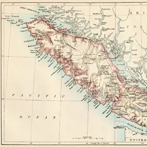
Province of British Columbia, Canada, Relief Map

![]()
Wall Art and Photo Gifts from Universal Images Group (UIG)
Province of British Columbia, Canada, Relief Map
Relief map of British Columbia, Canada. This image was compiled from data acquired by LANDSAT 5 & 7 satellites combined with elevation data
Universal Images Group (UIG) manages distribution for many leading specialist agencies worldwide
Media ID 9612961
© Planet Observer/UIG
British Columbia Canada Canadian Rockies Coastline Island Mountain Mountain Range Province Relief Map Shore Vancouver Victoria Satellite View
FEATURES IN THESE COLLECTIONS
> Aerial Photography
> America
> North America
> Canada
> Maps
> North America
> Canada
> Vancouver
> Popular Themes
> Canadian Rockies
> Universal Images Group (UIG)
> Universal Images Group
> Satellite and Aerial
> Planet Observer 4
MADE IN AUSTRALIA
Safe Shipping with 30 Day Money Back Guarantee
FREE PERSONALISATION*
We are proud to offer a range of customisation features including Personalised Captions, Color Filters and Picture Zoom Tools
SECURE PAYMENTS
We happily accept a wide range of payment options so you can pay for the things you need in the way that is most convenient for you
* Options may vary by product and licensing agreement. Zoomed Pictures can be adjusted in the Cart.