
Maps Collection
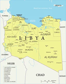
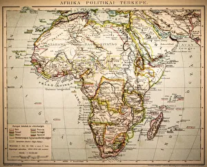
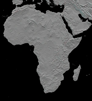
Libya is a country located in North Africa, bordered by the Mediterranean Sea to the north, Egypt to the east, Sudan to the southeast
Choose a picture from our Maps Collection for your Wall Art and Photo Gifts
81 items


All Professionally Made to Order for Quick Shipping
-
Maps Collection
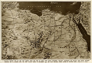
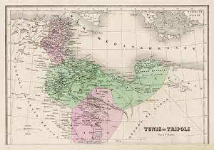
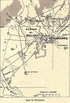
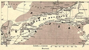
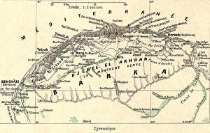
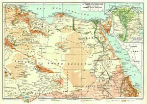
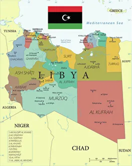
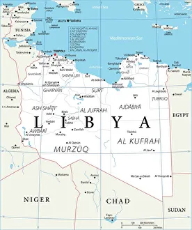
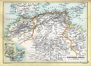
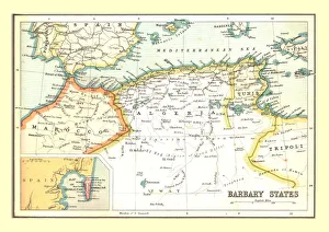
Libya is a country located in North Africa, bordered by the Mediterranean Sea to the north, Egypt to the east, Sudan to the southeast, Chad and Niger to the south and Algeria and Tunisia to the west. Libya is divided into three regions: Tripolitania in the northwest, Cyrenaica in the east and Fezzan in southwest. Maps of Libya show its physical features such as mountains, deserts and rivers. The capital city Tripoli is located on a bay of Mediterranean Sea. Other major cities include Benghazi (second largest city), Misrata (third largest city) and Sabha (fourth largest city). They also show important roads connecting these cities with each other as well as with neighbouring countries like Egypt, Sudan or Tunisia. In addition to physical features maps of Libya also indicate political boundaries between its three regions as well as international borders with neighbouring countries.
+
Our beautiful pictures are available as Framed Prints, Photos, Wall Art and Photo Gifts
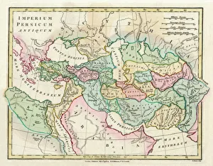
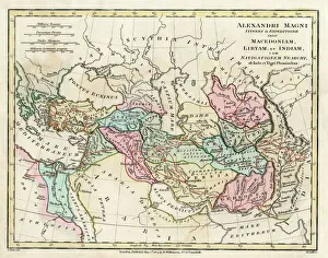
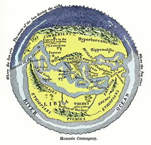
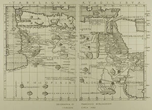
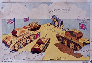
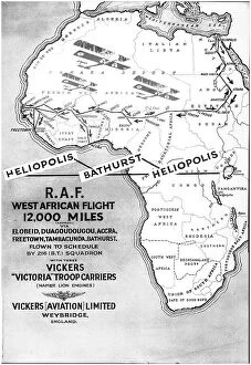
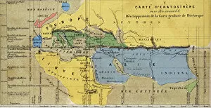
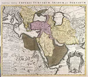
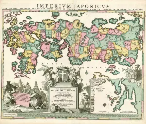
Media Storehouse offers a stunning collection of Maps of Libya Africa, which features an array of vintage and contemporary maps that depict the geography, topography, and political boundaries of Libya. Our collection includes detailed maps from various periods in history, such as Ottoman Empire era maps and World War II-era military maps. These intricate pieces showcase the evolution of cartography over time while also providing insight into the historical context surrounding each map. The Maps of Libya Africa collection is perfect for those interested in history or geography or anyone who wants to add a unique touch to their home decor. Each print is available in different sizes and can be framed according to your preference. Whether you're looking for a statement piece for your living room or office space, these prints are sure to impress with their intricate details and rich colors. Our Maps of Libya Africa collection provides an excellent opportunity to explore the country's past through beautifully crafted cartographic art pieces that will enhance any wall they adorn.
+
What are Maps of Libya Africa art prints?
Maps of Libya Africa art prints are beautiful and intricate depictions of the country of Libya, located in North Africa. These prints showcase the geography and topography of the region, including its deserts, mountains, and coastlines. They also highlight important landmarks such as cities, towns, rivers, lakes and other natural features. These maps are not only visually stunning but also serve as valuable educational tools for anyone interested in learning more about this fascinating part of the world. Whether you're a student studying geography or history or simply an art lover looking for unique wall decor that will spark conversation with your guests - Maps of Libya Africa art prints offer something special. We offer a wide range of these maps in various sizes to suit any space. They can be framed or mounted on canvas to create a striking focal point in any room. With their detailed designs and vibrant colors, Maps of Libya Africa art prints are sure to impress anyone who sees them.
+
What Maps of Libya Africa art prints can I buy from Media Storehouse?
We offer a wide range of Maps of Libya Africa art prints that you can purchase. These maps are available in various sizes and styles, including vintage, antique, and modern designs. You can choose from different types of maps such as political maps, physical maps, topographic maps, roadmaps, and more. The Maps of Libya Africa art prints available at Media Storehouse are perfect for anyone who loves geography or wants to decorate their home or office with unique artwork. They are printed on high-quality paper using advanced printing technology to ensure that the colors remain vibrant for years to come. Whether you're looking for a map of Libya's major cities or its natural features like deserts and mountains ranges, we have got you covered. With so many options to choose from, you're sure to find the perfect Maps of Libya Africa art print that suits your taste and style.
+
How do I buy Maps of Libya Africa art prints?
To buy Maps of Libya Africa art prints, you can visit our online platform. The website offers a wide range of high-quality art prints that are perfect for decorating your home or office space. You can browse through the collection and select the print that best suits your taste and preferences. Once you have selected the print, you can add it to your cart and proceed to checkout. At this stage, you will be required to provide your billing and shipping information. After completing the payment process, Media Storehouse will process your order and ship it out to you. The Maps of Libya Africa art prints available on Media Storehouse are created using state-of-the-art printing technology that ensures vibrant colors and sharp details. These prints are ideal for anyone who is interested in geography or African culture. Buying Maps of Libya Africa art prints from Media Storehouse is a simple process that involves browsing through their online store, selecting a print, providing billing information, making payment, and waiting for delivery.
+
How much do Maps of Libya Africa art prints cost?
We offer a wide range of Maps of Libya Africa art prints that vary in price depending on the size and type of print selected. Our collection includes vintage maps, satellite images, and contemporary designs to suit all tastes and preferences. We pride ourselves on providing high-quality prints that are perfect for home or office decor. Our prices are competitive and reflect the quality of our products. We believe that everyone should have access to beautiful artwork at an affordable price, which is why we strive to keep our prices reasonable without compromising on quality. Whether you're looking for a small print to add some character to your living room or a large statement piece for your office wall, we have something for everyone. So if you're interested in purchasing one of our Maps of Libya Africa art prints, browse through our collection today.
+
How will my Maps of Libya Africa art prints be delivered to me?
We take pride in delivering your Maps of Libya Africa art prints with utmost care and efficiency. Your order will be dispatched promptly after it has been processed and packaged securely to ensure its safe arrival at your doorstep. We use reliable courier services that are equipped to handle fragile items such as artwork, so you can rest assured that your print will arrive in pristine condition. Our delivery options include standard shipping or express delivery for urgent orders. You can choose the option that best suits your needs during checkout. Once your order is dispatched, you will receive a tracking number via email so you can track the progress of your shipment. We understand how important it is for our customers to receive their orders on time and in perfect condition. That's why we make every effort to ensure a smooth and hassle-free delivery process for all our customers around the world.