Cushion > North America > United States of America > Connecticut > Hartford
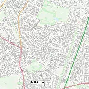
Cushion : CT Hartford West Hartford Vector Road Map


![]()
Home Decor from Fine Art Storehouse
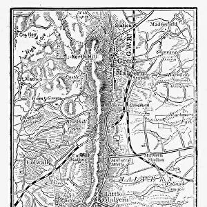
CT Hartford West Hartford Vector Road Map
CT Hartford West Hartford Vector Road Map. All source data is in the public domain. U.S. Census Bureau Census Tiger. Used Layers: areawater, linearwater, roads, rails, cousub, pointlm, uac10
Unleash your creativity and transform your space into a visual masterpiece!
Frank Ramspott
Media ID 20688027
© Frank Ramspott, all rights reserved
City Map Computer Graphic Connecticut County Digital Composite District Geographical Border Hartford Road Map Text Vector Village Digitally Generated Image Elmwood
Cushion
Refresh your home decor with a beautiful full photo 16"x16" (40x40cm) cushion, complete with cushion pad insert. Printed on both sides and made from 100% polyester with a zipper on the bottom back edge of the cushion cover. Care Instructions: Warm machine wash, do not bleach, do not tumble dry. Warm iron inside out. Do not dry clean.
Accessorise your space with decorative, soft cushions
Estimated Product Size is 40cm x 40cm (15.7" x 15.7")
These are individually made so all sizes are approximate
Artwork printed orientated as per the preview above, with landscape (horizontal) or portrait (vertical) orientation to match the source image.
FEATURES IN THESE COLLECTIONS
> Animals
> Mammals
> Cats (Wild)
> Tiger
> Animals
> Mammals
> Muridae
> Water Mouse
> Arts
> Contemporary art
> Digital artwork
> Street art
> Arts
> Landscape paintings
> Waterfall and river artworks
> River artworks
> Arts
> Portraits
> Pop art gallery
> Street art portraits
> Arts
> Street art graffiti
> Digital art
> Digital paintings
> Europe
> United Kingdom
> England
> Avon
> Maps and Charts
> Related Images
> North America
> United States of America
> Connecticut
> Hartford
> Popular Themes
> Lake District
> Fine Art Storehouse
> Map
> Reference Maps
EDITORS COMMENTS
This print showcases the intricate and detailed CT Hartford West Hartford Vector Road Map. Created by talented cartographer Frank Ramspott, this digitally generated image is a testament to his expertise in map design and geographical accuracy. Utilizing various layers such as areawater, linearwater, roads, rails, cousub, pointlm, and uac10 from the U. S. Census Bureau Census Tiger data (all of which are in the public domain), Ramspott has flawlessly depicted the physical geography of Connecticut's capital city. The vibrant color image highlights the geographical borders of different districts within Hartford and West Hartford while also featuring prominent landmarks like rivers, lakes, villages, towns, and streets. With no people present in this computer-generated composition, all attention is drawn towards the intricacies of this visually stunning piece. Ideal for enthusiasts of cartography or those with a love for urban landscapes, this print effortlessly combines artistry with functionality. Whether displayed at home or in an office setting, it serves as both a decorative element and a practical reference tool for navigating these cities' road networks
MADE IN AUSTRALIA
Safe Shipping with 30 Day Money Back Guarantee
FREE PERSONALISATION*
We are proud to offer a range of customisation features including Personalised Captions, Color Filters and Picture Zoom Tools
SECURE PAYMENTS
We happily accept a wide range of payment options so you can pay for the things you need in the way that is most convenient for you
* Options may vary by product and licensing agreement. Zoomed Pictures can be adjusted in the Cart.