Cushion > Europe > United Kingdom > Scotland > Aberdeenshire > Blackburn
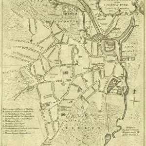
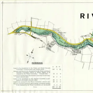
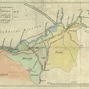
Cushion : A plan of the intended canal from Sheffield to Tinsley by W. and J. Fairbank, 1815


![]()
Home Decor from Sheffield City Archives
A plan of the intended canal from Sheffield to Tinsley by W. and J. Fairbank, 1815
Includes Greenland Engine.Original at Local Studies S33S
Sheffield City Archives and Local Studies Library has an unrivalled collection of images of Sheffield, England
Media ID 14048895
© Sheffield City Council
Attercliffe Brightside Brook Canals Carbrook Darnall Forge Hill Maps Mill Porter River Rivers Road Sheaf Street Tinsley Walk Wicker Acres Bawtry Blackburn Dyke Holmes Royds Weir Weirs Worksop
Cushion
Refresh your home decor with a beautiful full photo 16"x16" (40x40cm) cushion, complete with cushion pad insert. Printed on both sides and made from 100% polyester with a zipper on the bottom back edge of the cushion cover. Care Instructions: Warm machine wash, do not bleach, do not tumble dry. Warm iron inside out. Do not dry clean.
Accessorise your space with decorative, soft cushions
Estimated Product Size is 40cm x 40cm (15.7" x 15.7")
These are individually made so all sizes are approximate
Artwork printed orientated as per the preview above, with landscape (horizontal) or portrait (vertical) orientation to match the source image.
FEATURES IN THESE COLLECTIONS
> Europe
> United Kingdom
> Scotland
> Aberdeenshire
> Blackburn
> Europe
> United Kingdom
> Scotland
> West Lothian
> Blackburn
> Maps and Charts
> Related Images
> North America
> Greenland
> Maps
> North America
> Greenland
> Related Images
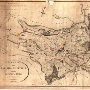
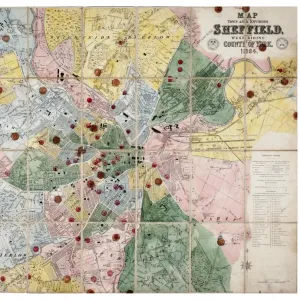
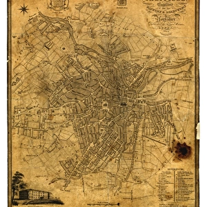
> Sheffield City Archives
> Maps and Plans
> Maps of Sheffield
> Sheffield City Archives
> Maps and Plans
Discovering Sheffield's Historic Waterways - A Glimpse into the Past
EDITORS COMMENTS
. This print showcases a remarkable piece of history - "A plan of the intended canal from Sheffield to Tinsley" meticulously crafted by W. and J. Fairbank in 1815. Preserved at the Local Studies S33S section of Sheffield City Archives, this extraordinary map offers an intriguing insight into the city's rich industrial heritage. The image depicts a network of canals stretching from Sheffield to Tinsley, encompassing notable landmarks such as Greenland Engine, rivers Sheaf and Porter, Royds Mill, and Brightside Weir among others. The intricate details on this map invite us to embark on a virtual journey through time. As we explore further, we encounter familiar names like Bawtry Road, Blackburn Acres, Darnall Hill Dyke, Carbrook Forge Pond – all reminders of how these areas have evolved over centuries. This snapshot transports us back to an era when waterways were vital for transportation and trade in Sheffield. While admiring this historical gem captured within the frame, let's take a moment to appreciate the efforts made by our ancestors who shaped these canals that once bustled with activity. This print serves as a reminder of our city's industrious past and encourages us to cherish its legacy
MADE IN AUSTRALIA
Safe Shipping with 30 Day Money Back Guarantee
FREE PERSONALISATION*
We are proud to offer a range of customisation features including Personalised Captions, Color Filters and Picture Zoom Tools
SECURE PAYMENTS
We happily accept a wide range of payment options so you can pay for the things you need in the way that is most convenient for you
* Options may vary by product and licensing agreement. Zoomed Pictures can be adjusted in the Cart.