Fraud Blocker Skip to main content

Home > Europe > France > Maps

Maps Collection (page 39)

Maps of France Europe are essential tools for travelers and tourists who want to explore the continent

11,167 items

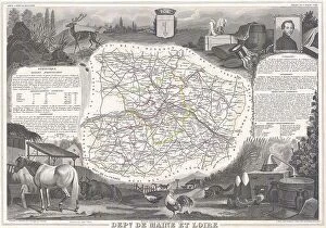
Background imageMaps Collection: 1847 Levasseur Map Of Dept. Maine Et Loire France
1847 Levasseur Map Of Dept. Maine Et Loire France
1847, Levasseur Map of Dept. Maine et Loire, France

Background imageMaps Collection: 1847 Levasseur Map Of The Dept. Du Lot France

1847 Levasseur Map Of The Dept. Du Lot France
1847, Levasseur Map of the Dept. Du Lot, France

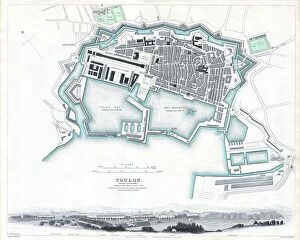
Background imageMaps Collection: 1840 S.D.U.K. Map Or City Plan Of Toulon France

1840 S.D.U.K. Map Or City Plan Of Toulon France
1840, S.D.U.K. Map or City Plan of Toulon, France

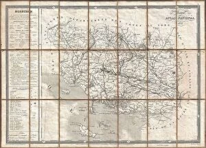
Background imageMaps Collection: 1833 Charle Map Of The Dept. Of Morbihan Bretagne

1833 Charle Map Of The Dept. Of Morbihan Bretagne
1833, Charle Map of the Dept. of Morbihan, Bretagne, France

Background imageMaps Collection: 1832 S.D.U.K. Map Of Bordeaux France Topography

1832 S.D.U.K. Map Of Bordeaux France Topography
1832, S.D.U.K. Map of Bordeaux, France

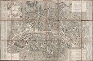
Background imageMaps Collection: 1802 Chez Jean Map Of Paris In 12 Municipalities

1802 Chez Jean Map Of Paris In 12 Municipalities
1802, Chez Jean Map of Paris in 12 Municipalities, France

Background imageMaps Collection: 1797 Tardieu Map Of Champagne France Topography

1797 Tardieu Map Of Champagne France Topography
1797, Tardieu Map of Champagne, France

Background imageMaps Collection: 1794 Jeffreys Map Of Corsica France Topography

1794 Jeffreys Map Of Corsica France Topography
1794, Jeffreys Map of Corsica, France

Background imageMaps Collection: 1797 Jean Map Of Paris And The Faubourgs France

1797 Jean Map Of Paris And The Faubourgs France
1797, Jean Map of Paris and the Faubourgs, France

Background imageMaps Collection: 1794 Anville Map Of Gaul Gallia Or France In Ancient Roman Times

1794 Anville Map Of Gaul Gallia Or France In Ancient Roman Times
1794, Anville Map of Gaul, Gallia or France in ancient Roman Times

Background imageMaps Collection: 1780 Bonne Map Of The Environs Of Paris France

1780 Bonne Map Of The Environs Of Paris France
1780, Bonne Map of the Environs of Paris, France, Rigobert Bonne 1727 - 1794, one of the most important cartographers of the late 18th century

Background imageMaps Collection: 1780 Bonne Map Of Alsace And Lorainne France

1780 Bonne Map Of Alsace And Lorainne France
1780, Bonne Map of Alsace and Lorainne, France, Rigobert Bonne 1727 - 1794, one of the most important cartographers of the late 18th century

Background imageMaps Collection: 1780 Bonne Map Of The Environs Of Paris France

1780 Bonne Map Of The Environs Of Paris France
1780, Bonne Map of the Environs of Paris, France, Rigobert Bonne 1727 - 1794, one of the most important cartographers of the late 18th century

Background imageMaps Collection: 1775 Esnauts And Rapilly Case Or Pocket Map Of Paris

1775 Esnauts And Rapilly Case Or Pocket Map Of Paris
1775, Esnauts and Rapilly Case or Pocket Map of Paris, France and environs

Background imageMaps Collection: 1771 Bonne Map Of Poitou Touraine And Anjou France

1771 Bonne Map Of Poitou Touraine And Anjou France
1771, Bonne Map of Poitou, Touraine and Anjou, France, Rigobert Bonne 1727 - 1794, one of the most important cartographers of the late 18th century

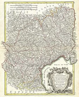
Background imageMaps Collection: 1771 Bonne Map Of Languedoc And Roussillon France

1771 Bonne Map Of Languedoc And Roussillon France
1771, Bonne Map of Languedoc and Roussillon, France, Rigobert Bonne 1727 - 1794, one of the most important cartographers of the late 18th century

Background imageMaps Collection: 1771 Bonne Map Of Guyenne And Gascony France

1771 Bonne Map Of Guyenne And Gascony France
1771, Bonne Map of Guyenne and Gascony, France, Rigobert Bonne 1727 - 1794, one of the most important cartographers of the late 18th century

Background imageMaps Collection: 1771 Bonne Map Of Burgundy Franche-Comte And Lyonnais

1771 Bonne Map Of Burgundy Franche-Comte And Lyonnais
1771, Bonne Map of Burgundy, Franche-Comte, and Lyonnais, France, Rigobert Bonne 1727 - 1794, one of the most important cartographers of the late 18th century

Background imageMaps Collection: 1771 Bonne Map Of Normandy France Rigobert Bonne 1727 – 1794

1771 Bonne Map Of Normandy France Rigobert Bonne 1727 – 1794
1771, Bonne Map of Normandy, France, Rigobert Bonne 1727 - 1794, one of the most important cartographers of the late 18th century

Background imageMaps Collection: 1771 Bonne Map Of Isle De France Vicinity Of Paris

1771 Bonne Map Of Isle De France Vicinity Of Paris
1771, Bonne Map of Isle de France, vicinity of Paris, France, Rigobert Bonne 1727 - 1794, one of the most important cartographers of the late 18th century

Background imageMaps Collection: 1771 Bonne Map Of Dauphine And Provence France

1771 Bonne Map Of Dauphine And Provence France
1771, Bonne Map of Dauphine and Provence, France, Rigobert Bonne 1727 - 1794, one of the most important cartographers of the late 18th century

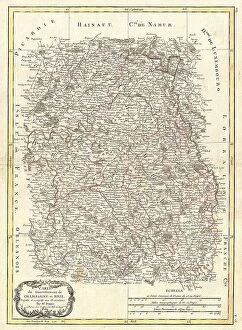
Background imageMaps Collection: 1771 Bonne Map Of Brie And Champagne France Rigobert Bonne 1727 – 1794

1771 Bonne Map Of Brie And Champagne France Rigobert Bonne 1727 – 1794
1771, Bonne Map of Brie and Champagne, France, Rigobert Bonne 1727 - 1794, one of the most important cartographers of the late 18th century

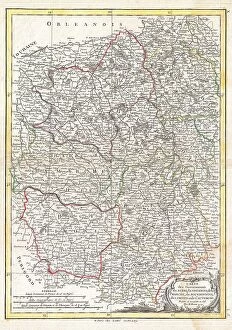
Background imageMaps Collection: 1771 Bonne Map Of The Auvergne Limosin Bourbonnais

1771 Bonne Map Of The Auvergne Limosin Bourbonnais
1771, Bonne Map of the Auvergne, Limosin, Bourbonnais, and Berri, France, Rigobert Bonne 1727 - 1794, one of the most important cartographers of the late 18th century

Background imageMaps Collection: 1771 Bonne Map Of Alsace And Lorraine France

1771 Bonne Map Of Alsace And Lorraine France
1771, Bonne Map of Alsace and Lorraine, France, Rigobert Bonne 1727 - 1794, one of the most important cartographers of the late 18th century

Background imageMaps Collection: 1771 Bonne Map Of Picardy Artois And French Flanders

1771 Bonne Map Of Picardy Artois And French Flanders
1771, Bonne Map of Picardy, Artois and French Flanders, France, Rigobert Bonne 1727 - 1794, one of the most important cartographers of the late 18th century

Background imageMaps Collection: 1747 La Feuille Map Of Languedoc France Topography

1747 La Feuille Map Of Languedoc France Topography
1747, La Feuille Map of Languedoc, France

Background imageMaps Collection: 1747 La Feuille Map Of Provence France Topography

1747 La Feuille Map Of Provence France Topography
1747, La Feuille Map of Provence, France

Background imageMaps Collection: 1747 La Feuille Map Of Alsace France Topography

1747 La Feuille Map Of Alsace France Topography
1747, La Feuille Map of Alsace, France

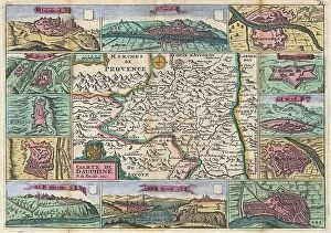
Background imageMaps Collection: 1747 La Feuille Map Of Dauphine And Hautes-Alpes

1747 La Feuille Map Of Dauphine And Hautes-Alpes
1747, La Feuille Map of Dauphine and Hautes-Alpes, France

Background imageMaps Collection: 1739 Bretez Turgot View And Map Of Paris France

1739 Bretez Turgot View And Map Of Paris France
1739, Bretez, Turgot View and Map of Paris, France

Background imageMaps Collection: 1739 Bretez Turgot View And Map Of Paris France

1739 Bretez Turgot View And Map Of Paris France
1739, Bretez, Turgot View and Map of Paris, France, c. 1900

Background imageMaps Collection: 1739 Bretez Turgot View And Map Of Paris France

1739 Bretez Turgot View And Map Of Paris France
1739, Bretez, Turgot View and Map of Paris, France, c. 1900

Background imageMaps Collection: 1716 Homann Map Of Burgundy France Topography

1716 Homann Map Of Burgundy France Topography
1716, Homann Map of Burgundy, France

Background imageMaps Collection: 1652 Gomboust Map Of Paris France C. 1900 Taride Reissue

1652 Gomboust Map Of Paris France C. 1900 Taride Reissue
1652, Gomboust Map of Paris, France, c. 1900 Taride reissue

Background imageMaps Collection: 1652 Gomboust 9 Panel Map Of Paris France C. 1900 Taride Reissue

1652 Gomboust 9 Panel Map Of Paris France C. 1900 Taride Reissue
1652, Gomboust 9 Panel Map of Paris, France, c. 1900 Taride reissue

Background imageMaps Collection: 1579 Ortelius Map Of Calais And Vermandois France And Vicinity

1579 Ortelius Map Of Calais And Vermandois France And Vicinity
1579, Ortelius Map of Calais and Vermandois, France and Vicinity, Abraham Ortelius, also Orthellius, 1527 - 1598, Flemish, Netherlandish cartographer and geographer

Background imageMaps Collection: Map Showing Allied Advance Eastwards France Belgium

Map Showing Allied Advance Eastwards France Belgium
Map showing the Allied advance eastwards across France, Belgium and Holland to the Rhine from 3 September 1945 during WWII. From The War in Pictures, Sixth Year

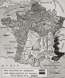
Background imageMaps Collection: Map Showing Occupation Demilitarisation Demilitarization

Map Showing Occupation Demilitarisation Demilitarization
Map showing the occupation, and demilitarization of France by Germany during WWII. From The War in Pictures, First Year

Background imageMaps Collection: Old engraved illustration of France and Belgium border map

Old engraved illustration of France and Belgium border map
Antique Illustration, Copyright has expired on this artwork. From my own archives, digitally restored

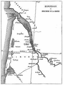
Background imageMaps Collection: Old engraved map of Bordeaux, port city on the river Garonne in the Gironde department

Old engraved map of Bordeaux, port city on the river Garonne in the Gironde department, Southwestern France
Antique Illustration, Copyright has expired on this artwork. From my own archives, digitally restored

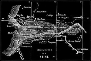
Background imageMaps Collection: Old engraved map of Seine River, a 777-kilometre-long (483 mi) river in northern France

Old engraved map of Seine River, a 777-kilometre-long (483 mi) river in northern France
Copyright has expired on this artwork. From my own archives, digitally restored

Background imageMaps Collection: Old engraved illustration of France climate map of growing areas and wildlife

Old engraved illustration of France climate map of growing areas and wildlife
Antique Illustration. Copyright has expired on this artwork. From my own archives, digitally restored

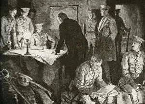
Background imageMaps Collection: WWI - British headquarters underground office

WWI - British headquarters underground office
3789980 WWI - British headquarters underground office; (add.info.: British headquarters underground office. A bomb proof subterranean apartment provides a workspace for generals to work out their)

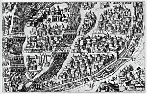
Background imageMaps Collection: Map of Paris in 16th century (engraving)

Map of Paris in 16th century (engraving)
3793834 Map of Paris in 16th century (engraving); (add.info.: Map of Paris in the 16th century. Engraving including the University quarter above no. 34)

Background imageMaps Collection: WWI Map of the position of the Armies August 22 1914

WWI Map of the position of the Armies August 22 1914
3789214 WWI Map of the position of the Armies August 22 1914; (add.info.: WWI - Map of the position of the Armies August 22 1914 in Belgium and France shwoing German army divisions and British)

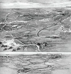
Background imageMaps Collection: WW1 - Battle of Cateau 1914

WW1 - Battle of Cateau 1914
3789968 WW1 - Battle of Cateau 1914; (add.info.: Battle of Cateau. Map shows the retreat of the British at Cateau, with calvary led by General Allenby)

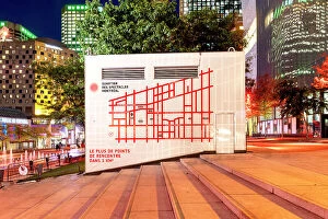
Background imageMaps Collection: Canada, Quebec, Montreal, Scene at Quartier Des Spectacles at night

Canada, Quebec, Montreal, Scene at Quartier Des Spectacles at night
-01

Background imageMaps Collection: View of Strasbourg with two towers

View of Strasbourg with two towers France Strasbourg. Date of Photograph:1950-1960


All Professionally Made to Order for Quick Shipping


-

Maps Collection

Maps of France Europe are essential tools for travelers and tourists who want to explore the continent. They provide an overview of the country, its major cities, and its attractions and are show roads, rivers, mountains, lakes, and other natural features that make up the landscape. Additionally, they often include information about local customs and culture as well as points of interest such as museums or monuments, and are be found in bookstores or online in various formats including paper maps or digital versions that can be accessed on mobile devices. With a map of France Europe in hand travelers will have no trouble navigating their way around this beautiful country.
+

Our beautiful pictures are available as Framed Prints, Photos, Wall Art and Photo Gifts

The Maps of France Europe collection is a stunning assortment of wall art and framed prints that showcase the beauty and diversity of France. Our collection features an extensive range of maps, including antique maps dating back to the 16th century, as well as modern-day maps highlighting the country's cities, regions, and landmarks. Each print in our collection has been carefully curated by Media Storehouse to provide customers with a unique glimpse into French history and culture. From detailed depictions of Parisian streets to panoramic views of the Alps, these prints are sure to captivate anyone who loves France or European geography. Whether you're looking for a beautiful piece of artwork for your home or office or want to give someone special a thoughtful gift, Maps of France Europe offers something for everyone. With its high-quality printing techniques and durable framing options, our collection is sure to impress even the most discerning art enthusiasts.
+

What are Maps of France Europe art prints?

Maps of France Europe art prints are high-quality reproductions of vintage and contemporary maps showcasing the geography, topography, and landmarks of France and its neighboring European countries. These prints are perfect for those who love history, travel, or simply appreciate the beauty of cartography. The collection includes a wide range of styles, from antique maps dating back to the 16th century to modern designs featuring vibrant colors and intricate details. Some prints focus on specific regions or cities within France or Europe while others provide an overview of the entire continent. These art prints can be used to decorate any room in your home or office, adding a touch of sophistication and elegance to your space. They also make great gifts for anyone with an interest in geography or history. Whether you're looking for a unique piece to add to your personal collection or want to give someone special a thoughtful gift they'll treasure forever, Maps of France Europe art prints from Media Storehouse are sure to impress.
+

What Maps of France Europe art prints can I buy from Media Storehouse?

We offer a wide range of Maps of France Europe art prints that are perfect for those who love to travel or have an interest in geography. These maps come in various styles and designs, including vintage, antique, and modern versions. You can choose from different sizes and formats such as canvas prints, framed prints, posters or photographic prints. Some popular options include the Antique Map of France by John Speed which dates back to 1626; the Vintage Map of Paris which showcases the city's famous landmarks; and the Modern Map of Europe which highlights all major cities across the continent. Whether you're looking for a decorative piece for your home or office space or want to gift it to someone who loves history or geography- Media Storehouse has got you covered with their vast collection of Maps of France Europe art prints.
+

How do I buy Maps of France Europe art prints?

To buy Maps of France Europe art prints from Media Storehouse, you can browse through our extensive collection of maps and select the ones that interest you. Once you have made your selection, add them to your cart and proceed to checkout. You will be prompted to enter your shipping and payment information before completing the purchase. We offer a variety of sizes for their art prints, so make sure to choose the one that best fits your needs. The maps are printed on high-quality paper using state-of-the-art printing technology, ensuring that they look great in any setting. If you have any questions or concerns about purchasing Maps of France Europe art prints from Media Storehouse, our customer service team is available to assist you. They can provide additional information about the products or help with any issues that may arise during the ordering process.
+

How much do Maps of France Europe art prints cost?

We offer a wide range of Maps of France Europe art prints at varying prices. The cost of these prints depends on several factors such as the size, quality, and type of print you choose. Our standard paper prints are more affordable than our premium canvas or framed options. Additionally, some maps may be more intricate and detailed than others which can also impact the price. We strive to provide high-quality products at reasonable prices for all customers. Our Maps of France Europe art prints make great additions to any home or office decor and are perfect for history buffs or those who love travel. With a variety of sizes and styles available, there is something for everyone's taste and budget. We encourage customers to browse our selection online to find the perfect map print that fits their needs and preferences without breaking the bank.
+

How will my Maps of France Europe art prints be delivered to me?

We take great care in delivering your Maps of France Europe art prints to you. We use high-quality packaging materials to ensure that your artwork arrives in pristine condition. Your print will be carefully rolled and placed inside a sturdy tube for protection during transit. We work with trusted shipping partners who offer reliable delivery services. Once your order has been dispatched, you will receive an email notification with tracking information so that you can monitor the progress of your shipment. Our team is dedicated to providing excellent customer service, and we are always available to answer any questions or concerns you may have about the delivery process. If there are any issues with your order upon arrival, please contact us immediately so that we can resolve them as quickly as possible. You can trust Media Storehouse to deliver your Maps of France Europe art prints safely and efficiently straight to your doorstep.