Fraud Blocker Skip to main content

Home > Europe > France > Maps

Maps Collection (page 35)

Maps of France Europe are essential tools for travelers and tourists who want to explore the continent

11,167 items

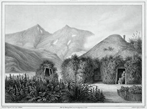
Background imageMaps Collection: View Taken in the Interior of the Lower Caroline Islands, 19th century

View Taken in the Interior of the Lower Caroline Islands, 19th century. Creators: Friedrich Heinrich Kittlitz
View Taken in the Interior of the Lower Caroline Islands, 19th century. One of 65 lithographs that were included in the volume of maps published after the round-the-world voyage of the corvette

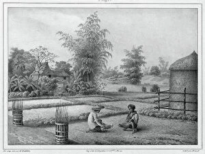
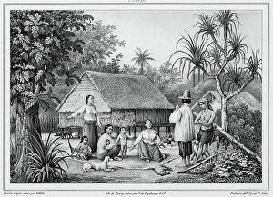
Background imageMaps Collection: Dwelling, Luzon Island, Philippines, 19th century. Creators: Friedrich Heinrich Kittlitz

Dwelling, Luzon Island, Philippines, 19th century. Creators: Friedrich Heinrich Kittlitz, Godefroy Engelmann
Dwelling, Luzon Island, Philippines, 19th century. One of 65 lithographs that were included in the volume of maps published after the round-the-world voyage of the corvette Seniavin commissioned by

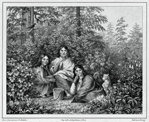
Background imageMaps Collection: Inhabitants of the island of Sitka (northwest coast of America), 19th century

Inhabitants of the island of Sitka (northwest coast of America), 19th century. One of 65 lithographs that were included in the volume of maps published after the round-the-world voyage of

Background imageMaps Collection: Inhabitants of the island of Sitkha (northwest coast of America), 19th century

Inhabitants of the island of Sitkha (northwest coast of America), 19th century. One of 65 lithographs that were included in the volume of maps published after the round-the-world voyage of

Background imageMaps Collection: Fishing in Kamchatka, 19th century. Creators: Friedrich Heinrich Kittlitz, Godefroy Engelmann

Fishing in Kamchatka, 19th century. Creators: Friedrich Heinrich Kittlitz, Godefroy Engelmann, Jules David
Fishing in Kamchatka, 19th century. One of 65 lithographs that were included in the volume of maps published after the round-the-world voyage of the corvette Seniavin commissioned by Tsar Nicholas I

Background imageMaps Collection: Dwelling of Kamchatka, 19th century. Creators: Friedrich Heinrich Kittlitz, Godefroy Engelmann

Dwelling of Kamchatka, 19th century. Creators: Friedrich Heinrich Kittlitz, Godefroy Engelmann, Jules David
Dwelling of Kamchatka, 19th century. One of 65 lithographs that were included in the volume of maps published after the round-the-world voyage of the corvette Seniavin commissioned by Tsar Nicholas I

Background imageMaps Collection: View of Kosrae Island, Caroline Islands, 19th century. Creators: Friedrich Heinrich Kittlitz

View of Kosrae Island, Caroline Islands, 19th century. Creators: Friedrich Heinrich Kittlitz, Godefroy Engelmann
View of Kosrae Island, Caroline Islands, 19th century. One of 65 lithographs that were included in the volume of maps published after the round-the-world voyage of the corvette Seniavin commissioned

Background imageMaps Collection: View of the entrance to Avacha Bay, taken from Starichkov Island, 19th century

View of the entrance to Avacha Bay, taken from Starichkov Island, 19th century. One of 65 lithographs that were included in the volume of maps published after the round-the-world voyage of

Background imageMaps Collection: Vegetation of Kamchatka, 19th century. Creators: Friedrich Heinrich Kittlitz

Vegetation of Kamchatka, 19th century. Creators: Friedrich Heinrich Kittlitz, Louis-Pierre-Alphonse Bichebois
Vegetation of Kamchatka, 19th century. One of 65 lithographs that were included in the volume of maps published after the round-the-world voyage of the corvette Seniavin commissioned by Tsar Nicholas

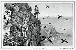
Background imageMaps Collection: Kamchatka, Hunting Puffins, 19th century. Creators: Friedrich Heinrich Kittlitz, Victor Adam

Kamchatka, Hunting Puffins, 19th century. Creators: Friedrich Heinrich Kittlitz, Victor Adam, Godefroy Engelmann
Kamchatka, Hunting Puffins, 19th century. One of 65 lithographs that were included in the volume of maps published after the round-the-world voyage of the corvette Seniavin commissioned by Tsar

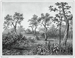
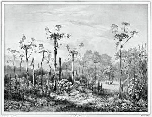
Background imageMaps Collection: Vegetation in the interior of the Kamchatka peninsula, 19th century

Vegetation in the interior of the Kamchatka peninsula, 19th century. Creators: Friedrich Heinrich Kittlitz
Vegetation in the interior of the Kamchatka peninsula, 19th century. One of 65 lithographs that were included in the volume of maps published after the round-the-world voyage of the corvette Seniavin

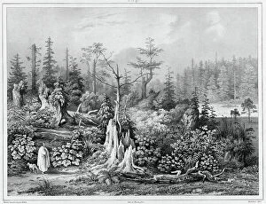
Background imageMaps Collection: Vegetation around the settlement of Novo-Arkhangelsk (northwest coast of America), 19th century

Vegetation around the settlement of Novo-Arkhangelsk (northwest coast of America), 19th century. One of 65 lithographs that were included in the volume of maps published after the round-the-world

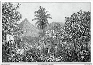
Background imageMaps Collection: View of the Interior, Luzon Island, Philippines, 19th century

View of the Interior, Luzon Island, Philippines, 19th century. Creators: Friedrich Heinrich Kittlitz, Victor Adam
View of the Interior, Luzon Island, Philippines, 19th century. One of 65 lithographs that were included in the volume of maps published after the round-the-world voyage of the corvette Seniavin

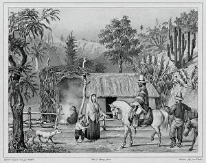
Background imageMaps Collection: Dwelling at Valparaiso, Chile, 19th century. Creators: Friedrich Heinrich Kittlitz, Victor Adam

Dwelling at Valparaiso, Chile, 19th century. Creators: Friedrich Heinrich Kittlitz, Victor Adam, Godefroy Engelmann
Dwelling at Valparaiso, Chile, 19th century. One of 65 lithographs that were included in the volume of maps published after the round-the-world voyage of the corvette Seniavin commissioned by Tsar

Background imageMaps Collection: Dwelling at Unalaska, Aleutian Islands, 19th century. Creators: Friedrich Heinrich Kittlitz

Dwelling at Unalaska, Aleutian Islands, 19th century. Creators: Friedrich Heinrich Kittlitz, Victor Adam
Dwelling at Unalaska, Aleutian Islands, 19th century. One of 65 lithographs that were included in the volume of maps published after the round-the-world voyage of the corvette Seniavin commissioned

Background imageMaps Collection: Dwelling of Two Shipwrecked Europeans in Port Lloyd of Peel Island, Bonin Islands, 19th century

Dwelling of Two Shipwrecked Europeans in Port Lloyd of Peel Island, Bonin Islands, 19th century. One of 65 lithographs that were included in the volume of maps published after the round-the-world

Background imageMaps Collection: Dwelling at Guam, Mariana Islands, 19th century. Creators: Friedrich Heinrich Kittlitz, Victor Adam

Dwelling at Guam, Mariana Islands, 19th century. Creators: Friedrich Heinrich Kittlitz, Victor Adam
Dwelling at Guam, Mariana Islands, 19th century. One of 65 lithographs that were included in the volume of maps published after the round-the-world voyage of the corvette Seniavin commissioned by

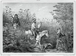
Background imageMaps Collection: Hunters of Kamchatka, 19th century. Creators: Friedrich Heinrich Kittlitz, Victor Adam

Hunters of Kamchatka, 19th century. Creators: Friedrich Heinrich Kittlitz, Victor Adam
Hunters of Kamchatka, 19th century. One of 65 lithographs that were included in the volume of maps published after the round-the-world voyage of the corvette Seniavin commissioned by Tsar Nicholas I

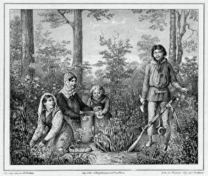
Background imageMaps Collection: Inhabitants of Kamchatka, 19th century. Creators: Friedrich Heinrich Kittlitz, Victor Adam

Inhabitants of Kamchatka, 19th century. Creators: Friedrich Heinrich Kittlitz, Victor Adam, Jean Louis Tirpenne
Inhabitants of Kamchatka, 19th century. One of 65 lithographs that were included in the volume of maps published after the round-the-world voyage of the corvette Seniavin commissioned by Tsar

Background imageMaps Collection: View of the Kamchatka River Kamchatka peninsula, 19th century. Creator: Friedrich Heinrich Kittlitz

View of the Kamchatka River Kamchatka peninsula, 19th century. Creator: Friedrich Heinrich Kittlitz
View of the Kamchatka River Kamchatka peninsula, 19th century. One of 65 lithographs that were included in the volume of maps published after the round-the-world voyage of the corvette Seniavin

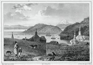
Background imageMaps Collection: View of the port of St Peter and St Paul, Kamchatka, 19th century

View of the port of St Peter and St Paul, Kamchatka, 19th century. Creators: Friedrich Heinrich Kittlitz
View of the port of St Peter and St Paul, Kamchatka, 19th century. One of 65 lithographs that were included in the volume of maps published after the round-the-world voyage of the corvette Seniavin

Background imageMaps Collection: Departure for an excursion to the island of Ualan (the Carolinas), 19th century

Departure for an excursion to the island of Ualan (the Carolinas), 19th century. One of 65 lithographs that were included in the volume of maps published after the round-the-world voyage of

Background imageMaps Collection: Hunting the Stag of the Mariana Islands, Guam Island, 19th century

Hunting the Stag of the Mariana Islands, Guam Island, 19th century. Creators: Friedrich Heinrich Kittlitz
Hunting the Stag of the Mariana Islands, Guam Island, 19th century. One of 65 lithographs that were included in the volume of maps published after the round-the-world voyage of the corvette Seniavin

Background imageMaps Collection: Bashkirs, 1862. Creator: Zakharov

Bashkirs, 1862. Creator: Zakharov
Bashkirs, 1862. Sheet 41 from the album "Description ethnographique des peuples de la Russie", volume 1. Description ethnographique des peuples de la Russie

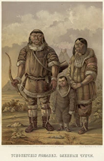
Background imageMaps Collection: Reindeer Chukchi, 1862. Creator: Zakharov

Reindeer Chukchi, 1862. Creator: Zakharov
Reindeer Chukchi, 1862. Sheet 57 from the album "Description ethnographique des peuples de la Russie", volume 1

Background imageMaps Collection: Hindus. (Fire worshipers from the outskirts of Baku), 1862. Creator: Zakharov

Hindus. (Fire worshipers from the outskirts of Baku), 1862. Creator: Zakharov
Hindus. (Fire worshipers from the outskirts of Baku), 1862. Sheet 20 from the album "Description ethnographique des peuples de la Russie", volume 1

Background imageMaps Collection: Illustration of Nukagiva Skulls, 1813. Creator: Unknown

Illustration of Nukagiva Skulls, 1813. Creator: Unknown
Illustration of Nukagiva Skulls, 1813. In 1803-06, Captain I. F. Kruzenshtern became the first Russian to circumnavigate the globe

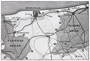
Background imageMaps Collection: Map of Dunkirk area during the evacuation, WW2

Map of Dunkirk area during the evacuation, WW2
Map of the Dunkirk area in northern France during the evacuation, showing two flooded areas of low-lying meadow land which assisted in the Allied retreat. Date: 1940

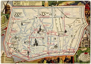
Background imageMaps Collection: Map of the Butte Montmartre, Paris, France

Map of the Butte Montmartre, Paris, France
Map of the Butte Montmartre, 18th arrondissement, Paris, France. Date: circa 1900s

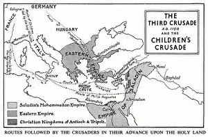
Background imageMaps Collection: Map of Third Crusade and Childrens Crusade

Map of Third Crusade and Childrens Crusade
Map of the Third Crusade and the Childrens Crusade, showing various routes and territories. Date: 1190

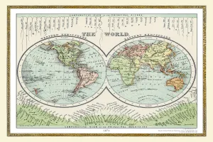
Background imageMaps Collection: Old Map of the World 1871

Old Map of the World 1871
THE WORLD THAT WAS 1871 - End of Franco-Prussian War; Germany unified, and Empire formed; Third Republic in France; suppression of the Paris Commune. British Columbia joins Canada. Chicago fires

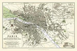
Background imageMaps Collection: Paris at the Outbreak of the French Revolution 1789

Paris at the Outbreak of the French Revolution 1789
This is a detailed Plan of Paris showing the Parks, Gardens and Squares, Palaces, Bridges over the River Seine, Churches, Convents

Background imageMaps Collection: BL Bolton, BL3 1

BL Bolton, BL3 1
BL3 1

Background imageMaps Collection: Europe Political Map

Europe Political Map
This detailed Europe map covers the whole of the continent of Europe, going east as far as Moscow and south to North Africa

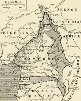
Background imageMaps Collection: Map Showing the German Cameroon Colony, 1916. Creator: Unknown

Map Showing the German Cameroon Colony, 1916. Creator: Unknown
Map Showing the German Cameroon Colony, 1916. German Cameroon was an African colony of the German Empire from 1884 to 1916

Background imageMaps Collection: Political Map of Africa, 1914, (1920). Creator: John Bartholomew & Son

Political Map of Africa, 1914, (1920). Creator: John Bartholomew & Son
Political Map of Africa, 1914, (1920). Colonial possessions in Africa at the start of the First World War. British colonies are pink, French - green, German - orange, Portuguese - purple

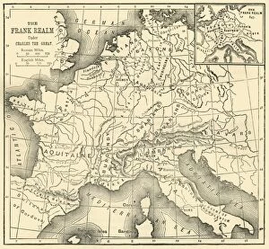
Background imageMaps Collection: Map of the Kingdom of the Franks Under Charlemagne, 1890. Creator: Unknown

Map of the Kingdom of the Franks Under Charlemagne, 1890. Creator: Unknown
Map of the Kingdom of the Franks Under Charlemagne, 1890. In 1771, Charlemagne (742-814) became king of the Franks, by 814, his empire encompassed most of Western Europe

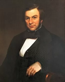
Background imageMaps Collection: John Couch Adams (1819-1892), Artist Unknown

John Couch Adams (1819-1892), Artist Unknown
Oil on canvas, English School, 19th century. John Couch Adams was born in 1819 on a farm in Laneast, near Launceston. From an early age he was fascinated by astronomy

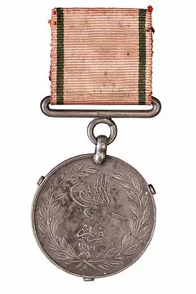
Background imageMaps Collection: Turkish Crimea Medal 1855, Crimean War 1854-1856

Turkish Crimea Medal 1855, Crimean War 1854-1856
This medal was awarded to Colonel George Frederick Stevenson Call. It is one of 17 campaign medals awarded to members of the Call family, now in the museum collection

Background imageMaps Collection: world map 1882

world map 1882
french map of the world showing the trajectories of travels and discovery around 1780 and 1822 - map is from 1882

Background imageMaps Collection: old map of central europe

old map of central europe
an old map form 1870, showing central europe countries

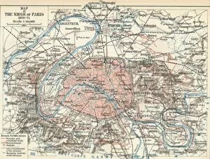
Background imageMaps Collection: Map of The Siege of Paris, 1870-71, 1907

Map of The Siege of Paris, 1870-71, 1907. The Siege of Paris and the consequent capture of the city by Prussian forces, led to French defeat in the Franco-Prussian War

Background imageMaps Collection: The Dauphin Map of the World, (1546), 1912. Artist: Pierre Desceliers

The Dauphin Map of the World, (1546), 1912. Artist: Pierre Desceliers
The Dauphin Map of the World, 1546. After Pierre Desceliers, (c1500-1558) Planisphere which is sometimes refered to as the Dauphin Map. The map was created for King Henri II of France (1519-1559)
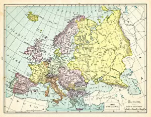
Background imageMaps Collection: Map of Europe 1895

Map of Europe 1895
The Rand-McNally Grammar School Geography 1895 - Chicago & New York

Background imageMaps Collection: Guilmin Map Of Paris France Monuments Topography

Guilmin Map Of Paris France Monuments Topography
Guilmin Map of Paris, France, Monuments

Background imageMaps Collection: 1865 Spruner Map Of France Or Gallia In Roman Times

1865 Spruner Map Of France Or Gallia In Roman Times
1865, Spruner Map of France or Gallia in Roman Times

Background imageMaps Collection: 1862 Perthes Map Of France Topography Cartography

1862 Perthes Map Of France Topography Cartography
1862, Perthes Map of France

Background imageMaps Collection: 1855 Spruneri Map Of France Gaul Gallia In Ancient Times

1855 Spruneri Map Of France Gaul Gallia In Ancient Times
1855, Spruneri Map of France, Gaul, Gallia in Ancient Times


All Professionally Made to Order for Quick Shipping


-

Maps Collection

Maps of France Europe are essential tools for travelers and tourists who want to explore the continent. They provide an overview of the country, its major cities, and its attractions and are show roads, rivers, mountains, lakes, and other natural features that make up the landscape. Additionally, they often include information about local customs and culture as well as points of interest such as museums or monuments, and are be found in bookstores or online in various formats including paper maps or digital versions that can be accessed on mobile devices. With a map of France Europe in hand travelers will have no trouble navigating their way around this beautiful country.
+

Our beautiful pictures are available as Framed Prints, Photos, Wall Art and Photo Gifts

The Maps of France Europe collection is a stunning assortment of wall art and framed prints that showcase the beauty and diversity of France. Our collection features an extensive range of maps, including antique maps dating back to the 16th century, as well as modern-day maps highlighting the country's cities, regions, and landmarks. Each print in our collection has been carefully curated by Media Storehouse to provide customers with a unique glimpse into French history and culture. From detailed depictions of Parisian streets to panoramic views of the Alps, these prints are sure to captivate anyone who loves France or European geography. Whether you're looking for a beautiful piece of artwork for your home or office or want to give someone special a thoughtful gift, Maps of France Europe offers something for everyone. With its high-quality printing techniques and durable framing options, our collection is sure to impress even the most discerning art enthusiasts.
+

What are Maps of France Europe art prints?

Maps of France Europe art prints are high-quality reproductions of vintage and contemporary maps showcasing the geography, topography, and landmarks of France and its neighboring European countries. These prints are perfect for those who love history, travel, or simply appreciate the beauty of cartography. The collection includes a wide range of styles, from antique maps dating back to the 16th century to modern designs featuring vibrant colors and intricate details. Some prints focus on specific regions or cities within France or Europe while others provide an overview of the entire continent. These art prints can be used to decorate any room in your home or office, adding a touch of sophistication and elegance to your space. They also make great gifts for anyone with an interest in geography or history. Whether you're looking for a unique piece to add to your personal collection or want to give someone special a thoughtful gift they'll treasure forever, Maps of France Europe art prints from Media Storehouse are sure to impress.
+

What Maps of France Europe art prints can I buy from Media Storehouse?

We offer a wide range of Maps of France Europe art prints that are perfect for those who love to travel or have an interest in geography. These maps come in various styles and designs, including vintage, antique, and modern versions. You can choose from different sizes and formats such as canvas prints, framed prints, posters or photographic prints. Some popular options include the Antique Map of France by John Speed which dates back to 1626; the Vintage Map of Paris which showcases the city's famous landmarks; and the Modern Map of Europe which highlights all major cities across the continent. Whether you're looking for a decorative piece for your home or office space or want to gift it to someone who loves history or geography- Media Storehouse has got you covered with their vast collection of Maps of France Europe art prints.
+

How do I buy Maps of France Europe art prints?

To buy Maps of France Europe art prints from Media Storehouse, you can browse through our extensive collection of maps and select the ones that interest you. Once you have made your selection, add them to your cart and proceed to checkout. You will be prompted to enter your shipping and payment information before completing the purchase. We offer a variety of sizes for their art prints, so make sure to choose the one that best fits your needs. The maps are printed on high-quality paper using state-of-the-art printing technology, ensuring that they look great in any setting. If you have any questions or concerns about purchasing Maps of France Europe art prints from Media Storehouse, our customer service team is available to assist you. They can provide additional information about the products or help with any issues that may arise during the ordering process.
+

How much do Maps of France Europe art prints cost?

We offer a wide range of Maps of France Europe art prints at varying prices. The cost of these prints depends on several factors such as the size, quality, and type of print you choose. Our standard paper prints are more affordable than our premium canvas or framed options. Additionally, some maps may be more intricate and detailed than others which can also impact the price. We strive to provide high-quality products at reasonable prices for all customers. Our Maps of France Europe art prints make great additions to any home or office decor and are perfect for history buffs or those who love travel. With a variety of sizes and styles available, there is something for everyone's taste and budget. We encourage customers to browse our selection online to find the perfect map print that fits their needs and preferences without breaking the bank.
+

How will my Maps of France Europe art prints be delivered to me?

We take great care in delivering your Maps of France Europe art prints to you. We use high-quality packaging materials to ensure that your artwork arrives in pristine condition. Your print will be carefully rolled and placed inside a sturdy tube for protection during transit. We work with trusted shipping partners who offer reliable delivery services. Once your order has been dispatched, you will receive an email notification with tracking information so that you can monitor the progress of your shipment. Our team is dedicated to providing excellent customer service, and we are always available to answer any questions or concerns you may have about the delivery process. If there are any issues with your order upon arrival, please contact us immediately so that we can resolve them as quickly as possible. You can trust Media Storehouse to deliver your Maps of France Europe art prints safely and efficiently straight to your doorstep.