Fraud Blocker Skip to main content

Home > Europe > Republic of Ireland > Maps

Maps Collection (page 10)

The Republic of Ireland is located in the North Atlantic Ocean and is part of Europe

1,486 items

Background imageMaps Collection: England East Coast. Sheet 2, late 19th century (print)

England East Coast. Sheet 2, late 19th century (print)
7340595 England East Coast. Sheet 2, late 19th century (print) by Imray, James & Son (19th century); National Maritime Museum, London

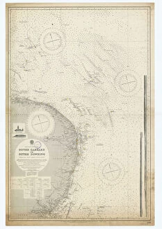
Background imageMaps Collection: England-East Coast. Outer Gabbard to Outer Dowsing, 1916 (engraving)

England-East Coast. Outer Gabbard to Outer Dowsing, 1916 (engraving)
7340585 England-East Coast. Outer Gabbard to Outer Dowsing, 1916 (engraving) by British School, (20th century) ; 98x64.5 cm; National Maritime Museum, London

Background imageMaps Collection: England-East Coast. Outer Gabbard to Outer Dowsing, 1938 (engraving)

England-East Coast. Outer Gabbard to Outer Dowsing, 1938 (engraving)
7340583 England-East Coast. Outer Gabbard to Outer Dowsing, 1938 (engraving) by British School, (20th century) ; 99x66 cm; National Maritime Museum, London

Background imageMaps Collection: England-East Coast. Outer Gabbard to Outer Dowsing, 1912 (engraving)

England-East Coast. Outer Gabbard to Outer Dowsing, 1912 (engraving)
7340580 England-East Coast. Outer Gabbard to Outer Dowsing, 1912 (engraving) by British School, (20th century) ; 99x66 cm; National Maritime Museum, London

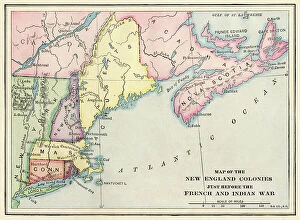
Background imageMaps Collection: New England colonies just before the French and Indian War

New England colonies just before the French and Indian War
NWI4853909 New England colonies just before the French and Indian War.; (add.info.: New England colonies just before the French and Indian War.); Photo © North Wind Pictures

Background imageMaps Collection: Allegory of the British Empire as the Colossus of Rhodes, 19th century

Allegory of the British Empire as the Colossus of Rhodes, 19th century
CUL4940269 Allegory of the British Empire as the Colossus of Rhodes, 19th century; (add.info.: Il Colosso di Rodi. Allegory of the British Empire as the 'Colossus of Rhodes" monitoring)

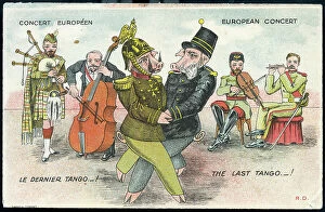
Background imageMaps Collection: First World War: France, Humorous map showing the two Austrian

First World War: France, Humorous map showing the two Austrian and German emperors in pig on a dance imposed by
LUX4736554 First World War: France, Humorous map showing the two Austrian and German emperors in pig on a dance imposed by the allies and nicknamed "the last tango"

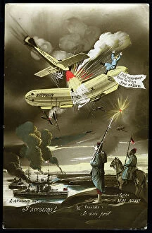
Background imageMaps Collection: First World War: France, Patriotic Map showing the plane of the distruding triple agreement

First World War: France, Patriotic Map showing the plane of the distruding triple agreement and German Zeppelin, 1914
LUX4740514 First World War: France, Patriotic Map showing the plane of the distruding triple agreement and German Zeppelin

Background imageMaps Collection: Map of Scotland showing Telford's and military roads, 1850

Map of Scotland showing Telford's and military roads, 1850
3359154 Map of Scotland showing Telford's and military roads, 1850; (add.info.: Map of Scotland showing Telford's roads (dotted lines) and military roads (solid lines)

Background imageMaps Collection: Ireland pictured in Ecclesiastical Divisions, 1766

Ireland pictured in Ecclesiastical Divisions, 1766
2902828 Ireland pictured in Ecclesiastical Divisions, 1766; (add.info.: Ireland pictured in Ecclesiastical Divisions, 1766.); Buyenlarge Archive/UIG

Background imageMaps Collection: Memoir Map of Ireland, 1797

Memoir Map of Ireland, 1797
2902826 Memoir Map of Ireland, 1797; (add.info.: Memoir Map of Ireland, 1797.); Buyenlarge Archive/UIG

Background imageMaps Collection: Tudor nobleman (detail), from a map of England and wales by John Speed, c.1612 (engraving)

Tudor nobleman (detail), from a map of England and wales by John Speed, c.1612 (engraving)
2911212 Tudor nobleman (detail), from a map of England and wales by John Speed, c.1612 (engraving); Universal History Archive/UIG

Background imageMaps Collection: Tudor nobleman (detail), from a map of England and wales by John Speed, c.1612 (engraving)

Tudor nobleman (detail), from a map of England and wales by John Speed, c.1612 (engraving)
2911211 Tudor nobleman (detail), from a map of England and wales by John Speed, c.1612 (engraving); Universal History Archive/UIG

Background imageMaps Collection: English Claims to North America, 1755

English Claims to North America, 1755
2902802 English Claims to North America, 1755; (add.info.: The English empire in North America; Representing their rightful claim as confirmed by charters)

Background imageMaps Collection: London: The City Churches (litho)

London: The City Churches (litho)
8629747 London: The City Churches (litho) by English Photographer, (20th century); Private Collection; (add.info.: The City Churches)

Background imageMaps Collection: London: The Palace of Westminster (litho)

London: The Palace of Westminster (litho)
8629745 London: The Palace of Westminster (litho) by English Photographer, (20th century); Private Collection; (add.info.: The Palace of Westminster)

Background imageMaps Collection: The Grand National course, Aintree (litho)

The Grand National course, Aintree (litho)
8664071 The Grand National course, Aintree (litho) by English School, (20th century); Private Collection; (add.info.: The Grand National course, Aintree, Merseyside)

Background imageMaps Collection: Ancient Roman walls of Chester (litho)

Ancient Roman walls of Chester (litho)
8672213 Ancient Roman walls of Chester (litho) by English School, (20th century); Private Collection; (add.info.: The ancient Roman walls of the city of Chester, Cheshire)

Background imageMaps Collection: Plan of St Andrews (b/w photo)

Plan of St Andrews (b/w photo)
8648812 Plan of St Andrews (b/w photo) by English Photographer, (20th century); Private Collection; (add.info.: Plan of St Andrews)

Background imageMaps Collection: Map of Fenland (b/w photo)

Map of Fenland (b/w photo)
8648808 Map of Fenland (b/w photo) by English Photographer, (20th century); Private Collection; (add.info.: Map of Fenland)

Background imageMaps Collection: Map of the Channel Islands (b/w photo)

Map of the Channel Islands (b/w photo)
8648805 Map of the Channel Islands (b/w photo) by English Photographer, (20th century); Private Collection; (add.info.: Map of the Channel Islands)

Background imageMaps Collection: Map of the Upper Severn (b/w photo)

Map of the Upper Severn (b/w photo)
8648796 Map of the Upper Severn (b/w photo) by English Photographer, (20th century); Private Collection; (add.info.: Map of the Upper Severn)

Background imageMaps Collection: Map of the Tunbridge Wells Country (b/w photo)

Map of the Tunbridge Wells Country (b/w photo)
8648790 Map of the Tunbridge Wells Country (b/w photo) by English Photographer, (20th century); Private Collection; (add.info.: Map of the Tunbridge Wells Country)

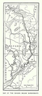
Background imageMaps Collection: Map of the Severn below Shrewsbury (b/w photo)

Map of the Severn below Shrewsbury (b/w photo)
8648787 Map of the Severn below Shrewsbury (b/w photo) by English Photographer, (20th century); Private Collection; (add.info.: Map of the Severn below Shrewsbury)

Background imageMaps Collection: Map of the Thames, from the Source to London (b/w photo)

Map of the Thames, from the Source to London (b/w photo)
8648777 Map of the Thames, from the Source to London (b/w photo) by English Photographer, (20th century); Private Collection; (add.info.: Map of the Thames, from the Source to London)

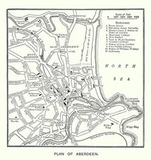
Background imageMaps Collection: Plan of Aberdeen (b/w photo)

Plan of Aberdeen (b/w photo)
8648771 Plan of Aberdeen (b/w photo) by English Photographer, (20th century); Private Collection; (add.info.: Plan of Aberdeen)

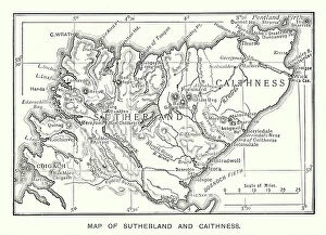
Background imageMaps Collection: Map of Sutherland and Caithness (b/w photo)

Map of Sutherland and Caithness (b/w photo)
8648683 Map of Sutherland and Caithness (b/w photo) by English Photographer, (20th century); Private Collection; (add.info.: Map of Sutherland and Caithness)

Background imageMaps Collection: The City Boundaries (b/w photo)

The City Boundaries (b/w photo)
8648673 The City Boundaries (b/w photo) by English Photographer, (20th century); Private Collection; (add.info.: The City Boundaries)

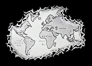
Background imageMaps Collection: The world as known after the circumnavigation by Sir Francis Drake

The world as known after the circumnavigation by Sir Francis Drake
1578478 The world as known after the circumnavigation by Sir Francis Drake; (add.info.: The world as known after the circumnavigation by Sir Francis Drake in the years 1577-1580)

Background imageMaps Collection: Cambridge: Physiographical Map showing Iron Age, Roman and Saxon Remains in and near Cambridge

Cambridge: Physiographical Map showing Iron Age, Roman and Saxon Remains in and near Cambridge (colour litho)
8621722 Cambridge: Physiographical Map showing Iron Age, Roman and Saxon Remains in and near Cambridge (colour litho) by English School

Background imageMaps Collection: Manchester and District (colour litho)

Manchester and District (colour litho)
8658795 Manchester and District (colour litho) by English School, (20th century); Private Collection; (add.info.: Manchester and District)

Background imageMaps Collection: Grims Dyke, Map shewing position in relation to the existing roads (litho)

Grims Dyke, Map shewing position in relation to the existing roads (litho)
8661960 Grims Dyke, Map shewing position in relation to the existing roads (litho) by English School, (20th century); Private Collection; (add.info.: Grims Dyke)

Background imageMaps Collection: Places mentioned in Dickens' Works (litho)

Places mentioned in Dickens' Works (litho)
8652517 Places mentioned in Dickens' Works (litho) by Bartholomew, John George (1860-1920) ; Private Collection; (add.info.: Places mentioned in Dickens' Works)

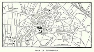
Background imageMaps Collection: Plan of Southwell (b/w photo)

Plan of Southwell (b/w photo)
8651733 Plan of Southwell (b/w photo) by English Photographer, (20th century); Private Collection; (add.info.: Plan of Southwell)

Background imageMaps Collection: Plan of Glasgow (b/w photo)

Plan of Glasgow (b/w photo)
8651359 Plan of Glasgow (b/w photo) by English Photographer, (20th century); Private Collection; (add.info.: Plan of Glasgow)

Background imageMaps Collection: Map of Cornwall and the Scilly Isles (b/w photo)

Map of Cornwall and the Scilly Isles (b/w photo)
8651358 Map of Cornwall and the Scilly Isles (b/w photo) by English Photographer, (20th century); Private Collection; (add.info.: Map of Cornwall and the Scilly Isles)

Background imageMaps Collection: Part of Speed's map of Wiltshire (engraving)

Part of Speed's map of Wiltshire (engraving)
8641418 Part of Speed's map of Wiltshire (engraving) by English School, (19th century); Private Collection; (add.info.: Part of Speed's map of Wiltshire)

Background imageMaps Collection: OS map, 1922: Dorset (colour litho)

OS map, 1922: Dorset (colour litho)
8645570 OS map, 1922: Dorset (colour litho) by English School, (20th century); Private Collection; (add.info.: Dorset. Illustration for the Ordnance Survey Map of England and Wales)

Background imageMaps Collection: OS map, 1922: Worcestershire, Warwickshire, Hertfordshire (colour litho)

OS map, 1922: Worcestershire, Warwickshire, Hertfordshire (colour litho)
8645560 OS map, 1922: Worcestershire, Warwickshire, Hertfordshire (colour litho) by English School, (20th century); Private Collection; (add.info.: Worcestershire, Warwickshire, Hertfordshire)

Background imageMaps Collection: OS map, 1922: Parts of Kesteven, Parts of Holland, Norfolk (colour litho)

OS map, 1922: Parts of Kesteven, Parts of Holland, Norfolk (colour litho)
8645558 OS map, 1922: Parts of Kesteven, Parts of Holland, Norfolk (colour litho) by English School, (20th century); Private Collection; (add.info.: Parts of Kesteven, Parts of Holland, Norfolk)

Background imageMaps Collection: OS map, 1922: Anglesey, Carnarvonshire, Denbigh (colour litho)

OS map, 1922: Anglesey, Carnarvonshire, Denbigh (colour litho)
8645554 OS map, 1922: Anglesey, Carnarvonshire, Denbigh (colour litho) by English School, (20th century); Private Collection; (add.info.: Anglesey, Carnarvonshire, Denbigh)

Background imageMaps Collection: OS map, 1922: Irish Sea, Lancashire (colour litho)

OS map, 1922: Irish Sea, Lancashire (colour litho)
8645552 OS map, 1922: Irish Sea, Lancashire (colour litho) by English School, (20th century); Private Collection; (add.info.: Irish Sea, Lancashire)

Background imageMaps Collection: Peninsular War (engraving)

Peninsular War (engraving)
8636199 Peninsular War (engraving) by English School, (19th century); Private Collection; (add.info.: Peninsular War. Illustration for Philips' Picturesque History of England edited by J Francon)

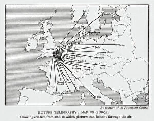
Background imageMaps Collection: Picture telegraphy: map of Europe (litho)

Picture telegraphy: map of Europe (litho)
8635920 Picture telegraphy: map of Europe (litho) by English School, (20th century); Private Collection; (add.info.: Picture telegraphy: map of Europe)

Background imageMaps Collection: Famous rivers: The Thames (litho)

Famous rivers: The Thames (litho)
8634757 Famous rivers: The Thames (litho) by English School, (20th century); Private Collection; (add.info.: The Thames. Illustration for Chatterbox, 1913.); © Look and Learn

Background imageMaps Collection: Och! My blessin' go wid ye (colour litho)

Och! My blessin' go wid ye (colour litho)
8656037 Och! My blessin' go wid ye (colour litho) by English School, (20th century); Private Collection; (add.info.: Och! My blessin' go wid ye, every inch of the way that ye go)

Background imageMaps Collection: Ireland (colour litho)

Ireland (colour litho)
8653595 Ireland (colour litho) by English School, (19th century); Private Collection; (add.info.: Ireland. Illustration for "The Times" Atlas (Office of "The Times")

Background imageMaps Collection: Roman Britain (litho)

Roman Britain (litho)
8661402 Roman Britain (litho) by English School, (20th century); Private Collection; (add.info.: Roman Britain. Following the raids of Julius Caesar in 55 and 54 BC the southern British tribes)


All Professionally Made to Order for Quick Shipping


-

Maps Collection

The Republic of Ireland is located in the North Atlantic Ocean and is part of Europe. Maps of the Republic of Ireland are widely available, both online and in print. These maps typically show the country's major cities, rivers, lakes, mountains, national parks and other features. They also often include information about roads and other transportation networks as well as political boundaries. They can useful for travelers who wish to explore the country or plan a route from one destination to another. Additionally, they can be used by businesses looking to expand their operations into new markets or investors seeking potential opportunities in different parts of the country.
+

Our beautiful pictures are available as Framed Prints, Photos, Wall Art and Photo Gifts

The Maps of Republic of Ireland Europe collection from Media Storehouse is a stunning range of wall art and framed prints that showcase the beauty and diversity of Ireland's landscapes. Our collection features an extensive selection of maps, including antique maps, topographical maps, and modern-day roadmaps. Each print in our collection is carefully crafted to capture the unique character and charm of Ireland's cities, towns, villages, mountains, lakes, rivers and coastlines. Whether you are looking for a striking piece to hang in your home or office or want to give a thoughtful gift to someone special who loves Irish culture and history - our collection has something for everyone. From Dublin's bustling streets to the rugged beauty of Connemara National Park; from the ancient ruins at Newgrange to the rolling hillsides dotted with sheep - these prints offer a glimpse into one of Europe's most enchanting countries. With its rich history, vibrant culture and breathtaking scenery - it's no wonder why so many people fall in love with Ireland.
+

What are Maps of Republic of Ireland Europe art prints?

Maps of Republic of Ireland Europe art prints are high-quality reproductions of maps that depict the geography and topography of the Republic of Ireland. These prints showcase intricate details such as cities, towns, rivers, mountains, and other landmarks that make up the Irish landscape. They are designed to be visually appealing and informative at the same time. These art prints are perfect for anyone who loves history or geography or has an interest in exploring new places. They can be used to decorate homes, offices, schools or any space where a touch of sophistication is needed. Maps of Republic of Ireland Europe art prints come in various sizes and styles to suit different preferences. These art prints offer a unique way to appreciate the beauty and complexity of one's surroundings while also providing valuable information about them. Whether you're looking for a decorative piece or something more educational, Maps of Republic of Ireland Europe art prints from Media Storehouse are sure to impress.
+

What Maps of Republic of Ireland Europe art prints can I buy from Media Storehouse?

We offer a wide range of Republic of Ireland Europe art prints that are perfect for those who want to add a touch of elegance and sophistication to their home or office. These maps showcase the beauty and intricacy of the region, highlighting its unique features and landmarks. Some popular options include vintage-style maps that capture the history and charm of Ireland, as well as modern designs that offer a fresh take on this stunning country. You can choose from different sizes, styles, and finishes to suit your preferences. Whether you're looking for a statement piece or something more subtle, we have plenty of options to choose from. Their high-quality prints are made using premium materials that ensure they look great for years to come. So if you want to bring some Irish flair into your space, be sure to check out their selection today.
+

How do I buy Maps of Republic of Ireland Europe art prints?

To buy Maps of Republic of Ireland Europe art prints from Media Storehouse, you can browse our extensive collection online. Simply search for the specific map or artwork that you are interested in and add it to your cart. You can also refine your search by selecting different categories such as size, orientation, and color. Once you have added all the items to your cart, proceed to checkout where you will be prompted to enter your shipping and payment information. After completing the purchase process, Media Storehouse will process your order and ship it directly to your desired location. We offer a wide range of high-quality art prints featuring maps of Republic of Ireland Europe that are perfect for decorating any space in your home or office. Whether you're looking for a vintage-style map or a modern interpretation, they have something for everyone's taste and budget. So start exploring our collection today.
+

How much do Maps of Republic of Ireland Europe art prints cost?

As We offer a wide range of maps of the Republic of Ireland and Europe art prints, the cost may vary depending on factors such as size, framing options, and printing materials. However, you can be assured that they will receive high-quality prints at reasonable prices. The company sources its images from top photographers and archives worldwide to ensure that our collection is diverse and unique. Our maps of the Republic of Ireland and Europe art prints are perfect for those who want to add a touch of sophistication to their home or office decor. These prints come in various sizes ranging from small to large formats, making them suitable for any space. You can choose between unframed or framed options based on their preferences. We provide excellent value for money when it comes to purchasing maps of the Republic of Ireland and Europe art prints. Their products are affordable yet maintain exceptional quality standards that meet customer expectations.
+

How will my Maps of Republic of Ireland Europe art prints be delivered to me?

Your Maps of Republic of Ireland Europe art prints will be delivered to you in a safe and secure manner. We take great care in packaging your order so that it arrives at your doorstep without any damage. The prints are carefully rolled and placed inside a sturdy tube, which is then sealed with protective caps on both ends. We use reliable courier services to deliver your order, ensuring that it reaches you within the estimated delivery time frame. You can track your package using the tracking number provided once it has been dispatched from our warehouse. We understand how important it is for our customers to receive their orders promptly and in perfect condition. That's why we have partnered with trusted shipping companies who share our commitment to quality service. Rest assured that when you order Maps of Republic of Ireland Europe art prints from us, they will be delivered to you safely and efficiently.