Fraud Blocker Skip to main content

Home > Europe > Sweden > Maps

Maps Collection

Sweden is a country located in Northern Europe, bordered by Norway and Finland, and is the largest of the Nordic countries

Choose a picture from our collection for your Wall Art and Photo Gifts

149 Items

Background imageMaps Collection: Europe map 1867

Europe map 1867
Mitchellas Modern Atlas - Published by E.H. Butler and Co - Philadelphia 1867

Background imageMaps Collection: Map of Scandinavia

Map of Scandinavia

Background imageMaps Collection: Europe Map with France, Portugal, Spain and Netherlands

Europe Map with France, Portugal, Spain and Netherlands
Europe Map. Vector Illustration with France, Portugal, Spain and Netherlands

Background imageMaps Collection: Map of Sweden - Vector

Map of Sweden - Vector illustration

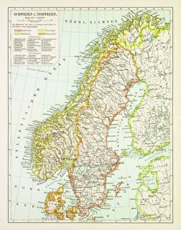
Background imageMaps Collection: Map of Denmark, Southern Norway and Southern Sweden, lithograph, 1897

Map of Denmark, Southern Norway and Southern Sweden, lithograph, 1897
Topographic map of Denmark, Southern Norway and Southern Sweden. Lithograph, published in 1897

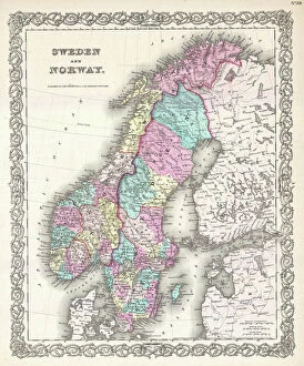
Background imageMaps Collection: 1855, Colton Map of Scandinavia, Norway, Sweden, Finland, topography, cartography

1855, Colton Map of Scandinavia, Norway, Sweden, Finland, topography, cartography
1855, Colton Map of Scandinavia, Norway, Sweden, Finland

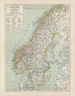
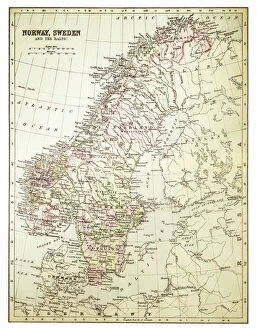
Background imageMaps Collection: Sweden and Norway, lithograph, published in 1878

Sweden and Norway, lithograph, published in 1878
Ancient map of Sweden and Norway. Lithograph, published in 1878

Background imageMaps Collection: Computer graphic of global internet traffic

Computer graphic of global internet traffic
Internet traffic. Computer graphic of global internet traffic. Each line represents the path of sample data sent out to one of 20, 000 pre- selected locations using a system called Skitter

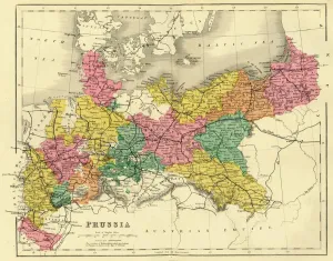
Background imageMaps Collection: Map of Prussia, c1872. Creator: Unknown

Map of Prussia, c1872. Creator: Unknown
Map of Prussia, c1872. Showing the various regions including Holstein, Hanover, Westphalia, Lower Rhine, Lorraine, Nassau, Cassel, Saxony, Brandedburg, Silesia, Pomerania, West Prussia

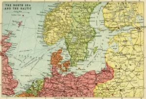
Background imageMaps Collection: Map of the North Sea and the Baltic, c1914, (c1920). Creator: John Bartholomew & Son

Map of the North Sea and the Baltic, c1914, (c1920). Creator: John Bartholomew & Son
Map of the North Sea and the Baltic, c1914, (c1920). Northern Europe at the start of the First World War, including parts of Norway, Sweden, Finland, Russia, Germany, Denmark

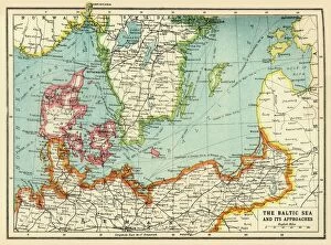
Background imageMaps Collection: The Baltic Sea and Its Approaches, First World War, c1915, (c1920)

The Baltic Sea and Its Approaches, First World War, c1915, (c1920). Map of part of northern Europe, showing sections of the coasts of Norway, Sweden, Russia, Germany and Denmark

Background imageMaps Collection: Map of central Europe 1889

Map of central Europe 1889
Indiana Educational Series The Complete Geography - Indianapolis 1889

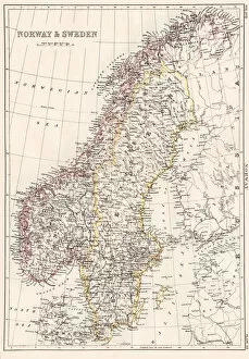
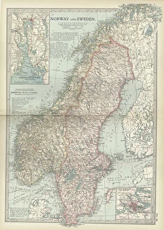
Background imageMaps Collection: Map of Sweden and Norway 1897

Map of Sweden and Norway 1897
Map of Sweden and Norway

Background imageMaps Collection: Map of Norway and Sweden 1894

Map of Norway and Sweden 1894
Map of Norway and Sweden

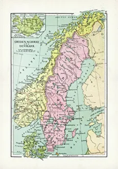
Background imageMaps Collection: Antique Map of Sweden, Norway and Denmark

Antique Map of Sweden, Norway and Denmark
Vintage map of Sweden, Norway and Denmark, from 1894

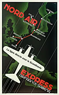
Background imageMaps Collection: Nord Air Express Poster

Nord Air Express Poster
Nord Air Express Air France - Sabena Poster, the direct route for Scandinavia, with a map showing routes between cities. 20th century

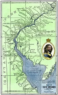
Background imageMaps Collection: EXPL2A-00165

EXPL2A-00165
Map of colonial New Sweden in America, 1638-1685. Hand-colored 19th-century woodcut reproduction of a 17th-century map

Background imageMaps Collection: Norway and Sweden map 1884

Norway and Sweden map 1884
Encyclopedia Britannica 9th Edition New York Charles Scribners and Sonsl 1884 Vol XVII

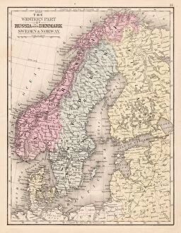
Background imageMaps Collection: Denmark Sweden Norway map 1867

Denmark Sweden Norway map 1867
Mitchellas Modern Atlas - Published by E.H. Butler and Co - Philadelphia 1867

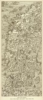
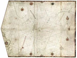
Background imageMaps Collection: Map / Scandinavia 1539

Map / Scandinavia 1539
Map of Norway, Finland, Sweden and Denmark

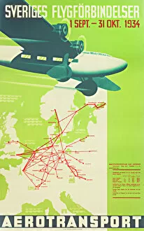
Background imageMaps Collection: Swedish airline poster

Swedish airline poster, Sveriges Flygforbindelser, 1 September - 31 October 1934, showing a map of Europe with flight routes. 1934

Background imageMaps Collection: Map of Sweden and Norway 1897

Map of Sweden and Norway 1897
Map of Sweden and Norway

Background imageMaps Collection: Europe Political Map

Europe Political Map
This detailed Europe map covers the whole of the continent of Europe, going east as far as Moscow and south to North Africa

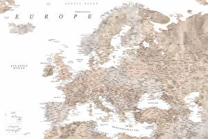
Background imageMaps Collection: Teal detailed map of Europe

Teal detailed map of Europe
Rosana Laiz Blursbyai

Background imageMaps Collection: Taupe detailed map of Europe

Taupe detailed map of Europe
Rosana Laiz Blursbyai

Background imageMaps Collection: Sweden & Norway 1851

Sweden & Norway 1851
A fine facimile artworked from an antique original map of Sweden and Norway, issued as part of the 1851 edition of John Tallis and Companys " The Illustrated Atlas

Background imageMaps Collection: Old Map of Sweden and Norway 1852 by Henry George Collins

Old Map of Sweden and Norway 1852 by Henry George Collins
This is a finely detailed map of Sweden and Norway remastered from a rare Atlas of the World published in 1852 by Henry George Collins

Background imageMaps Collection: Southwark SE16 7 Map

Southwark SE16 7 Map
Postcode Sector Map of Southwark SE16 7

Background imageMaps Collection: Harborough LE16 7 Map

Harborough LE16 7 Map
Postcode Sector Map of Harborough LE16 7

Background imageMaps Collection: Map of Sweden and Norway 1900

Map of Sweden and Norway 1900
Meyers hand-Atlas Leipzig und Wien Verlag des Bibliographischen Instituts 1900

Background imageMaps Collection: 1850 Mitchell Map Of Sweden And Norway Topography

1850 Mitchell Map Of Sweden And Norway Topography
1850, Mitchell Map of Sweden and Norway

Background imageMaps Collection: 1870 Johnson Map Of Sweden Norway And Denmark

1870 Johnson Map Of Sweden Norway And Denmark
1870, Johnson Map of Sweden, Norway and Denmark

Background imageMaps Collection: 1865 Johnson Map Of Sweden Norway And Denmark

1865 Johnson Map Of Sweden Norway And Denmark
1865, Johnson Map of Sweden, Norway and Denmark

Background imageMaps Collection: 1864 Johnson Map Of Scandinavia Norway Sweden

1864 Johnson Map Of Scandinavia Norway Sweden
1864, Johnson Map of Scandinavia, Norway, Sweden, Denmark, Prussia

Background imageMaps Collection: 1862 Johnson's Map Of Scandinavia Norway Sweden

1862 Johnson's Map Of Scandinavia Norway Sweden
1862, Johnson's Map of Scandinavia, Norway, Sweden, Finland and Denmark

Background imageMaps Collection: 1855 Colton Map Of Scandinavia Norway Sweden

1855 Colton Map Of Scandinavia Norway Sweden
1855, Colton Map of Scandinavia, Norway, Sweden, Finland

Background imageMaps Collection: 1851 Black Map Of Norway And Sweden Scandinavia

1851 Black Map Of Norway And Sweden Scandinavia
1851, Black Map of Norway and Sweden, Scandinavia

Background imageMaps Collection: 1850 Mitchell Map Of Scandinavia Norway Sweden

1850 Mitchell Map Of Scandinavia Norway Sweden
1850, Mitchell Map of Scandinavia, Norway, Sweden, Denmark, Finland

Background imageMaps Collection: 1840 Lizars Map Of Scandinavia Norway Sweden

1840 Lizars Map Of Scandinavia Norway Sweden
1840, Lizars Map of Scandinavia, Norway, Sweden, Finland, Denmark, Iceland

Background imageMaps Collection: 1827 Finley Map Of Scandinavia Norway Sweden

1827 Finley Map Of Scandinavia Norway Sweden
1827, Finley Map of Scandinavia, Norway, Sweden, Denmark, Anthony Finley mapmaker of the United States in the 19th century

Background imageMaps Collection: 1799 Clement Cruttwell Map Of Sweden Denmark And Norway

1799 Clement Cruttwell Map Of Sweden Denmark And Norway
1799, Clement Cruttwell Map of Sweden, Denmark and Norway

Background imageMaps Collection: 1794 Laurie And Whittle Map Of Norway Sweden

1794 Laurie And Whittle Map Of Norway Sweden
1794, Laurie and Whittle Map of Norway, Sweden, Denmark and Finland, 1794 - 1812

Background imageMaps Collection: 1762 Janvier Map Of Scandinavia Norway Sweden

1762 Janvier Map Of Scandinavia Norway Sweden
1762, Janvier Map of Scandinavia, Norway, Sweden, Denmark, Finland

Background imageMaps Collection: 1747 La Feuille Map Of Scandinavia Sweden Norway

1747 La Feuille Map Of Scandinavia Sweden Norway
1747, La Feuille Map of Scandinavia, Sweden, Norway, Finland

Background imageMaps Collection: 1730 Homann Map Of Scandinavia Norway Sweden

1730 Homann Map Of Scandinavia Norway Sweden
1730, Homann Map of Scandinavia, Norway, Sweden, Denmark, Finland and the Baltics

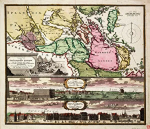
Background imageMaps Collection: Map of Stockholm

Map of Stockholm 1836

Background imageMaps Collection: Battle of Novgorod in 1611. Creator: Johan Hammer

Battle of Novgorod in 1611. Creator: Johan Hammer
Battle of Novgorod in 1611, Unknown date

Background imageMaps Collection: Gustav III and his brothers, 1771. Creator: Alexander Roslin

Gustav III and his brothers, 1771. Creator: Alexander Roslin
Gustav III and his brothers, 1771

Background imageMaps Collection: Project to redesign the garden for Mr. Brunet and Pidou at Brunoy, 1687. Creator: Andre Le Notre

Project to redesign the garden for Mr. Brunet and Pidou at Brunoy, 1687. Creator: Andre Le Notre
Project to redesign the garden for Mr. Brunet and Pidou at Brunoy, 1687

Background imageMaps Collection: Exotic scene. Creator: Gerard van Houten

Exotic scene. Creator: Gerard van Houten
Exotic scene

Background imageMaps Collection: Boy with Map of Scandinavia, 1771. Creator: Ulrika Fredrika Pasch

Boy with Map of Scandinavia, 1771. Creator: Ulrika Fredrika Pasch
Boy with Map of Scandinavia, 1771

Background imageMaps Collection: The Baltic Sea and its Coasts; Map, 1854. Creator: Unknown

The Baltic Sea and its Coasts; Map, 1854. Creator: Unknown
The Baltic Sea and its Coasts; Map, 1854. From "Cassells Illustrated Family Paper; London Weekly 31/12/1853 - 30/12/1854"

Background imageMaps Collection: Black Maps Earth Tones 83

Black Maps Earth Tones 83
Emiliano Deificus

Background imageMaps Collection: 1 Maps 23

1 Maps 23
Emiliano Deificus

Background imageMaps Collection: City Love Maps 83

City Love Maps 83
Emiliano Deificus

Background imageMaps Collection: Black Maps 83

Black Maps 83
Emiliano Deificus

Background imageMaps Collection: 0023 City

0023 City
Emiliano Deificus

Background imageMaps Collection: Swedes. On the islands of Estonia, 1862. Creator: Karl Fiale

Swedes. On the islands of Estonia, 1862. Creator: Karl Fiale
Swedes. On the islands of Estonia, 1862. Sheet 18 from the album "Description ethnographique des peuples de la Russie", volume 1

Background imageMaps Collection: Abosko-B'erneborg Province, 1856. Creator: Unknown

Abosko-B'erneborg Province, 1856. Creator: Unknown
Abosko-B'erneborg Province, 1856. This card is one of a souvenir set of 82 illustrated cards-one for each province of the Russian Empire as it existed in 1856

Background imageMaps Collection: Dickson'in sataman. Kartta. G. Boven tekema, 1878. Creator: G. Boven

Dickson'in sataman. Kartta. G. Boven tekema, 1878. Creator: G. Boven
Dickson'in sataman. Kartta. G. Boven tekema, 1878. Dikson, o-v. Karta puteshestvii?a? Nordenshel'da na karable "Vega" u beregov Diksona v 1878 godu

Background imageMaps Collection: The Kingdoms of Sweden, Denmark and Norway, engraving by G. Zuliani taken from Tome III of

The Kingdoms of Sweden, Denmark and Norway, engraving by G. Zuliani taken from Tome III of the "Newest Atlas" published in Venice in 1781 by Antonio Zatta

Background imageMaps Collection: Sweden divided into its Kingdoms, engraving by G. Zuliani taken from Tome III of the 'Newest

Sweden divided into its Kingdoms, engraving by G. Zuliani taken from Tome III of the "Newest Atlas" published in Venice in 1781 by Antonio Zatta

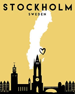
Background imageMaps Collection: Stockholm White

Stockholm White
StudioSix

Background imageMaps Collection: 13867872

13867872

Background imageMaps Collection: 13849201

13849201

Background imageMaps Collection: 13834573

13834573

Background imageMaps Collection: 13834549

13834549

Background imageMaps Collection: 13833899

13833899

Background imageMaps Collection: 13824478

13824478

Background imageMaps Collection: Advert, The United Steamship Company, Copenhagen

Advert, The United Steamship Company, Copenhagen - to Scandinavia and the Continent via Esbjerg Date: 1955

Background imageMaps Collection: Advert, Swedish Lloyd Cruise Ships

Advert, Swedish Lloyd Cruise Ships - from the heart of London to the heart of Scandinavia Date: 1955

Background imageMaps Collection: Old map of Norway and Sweden (Scandinavia)

Old map of Norway and Sweden (Scandinavia)
Antique Illustration. Copyright has expired on this artwork. From my own archives, digitally restored

Background imageMaps Collection: Map of Sweden, Norway and Denmark

Map of Sweden, Norway and Denmark
Marcus Ward's Home Atlas - London, 1894

Background imageMaps Collection: Old chromolithograph map of Norway and Sweden (Scandinavia)

Old chromolithograph map of Norway and Sweden (Scandinavia)
Antique Illustration. Copyright has expired on this artwork. From my own archives, digitally restored

Background imageMaps Collection: Antique map of Sweden and Norway in 1890s, Victorian 19th Century

Antique map of Sweden and Norway in 1890s, Victorian 19th Century

Background imageMaps Collection: Map of Stockholm (Aubry de La Mottrayes 'Travels throughout Europe

Map of Stockholm (Aubry de La Mottrayes "Travels throughout Europe
Map of Stockholm (Aubry de La Mottrayes " Travels throughout Europe, Asia and into Part of Africa... " London, 1724, vol. II, pl. 32), 1723-24

Background imageMaps Collection: Charles XII at Bender (Aubry de La Mottrayes 'Travels throughout Europe

Charles XII at Bender (Aubry de La Mottrayes "Travels throughout Europe
Charles XII at Bender (Aubry de La Mottrayes " Travels throughout Europe, Asia and into Part of Africa... " London, 1724, vol. II, pl. 30), 1723-24

Background imageMaps Collection: Hampshire RG26 3 Map

Hampshire RG26 3 Map
Postcode Sector Map of Hampshire RG26 3

Background imageMaps Collection: Sefton L22 9 Map

Sefton L22 9 Map
Postcode Sector Map of Sefton L22 9

Background imageMaps Collection: South Lakeland LA22 9 Map

South Lakeland LA22 9 Map
Postcode Sector Map of South Lakeland LA22 9

Background imageMaps Collection: Forest Heath IP27 0 Map

Forest Heath IP27 0 Map
Postcode Sector Map of Forest Heath IP27 0

Background imageMaps Collection: Tewkesbury GL20 7 Map

Tewkesbury GL20 7 Map
Postcode Sector Map of Tewkesbury GL20 7

Background imageMaps Collection: Tendring CO12 4 Map

Tendring CO12 4 Map
Postcode Sector Map of Tendring CO12 4

Background imageMaps Collection: Tendring CO11 2 Map

Tendring CO11 2 Map
Postcode Sector Map of Tendring CO11 2


All Professionally Made to Order for Quick Shipping


-

Maps Collection

Sweden is a country located in Northern Europe, bordered by Norway and Finland, and is the largest of the Nordic countries, with an area of 449,964 square kilometres. Sweden has a long history and rich cultural heritage, with many ancient sites to explore. Maps of Sweden provide an excellent way to discover this beautiful country. They show its geographical features such as mountains, rivers, lakes and forests; its major cities; and its political boundaries. It also highlight important landmarks such as castles and churches that are part of Sweden's history. With maps of Sweden you can plan your journey through this fascinating land or simply admire its beauty from afar.
+

Our beautiful Wall Art and Photo Gifts include Framed Prints, Photo Prints, Poster Prints, Canvas Prints, Jigsaw Puzzles, Metal Prints and so much more

The Maps of Sweden Europe collection, available on Media Storehouse, is a stunning assortment of wall art and framed prints that showcases the beauty and intricacy of Swedish cartography. Our collection features a range of maps dating back to the 16th century, including antique maps from renowned cartographers such as Abraham Ortelius and Gerard Mercator. These maps offer a fascinating glimpse into the history and evolution of Sweden's geography over time. In addition to historical maps, our collection also includes contemporary designs featuring modern-day landmarks and attractions in cities like Stockholm and Gothenburg. Each print is expertly crafted using high-quality materials to ensure durability and longevity. Whether you're an avid collector or simply looking for a unique piece of wall art to add character to your home or office space, the Maps of Sweden Europe collection offers something for everyone. With its rich history, intricate details, and striking visuals, our collection is sure to impress anyone with an appreciation for fine artistry.
+

What are Maps of Sweden Europe art prints?

Maps of Sweden Europe art prints are high-quality reproductions of antique and contemporary maps that depict the geography, topography, and political boundaries of Sweden and other European countries. These prints are created using advanced printing techniques to ensure that every detail is captured accurately, from the intricate lines and symbols on the map to the colors used to represent different regions. These art prints offer a unique way for people to explore and appreciate the rich history and culture of Sweden and Europe. They can be used as decorative pieces in homes or offices, or as educational tools in classrooms or libraries. Whether you're interested in tracing your family's roots back to their Swedish homeland or simply want to learn more about this fascinating country, Maps of Sweden Europe art prints provide an engaging visual representation that will enhance your understanding and appreciation of these places.
+

What Maps of Sweden Europe art prints can I buy from Media Storehouse?

We offer a wide range of Maps of Sweden Europe art prints that are perfect for anyone who loves geography, history or travel. These prints showcase the beauty and diversity of Sweden's landscapes, cities and regions, as well as its rich cultural heritage. Some of the most popular Maps of Sweden Europe art prints available at Media Storehouse include vintage maps from different eras, detailed topographic maps that show the country's terrain and natural features, political maps that highlight its administrative divisions and major cities, and artistic interpretations that capture its unique character. Whether you're looking for a decorative piece to hang in your home or office or a gift for someone special who shares your passion for cartography, we have something to suit every taste and budget. With high-quality printing techniques and materials used in all their products, you can be sure that these Maps of Sweden Europe art prints will look stunning wherever they are displayed.
+

How do I buy Maps of Sweden Europe art prints?

To buy Maps of Sweden Europe art prints from Media Storehouse, you can browse our online collection and select the print that best suits your needs. The website offers a wide range of options to choose from, including different sizes and framing options. Once you have made your selection, simply add it to your cart and proceed to checkout. At checkout, you will be prompted to enter your shipping information and payment details. We accept various forms of payment, including credit cards and PayPal. Once your order has been processed, the print will be carefully packaged and shipped directly to your doorstep. It's important to note that while these prints are perfect for personal use or as gifts for friends and family members who love maps or geography-related artwork, they should not be used for commercial purposes without permission from the copyright holder.
+

How much do Maps of Sweden Europe art prints cost?

We offer a wide range of Maps of Sweden Europe art prints at varying prices. Our collection includes vintage and modern maps that showcase the beauty and history of Sweden and Europe. The cost of our Maps of Sweden Europe art prints depends on several factors such as size, framing options, and printing materials. We have different sizes available to suit your preferences ranging from small to large formats. Our high-quality paper prints are affordable while our premium canvas prints are more expensive due to their durability and longevity. We also offer a variety of framing options which can add to the overall cost but enhance the aesthetic appeal of your chosen print. You can find Maps of Sweden Europe art prints that fit within any budget at Media Storehouse without compromising on quality or style.
+

How will my Maps of Sweden Europe art prints be delivered to me?

Your Maps of Sweden Europe art prints will be delivered to you with utmost care and attention. We use high-quality packaging materials to ensure that your prints arrive in pristine condition. Our team takes great pride in delivering your order promptly, so you can expect a timely delivery once your order is processed. We work with reliable shipping partners who are committed to providing excellent service. You can track the progress of your shipment using the tracking number provided upon dispatch. We understand how important it is for our customers to receive their orders on time and in perfect condition. That's why we take every step necessary to ensure that your Maps of Sweden Europe art prints are delivered safely and securely. Whether you're ordering for personal or commercial use, rest assured that we'll handle your order with professionalism and efficiency from start to finish.
© Copyright Media Storehouse, All Rights Reserved 2003 - 2024
Facebook     Pinterest     Card Payments     Reviews IO