Home > Europe > France > Maps
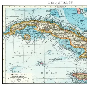
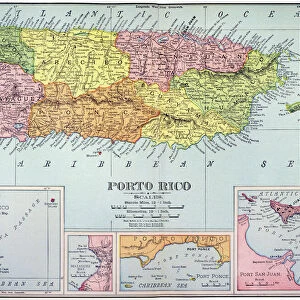
Geographic map of Central America (one distinguishes Puerto Rico, Haiti, Jamaica and Cuba) - 17th or 18th century - Museum of America, Madrid
![]()

Wall Art and Photo Gifts from Fine Art Finder
Geographic map of Central America (one distinguishes Puerto Rico, Haiti, Jamaica and Cuba) - 17th or 18th century - Museum of America, Madrid
XEE5027156 Geographic map of Central America (one distinguishes Puerto Rico, Haiti, Jamaica and Cuba) - 17th or 18th century - Museum of America, Madrid; (add.info.: Geographic map of Central America (one distinguishes Puerto Rico, Haiti, Jamaica and Cuba) - 17th or 18th century - Museum of America, Madrid); Stefano Bianchetti
Media ID 38168002
© Stefano Bianchetti / Bridgeman Images
Caribbean Caribbean Island Central America Cuba Cuban Dom Tom Geographical Map Leemage Whiteimages
FEATURES IN THESE COLLECTIONS
> Fine Art Finder
> Artists
> Unknown Artist
> North America
> Cuba
> Maps
> North America
> Cuba
> Related Images
> North America
> Haiti
> Maps
> North America
> Haiti
> Related Images
> North America
> Jamaica
> Maps
> North America
> Jamaica
> Related Images
> North America
> Puerto Rico
> Maps
EDITORS COMMENTS
This stunning print of a Geographic map of Central America from the 17th or 18th century, housed in the Museum of America in Madrid, is a true treasure for history and geography enthusiasts alike. The intricate details on this map allow viewers to distinguish Puerto Rico, Haiti, Jamaica, and Cuba with ease.
As one gazes upon this piece, they are transported back in time to an era when exploration and discovery were at the forefront of human endeavors. The vibrant colors used on the map bring each region to life, showcasing the beauty and diversity of Central America.
The inclusion of these Caribbean islands adds another layer of intrigue to this historical artifact. Each island has its own unique story to tell, from colonization by European powers to struggles for independence.
Stefano Bianchetti's skillful engraving captures the essence of this Geographic map with precision and artistry. It serves as a reminder of how far we have come in terms of cartography and geographical knowledge.
Whether you are a seasoned traveler or simply curious about the world around you, this print is sure to captivate your imagination and inspire further exploration into the rich history of Central America.
MADE IN AUSTRALIA
Safe Shipping with 30 Day Money Back Guarantee
FREE PERSONALISATION*
We are proud to offer a range of customisation features including Personalised Captions, Color Filters and Picture Zoom Tools
SECURE PAYMENTS
We happily accept a wide range of payment options so you can pay for the things you need in the way that is most convenient for you
* Options may vary by product and licensing agreement. Zoomed Pictures can be adjusted in the Cart.


