
Maps Collection
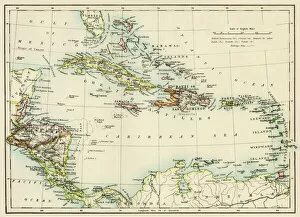
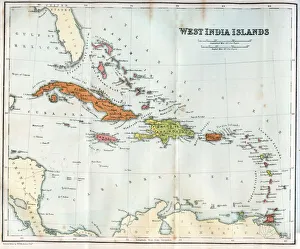
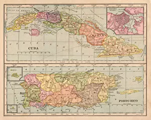
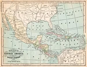
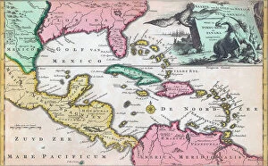
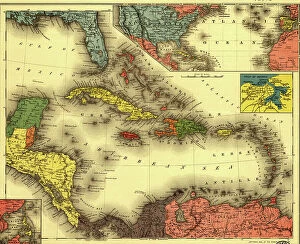
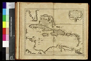
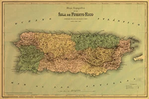
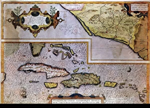
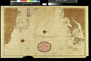
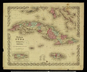
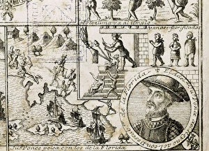
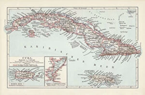
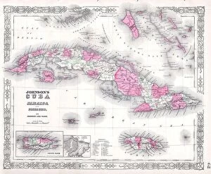
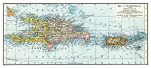
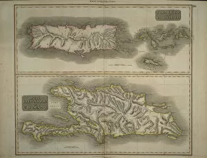
Puerto Rico is an unincorporated territory of the United States located in the Caribbean Sea
Choose a picture from our Maps Collection for your Wall Art and Photo Gifts
71 items


All Professionally Made to Order for Quick Shipping
-
Maps Collection
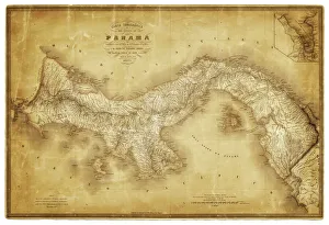
Puerto Rico is an unincorporated territory of the United States located in the Caribbean Sea. Maps of Puerto Rico North America provide a detailed overview of this beautiful island nation. These maps show major cities, towns, roads, rivers and other features such as mountains and national parks. They also provide information about the climate, population density and other important facts about Puerto Rico. They can useful for travelers who want to explore this diverse country or for those who want to learn more about its history and culture. Additionally, these they are be used to plan trips or find out more information about specific areas of interest in Puerto Rico North America.
+
Our beautiful pictures are available as Framed Prints, Photos, Wall Art and Photo Gifts
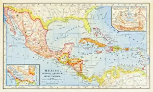
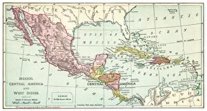
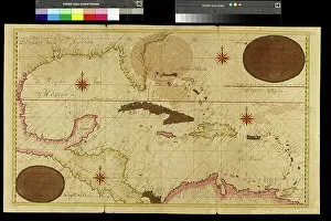
The Maps of Puerto Rico North America collection from Media Storehouse is a stunning assortment of wall art and framed prints that showcase the beauty and diversity of Puerto Rico. Our collection features an array of maps, ranging from vintage to contemporary, that depict the island's geography, topography, history, culture, and landmarks. Each map is carefully selected for its artistic merit and historical significance. Whether you're a lover of cartography or simply looking to add some visual interest to your home decor, our collection has something for everyone. From colorful satellite images to intricate hand-drawn illustrations, these maps are sure to captivate your imagination and inspire your sense of adventure. With high-quality printing techniques and premium materials used in each piece's creation process at Media Storehouse ensures that every print will look beautiful on any wall in any room. Our collection is perfect for anyone who wants to celebrate the unique beauty and rich heritage of Puerto Rico while adding some style and sophistication to their living space.
+
What are Maps of Puerto Rico North America art prints?
Maps of Puerto Rico North America art prints are high-quality reproductions of maps that depict the geography, topography, and landmarks of Puerto Rico. These prints are created using advanced printing technology and archival-grade materials to ensure their longevity and durability. These art prints are an excellent way to showcase your love for Puerto Rico's rich history and culture. They make great additions to any home or office decor, adding a touch of sophistication and elegance. Whether you're a collector, historian, or simply someone who appreciates beautiful artwork, Maps of Puerto Rico North America art prints offer something for everyone. With their intricate details and vibrant colors, these prints capture the essence of this beautiful island nation in stunning detail. So if you're looking for a unique piece of artwork that celebrates the beauty and diversity of Puerto Rico's landscape, consider investing in one of these exquisite art prints today.
+
What Maps of Puerto Rico North America art prints can I buy from Media Storehouse?
We offer a wide range of Maps of Puerto Rico North America art prints that you can purchase. These maps are available in various sizes and styles, including vintage, modern, and antique designs. You can choose from different types of maps such as topographic, political, physical or roadmaps. The collection includes high-quality prints featuring detailed cartography with accurate geographical information about the island's terrain, cities and towns. The maps also highlight important landmarks like national parks, beaches and historical sites. Whether you're looking for a map to decorate your home or office space or to use as an educational tool for students or professionals in geography-related fields; Media Storehouse has something for everyone. Their extensive selection ensures that you'll find the perfect map print to suit your needs. If you want to buy Maps of Puerto Rico North America art prints that are both aesthetically pleasing and informative - Media Storehouse is the place to go.
+
How do I buy Maps of Puerto Rico North America art prints?
To buy maps of Puerto Rico North America art prints from Media Storehouse, you can browse our extensive collection of artwork online. Start by searching for "maps of Puerto Rico" or "North America art prints" on the website's search bar to see all available options. Once you find a print that interests you, click on it to view more details and choose your preferred size and framing option. You can also customize your order by selecting different materials such as canvas or paper, depending on your preference. After adding the item to your cart, proceed to checkout and enter your payment information. We accept various forms of payment including credit cards and PayPal. Once your order is confirmed, Media Storehouse will process it promptly and ship it directly to you. You can expect high-quality prints that are perfect for home decor or as gifts for friends and family who love maps or North American art.
+
How much do Maps of Puerto Rico North America art prints cost?
Maps of Puerto Rico North America art prints are available for purchase at Media Storehouse. The cost of these prints may vary depending on the size, quality, and type of paper used. Generally, prices range from affordable to high-end options. We offer a wide selection of maps that showcase the beauty and history of Puerto Rico in North America. These maps come in various styles and designs that cater to different preferences and tastes. Whether you're looking for vintage or modern maps, we have got you covered. You can choose from a range of sizes to fit your space requirements perfectly. Maps of Puerto Rico North America art prints are an excellent investment for anyone who loves geography or wants to decorate their home with unique artwork. With its reasonable pricing and exceptional quality, it's no wonder why many people choose Media Storehouse as their go-to source for map art prints.
+
How will my Maps of Puerto Rico North America art prints be delivered to me?
Your Maps of Puerto Rico North America art prints will be delivered to you through a reliable and secure shipping service. The company takes great care in ensuring that your order is packaged properly, so it arrives at your doorstep in pristine condition. Your art prints will be rolled up and placed inside a sturdy tube for protection during transit. The delivery process is straightforward, and you can expect to receive regular updates on the status of your shipment. Once your order has been dispatched, you'll receive an email notification with tracking information so that you can monitor its progress. Media Storehouse values customer satisfaction above all else, which is why they go the extra mile to ensure that every aspect of their service meets or exceeds expectations. You can rest assured knowing that your Maps of Puerto Rico North America art prints will arrive promptly and in perfect condition thanks to their commitment to quality and reliability.