Home > Maps and Charts > Americas
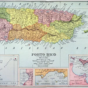
Geography map: representation of the Caribbean Sea with part of the archipelago of the Great Antilles (Hispaniola, Puerto Rico) and the small Antilles as well as the northern coasts of South America, and of the South of the United States
 and the small Antilles as well as the northern coasts of South America, and of the South of the United States")
![]()
Wall Art and Photo Gifts from Fine Art Finder
Geography map: representation of the Caribbean Sea with part of the archipelago of the Great Antilles (Hispaniola, Puerto Rico) and the small Antilles as well as the northern coasts of South America, and of the South of the United States
VEN5030217 Geography map: representation of the Caribbean Sea with part of the archipelago of the Great Antilles (Hispaniola, Puerto Rico) and the small Antilles as well as the northern coasts of South America, and of the South of the United States, the south east to the left and the north to the right, made by the Dutch cartographer Gerard van Keulen (1678-1726) 1709-1713. Biblioteca Angelica, Rome; (add.info.: Geography map: representation of the Caribbean Sea with part of the archipelago of the Great Antilles (Hispaniola, Puerto Rico) and the small Antilles as well as the northern coasts of South America, and of the South of the United States, the south east to the left and the north to the right, made by the Dutch cartographer Gerard van Keulen (1678-1726) 1709-1713. Biblioteca Angelica, Rome); © Marage Photos
Media ID 38167646
© © Marage Photos / Bridgeman Images
18eme Siecle Amerique (continent) Amerique Du Nord Amerique Du Sud Caraïbes Caribbean Caribbean Island Carte Geographique Etats Unis Etats Unis Damèrique Geographical Map Geographie Latin America Latinamerica Latine America Southamerica Stockravenna
FEATURES IN THESE COLLECTIONS
> Fine Art Finder
> Artists
> Unknown Artist
> Maps and Charts
> Early Maps
> North America
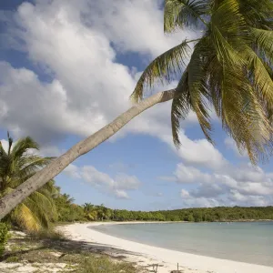
> Puerto Rico
> Maps
> North America
> Puerto Rico
> Related Images
> North America
> United States of America
> Maps
> Popular Themes
> North Island
EDITORS COMMENTS
This stunning print captures a detailed representation of the Caribbean Sea, showcasing the archipelago of the Great Antilles including Hispaniola and Puerto Rico, as well as the small Antilles and the northern coasts of South America. Created by Dutch cartographer Gerard van Keulen between 1709-1713, this map offers a glimpse into the intricate beauty of these regions during that time period.
The careful attention to detail in this map is evident, with each island and coastline meticulously outlined. The orientation from south east to north adds an interesting perspective, allowing viewers to immerse themselves in the geography of these diverse landscapes.
As you study this map, you can almost feel yourself being transported back in time to when exploration and discovery were at the forefront of human curiosity. The historical significance of this piece is undeniable, serving as a reminder of how far we have come in understanding our world.
Whether you have a personal connection to these regions or simply appreciate the artistry behind cartography, this print is sure to captivate your imagination and inspire a sense of wanderlust for these enchanting locales.
MADE IN AUSTRALIA
Safe Shipping with 30 Day Money Back Guarantee
FREE PERSONALISATION*
We are proud to offer a range of customisation features including Personalised Captions, Color Filters and Picture Zoom Tools
SECURE PAYMENTS
We happily accept a wide range of payment options so you can pay for the things you need in the way that is most convenient for you
* Options may vary by product and licensing agreement. Zoomed Pictures can be adjusted in the Cart.