Fine Art Print > North America > United States of America > Lakes > Lake Michigan
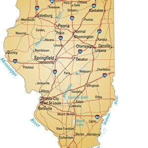
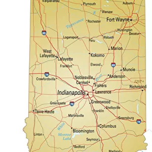
Fine Art Print : Illinois 1852 Map


![]()
Fine Art Prints from Fine Art Storehouse
Illinois 1852 Map
Unleash your creativity and transform your space into a visual masterpiece!
benoitb
Media ID 13666905
© benoitb
Color Swatch Geographic Map Illinois Lake Michigan Line Art North America Sketch State The Americas Us State Border Classical Style Drawing Art Product Painted Image Retro Styled Victorian Style
20"x16" (+3" Border) Fine Art Print
20x16 image printed on 26x22 Fine Art Rag Paper with 3" (76mm) white border. Our Fine Art Prints are printed on 300gsm 100% acid free, PH neutral paper with archival properties. This printing method is used by museums and art collections to exhibit photographs and art reproductions.
Our fine art prints are high-quality prints made using a paper called Photo Rag. This 100% cotton rag fibre paper is known for its exceptional image sharpness, rich colors, and high level of detail, making it a popular choice for professional photographers and artists. Photo rag paper is our clear recommendation for a fine art paper print. If you can afford to spend more on a higher quality paper, then Photo Rag is our clear recommendation for a fine art paper print.
Estimated Image Size (if not cropped) is 37cm x 50.8cm (14.6" x 20")
Estimated Product Size is 55.9cm x 66cm (22" x 26")
These are individually made so all sizes are approximate
Artwork printed orientated as per the preview above, with portrait (vertical) orientation to match the source image.
FEATURES IN THESE COLLECTIONS
> Arts
> Landscape paintings
> Waterfall and river artworks
> River artworks
> Maps and Charts
> Related Images
> North America
> Related Images
> North America
> United States of America
> Illinois
> Related Images
> North America
> United States of America
> Lakes
> Lake Michigan
> North America
> United States of America
> Lakes
> Related Images
> North America
> United States of America
> Maps
> North America
> United States of America
> Michigan
> Related Images
> Fine Art Storehouse
> Map
> Historical Maps
> Fine Art Storehouse
> Map
> USA Maps
EDITORS COMMENTS
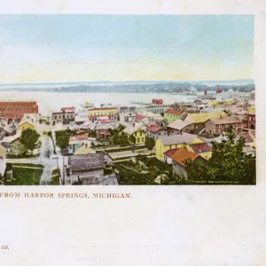
This print takes us back in time to the year 1852, when Illinois was still a young and developing state. The intricate details of this retro-styled map transport us to an era where cartography was both an art form and a scientific endeavor. Painted with delicate brushstrokes, this image exudes the charm of 19th-century style. The artist's skillful use of line art and engraving techniques gives this antique illustration a timeless quality. Every river, lake, and state border is meticulously depicted, showcasing the physical geography of Illinois with precision. Lake Michigan stands proudly as a majestic centerpiece, while other rivers meander through the land like lifelines connecting communities. Inspired by Victorian and classical styles, this piece offers more than just geographical information; it provides us with glimpses into history itself. As we admire its old-world allure, we can't help but imagine how different life must have been during that period in Illinois. Whether you are an art enthusiast or a history buff, this print will surely captivate your imagination. Hang it on your wall as a reminder of our ever-changing world or gift it to someone who appreciates the beauty found in maps and drawings alike. Benoitb's creation truly embodies the essence of artistry blended seamlessly with geographic accuracy – a true masterpiece from another era brought to life once again for our enjoyment today.
MADE IN AUSTRALIA
Safe Shipping with 30 Day Money Back Guarantee
FREE PERSONALISATION*
We are proud to offer a range of customisation features including Personalised Captions, Color Filters and Picture Zoom Tools
SECURE PAYMENTS
We happily accept a wide range of payment options so you can pay for the things you need in the way that is most convenient for you
* Options may vary by product and licensing agreement. Zoomed Pictures can be adjusted in the Cart.