Fine Art Print > Europe > Russia > Maps
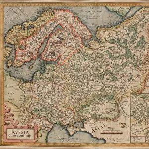
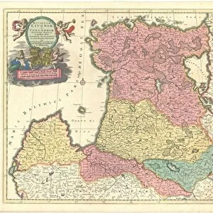
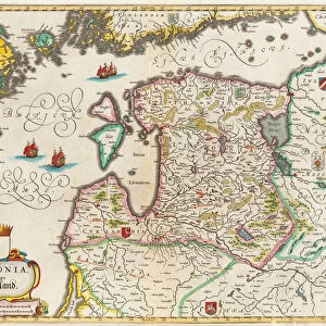
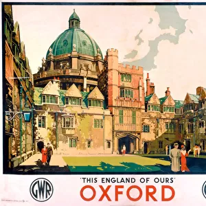
Fine Art Print : Map of Muscovy, with coats of arms, Russian coins of the day and explanatory panels


![]()
Fine Art Prints from Heritage Images
Map of Muscovy, with coats of arms, Russian coins of the day and explanatory panels
Map of Muscovy, with coats of arms, Russian coins of the day and explanatory panels. Private Collection
Heritage Images features heritage image collections
Media ID 15034226
© Fine Art Images
Cartography Chatelain Early Rus Grand Duchy Of Moscow History Of Russia Moscow Principality Muscovy Peter I Russian History
21"x7" (+3" Border) Fine Art Print
Step back in time with our exquisite Fine Art Prints from the Media Storehouse collection, featuring the intricately detailed Map of Muscovy. This captivating piece transports you to the heart of 16th century Russia, adorned with meticulously researched coats of arms and authentic Russian coins of the day. Each print comes with informative explanatory panels from Heritage Images, adding depth and context to this historical masterpiece. Bring the rich history and culture of Russia into your home or office with this stunning addition to your decor.
21x7 image printed on 27x13 Fine Art Rag Paper with 3" (76mm) white border. Our Fine Art Prints are printed on 300gsm 100% acid free, PH neutral paper with archival properties. This printing method is used by museums and art collections to exhibit photographs and art reproductions.
Our fine art prints are high-quality prints made using a paper called Photo Rag. This 100% cotton rag fibre paper is known for its exceptional image sharpness, rich colors, and high level of detail, making it a popular choice for professional photographers and artists. Photo rag paper is our clear recommendation for a fine art paper print. If you can afford to spend more on a higher quality paper, then Photo Rag is our clear recommendation for a fine art paper print.
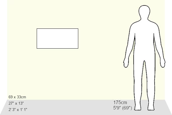
Estimated Image Size (if not cropped) is 42.5cm x 17.7cm (16.7" x 7")
Estimated Product Size is 68.6cm x 33cm (27" x 13")
These are individually made so all sizes are approximate
Artwork printed orientated as per the preview above, with landscape (horizontal) orientation to match the source image.
FEATURES IN THESE COLLECTIONS
> Europe
> Russia
> Related Images
> Maps and Charts
> Early Maps
> Maps and Charts
> Related Images
EDITORS COMMENTS
This print showcases a rare and exquisite "Map of Muscovy" from a private collection. The map, created by the talented cartographer Henri Abraham Chatelain (1684-1743), offers a fascinating glimpse into the history of Russia. With its intricate details and vibrant colors, this watercolor masterpiece is truly a work of art. The Map of Muscovy features not only geographical information but also coats of arms, Russian coins, and explanatory panels that provide insights into the region's rich heritage. It takes us back to the days when Muscovy was known as the Moscow Principality or Grand Duchy of Moscow. Through this map, we can explore the early Rus period and gain an understanding of how Peter I shaped Russian history during his reign. This piece serves as a valuable resource for historians studying Russian culture and politics. The fine etching techniques used in creating this print further enhance its beauty and historical significance. Its inclusion in this private collection speaks to its rarity and desirability among collectors worldwide. Whether you are interested in cartography, graphic arts, or simply fascinated by Russian history, this Map of Muscovy is sure to captivate your imagination. It stands as both an artistic treasure and an invaluable window into Russia's past.
MADE IN AUSTRALIA
Safe Shipping with 30 Day Money Back Guarantee
FREE PERSONALISATION*
We are proud to offer a range of customisation features including Personalised Captions, Color Filters and Picture Zoom Tools
SECURE PAYMENTS
We happily accept a wide range of payment options so you can pay for the things you need in the way that is most convenient for you
* Options may vary by product and licensing agreement. Zoomed Pictures can be adjusted in the Cart.