Fraud Blocker Skip to main content

Home > Europe > Denmark > Heritage Sites > Wadden Sea

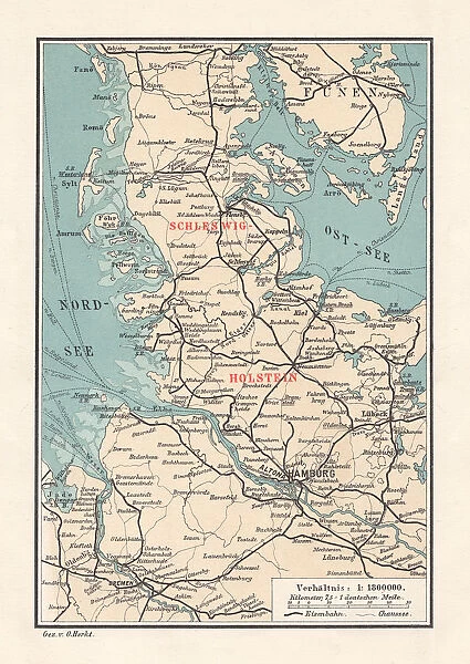
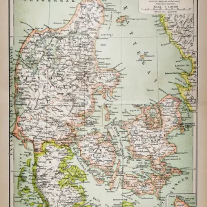
Map of Schleswig-Holstein, northernmost state of Germany, lithograph, published 1887

Map of Schleswig-Holstein, northernmost state of Germany, lithograph, published 1887
Sold 1
In Stock
We accept all major credit cards
Framed Photos
Buy from AU$119.99
Photo Prints
Buy from AU$12.99
Jigsaw Puzzles
Buy from AU$89.99
Poster Prints
Buy from AU$24.99
Canvas Prints
Buy from AU$124.99
Fine Art Prints
Buy from AU$92.53
Metal Prints
Buy from AU$43.99
Cards
Buy from AU$12.99
Home Decor
Buy from AU$24.99

Fine Art Storehouse Photo Prints and Wall Art

Map of Schleswig-Holstein, northernmost state of Germany, lithograph, published 1887

Map of Schleswig-Holstein, northernmost state of Germany. Lithograph, published in 1887. Unleash your creativity and transform your space into a visual masterpiece. © This content is subject to copyright

Media ID 14537608

Baltic Sea Bremen Canal Capital Colorful Danish Culture Denmark European Culture Friesland German Culture Hamburg Kiel Lubeck Nordfriesland North Frisian Islands North Sea Schleswig Holstein Travel Destination Wadden Sea Fano Flensburg Funen Husum Kiel Canal Northern Friesland Oldenburg Wattenmeer

FEATURES IN THESE COLLECTIONS

> Europe > Denmark > Heritage Sites > Wadden Sea

> Europe > Denmark > Maps

> Europe > Denmark > Posters

> Europe > Denmark > Related Images

> Europe > Germany > Bremen

> Europe > Germany > Hamburg

> Europe > Germany > Heritage Sites > Wadden Sea

> Europe > Germany > Maps

> Europe > Germany > Posters

> Europe > Germany > Related Images

> Fine Art Storehouse > Map > Denmark Maps

> Fine Art Storehouse > Map > Historical Maps

> Fine Art Storehouse > Map

SECURE PAYMENTS
We happily accept a wide range of payment options so you can pay for the things you need in the way that is most convenient for you

MADE IN AUSTRALIA
Safe Shipping with 30 Day Money Back Guarantee

FREE PERSONALISATION
We are proud to offer a range of customisation including Cropping, Captions, and Filters. Zoom Cropping can be adjusted in the Basket.


EDITORS COMMENTS

This vibrant lithograph from 1887 showcases the captivating Map of Schleswig-Holstein, Germany's northernmost state. The intricate details and colorful engravings depict a region rich in history and natural beauty. From the bustling cities of Hamburg, Flensburg, Bremen, and Lubeck to the serene coastal towns of Husum and Kiel, this map captures the essence of Schleswig-Holstein. The map also highlights significant landmarks such as the North Sea and Baltic Sea, emphasizing the state's close connection with maritime activities. Notably, it features the renowned Schleswig Holstein Wadden Sea National Park—an ecological treasure trove encompassing Nordfriesland and North Frisian Islands—showcasing its importance for conservation efforts. Additionally, this lithograph portrays key engineering marvels like the Kiel Canal (Nord Ostsee Kanal), which connects these two seas through Friesland. It serves as a testament to human ingenuity while blending seamlessly with nature's splendor. Beyond geographical information, this print offers glimpses into Danish culture due to its proximity to Denmark. The mention of Funen Island (Fano) and Romo hints at cross-cultural influences between Germany and Denmark along their shared coastline. With its vertical layout and vivid colors meticulously engraved on paper, this artwork is not only visually stunning but also serves as an invaluable historical document. Whether you are an art enthusiast or a travel aficionado seeking inspiration for your next adventure in Europe.


Framed Prints

Introducing the exquisite Framed Print of the Map of Schleswig-Holstein from our Fine Art Storehouse collection. This beautiful piece, published in 1887, is a captivating lithograph depicting the intricate details of the northernmost state of Germany. With its rich historical significance, this framed print adds an air of sophistication and educational charm to any room. The high-quality lithograph is meticulously framed in a classy, contemporary design, ensuring that it stands out as a stunning piece of art and a conversation starter. Discover the beauty of history with this unique and captivating framed print from Media Storehouse.


Photo Prints

Discover the rich history of Schleswig-Holstein with our exquisite, vintage Map of Schleswig-Holstein print from the Media Storehouse Fine Art collection. This beautifully preserved lithograph, published in 1887, offers a captivating glimpse into the past, showcasing intricate details of the northernmost state of Germany. Bring a touch of history and timeless charm to your home or office with this authentic, museum-quality print. Order now and let this piece of fine art tell a story that spans generations.


Poster Prints

"Discover the historical charm of Germany's Schleswig-Holstein region with our exquisite, vintage Map Print from Media Storehouse. This beautiful lithograph, published in 1887, showcases intricate details of the northernmost state's borders and geographical features. A perfect addition to your home or office, this fine art print transports you back in time and adds an air of sophistication and history to any space. Order yours today from our Fine Art Storehouse collection and bring a piece of the past into your present."


Jigsaw Puzzles

Discover the rich history of Schleswig-Holstein, Germany's northernmost state, with our intricately detailed jigsaw puzzle from Media Storehouse. This beautiful puzzle features a stunning lithograph of a historic map, published in 1887. Immerse yourself in the intricacies of this captivating puzzle, perfect for puzzle enthusiasts and history buffs alike. Recreate this piece of cartographic history and transport yourself back in time as you piece together the map of Schleswig-Holstein.

diamond
Made With High Grade Materials
thumb_up
Professional Quality Finish
package_2
Carefully Packed To Aid Safe Arrival

You May Also Like


Picture No. 10861059Picture No. 10861059
Add to Basket
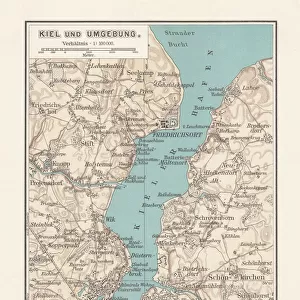
Old city map of Kiel, Schleswig-Holstein, Germany, lithograph, published 1897Old city map of Kiel, Schleswig-Holstein, Germany, lithograph, published 1897
Add to Basket
Topographic map of Schleswig-Holstein, German Empire, lithograph, published in 1897Topographic map of Schleswig-Holstein, German Empire, lithograph, published in 1897
Add to Basket
The Arsenal and Chelsea players observe a minute silence for the people that lost their lives in theThe Arsenal and Chelsea players observe a minute silence for the people that lost their lives in the
Add to Basket
No 3408 OphirNo 3408 Ophir
Add to Basket
Tarot Card - Reyne d Epee (Queen of Swords)Tarot Card - Reyne d Epee (Queen of Swords)
Add to Basket
Gloucester Old Spot Pig Piglet with pumpkinsGloucester Old Spot Pig Piglet with pumpkins
Add to Basket
Belsay Hall K020694Belsay Hall K020694
Add to Basket
Autotrain departing from Weymouth Station, Dorset, 1947Autotrain departing from Weymouth Station, Dorset, 1947
Add to Basket
Hawker Hurricane IIcHawker Hurricane IIc
Add to Basket
Image taken with a Holga medium format 120 film toy camera of old Omani studded timber doorImage taken with a Holga medium format 120 film toy camera of old Omani studded timber door
Add to Basket
Positano, Amalfi coastPositano, Amalfi coast
Add to Basket

Gallery Wall Inspiration

Cartoon map of LUXEMBOURG
Europe Map with France, Portugal, Spain and Netherlands
Map of Scandinavia
27 - Denmark - Color1 10
Denmark map
Northern Friesland (Nordfriesland), and islands, Schleswig-Holstein, Germany, lithograph, published 1887
Map of Denmark, Southern Norway and Southern Sweden, lithograph, 1897
Europe map 1867
Antique map of Denmark
Denmark Vector Map
Map of central Europe 1889
Map of Schleswig-Holstein, northernmost state of Germany, lithograph, published 1887
Map of Denmark 1900
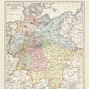
Map of the German Confederation (1815-1866), lithograph, published in 1897
Antique map of Denmark
Antique Map of Sweden, Norway and Denmark
Antquie Map of Prussia
Norway and Sweden map 1884
Denmark Sweden Norway map 1867
Topographic map of Schleswig-Holstein, German Empire, lithograph, published in 1897
Old chromolithograph map of Copenhagen, Denmark
Old chromolithograph map of Copenhagen, capital and most populous city of Denmark
Map of Sweden, Norway and Denmark
Antique Map of Denmark, 1890s, 19th Century
Antique Map of Copenhagen, Denmark, 19th Century
Sweden, Norway and Denmark Engraving Antique Illustration, Published 1851
Engraved Antique, Sweden, Norway and Denmark Engraving Antique Illustration, Published

Discover Our Collections


Wadden SeaWadden Sea
View Collection
Wadden SeaWadden Sea
View Collection
MapMap
View Collection
Denmark MapsDenmark Maps
View Collection
Denmark Related ImagesDenmark Related Images
View Collection
Germany Related ImagesGermany Related Images
View Collection
HamburgHamburg
View Collection
BremenBremen
View Collection
MapsMaps
View Collection
MapsMaps
View Collection
PostersPosters
View Collection
PostersPosters
View Collection
Historical MapsHistorical Maps
View Collection


© Copyright Media Storehouse, All Rights Reserved 2003 - 2024
Facebook     Pinterest     Card Payments     Reviews IO