Framed Print > Africa > Tunisia > Maps
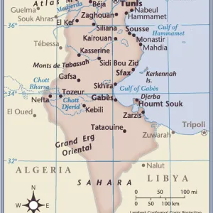
Framed Print : Geographic atlas: detail of Juan Oliva's portulan representing the coast of Tunisia. 1593 Municipal Library of Marseille


![]()
Framed Photos From Fine Art Finder
Geographic atlas: detail of Juan Oliva's portulan representing the coast of Tunisia. 1593 Municipal Library of Marseille
JEB4874925 Geographic atlas: detail of Juan Oliva's portulan representing the coast of Tunisia. 1593 Municipal Library of Marseille.; (add.info.: Geographic atlas: detail of Juan Oliva's portulan representing the coast of Tunisia. 1593 Municipal Library of Marseille.); © Jean Bernard. All rights reserved 2023
Media ID 38479920
© © Jean Bernard. All rights reserved 2024 / Bridgeman Images
Maghrebin Maghrebine Mediterranean Sea Tunisia Tunisian Arab Civilization Arab Culture Arabians Geographical Map Jeanbernard Maghreb Maghrebi Maghrebian
13.5"x11.5" (34x29cm) Premium Frame
Transport yourself back in time with this stunning framed print of Juan Oliva's portulan representing the coast of Tunisia from 1593. A true masterpiece from the Municipal Library of Marseille, this piece is sure to add a touch of history and sophistication to any space.
Framed and mounted 9x7 print. Professionally handmade full timber moulded frames are finished off with framers tape and come with a hanging solution on the back. Outer dimensions are 13.5x11.5 inches (34x29cm). Quality timber frame frame moulding (20mm wide and 30mm deep) with frame colours in your choice of black, white, or raw oak and a choice of black or white card mounts. Frames have a perspex front providing a virtually unbreakable glass-like finish which is easily cleaned with a damp cloth.
Contemporary Framed and Mounted Prints - Professionally Made and Ready to Hang
Estimated Image Size (if not cropped) is 21.4cm x 21.4cm (8.4" x 8.4")
Estimated Product Size is 34cm x 29.2cm (13.4" x 11.5")
These are individually made so all sizes are approximate
Artwork printed orientated as per the preview above, with landscape (horizontal) or portrait (vertical) orientation to match the source image.
FEATURES IN THESE COLLECTIONS
> Fine Art Finder
> Artists
> Spanish School (after)
> Africa
> Tunisia
> Related Images
> Maps and Charts
> Related Images
EDITORS COMMENTS
This stunning print captures the intricate detail of Juan Oliva's portulan representing the coast of Tunisia in 1593. The Municipal Library of Marseille houses this historical gem, showcasing the artistry and precision of cartography from the 16th century.
The map provides a glimpse into the Arab civilization and culture of North Africa, highlighting the rich history and geography of Tunisia. From the Mediterranean Sea to the vibrant cities along the coast, every line and symbol on this portulan tells a story of exploration and discovery.
As we study this detailed representation, we are transported back in time to an era where maps were not just tools for navigation but works of art that celebrated the beauty and diversity of our world. The craftsmanship displayed in Juan Oliva's work is truly remarkable, capturing both the essence of Tunisian landscapes and its people with accuracy and elegance.
Through this Geographic atlas print, we are reminded of how interconnected our global community has always been, with trade routes crisscrossing continents and cultures blending at every shore. It serves as a testament to human ingenuity and curiosity, inspiring us to continue exploring new horizons while honoring our past.
MADE IN AUSTRALIA
Safe Shipping with 30 Day Money Back Guarantee
FREE PERSONALISATION*
We are proud to offer a range of customisation features including Personalised Captions, Color Filters and Picture Zoom Tools
SECURE PAYMENTS
We happily accept a wide range of payment options so you can pay for the things you need in the way that is most convenient for you
* Options may vary by product and licensing agreement. Zoomed Pictures can be adjusted in the Basket.