Framed Print > Europe > Related Images
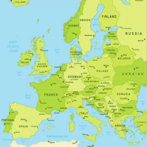
Framed Print : Map of Europe 1900


![]()
Framed Photos from Fine Art Storehouse
Map of Europe 1900
Meyers hand-Atlas Leipzig und Wien Verlag des Bibliographischen Instituts 1900
Unleash your creativity and transform your space into a visual masterpiece!
THEPALMER
Media ID 18106875
© 2014 Roberto Adrian Photography
13.5"x11.5" (34x29cm) Premium Frame
Step back in time with our exquisite Framed Print of "Map of Europe 1900" by THEPALMER from our Media Storehouse Fine Art collection. This intricately detailed map, taken from the Meyers Hand-Atlas published by the Bibliographischen Instituts Leipzig und Wien Verlag in 1900, offers a captivating glimpse into Europe's historical geography. The rich, antique tones and meticulous craftsmanship of this print are sure to add an air of sophistication and intrigue to any room. Bring history to life in your home or office with this stunning piece of decorative art.
Framed and mounted 9x7 print. Professionally handmade full timber moulded frames are finished off with framers tape and come with a hanging solution on the back. Outer dimensions are 13.5x11.5 inches (34x29cm). Quality timber frame frame moulding (20mm wide and 30mm deep) with frame colours in your choice of black, white, or raw oak and a choice of black or white card mounts. Frames have a perspex front providing a virtually unbreakable glass-like finish which is easily cleaned with a damp cloth.
Contemporary Framed and Mounted Prints - Professionally Made and Ready to Hang
Estimated Image Size (if not cropped) is 21.4cm x 21.4cm (8.4" x 8.4")
Estimated Product Size is 34cm x 29.2cm (13.4" x 11.5")
These are individually made so all sizes are approximate
Artwork printed orientated as per the preview above, with landscape (horizontal) or portrait (vertical) orientation to match the source image.
FEATURES IN THESE COLLECTIONS
> Fine Art Storehouse
> Map
> Historical Maps
> Europe
> Related Images
EDITORS COMMENTS
In this print titled "Map of Europe 1900". THEPALMER takes us on a journey back in time to the turn of the 20th century. The image showcases an exquisite piece from Meyers hand-Atlas Leipzig und Wien Verlag des Bibliographischen Instituts, originally published in 1900. The map itself is a true testament to the artistry and precision that went into cartography during that era. With intricate details and delicate lines, it beautifully captures the political boundaries, cities, rivers, and mountain ranges of Europe as they were known over a century ago. As we gaze upon this vintage masterpiece, we are transported to a different world - one where empires still reigned supreme and borders held different meanings. It serves as a reminder of how history has shaped our present-day geopolitical landscape. Beyond its historical significance, this print also stands out for its aesthetic appeal. The muted colors evoke a sense of nostalgia while adding an air of elegance to any space it graces. Whether displayed in homes or offices, it effortlessly becomes both an educational tool and an eye-catching work of art. "The Map of Europe 1900" by THEPALMER offers us not only a glimpse into the past but also invites us to appreciate the beauty found within historical artifacts. It serves as a timeless reminder that even in our fast-paced digital age, there is immense value in preserving tangible pieces that connect us with our collective heritage.
MADE IN AUSTRALIA
Safe Shipping with 30 Day Money Back Guarantee
FREE PERSONALISATION*
We are proud to offer a range of customisation features including Personalised Captions, Color Filters and Picture Zoom Tools
SECURE PAYMENTS
We happily accept a wide range of payment options so you can pay for the things you need in the way that is most convenient for you
* Options may vary by product and licensing agreement. Zoomed Pictures can be adjusted in the Cart.