Fraud Blocker Skip to main content

Forts Collection (page 5)

"Exploring the Rich History of Forts

Background imageForts Collection: Deer and Doe on columns at entrance to Mandraki Harbour, former Colossus of Rhodes location

Deer and Doe on columns at entrance to Mandraki Harbour, former Colossus of Rhodes location, Saint Nicholas Fortress in the background, sunrise, Rhodes City, Rhodes Island, Dodecanese, Greek Islands

Background imageForts Collection: Platanos and Medieval Castle of Pandeli, Agia Marina, Leros Island, Dodecanese, Greek Islands

Platanos and Medieval Castle of Pandeli, Agia Marina, Leros Island, Dodecanese, Greek Islands, Greece, Europe

Background imageForts Collection: Antimachia Castle near Kardamaina, Kos Island, Dodecanese, Greek Islands, Greece, Europe

Antimachia Castle near Kardamaina, Kos Island, Dodecanese, Greek Islands, Greece, Europe

Background imageForts Collection: Venetian Fortezza Castle, City of Rethymno, Rethymno Region, Crete, Greek Islands, Greece, Europe

Venetian Fortezza Castle, City of Rethymno, Rethymno Region, Crete, Greek Islands, Greece, Europe

Background imageForts Collection: Venetian Fortezza Castle, City of Rethymno, Rethymno Region, Crete, Greek Islands, Greece, Europe

Venetian Fortezza Castle, City of Rethymno, Rethymno Region, Crete, Greek Islands, Greece, Europe

Background imageForts Collection: View towards the Venetian Fortezza Castle, City of Rethymno, Rethymno Region, Crete

View towards the Venetian Fortezza Castle, City of Rethymno, Rethymno Region, Crete, Greek Islands, Greece, Europe

Background imageForts Collection: Venetian Fortezza Castle, City of Rethymno, Rethymno Region, Crete, Greek Islands, Greece, Europe

Venetian Fortezza Castle, City of Rethymno, Rethymno Region, Crete, Greek Islands, Greece, Europe

Background imageForts Collection: Antimachia Castle near Kardamaina, Kos Island, Dodecanese, Greek Islands, Greece, Europe

Antimachia Castle near Kardamaina, Kos Island, Dodecanese, Greek Islands, Greece, Europe

Background imageForts Collection: View towards The Koules Fortress, City of Heraklion, Crete, Greek Islands, Greece, Europe

View towards The Koules Fortress, City of Heraklion, Crete, Greek Islands, Greece, Europe

Background imageForts Collection: The Koules Fortress, City of Heraklion, Crete, Greek Islands, Greece, Europe

The Koules Fortress, City of Heraklion, Crete, Greek Islands, Greece, Europe

Background imageForts Collection: View towards The Koules Fortress, City of Heraklion, Crete, Greek Islands, Greece, Europe

View towards The Koules Fortress, City of Heraklion, Crete, Greek Islands, Greece, Europe

Background imageForts Collection: The Tonnata (old tuna factory), Santa Caterina Fortress, Favignana, Aegadian Islands, Sicily

The Tonnata (old tuna factory), Santa Caterina Fortress, Favignana, Aegadian Islands, Sicily, Italy, Mediterranean, Europe

Background imageForts Collection: View towards the Kazarma Fortress, Sitia, Lasithi Region, Crete, Greek Islands, Greece, Europe

View towards the Kazarma Fortress, Sitia, Lasithi Region, Crete, Greek Islands, Greece, Europe

Background imageForts Collection: Forchtenstein Castle, Burgenland, Austria, Europe

Forchtenstein Castle, Burgenland, Austria, Europe

Background imageForts Collection: Forchtenstein Castle, Burgenland, Austria, Europe

Forchtenstein Castle, Burgenland, Austria, Europe

Background imageForts Collection: View of Warkworth Castle and River Coquet, Warkworth, Northumberland, England, United Kingdom

View of Warkworth Castle and River Coquet, Warkworth, Northumberland, England, United Kingdom, Europe

Background imageForts Collection: Tien-Tsin, on the banks of the Peiho River, 1860. Creator: Unknown

Tien-Tsin, on the banks of the Peiho River, 1860. Creator: Unknown
Tien-Tsin, on the banks of the Peiho River, 1860. The British in China. Small vessels only can approach the mouth of the Peiho River

Background imageForts Collection: Map of the area between Bergen op Zoom and Steenbergen, 1630. Creator: Franciscus van Schooten

Map of the area between Bergen op Zoom and Steenbergen, 1630. Creator: Franciscus van Schooten
Map of the area between Bergen op Zoom and Steenbergen, 1630. Tabula Bergarum ad Zomam Stenbergae'. Showing fortresses, trees, hills, harbours, areas susceptible to flooding

Background imageForts Collection: Sebastopol - North Side - sketched by J. A. Crowe, 1856. Creator: J. A. Crowe

Sebastopol - North Side - sketched by J. A. Crowe, 1856. Creator: J. A. Crowe
Sebastopol - North Side - sketched by J. A. Crowe, 1856. Crimean War: The position of the Russians on the north side of the harbour of Sebastopol...has remained without any alteration for the last

Background imageForts Collection: Map of Antwerp during the siege by the French, 1832, (1832-1833)

Map of Antwerp during the siege by the French, 1832, (1832-1833). Creators: Anon, Johannes Paulus Houtman
Plan showing Schelde and Antwerp with the location of the forts in Dutch hands, during the siege of the Citadel by the French, 1832, (1832-1833). Dutch gunboats on the Scheldt

Background imageForts Collection: View of Namur from the East during the Siege of 1695, (1695). Creator: Dirk Maes

View of Namur from the East during the Siege of 1695, (1695). Creator: Dirk Maes
View of Namur from the East during the Siege of 1695, (1695)

Background imageForts Collection: The Siege of Jülich, 1621-22, c.1635. Creator: Sebastian Vrancx

The Siege of Jülich, 1621-22, c.1635. Creator: Sebastian Vrancx
The Siege of Julich, 1621-22, c.1635. Scene from the Eighty Years War. Attributed to Sebastiaen Vrancx

Background imageForts Collection: Reconnoitring at Cronstadt, 1854. Creator: Unknown

Reconnoitring at Cronstadt, 1854. Creator: Unknown
Reconnoitring at Cronstadt, 1854. Crimean War. Fort Peter I.; Fort Alexander; Fort Menschikoff; "Bulldog"; "Phlegethon"

Background imageForts Collection: Bombardment of Bomarsund, 1854. Creator: Unknown

Bombardment of Bomarsund, 1854. Creator: Unknown
Bombardment of Bomarsund, 1854. 2nd Round Fort - Long Fort, 80 Guns - "Odin" - 3rd Round Fort'. British warships during the Aland War - British-French naval force against military

Background imageForts Collection: Bombardment of Bomarsund, 1854. Creator: Unknown

Bombardment of Bomarsund, 1854. Creator: Unknown
Bombardment of Bomarsund, 1854. Riflemen - Masked Battery - "Hecla" - 1st Round Fort - "Valorous" - Village of Bomarsund'. British warships during the Aland War

Background imageForts Collection: Plan of the Forts of Bomarsund, 1854. Creator: Unknown

Plan of the Forts of Bomarsund, 1854. Creator: Unknown
Plan of the Forts of Bomarsund, 1854. From "Cassell's Illustrated Family Paper; London Weekly 31 Dec 1853 to 30 Dec 1854"

Background imageForts Collection: Cronstadt, 1854. Creator: Unknown

Cronstadt, 1854. Creator: Unknown
Cronstadt, 1854. From "Cassells Illustrated Family Paper; London Weekly 31/12/1853 - 30/12/1854"

Background imageForts Collection: Sebastopol and Balaclava shewing the position of the Allied Forces, 1854. Creator: John Dower

Sebastopol and Balaclava shewing the position of the Allied Forces, 1854. Creator: John Dower
Sebastopol and Balaclava shewing the position of the Allied Forces, 1854. Crimean War. The severe and costly battles of Balaclava and Inkerman

Background imageForts Collection: Naval Attack on the Russian Fort of Petropaulovski, 1854. Creator: Unknown

Naval Attack on the Russian Fort of Petropaulovski, 1854. Creator: Unknown
Naval Attack on the Russian Fort of Petropaulovski, [Kamchatka], 1854. Crimean War. French and English warships: L'Obligator; Virago; Eurydice

Background imageForts Collection: The Coast North of Sebastopol, and New Earth Batteries, 1854. Creator: Unknown

The Coast North of Sebastopol, and New Earth Batteries, 1854. Creator: Unknown
The Coast North of Sebastopol, and New Earth Batteries, 1854. Crimean War. Map of the strategic Black Sea port, ...sketched on board H.M.S

Background imageForts Collection: New Russian Works, 1854. Creator: Unknown

New Russian Works, 1854. Creator: Unknown
New Russian Works, 1854. Crimean War. Map showing the besieged Black Sea port of Sebastopol. English, French and Turkish ships are ranged across the entrance to the harbour

Background imageForts Collection: Entrance to Balaclava Harbour, 1854. Creator: Unknown

Entrance to Balaclava Harbour, 1854. Creator: Unknown
Entrance to Balaclava Harbour, 1854. Crimean War. The town of Balaclava is situated close to the harbour, along the foot of the mountain, but it is not provided with good water

Background imageForts Collection: Balaclava - view inside the port, 1854. Creator: Unknown

Balaclava - view inside the port, 1854. Creator: Unknown
Balaclava - view inside the port, 1854. Crimean War. View of the'...inside of the port, which is only accessible through a very narrow circuitous channel, in the form of the letter S

Background imageForts Collection: Balaclava Harbour, 1854. Creator: Unknown

Balaclava Harbour, 1854. Creator: Unknown
Balaclava Harbour, 1854. Crimean War....Balaclava has been completely changed into a Greek town...[It] is situated close to the harbour, along the foot of the mountain

Background imageForts Collection: The 'Agamemnon' and 'Sanspareil' attacking Sebastopol, 1854. Creator: Unknown

The "Agamemnon" and "Sanspareil" attacking Sebastopol, 1854. Creator: Unknown
The "Agamemnon" and "Sanspareil" attacking Sebastopol, 1854. Crimean War: Royal Navy ships....the Agamemnon...opened fire from her large pivot gun on the "Wasp" Fort

Background imageForts Collection: Sebastopol, sketched from Fort Constantine, 1854. Creator: Unknown

Sebastopol, sketched from Fort Constantine, 1854. Creator: Unknown
Sebastopol, sketched from Fort Constantine, 1854. Crimean War: strategic port on the Black Sea under siege. [British commander] Lord Raglan, it is said, received a few days ago

Background imageForts Collection: The Sunken Ships at the Mouth of the Harbour of Sebastopol, sketched by Lieut. Montagu... 1854

The Sunken Ships at the Mouth of the Harbour of Sebastopol, sketched by Lieut. Montagu... 1854. Creator: Unknown
The Sunken Ships at the Mouth of the Harbour of Sebastopol, sketched by Lieut. Montagu O'Reilly, H.M.S. Retribution, 1854. Crimean War

Background imageForts Collection: British Outposts, near Sebastopol, 1854. Creator: Unknown

British Outposts, near Sebastopol, 1854. Creator: Unknown
British Outposts, near Sebastopol, 1854. Crimean War: panorama showing Cossacks; Fort; English Steamer; Russian Soldiers Camp Cooking Houses

Background imageForts Collection: Sebastopol - from an original drawing, 1854. Creator: Edmund Evans

Sebastopol - from an original drawing, 1854. Creator: Edmund Evans
Sebastopol - from an original drawing, 1854. Crimean War. Warships on the Black Sea near the port of Sebastopol. The Siege of Sevastopol was the subject of Crimean soldier Leo Tolstoy's

Background imageForts Collection: Fortifications of Bomarsund, 1854. Creator: Unknown

Fortifications of Bomarsund, 1854. Creator: Unknown
Fortifications of Bomarsund, 1854. Crimean War. Map of Russian forts on the Baltic Sea coast in Findland. Also shown are positions of the English and French armies

Background imageForts Collection: Steam-ships of the Allied Fleet searching for Infernal Machines off Cronstadt... 1854

Steam-ships of the Allied Fleet searching for Infernal Machines off Cronstadt... 1854. Creator: Unknown
Steam-ships of the Allied Fleet searching for Infernal Machines off Cronstadt - from a sketch by W.O. Brierly, 1854. Crimean War

Background imageForts Collection: Steam-ships reconnoitring at Sveaborg, in the Gulf of Finland, 1854. Creator: Unknown

Steam-ships reconnoitring at Sveaborg, in the Gulf of Finland, 1854. Creator: Unknown
Steam-ships reconnoitring at Sveaborg, in the Gulf of Finland, 1854. Crimean War: Royal Navy ships off Russian-held Sveaborg [modern Suomenlinna]

Background imageForts Collection: General Map of Ekaterinoslav Province: Showing Postal and Major Roads, Stations and the... 1821

General Map of Ekaterinoslav Province: Showing Postal and Major Roads, Stations and the... 1821
General Map of Ekaterinoslav Province: Showing Postal and Major Roads, Stations and the Distance in Versts between Them, 1821

Background imageForts Collection: General Map of Kharkiv Province: Showing Postal and Major Roads, Stations and the... 1821

General Map of Kharkiv Province: Showing Postal and Major Roads, Stations and the... 1821
General Map of Kharkiv Province: Showing Postal and Major Roads, Stations and the Distance in Versts between Them, 1821. This 1821 map of Kharkiv Provinceis from a larger work

Background imageForts Collection: General Map of Kursk Province: Showing Postal and Major Roads, Stations and the... 1822

General Map of Kursk Province: Showing Postal and Major Roads, Stations and the... 1822
General Map of Kursk Province: Showing Postal and Major Roads, Stations and the Distance in Versts between Them, 1822. This 1822 map of Kursk Provinceis from a larger work

Background imageForts Collection: General Map of Taurida Province: Showing Postal and Major Roads, Stations and.. 1822

General Map of Taurida Province: Showing Postal and Major Roads, Stations and.. 1822
General Map of Taurida Province: Showing Postal and Major Roads, Stations and the Distance in Versts between Them, 1822. This 1822 map ofTaurida Provinceis from a larger work

Background imageForts Collection: Red Fort, UNESCO World Heritage Site, Old Delhi, India, Asia

Red Fort, UNESCO World Heritage Site, Old Delhi, India, Asia

Background imageForts Collection: Loket Castle and bridge over Ohre river, Loket, Sokolov District, Karlovy Vary Region

Loket Castle and bridge over Ohre river, Loket, Sokolov District, Karlovy Vary Region, Bohemia, Czech Republic


All Professionally Made to Order for Quick Shipping

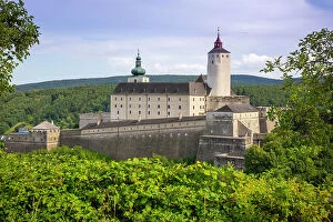
"Exploring the Rich History of Forts: From Iron-Age British Camps to Majestic Castles" Discovering the ancient secrets of an Iron-Age British Camp hill fort amidst the breathtaking autumn hues of Malvern Hills in Great Malvern, Worcestershire. Unveiling the rugged beauty and historical significance of Dunnottar Castle, standing proudly outside Stonehaven in Aberdeenshire, Scotland. Journeying through time at Carreg Cennen Castle, nestled near Llandeilo within the enchanting Brecon Beacons National Park in Carmarthenshire, Wales. Crossing Monnow Bridge and Gate over River Monnow in Monmouthshire, Wales - a captivating glimpse into medieval fortification and architectural brilliance. Standing atop Hambledon Hill's prehistoric ramparts above Blackmore Vale - a testament to our ancestors' ingenuity and strategic prowess. Embracing history's embrace at Dunstanburgh Castle on Embleton Bay Beach in Northumberland, England - where nature meets ruins with stunning coastal views. Experiencing awe-inspiring solitude on Eilean Tioram as we marvel at Castle Tioram's majestic presence where River Shiel merges with Loch Moidart. Gazing upon Chepstow Castle's grandeur while admiring the meandering River Wye in Gwent, Wales - a perfect blend of natural beauty and architectural splendor. Immersing ourselves amidst Harlech Castle's towering walls against Snowdonia National Park's magnificent mountain backdrop in Gwynedd, Wales. Witnessing nature's masterpiece unfold as sunrise paints vibrant colors across Embleton Bay towards Dunstanburgh Castle’s silhouette reflected upon sea and wet sand. Exploring Dorset’s Corfe Castle alongside Swanage Railway station – a harmonious blend of history and scenic charm that captivates the soul.