Fraud Blocker Skip to main content

Satellite Image Collection (page 18)

"Exploring the vastness of our universe, satellite images capture breathtaking views that redefine our perspective

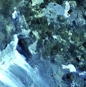
Background imageSatellite Image Collection: Volcanic landscape, satellite image

Volcanic landscape, satellite image. North is at top. Desert sands and salt deposits are white, with the colour varying to light blue depending on the amount of rock content

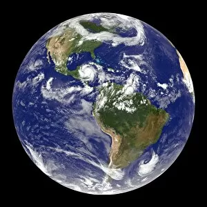
Background imageSatellite Image Collection: Earth and Hurricane Dean, 20 August 2007

Earth and Hurricane Dean, 20 August 2007
Earth and Hurricane Dean, satellite image. North is at top. Hurricane Dean is the large rotating cloud system (white) at upper left, in the western Caribbean, to the east of Mexico

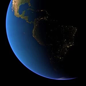
Background imageSatellite Image Collection: South America at night

South America at night
South America, satellite image

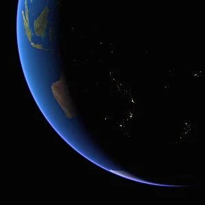
Background imageSatellite Image Collection: Australia at night

Australia at night, satellite image from space

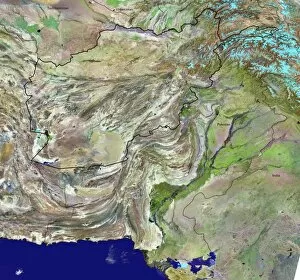
Background imageSatellite Image Collection: Afghanistan

Afghanistan and surroundings, coloured satellite image. North is at top. Vegetation is green, deserts are pink, mountains are grey, water is dark blue, snow/ice is light blue, and borders are black

Background imageSatellite Image Collection: North America, satellite image

North America, satellite image
North America. Satellite image of the Earth, set against a background of stars, centred on the continent of North America. North is at top. Clouds (white) are seen in the atmosphere

Background imageSatellite Image Collection: Asia at night, satellite image

Asia at night, satellite image. City lights (yellow) show areas of dense population. Large, densely populated areas include India (lower centre), China (lower right) and Japan (right)

Background imageSatellite Image Collection: Arabian Sea, satellite image

Arabian Sea, satellite image
Arabian Sea. Satellite image of the Earth centred on the Arabian Sea and western India. Clouds and Arctic ice (top) are white, oceans are blue and land is green and brown

Background imageSatellite Image Collection: The Americas, satellite image

The Americas, satellite image
The Americas. Satellite image of the Earth centred on the Caribbean Islands, with North America at upper left and South America at bottom

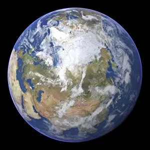
Background imageSatellite Image Collection: Northern Asia and the Arctic

Northern Asia and the Arctic. Satellite image of the Earth centred on Siberia, with the North Pole at upper centre. Clouds and Arctic sea ice are white, oceans are blue and land is green and brown

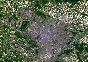
Background imageSatellite Image Collection: Paris, France, satellite image

Paris, France, satellite image
Paris, France. Satellite image of the city of Paris (centre) and its surrounding area in north-central France. North is at top

Background imageSatellite Image Collection: New York City, USA, satellite image

New York City, USA, satellite image
New York city, USA, and its surrounding area, satellite image. North is at top. The island of Manhattan is at upper centre, bordered by the Hudson (left) and East (right) rivers

Background imageSatellite Image Collection: Moscow, Russia, satellite image

Moscow, Russia, satellite image
Moscow, Russia. Satellite image of the city of Moscow (centre) and its surrounding area in west-central Russia. North is at top. The Moskva river is seen running diagonally through the city

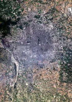
Background imageSatellite Image Collection: Madrid, Spain, satellite image

Madrid, Spain, satellite image
Madrid, Spain. Satellite image of the city of Madrid (centre) and its surrounding area in central Spain. North is at top. The river Manzanares is seen flowing through the city from top left to bottom

Background imageSatellite Image Collection: Los Angeles, USA, satellite image

Los Angeles, USA, satellite image
Los Angeles, USA. Satellite image of the city of Los Angeles (centre) and its surrounding area in California, USA. North is at top. The Pacific Ocean is at bottom left

Background imageSatellite Image Collection: English Channel, satellite image

English Channel, satellite image
English Channel. Satellite image of the English Channel, the stretch of water that separates southern England from northern France. North is at top

Background imageSatellite Image Collection: Cape Town, South Africa, satellite image

Cape Town, South Africa, satellite image
Cape Town, South Africa. Satellite image of the city of Cape Town (upper centre and left) and its surrounding area in western South Africa. North is at top. Robben Island is at top left

Background imageSatellite Image Collection: Milan, Italy, satellite image

Milan, Italy, satellite image
Milan, Italy. Satellite image of the city of Milan (centre) and its surrounding area in northern Italy. North is at top. Forested areas are dark green

Background imageSatellite Image Collection: Cologne, Germany, satellite image

Cologne, Germany, satellite image
Cologne, Germany. Satellite image of the city of Cologne (centre) and its surrounding area in western Germany. North is at top. The River Rhine is seen running through the city from top to bottom

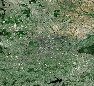
Background imageSatellite Image Collection: Krakow, satellite image

Krakow, satellite image
Krakow. Satellite image of the city of Krakow (centre) and its surrounding area in southern Poland. North is at top. Forested areas are dark green

Background imageSatellite Image Collection: New York City, USA, satellite image

New York City, USA, satellite image. North is attop. The island of Manhattan is at upper centre, bordered by the Hudson (left) and East (right)rivers

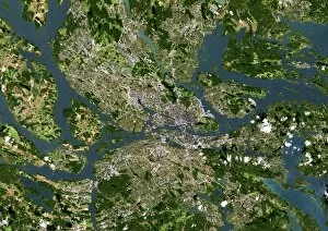
Background imageSatellite Image Collection: Stockholm, satellite image

Stockholm, satellite image. North is at top. Wateris blue, vegeatation is green, bare ground brownand urbanised areas are grey. Cloud cover iswhite. Stockholm is the captial city of Sweden

Background imageSatellite Image Collection: Seoul, satellite image

Seoul, satellite image. North is at top.Vegetation is green, urbanised areas are grey andsediments are grey/brown. Seoul (upper right) isthe capital city of South Korea

Background imageSatellite Image Collection: Sao Paulo, satellite image

Sao Paulo, satellite image. North is at top.Vegetation is green, water is azure and blue andurbanised areas are cream. Sao Paulo is a city inBrazil near the coast of the South Atlantic Ocean(bottom)

Background imageSatellite Image Collection: San Francisco, satellite image

San Francisco, satellite image. North is at top.Vegetation is green, water is blue, bare ground isshades of brown and urbanised areas are grey

Background imageSatellite Image Collection: Paris, satellite image

Paris, satellite image. North is at top. Forest isdark green, cultivated land is light green andcream and urbanised areas are pink and grey.Paris is the capital city of France

Background imageSatellite Image Collection: Mexico City, satellite image

Mexico City, satellite image. North is at top.Vegetation is green. Urbanised areas are grey, bare or arid ground is brown. Mexico City is thecapital city of Mexico

Background imageSatellite Image Collection: Madrid, satellite image

Madrid, satellite image
Madrid metropolitan area, satellite image. Northis at top. Vegetation is green, densely populatedareas are pink. Arid or bare ground is shades ofcream and orange, water is blue

Background imageSatellite Image Collection: Beijing, China, satellite image

Beijing, China, satellite image. North is at top, urban areas are grey and vegetation is green.Beijing is the capital of the Peoples Republic ofChina

Background imageSatellite Image Collection: London, coloured satellite image

London, coloured satellite image
London, UK, coloured satellite image. Theregion has been colour-coded: red areas areresidences, cyan areas are industrial and greenand yellow areas represent thick and shortvegetation respectively

Background imageSatellite Image Collection: Forbidden Palace, Beijing

Forbidden Palace, Beijing
Forbidden Palace. Satellite image of the largecomplex of historical royal buildings known as theForbidden Palace, in Beijing, China. Image takenby the Ikonos satellite on 26 April 2002

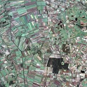
Background imageSatellite Image Collection: Agricultural fields around Bourtange

Agricultural fields around Bourtange
Agricultural fields. Satellite image of thefields surrounding the star-shaped 17th centuryfortress (centre) and town of Bourtange, theNetherlands


All Professionally Made to Order for Quick Shipping

"Exploring the vastness of our universe, satellite images capture breathtaking views that redefine our perspective. Inspired by Voyager 1's iconic 'Pale Blue Dot' image, we witness the beauty and fragility of Earth from space. From the British Isles to Europe at night, these satellite images reveal a tapestry of lights illuminating cities and towns across continents. Marvel at the mesmerizing glow as darkness blankets Europe or gaze in awe at the captivating sight of our entire planet aglow during nighttime. Delve into Tenerife's intricate landscapes, where satellite imagery unveils its hidden wonders with stunning clarity. Venturing beyond our home planet, New Horizons grants us an extraordinary glimpse into Jupiter and its moon Io – a celestial dance frozen in time. Witnessing Earth from afar reminds us of its remarkable diversity; behold Scotland's rugged terrain captured through a lens high above. Satellite imagery also unravels nature's grandeur: observe awe-inspiring solar prominences erupting from the sun’s surface like fiery tendrils reaching towards infinity. In January 2010, witness Mother Nature transforming the United Kingdom into a winter wonderland as snow blankets every corner. Finally, explore North America at night through satellite lenses – an ethereal spectacle showcasing bustling metropolises intertwined with serene natural landscapes under starlit skies. " Note.