Fraud Blocker Skip to main content

Satellite Image Collection (page 12)

"Exploring the vastness of our universe, satellite images capture breathtaking views that redefine our perspective

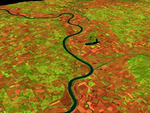
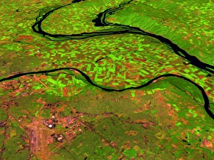
Background imageSatellite Image Collection: Pre-flood Missouri River

Pre-flood Missouri River (image 1 of 2). Coloured three-dimensional computer image, based on satell- ite data, of the Missouri River, USA

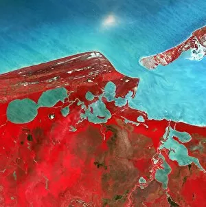
Background imageSatellite Image Collection: Coastal lagoons, satellite image

Coastal lagoons, satellite image. North is at top. Vegetation is red and water is blue. This area is on the western coast of Mexicos Yucatan Peninsula

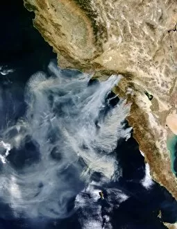
Background imageSatellite Image Collection: Californian wild fires

Californian wild fires. Satellite image of the wild fires that raged in California, USA, in late October 2003. Huge plumes of smoke are seen being blown out over the Pacific Ocean

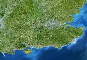
Background imageSatellite Image Collection: South-East England

South-East England, satellite image. North is at top. This view is about 280 kilometres across, stretching from Bristol (grey area, centre left) to the eastern coast of Kent (far right)

Background imageSatellite Image Collection: Tropical Storm Lane

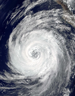
Tropical Storm Lane, true-colour satellite image. This cyclonic storm began as Tropical Depression 14-E on 5 September 2000, over the Pacific Ocean around 200 miles off the Mexican coast

Background imageSatellite Image Collection: Tropical cyclones

Tropical cyclones over the Indian Ocean, satellite image. North is at top. The coast of Madagascar is at far left (green). The cyclones are (from left- right): Gerry, Hape, 18S and Fiona

Background imageSatellite Image Collection: Open cell clouds over the South Atlantic

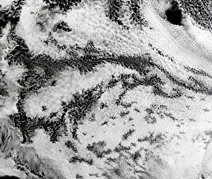
Open cell clouds over the South Atlantic
Open cell clouds. Terra satellite image of a cloud formation known as open cell, over the South Atlantic Ocean. This pattern appears on the back of a low pressure system or cyclone

Background imageSatellite Image Collection: Sand storm over Canary Islands

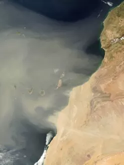
Sand storm over Canary Islands
Sand storm. True-colour satellite image of a sand storm from the Sahara Desert, Africa (right), over the Canary Islands (centre to centre left) in the Atlantic Ocean. North is at top

Background imageSatellite Image Collection: Forest fires in South America

Forest fires in South America. Satellite image of smoke from thousands of fires (red circles) in South America, near the Brazil-Bolivia border

Background imageSatellite Image Collection: French coastline

French coastline. True-colour satellite image of the Atlantic coastline of south-west France. North is at top. Vegetation is green and water is blue. A sandy beach (white) stretches up the coast

Background imageSatellite Image Collection: Dust storm over the Canary Islands

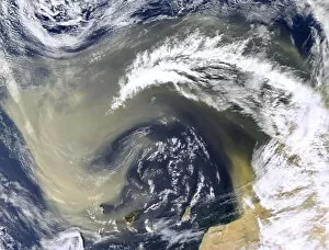
Dust storm over the Canary Islands, Aqua satellite image. Sand has blown north-west from the Sahara desert (bottom right) and is swirling over the Canary Islands (bottom centre)

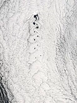
Background imageSatellite Image Collection: Von Karman vortices, Cape Verde islands

Von Karman vortices, Cape Verde islands
Von Karman vortices. Terra satellite image of von Karman vortices (best seen at top left) in clouds over the Cape Verde Islands off West Africa

Background imageSatellite Image Collection: Earth with 5 hurricanes, satellite image

Earth with 5 hurricanes, satellite image
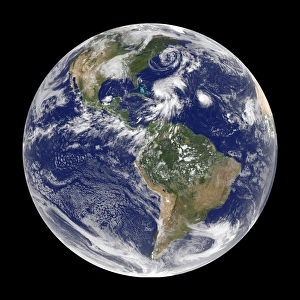
Earth with five hurricanes, satellite image. North is at top. There are five rotating cloud systems (white) seen across the upper hemisphere of Earth

Background imageSatellite Image Collection: St Ives, Cornwall, UK, satellite image

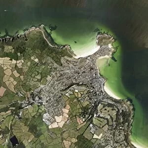
St Ives, Cornwall, UK, satellite image. North is at top. Water is dark green, land is green, brown and grey. Sand is white/pale green

Background imageSatellite Image Collection: Heath and moorland fires, UK

Heath and moorland fires, UK
Heath and moorland fires in the UK, Aqua satellite image. April 2003 was a warm, dry month in Northern Europe. This, combined with a strong easterly wind

Background imageSatellite Image Collection: Hurricane Emily, 14th July 2005

Hurricane Emily, 14th July 2005
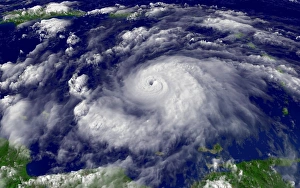
Hurricane Emily in the Caribbean Sea, at 19:15 GMT (20:15 BST) on 14th July 2005. At this stage Emily was a category four hurricane, the second strongest level

Background imageSatellite Image Collection: Tropical Cyclone Hary

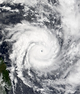
Tropical Cyclone Hary. Satellite image of Tropical Cyclone Hary approaching the coast of Madagascar. The storm affected the northern and eastern shores of Madagascar

Background imageSatellite Image Collection: Antarctic ozone hole, 2006

Antarctic ozone hole, 2006
Antarctic ozone hole. Coloured satellite image of the reduced atmospheric ozone layer over Antarctica on 13th September 2007

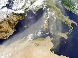
Background imageSatellite Image Collection: Dust plume crossing the Mediterranean

Dust plume crossing the Mediterranean sea, Terra satellite image. Sand and dust from North Africa and the Sahara (bottom) has blown north towards Italy in a large plume

Background imageSatellite Image Collection: County Durham, England

County Durham, England
County Durham, UK, satellite image. Vegetation is green, water is blue and urban areas are grey. North is at top. County Durham is a county in north-east England

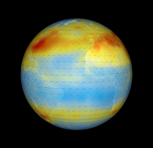
Background imageSatellite Image Collection: Carbon dioxide levels, Atlantic, 2003

Carbon dioxide levels, Atlantic, 2003
Atmospheric carbon dioxide levels centred on the Atlantic Ocean, satellite data. Carbon dioxide (CO2) is a greenhouse gas that contributes to global warming

Background imageSatellite Image Collection: Dust storm over the Arabian Sea

Dust storm over the Arabian Sea and Persian Gulf, Terra and Aqua composite satellite image. Sand and dust from surrounding countries has been picked up by winds, forming a sandstorm

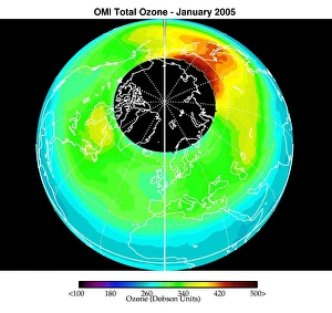
Background imageSatellite Image Collection: Arctic ozone distribution

Arctic ozone distribution. Coloured satellite image of average total column ozone levels (amount of ozone in a column of air between the Earths surface and space) over the Arctic during January 2005

Background imageSatellite Image Collection: Von Karman vortices in clouds

Von Karman vortices in clouds
Von Karmen vortices. Aqua satellite image of clouds showing a Von Karmen vortex street (braid- like area, centre) over Jan Mayen Island (at top of street). The wind is blowing from the top

Background imageSatellite Image Collection: Mediterranean Basin, satellite image

Mediterranean Basin, satellite image. North is at top. The mediterranean separates the continents of Europe and Africa. The northern Mediterranean borders Spain, France, Italy, Slovenia

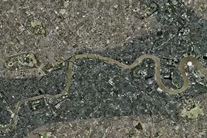
Background imageSatellite Image Collection: Flood risk in London, satellite image

Flood risk in London, satellite image
Flood risk in London. Satellite image of central London illustrating the areas at risk of flooding due to a rise in sea-level. North is at top

Background imageSatellite Image Collection: Atlantic storms, QuikSCAT radar image

Atlantic storms, QuikSCAT radar image
Atlantic storms, radar image. This map, centred on the Atlantic, shows wind speeds measured by radar from the QuikSCAT satellite

Background imageSatellite Image Collection: Hurricane Emily, 17 July 2005

Hurricane Emily, 17 July 2005
Hurricane Emily. Satellite image of Hurricane Emily (centre) approaching Yucatan (left), Mexico, on 17 July 2005 at 1625 GMT

Background imageSatellite Image Collection: Pre-flood rivers

Pre-flood rivers (image 1 of 2). Coloured three- dimensional computer image, based on satellite data, of three US rivers before they flooded

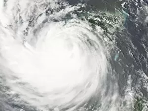
Background imageSatellite Image Collection: Hurricane Dean, 21 August 2007

Hurricane Dean, 21 August 2007
Hurricane Dean, satellite image. North is at top. Image obtained at 15:05 local time on 21 August 2007 as the hurricane passed over Mexicos Yucatan peninsula

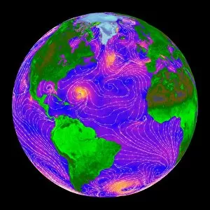
Background imageSatellite Image Collection: Global ocean circulation

Global ocean circulation. Satellite image of the Earth from space with a map of ocean circulation. Ocean currents flow around the world due to differences in temperature and salinity

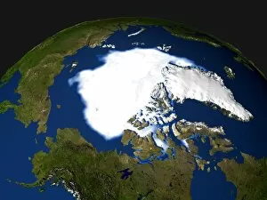
Background imageSatellite Image Collection: Arctic ice minimum extent, 2005

Arctic ice minimum extent, 2005
Arctic sea ice minimum extent, 2005. The extent of the sea ice varies over the course of a year, being largest in winter and smallest in summer

Background imageSatellite Image Collection: Nile Delta, satellite image

Nile Delta, satellite image
Nile Delta, Egypt, satellite image. North is at top. The River Nile flows from bottom, out of the deserts (light brown) of Egypt, and into the Mediterranean Sea (top, blue)

Background imageSatellite Image Collection: Rhine-Meuse delta, satellite image

Rhine-Meuse delta, satellite image. North is at top. Vegetation is red, barren areas are light blue, and water is dark blue

Background imageSatellite Image Collection: Mouth of the mississippi, Landsat image

Mouth of the mississippi, Landsat image
Mouth of the Mississippi river, Landsat 7 satellite image. Draining much of North America, the Mississippi carries large quantities of sediment into the Gulf of Mexico

Background imageSatellite Image Collection: Gulf of Papua deltas, satellite image

Gulf of Papua deltas, satellite image
River deltas, Papua New Guinea, satellite image. North is at top. The rivers, flowing from inland through dense jungle and vast swamp plains (green)

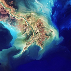
Background imageSatellite Image Collection: Mississippi Delta

Mississippi Delta. Coloured satellite image of the delta of the Mississippi River, USA. North is at top, the Gulf of Mexico is at lower left

Background imageSatellite Image Collection: River deltas in Borneo

River deltas in Borneo, satellite image. North is at top. Three rivers flow into the sea, carrying red silt deposits of sediment, mineral ores and organic matter

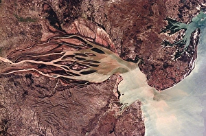
Background imageSatellite Image Collection: Bombetoka Bay, Madagascar

Bombetoka Bay, Madagascar. This bay is formed from the estuary of the Betsiboka River, which flows from the islands interior into the Mozambique Channel. North is at lower right

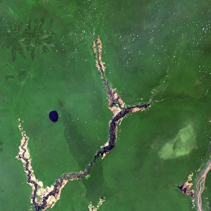
Background imageSatellite Image Collection: River Congo in forest

River Congo in forest
River Congo, Democratic Republic of Congo, satellite image. Formerly known as the Zaire, the Congo is seen flowing through forest (dark green) and swamp land (light green)

Background imageSatellite Image Collection: Turpan Depression, satellite image

Turpan Depression, satellite image. North is at top. The Turpan (or Turfan) depression (lower frame) is located at the foot of Chinas Bogda Mountains (green, upper frame)

Background imageSatellite Image Collection: Ganges Delta

Ganges Delta

Background imageSatellite Image Collection: Himalaya mountain range, satellite image

Himalaya mountain range, satellite image. North is towards upper left. The Himalaya mountain range stretches from Afghanistan (far left) to Bhutan (far right)

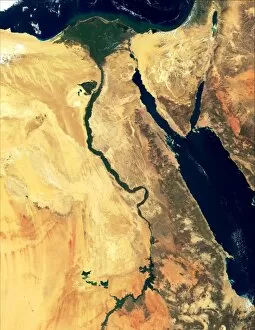
Background imageSatellite Image Collection: River Nile

River Nile, true-colour satellite image. North is at top. Water is blue, deserts are brown, clouds are white. The lower reaches of the River Nile flow through Egypts deserts before reaching

Background imageSatellite Image Collection: Amazon delta, Brazil

Amazon delta, Brazil
Amazon River delta, Brazil, satellite image. The Amazon River drains much of northern South America, meeting the Atlantic Ocean towards the north of Brazil
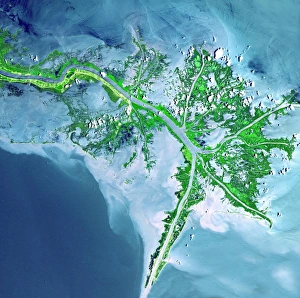
Background imageSatellite Image Collection: Lena River Delta, satellite image

Lena River Delta, satellite image
Lena River Delta. Satellite image of part of the delta of the Lena River. North is at top. Water is blue and wetland areas are green
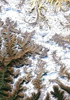
Background imageSatellite Image Collection: Mount Everest, satellite image

Mount Everest, satellite image. North is at top. Mount Everest is the worlds highest peak (8848 metres). The summit peak forms a pyramidal shape just above and right of centre

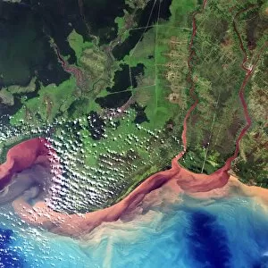
Background imageSatellite Image Collection: Saharan desert rivers, satellite image

Saharan desert rivers, satellite image. North is at top. Water is blue, desert areas are white, and fresh sediments and vegetation is orange/green


All Professionally Made to Order for Quick Shipping

"Exploring the vastness of our universe, satellite images capture breathtaking views that redefine our perspective. Inspired by Voyager 1's iconic 'Pale Blue Dot' image, we witness the beauty and fragility of Earth from space. From the British Isles to Europe at night, these satellite images reveal a tapestry of lights illuminating cities and towns across continents. Marvel at the mesmerizing glow as darkness blankets Europe or gaze in awe at the captivating sight of our entire planet aglow during nighttime. Delve into Tenerife's intricate landscapes, where satellite imagery unveils its hidden wonders with stunning clarity. Venturing beyond our home planet, New Horizons grants us an extraordinary glimpse into Jupiter and its moon Io – a celestial dance frozen in time. Witnessing Earth from afar reminds us of its remarkable diversity; behold Scotland's rugged terrain captured through a lens high above. Satellite imagery also unravels nature's grandeur: observe awe-inspiring solar prominences erupting from the sun’s surface like fiery tendrils reaching towards infinity. In January 2010, witness Mother Nature transforming the United Kingdom into a winter wonderland as snow blankets every corner. Finally, explore North America at night through satellite lenses – an ethereal spectacle showcasing bustling metropolises intertwined with serene natural landscapes under starlit skies. " Note.