Fraud Blocker Skip to main content

Satellite Image Collection (page 17)

"Exploring the vastness of our universe, satellite images capture breathtaking views that redefine our perspective

Background imageSatellite Image Collection: Pine Island Glacier, satellite image

Pine Island Glacier, satellite image
Pine Island Glacier. Satellite image of the Pine Island Glacier on the Antarctic coast. A large ice berg has calved from the glacier into Pine Island bay (bottom centre)

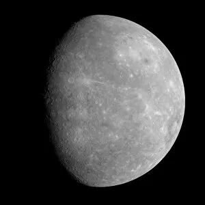
Background imageSatellite Image Collection: Mercury, MESSENGER January 2008 flyby

Mercury, MESSENGER January 2008 flyby
Mercury. MESSENGER image of Mercury, the closest planet to the Sun. At upper right is the giant Caloris basin. The MESSENGER (Mercury Surface, Space Environment)

Background imageSatellite Image Collection: Storm over Iceland, satellite image

Storm over Iceland, satellite image
Storm over Iceland. Satellite image showing the swirling clouds (white) of a storm over Iceland. North is at top, water is blue

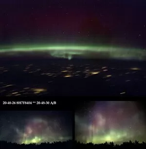
Background imageSatellite Image Collection: Aurora Borealis from Earth and space

Aurora Borealis from Earth and space
Aurora borealis from Earth and space. Two images of the aurora borealis (northern lights) taken in Finland (bottom left and right), and one taken from the International Space Station (ISS, top)
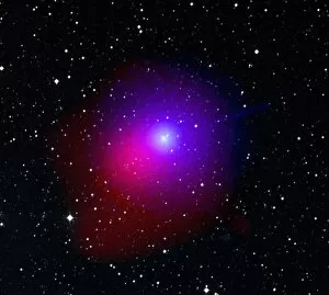
Background imageSatellite Image Collection: Comet Lulin

Comet Lulin. Composite image of comet Lulin passing through the constellation Libra. The Lulin image was taken by the ultraviolet/optical telescope (blue and green areas)
Background imageSatellite Image Collection: Earth and solar eclipse

Earth and solar eclipse. Computer artwork of the Earth in space looking down on the Indian Ocean from an altitude of 25, 000 miles

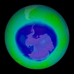
Background imageSatellite Image Collection: Antarctic ozone hole maximum, 2008

Antarctic ozone hole maximum, 2008
Antarctic ozone hole maximum. Satellite image of the maximum extent in 2008 of the ozone hole (blue) over Antarctica (centre)

Background imageSatellite Image Collection: Vredefort crater, satellite image

Vredefort crater, satellite image. The Vredefort meteor impact crater (semi-circular, lower centre) is the largest, and second-oldest, known impact crater on Earth

Background imageSatellite Image Collection: Mount Unzen, satellite image

Mount Unzen, satellite image. Satellite image showing part of the island of Kyushu with Mount Unzen at centre. Water is blue, vegetation is green, cloud, snow and ice are white

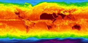
Background imageSatellite Image Collection: Global temperatures, April 2003

Global temperatures, April 2003. Infrared satellite map of worldwide surface and cloud temperatures in April 2003. The colour-coded map shows temperatures in degrees Celsius

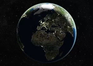
Background imageSatellite Image Collection: Europe at night, satellite image

Europe at night, satellite image
Europe at night. Satellite image of the Earth seen at 00:00 (midnight) GMT (UTC), centred on Europe. City lights (yellow) in dark areas show areas of dense population

Background imageSatellite Image Collection: Global temperatures, May 2009

Global temperatures, May 2009. Infrared satellite map of average daytime air temperatures at 3000 metres elevation worldwide in May 2009

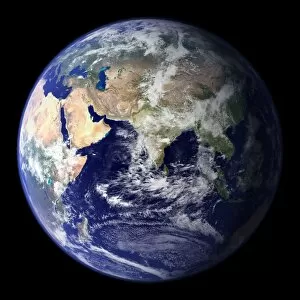
Background imageSatellite Image Collection: Blue Marble image of Earth (2010)

Blue Marble image of Earth (2010)
Blue Marble image of Earth. Composite satellite image of Earths eastern hemisphere, centred on India. North is at top. This image is one of a set released in March 2010 using Blue Marble

Background imageSatellite Image Collection: Eyjafjallajokull eruption, April 2010

Eyjafjallajokull eruption, April 2010
Eyjafjallajokull eruption. Satellite image of the ash cloud (grey, centre) from the April 2010 Eyjafjallajokull eruption being blown towards Europe

Background imageSatellite Image Collection: Global carbon dioxide transport, 2008

Global carbon dioxide transport, 2008. Map showing the global variation in atmospheric carbon dioxide levels in July 2008

Background imageSatellite Image Collection: Global tropospheric methane, 2005

Global tropospheric methane, 2005. Map showing the global variation of the greenhouse gas methane in the troposphere in August 2005

Background imageSatellite Image Collection: Martian central-peak crater floor

Martian central-peak crater floor, coloured satellite image. Central-peak craters form when the force of an impact causes the initial crater walls to collapse and produce a central uplift, or peak

Background imageSatellite Image Collection: Noctis Labyrinthus, Mars

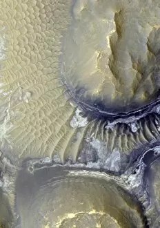
Noctis Labyrinthus, Mars. Coloured satellite image of exposed layers on the valley walls of Noctis Labyrinthus on Mars. The white and grey patches (middle right)

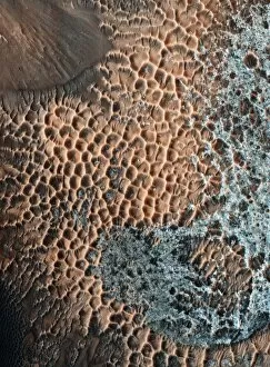
Background imageSatellite Image Collection: Martian impact crater, satellite image

Martian impact crater, satellite image
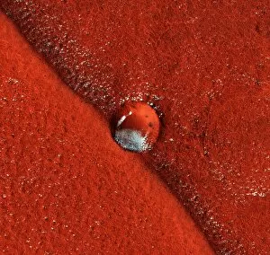
Martian impact crater. Coloured satellite image of an impact crater (centre, middle) on the northern plains of Mars. The terrain surface (red) is pitted with pockets of carbon dioxide frost (white)

Background imageSatellite Image Collection: Terra Sirenum region, Mars

Terra Sirenum region, Mars, coloured satellite image. This region, in the southern hemisphere, is heavily cratered. Spectrometer analysis of the rocks show the presence of ancient

Background imageSatellite Image Collection: Gullies on Mars

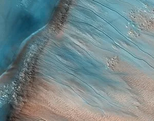
Gullies on Mars. Coloured satellite image of gullies on the wall of a crater in the South Aonia Terra region on Mars. The crater rim runs from lower left to middle top

Background imageSatellite Image Collection: Volcanic blocks, Cerberus Palus, Mars

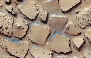
Volcanic blocks, Cerberus Palus, Mars. Coloured satellite image of disrupted terrain in Cerberus Palus, near the equator of Mars. This region is covered with ancient lava

Background imageSatellite Image Collection: Gullies on a martian sand dune

Gullies on a martian sand dune
Gullies on a Martian sand dune. Coloured satellite image of gullies on a sand dune within Russell Crater, Mars. The source of the gullies is not known

Background imageSatellite Image Collection: Gullies on martian sand dunes

Gullies on martian sand dunes
Gullies on Martian sand dunes. Coloured satellite image of Martian sand dunes with gully-like features. The source of the gullies is not known

Background imageSatellite Image Collection: Layered Martian terrain, satellite image

Layered Martian terrain, satellite image
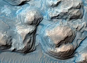
Layered Martian terrain. Coloured satellite image of layered rocks in Arabia Terra, northern Mars. The rocks have layers of roughly uniform depth

Background imageSatellite Image Collection: Martian crater rim, satellite image

Martian crater rim, satellite image
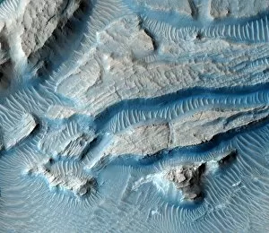
Martian crater rim. Coloured satellite image of a fractured crater rim in Arabia Terra, northern Mars. It is thought the crater once held a large lake, which deposited sediments

Background imageSatellite Image Collection: Ice cap erosion on Mars, satellite image

Ice cap erosion on Mars, satellite image
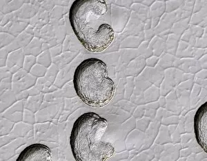
Ice cap erosion on Mars. Coloured satellite image of pits on the south polar ice cap. The ice cap is made from frozen carbon dioxide

Background imageSatellite Image Collection: Martian sand dune, satellite image

Martian sand dune, satellite image
Martian sand dune. Coloured satellite image of a crater-floor sand dune. The blue-grey swirling patterns are trails created by small tornadoes, known as dust devils

Background imageSatellite Image Collection: Ocean current speed

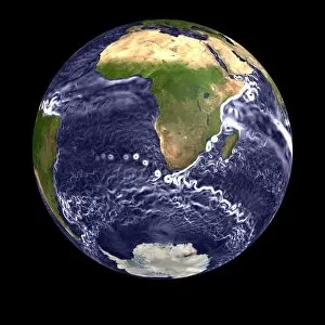
Ocean current speed. Computer visualisation of ocean surface current speeds. Major ocean currents (coloured white) are visible, such as the Agulhas current (eastern side of Africa)

Background imageSatellite Image Collection: Antarctic ocean current, computer model

Antarctic ocean current, computer model
Antarctic ocean current. Computer model of the Antarctic circumpolar current in the Southern Ocean on the 12th May 2006. Ocean current data from satellites

Background imageSatellite Image Collection: The Americas, satellite image

The Americas, satellite image. Oceans are blue and land is green and brown. City lights (yellow) in dark areas show areas of dense population

Background imageSatellite Image Collection: Hurricane Epsilon, satellite image

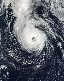
Hurricane Epsilon, satellite image
Hurricane Epsilon. Satellite image of hurricane Epsilon over the central Atlantic Ocean on 4th December 2005. This hurricane remained in the central Atlantic Ocean, never making landfall

Background imageSatellite Image Collection: San Francisco Bay, USA, satellite image

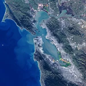
San Francisco Bay, USA, satellite image
San Francisco Bay, USA. Satellite image of the San Francisco Bay area in California, USA. North is at top. The city of San Francisco is located on the tip of the San Francisco Peninsula

Background imageSatellite Image Collection: Deforestation in the Amazon, 2000

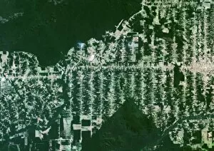
Deforestation in the Amazon, 2000
Deforestation in the Amazon. True colour Landsat satellite image of the Eastern part of the state of Rondonia in Brazil, showing areas of deforestation (light green and brown)

Background imageSatellite Image Collection: Mount St Helens, 3D satellite image

Mount St Helens, 3D satellite image. Satellite image showing the snow-capped Mount St Helens (centre), viewed from the south

Background imageSatellite Image Collection: The Arctic, night-day satellite image

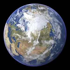
The Arctic, night-day satellite image
Asia, night-day satellite image. This composite image of the Earth is set against a background of stars, and is centred on the continent of Asia. North is at top

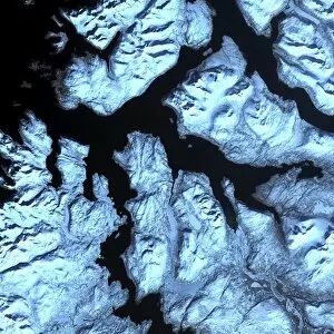
Background imageSatellite Image Collection: Norwegian fjords, satellite image

Norwegian fjords, satellite image. North is at top. Water is black, snow is white and ice is blue. Glaciers (blue) are seen in several of the valleys, carrying ice down from the mountains to the sea

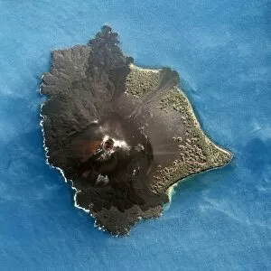
Background imageSatellite Image Collection: Anak Krakatau volcano satellite image

Anak Krakatau volcano satellite image
Anak Krakatau volcano. Satellite image of the volcano Anak Krakatau (Child of Krakatau) showing the crater (circular, centre), surrounded by lava flows (red) and black ash

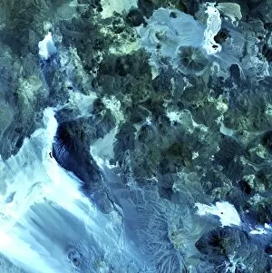
Background imageSatellite Image Collection: Volcanic landscape, satellite image

Volcanic landscape, satellite image. North is at top. Desert sands and salt deposits are white, with the colour varying to light blue depending on the amount of rock content

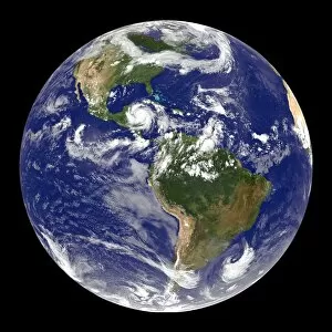
Background imageSatellite Image Collection: Earth and Hurricane Dean, 20 August 2007

Earth and Hurricane Dean, 20 August 2007
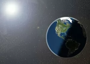
Earth and Hurricane Dean, satellite image. North is at top. Hurricane Dean is the large rotating cloud system (white) at upper left, in the western Caribbean, to the east of Mexico

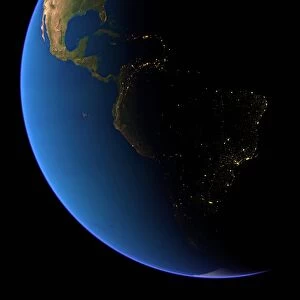
Background imageSatellite Image Collection: South America at night

South America at night
South America, satellite image

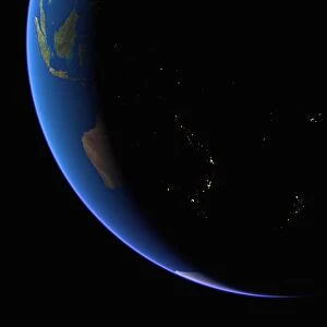
Background imageSatellite Image Collection: Australia at night

Australia at night, satellite image from space

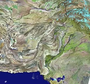
Background imageSatellite Image Collection: Afghanistan

Afghanistan and surroundings, coloured satellite image. North is at top. Vegetation is green, deserts are pink, mountains are grey, water is dark blue, snow/ice is light blue, and borders are black

Background imageSatellite Image Collection: North America, satellite image

North America, satellite image
North America. Satellite image of the Earth, set against a background of stars, centred on the continent of North America. North is at top. Clouds (white) are seen in the atmosphere

Background imageSatellite Image Collection: Asia at night, satellite image

Asia at night, satellite image. City lights (yellow) show areas of dense population. Large, densely populated areas include India (lower centre), China (lower right) and Japan (right)

Background imageSatellite Image Collection: Arabian Sea, satellite image

Arabian Sea, satellite image
Arabian Sea. Satellite image of the Earth centred on the Arabian Sea and western India. Clouds and Arctic ice (top) are white, oceans are blue and land is green and brown

Background imageSatellite Image Collection: The Americas, satellite image

The Americas, satellite image
The Americas. Satellite image of the Earth centred on the Caribbean Islands, with North America at upper left and South America at bottom

Background imageSatellite Image Collection: Northern Asia and the Arctic

Northern Asia and the Arctic. Satellite image of the Earth centred on Siberia, with the North Pole at upper centre. Clouds and Arctic sea ice are white, oceans are blue and land is green and brown


All Professionally Made to Order for Quick Shipping

"Exploring the vastness of our universe, satellite images capture breathtaking views that redefine our perspective. Inspired by Voyager 1's iconic 'Pale Blue Dot' image, we witness the beauty and fragility of Earth from space. From the British Isles to Europe at night, these satellite images reveal a tapestry of lights illuminating cities and towns across continents. Marvel at the mesmerizing glow as darkness blankets Europe or gaze in awe at the captivating sight of our entire planet aglow during nighttime. Delve into Tenerife's intricate landscapes, where satellite imagery unveils its hidden wonders with stunning clarity. Venturing beyond our home planet, New Horizons grants us an extraordinary glimpse into Jupiter and its moon Io – a celestial dance frozen in time. Witnessing Earth from afar reminds us of its remarkable diversity; behold Scotland's rugged terrain captured through a lens high above. Satellite imagery also unravels nature's grandeur: observe awe-inspiring solar prominences erupting from the sun’s surface like fiery tendrils reaching towards infinity. In January 2010, witness Mother Nature transforming the United Kingdom into a winter wonderland as snow blankets every corner. Finally, explore North America at night through satellite lenses – an ethereal spectacle showcasing bustling metropolises intertwined with serene natural landscapes under starlit skies. " Note.