
Thomas Moule Collection
Thomas Moule was a renowned cartographer in the 19th century, known for his exquisite old maps that captured the essence of various regions across England


All Professionally Made to Order for Quick Shipping
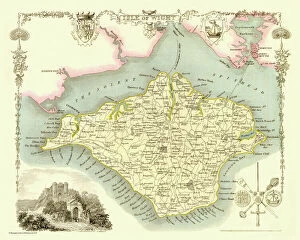
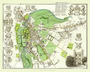
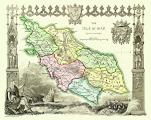
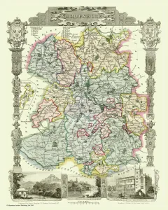
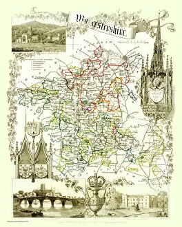
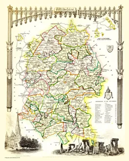
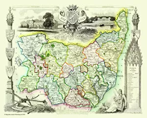
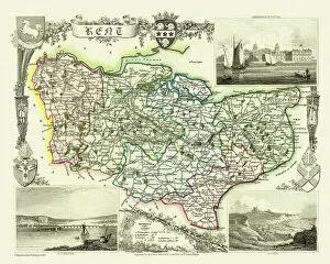
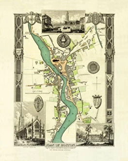
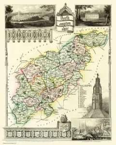
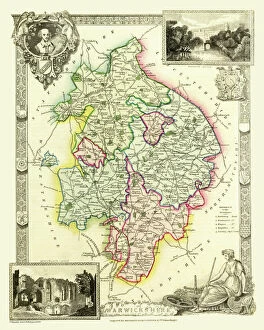
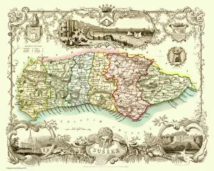
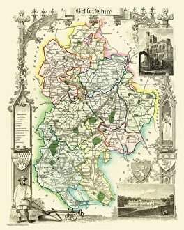
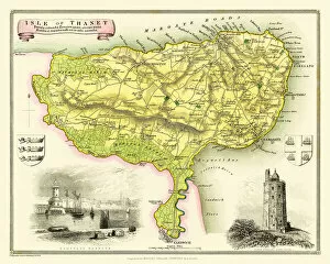
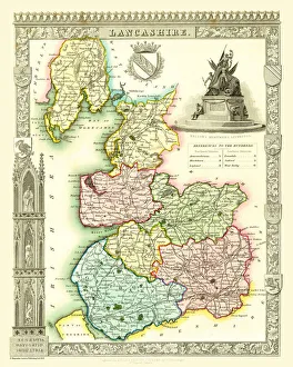
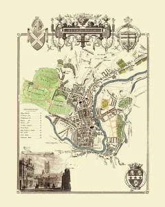
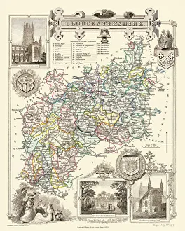
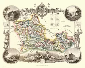
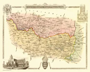
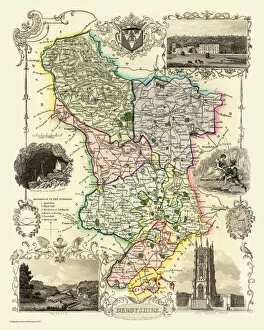
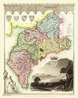
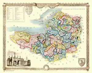
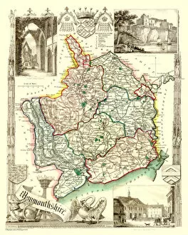
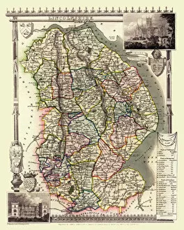
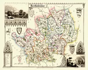
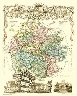
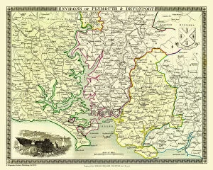
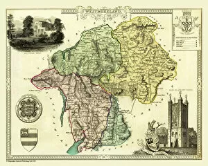
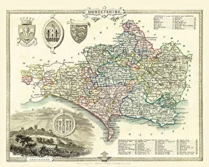
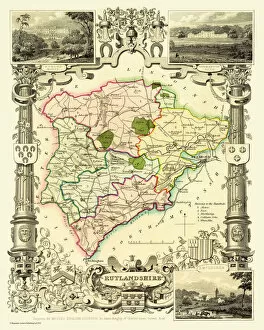
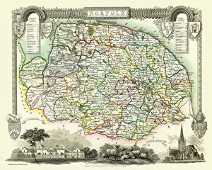
Thomas Moule was a renowned cartographer in the 19th century, known for his exquisite old maps that captured the essence of various regions across England. His attention to detail and artistic flair are evident in his works, such as the Old Map of The Isle of Wight 1836, where every contour and coastline is delicately etched onto paper. Moule's craftsmanship shines through in the Old County Map of Worcestershire 1836, showcasing not only geographical accuracy but also an appreciation for historical landmarks and local culture. Similarly, his Old Map of The Isle of Man 1836 transports us back in time with its intricate illustrations and vibrant colors. In the Old County Map of Shropshire 1836, Moule skillfully combines geography with history by highlighting significant towns and villages alongside natural features like rivers and hills. This attention to detail is mirrored in his other works too; take for instance the Old Map of the City of Cambridge 1836 or the Old County Map of Suffolk 1836. Moule's talent extends beyond individual counties; he masterfully captures entire regions on maps like the Old County Map of Warwickshire 1836 or Sussex. These maps serve as valuable historical artifacts that allow us to explore how these areas have evolved over time. One cannot overlook Moule's contribution to documenting regional boundaries either - just look at his meticulously crafted Old County Maps such as Kent or Devonshire from 1836. These maps provide insight into administrative divisions while simultaneously celebrating each region's unique character. Even beyond land borders, Moule showcases his expertise with maps like The Environs of Portsmouth from 1836 or The Isle Of Thanet map. These demonstrate not only a keen eye for topography but also an understanding of how cities interacted with their surrounding landscapes during this era. Thomas Moule's legacy lives on through these exceptional old maps which continue to captivate historians, cartographers, and enthusiasts alike.