Greetings Card > Asia > Japan > Maps
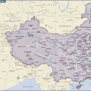
Greetings Card : Map Of China And Japan, Circa. 1760. From "Atlas De Toutes Les Parties Connues Du Globe Terrestre "By Cartographer Rigobert Bonne. Published Geneva Circa. 1760


![]()
Cards from Design Pics
Map Of China And Japan, Circa. 1760. From "Atlas De Toutes Les Parties Connues Du Globe Terrestre "By Cartographer Rigobert Bonne. Published Geneva Circa. 1760
Map Of China And Japan, Circa.1760. From " Atlas De Toutes Les Parties Connues Du Globe Terrestre " By Cartographer Rigobert Bonne. Published Geneva Circa. 1760
Design Pics offers Distinctively Different Imagery representing over 1,500 contributors
Media ID 18186388
© Ken Welsh / Design Pics
Cartography China Geography Japan Mapmaking Plate
Greetings Card (7"x5")
Step back in time with our exquisite selection of vintage greeting cards from Media Storehouse. This card features an intriguing map of China and Japan, taken from the "Atlas De Toutes Les Parties Connues Du Globe Terrestre" published in Geneva around 1760. The map, created by renowned cartographer Rigobert Bonne, showcases the detailed cartography of the time, making it a unique and thoughtful addition to your correspondence. Travel back to the 18th century with every card you send. #vintage #maplovers #china #japan #historicalgreetings
Folded Greeting Cards (12.5x17.5 cm) have a laminate finish and are supplied with an envelope. The front and inside can be personalised with text in a selection of fonts, layouts and colours.
Greetings Cards suitable for Birthdays, Weddings, Anniversaries, Graduations, Thank You and much more
Estimated Product Size is 17.5cm x 12.5cm (6.9" x 4.9")
These are individually made so all sizes are approximate
Artwork printed orientated as per the preview above, with landscape (horizontal) or portrait (vertical) orientation to match the source image.
FEATURES IN THESE COLLECTIONS
> Maps and Charts
> Related Images
EDITORS COMMENTS
This print showcases a remarkable piece of cartographic history - the Map of China and Japan, circa 1760. Crafted by renowned cartographer Rigobert Bonne, this exquisite map is taken from his esteemed work "Atlas De Toutes Les Parties Connues Du Globe Terrestre" published in Geneva around the same time. The intricate details and vibrant colors of this engraving bring to life the geographical landscape of these two ancient Asian nations. Every contour, river, and mountain range has been meticulously depicted with precision and accuracy, reflecting Bonne's mastery in mapmaking. As we delve into this vertical plate illustration, we are transported back to a time when exploration was at its peak. This map not only serves as an invaluable tool for understanding the geography of China and Japan during that era but also offers insights into their cultural heritage. From bustling cities to serene countryside vistas, every corner of these lands is beautifully captured on this historic document. The careful use of color adds depth and dimension to each region, allowing us to visualize how people navigated through these vast territories centuries ago. Whether you are a lover of history or simply fascinated by the artistry behind old maps, this print will undoubtedly captivate your imagination. It serves as a testament to human curiosity and our eternal quest for knowledge about our world's diverse landscapes.
MADE IN AUSTRALIA
Safe Shipping with 30 Day Money Back Guarantee
FREE PERSONALISATION*
We are proud to offer a range of customisation features including Personalised Captions, Color Filters and Picture Zoom Tools
SECURE PAYMENTS
We happily accept a wide range of payment options so you can pay for the things you need in the way that is most convenient for you
* Options may vary by product and licensing agreement. Zoomed Pictures can be adjusted in the Cart.