Home > Arts > Artists > O > Oceanic Oceanic
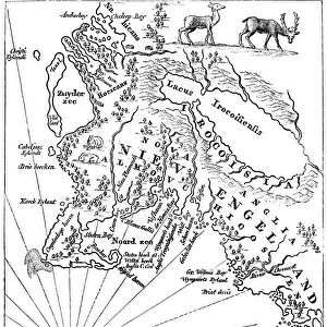
Old map of Acadia, 17th century (c1880)
![]()

Wall Art and Photo Gifts from Heritage Images
Old map of Acadia, 17th century (c1880)
Old map of Acadia, 17th century (c1880). Acadia (Acadie) was part of the territory claimed by the French in North America from 1604. Corresponding to what is now Nova Scotia, it became a British possession after the Treaty of Utrecht in 1713. A print from Cassells History of the United States, by Edmund Ollier, Volume I, Cassell Petter and Galpin, London, c1880
Heritage Images features heritage image collections
Media ID 14946121
© The Print Collector / Heritage-Images
Atlantic Ocean Canada Cartography Colony Edmund Edmund Ollier Gulf Map Making Nova Scotia Ocean Ollier Acadia Gulf Of St Lawrence Print Collector8
FEATURES IN THESE COLLECTIONS
> Arts
> Artists
> O
> Oceanic Oceanic
> Maps and Charts
> Related Images
> North America
> Canada
> Maps
> North America
> Canada
> Related Images
EDITORS COMMENTS
This print showcases an old map of Acadia, dating back to the 17th century. The map, created around 1880 by Edmund Ollier for Cassells History of the United States, offers a glimpse into the historical significance of this region. Acadia, also known as Acadie, was a territory claimed by the French in North America from 1604 onwards. This particular map highlights its location corresponding to present-day Nova Scotia in Canada. With intricate cartography and precise engraving techniques, it provides valuable insights into the geography and coastal features of this colonial settlement. The print depicts Acadia's position along the Gulf of St Lawrence and Atlantic Ocean, emphasizing its strategic importance during that era. As we delve into this monochrome masterpiece, we are transported back to a time when France held sway over this land before it became a British possession following the Treaty of Utrecht in 1713. The creator of this remarkable piece remains unknown; however, their craftsmanship is evident through every stroke on paper. The attention to detail invites us to explore not only the physical landscape but also appreciate how maps were meticulously crafted during that period. As we admire this vintage treasure from Heritage Images' collection, let us reflect upon Acadia's rich history as an integral part of early European colonization efforts in North America.
MADE IN AUSTRALIA
Safe Shipping with 30 Day Money Back Guarantee
FREE PERSONALISATION*
We are proud to offer a range of customisation features including Personalised Captions, Color Filters and Picture Zoom Tools
SECURE PAYMENTS
We happily accept a wide range of payment options so you can pay for the things you need in the way that is most convenient for you
* Options may vary by product and licensing agreement. Zoomed Pictures can be adjusted in the Cart.


