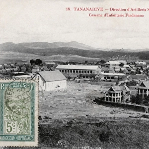
Jigsaw Puzzle > Europe > France > Canton > Allier
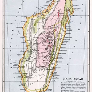
Jigsaw Puzzle : Madagascar strategic island by G. H. Davis


![]()
Jigsaw Puzzles from Mary Evans Picture Library
Madagascar strategic island by G. H. Davis
Madagascar, the strategic island to Allied communications in the East, occupied by British forces, forestalls a Japanese plot during the Second World War. At the time, Madagascar belonged to Vichy France. Date: 1942
Mary Evans Picture Library makes available wonderful images created for people to enjoy over the centuries
Media ID 14133295
© Illustrated London News Ltd/Mary Evans
1942 Allied Allies Davis Foil Forces Madagascar Maps Occupation Occupied Plot Route Routes Strategic Strategy Territory Vichy Foils
Jigsaw Puzzle (500 Pieces)
Discover the captivating history of Madagascar with our latest addition to the Media Storehouse Jigsaw Puzzles collection. Featuring the stunning image "Madagascar Strategic Island by G. H. Davis," this puzzle brings to life the pivotal role Madagascar played during the Second World War. As Allied communications in the East, the island was strategically occupied by British forces, preventing a Japanese plot from unfolding. Piece together this intriguing piece of history and immerse yourself in the rich tapestry of global events. Engage your mind, challenge your problem-solving skills, and create a beautiful display with this captivating jigsaw puzzle.
500 piece puzzles are custom made in Australia and hand-finished on 100% recycled 1.6mm thick laminated puzzle boards. There is a level of repetition in jigsaw shapes with each matching piece away from its pair. The completed puzzle measures 40x51cm and is delivered packaged in an attractive presentation box specially designed to fit most mail slots with a unique magnetic lid
Jigsaw Puzzles are an ideal gift for any occasion
Estimated Product Size is 40.3cm x 50.7cm (15.9" x 20")
These are individually made so all sizes are approximate
Artwork printed orientated as per the preview above, with landscape (horizontal) or portrait (vertical) orientation to match the source image.
EDITORS COMMENTS
Madagascar: The Strategic Island that Foiled Japanese Plots during World War II This photograph, taken by renowned photojournalist G.H. Davis in 1942, showcases a map of Madagascar, highlighting its strategic importance during the Second World War. At the time, Madagascar was under the control of Vichy France, but its significance extended far beyond its political affiliations. The island of Madagascar, located off the eastern coast of Africa, was a crucial communications hub for the Allied forces during the war. The map reveals the various routes and connections that made Madagascar an essential link in the Allied network, particularly in the East. The island's strategic position enabled the Allies to intercept and disrupt Japanese communications, thereby forestalling a potential Japanese plot to seize the island and gain a significant advantage in the war. British forces occupied Madagascar in May 1942, just months after the attack on Pearl Harbor, to secure this vital communications hub. The occupation of Madagascar was a pivotal moment in the war, as it prevented the Japanese from gaining a foothold in the Indian Ocean and disrupting Allied supply lines. This photograph is a testament to the historical significance of Madagascar during the Second World War and the role it played in foiling Japanese plans. The intricate details of the map reveal the complex web of communications and routes that made Madagascar a strategic prize worth fighting for. This image is an essential addition to any collection of historical maps or World War II memorabilia.
MADE IN AUSTRALIA
Safe Shipping with 30 Day Money Back Guarantee
FREE PERSONALISATION*
We are proud to offer a range of customisation features including Personalised Captions, Color Filters and Picture Zoom Tools
SECURE PAYMENTS
We happily accept a wide range of payment options so you can pay for the things you need in the way that is most convenient for you
* Options may vary by product and licensing agreement. Zoomed Pictures can be adjusted in the Cart.