Home > Europe > United Kingdom > England > London > Boroughs > Harrow
Daventry NN11 0 Map

![]()
Wall Art and Photo Gifts from Map Marketing
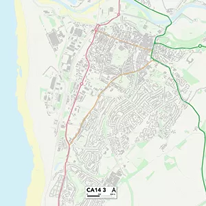
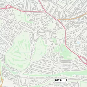
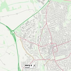
Daventry NN11 0 Map
Postcode Sector Map of Daventry NN11 0
Media ID 19975932
Acre Close Ash Close Ashby Road Ashdown Road Barley Close Burton Close Cabot Close Cedar Close Cheriton Close Cook Close Cotswold Close Curlew Way Daventry Eider Close Elder Drive Franklin Way Harrow Lane Harvest Close Hawthorn Drive Heron Court Hillary Close Hopton Close Hudson Close Langdon Close Lansdown Close Larch Drive Livingstone Road Magnolia Drive Meadow Close Newbury Drive Nightingale Close Nn11 Nursery Close Oak Grove Osprey Drive Peartree Close Plough Close Poplar Close Raleigh Court Rhodes Close Roman Way Rosewood Close Scott Close Stafford Close Sycamore Close Teal Close The Firs The Roundway The Rowans The Willows Welton Road Wheat Close
FEATURES IN THESE COLLECTIONS
> Map Marketing
> Postcode Sector Maps
> NN - Northampton
> Animals
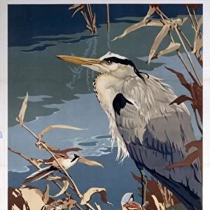
> Birds
> Herons
> Related Images
> Animals
> Birds
> Passerines
> Chats And Flycatchers
> Nightingale
> Arts
> Artists
> R
> Roman Roman
> Europe
> United Kingdom
> England
> London
> Boroughs
> Harrow
> Maps and Charts
> Related Images
MADE IN AUSTRALIA
Safe Shipping with 30 Day Money Back Guarantee
FREE PERSONALISATION*
We are proud to offer a range of customisation features including Personalised Captions, Color Filters and Picture Zoom Tools
SECURE PAYMENTS
We happily accept a wide range of payment options so you can pay for the things you need in the way that is most convenient for you
* Options may vary by product and licensing agreement. Zoomed Pictures can be adjusted in the Cart.