Fraud Blocker Skip to main content

Home > Maps and Charts > Americas

Americas Collection (page 61)

"Americas " refers to a collection of maps and charts that depict the geography, topography, climate, demographics, and other aspects of North America

3,930 items

Background imageAmericas Collection: Still from the film Sixty Years a Queen, c. 1914 (b / w photo)

Still from the film Sixty Years a Queen, c. 1914 (b / w photo)
5671611 Still from the film Sixty Years a Queen, c.1914 (b/w photo) by Byron Company (fl.1890-1942); Museum of the City of New York, USA; eMuseum of the City of New York; American, out of copyright

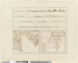
Background imageAmericas Collection: ii. (a) Four profiles of the coast of Terra del Fuego (b

ii. (a) Four profiles of the coast of Terra del Fuego (b
5670247 ii. (a) Four profiles of the coast of Terra del Fuego (b) A plan of Success Bay in Strait le Maire (c) A chart of the S.E. part of Terra del Fuego, engraved by T. Borven and J

Background imageAmericas Collection: Map of Central America and Peru, 16th century

Map of Central America and Peru, 16th century
AIS5391422 Map of Central America and Peru, 16th century by Santa Cruz, Alonso de (1505-67); Biblioteca Nacional, Madrid, Spain; (add.info.: Map of Central America and Peru)

Background imageAmericas Collection: Christophe Colomb decouvre l Amerique - Christopher Columbus Discovers America

Christophe Colomb decouvre l Amerique - Christopher Columbus Discovers America
FIA5407149 Christophe Colomb decouvre l Amerique - Christopher Columbus Discovers America - painting by Ruben, Christian (1805-1875) - Oil on canvas - National Gallery, Prague by Ruben

Background imageAmericas Collection: Indian Territory [Oklahoma], 1889 (colour litho)

Indian Territory [Oklahoma], 1889 (colour litho)
5914783 Indian Territory [Oklahoma], 1889 (colour litho) by American School, (19th century); New York Public Library, USA; (add.info.: Series of advertising cards issued by Arbuckle Bros)

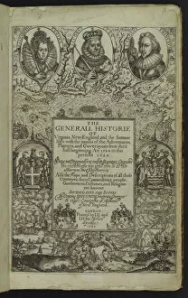
Background imageAmericas Collection: The General Historie of Virginia, New-England, and the Summer Isles

The General Historie of Virginia, New-England, and the Summer Isles
1764093 The General Historie of Virginia, New-England, and the Summer Isles, 1624 (engraving) by Smith, John (1580-1641); New York Public Library, USA; (add.info.: Generall Historie of Virginia)

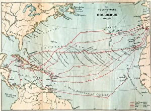
Background imageAmericas Collection: The Four Voyages of Christopher Columbus, from Life of Christopher Columbus

The Four Voyages of Christopher Columbus, from Life of Christopher Columbus
1772340 The Four Voyages of Christopher Columbus, from Life of Christopher Columbus by Clements R. Markham, published 1892 (colour litho) by English School

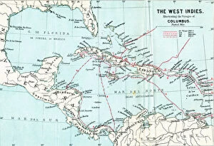
Background imageAmericas Collection: Map of the West Indies illustrating the voyages of Christopher Columbus

Map of the West Indies illustrating the voyages of Christopher Columbus
1772337 Map of the West Indies illustrating the voyages of Christopher Columbus, from Life of Christopher Columbus by Clements R

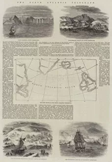
Background imageAmericas Collection: The North Atlantic Telegraph (engraving)

The North Atlantic Telegraph (engraving)
1612257 The North Atlantic Telegraph (engraving) by English School, (19th century); Private Collection; (add.info.: The North Atlantic Telegraph)

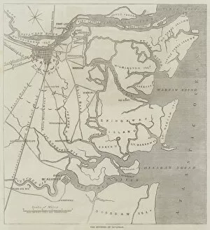
Background imageAmericas Collection: The Environs of Savannah (engraving)

The Environs of Savannah (engraving)
1610082 The Environs of Savannah (engraving) by Dower, John (fl.c.1845-55); Private Collection; (add.info.: The Environs of Savannah. Illustration for The Illustrated London News, 14 January 1865)

Background imageAmericas Collection: Plan of Part of the City of Valparaiso (engraving)

Plan of Part of the City of Valparaiso (engraving)
1609706 Plan of Part of the City of Valparaiso (engraving) by English School, (19th century); Private Collection; (add.info.: Plan of Part of the City of Valparaiso)

Background imageAmericas Collection: Map of the Behring Sea and Part of Alaska (engraving)

Map of the Behring Sea and Part of Alaska (engraving)
1602764 Map of the Behring Sea and Part of Alaska (engraving) by English School, (19th century); Private Collection; (add.info.: Map of the Behring Sea and Part of Alaska)

Background imageAmericas Collection: Street Plan of the British, French, and Part of the American Concessions at Shanghai (engraving)

Street Plan of the British, French, and Part of the American Concessions at Shanghai (engraving)
1606865 Street Plan of the British, French, and Part of the American Concessions at Shanghai (engraving) by English School, (19th century); Private Collection; (add.info.: Street Plan of the British)

Background imageAmericas Collection: Map of the San Juan Archipelago, with the Disputed Channel and Boundary (engraving)

Map of the San Juan Archipelago, with the Disputed Channel and Boundary (engraving)
1588983 Map of the San Juan Archipelago, with the Disputed Channel and Boundary (engraving) by English School, (19th century); Private Collection; (add.info.: Map of the San Juan Archipelago)

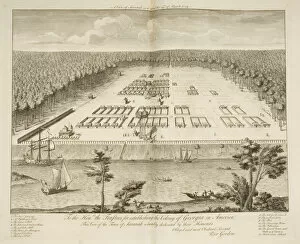
Background imageAmericas Collection: A View of Savannah as it stood on the 29th March 1734, engraved by P

A View of Savannah as it stood on the 29th March 1734, engraved by P
3964033 A View of Savannah as it stood on the 29th March 1734, engraved by P. Fourdrinier, London, c.1735 (engraving) by Gordon

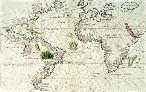
Background imageAmericas Collection: Portulan of the Atlantic and Pacific, 16th century. Geographic map of Portuguese

Portulan of the Atlantic and Pacific, 16th century. Geographic map of Portuguese
JLJ4613191 Portulan of the Atlantic and Pacific, 16th century. Geographic map of Portuguese Sebastien Lopez, 1570. Lisbon, National Museum of Ancient Art by Portuguese School

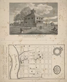
Background imageAmericas Collection: Friends Old Meeting House, Wilmington, Delaware, litho by P. S. Duval, 1845 (litho)

Friends Old Meeting House, Wilmington, Delaware, litho by P. S. Duval, 1845 (litho)
1272222 Friends Old Meeting House, Wilmington, Delaware, litho by P.S. Duval, 1845 (litho) by Ferris, Benjamin (1780-1867) (after); 19.7x11.1 cm; Free Library of Philadelphia; (add.info)

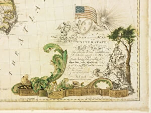
Background imageAmericas Collection: Americas first national map, 1784 (hand-coloured engraving)

Americas first national map, 1784 (hand-coloured engraving)
1268149 Americas first national map, 1784 (hand-coloured engraving) by Buell, Abel (1742-1822); 115.2x128.6 cm; Private Collection; (add.info)

Background imageAmericas Collection: Aerial view of, San Francisco, California, USA, 1878 (colour litho)

Aerial view of, San Francisco, California, USA, 1878 (colour litho)
3283843 Aerial view of, San Francisco, California, USA, 1878 (colour litho) by American School, (19th century); Private Collection; Peter Newark Pictures; American, out of copyright

Background imageAmericas Collection: The Isthmus of Darien, Sketches on the Panama Railway (engraving)

The Isthmus of Darien, Sketches on the Panama Railway (engraving)
1059715 The Isthmus of Darien, Sketches on the Panama Railway (engraving) by English School, (19th century); Private Collection; (add.info.: The Isthmus of Darien, Sketches on the Panama Railway)

Background imageAmericas Collection: Map of Florida, 1826 (colour litho)

Map of Florida, 1826 (colour litho)
945257 Map of Florida, 1826 (colour litho) by Finley, A. (fl.1826); HistoryMiami, Florida, USA; eHistoryMiami; out of copyright

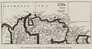
Background imageAmericas Collection: The Disputed Boundary of Venezuela and British Guiana (engraving)

The Disputed Boundary of Venezuela and British Guiana (engraving)
1100507 The Disputed Boundary of Venezuela and British Guiana (engraving) by English School, (19th century); Private Collection; (add.info.: The Disputed Boundary of Venezuela and British Guiana)

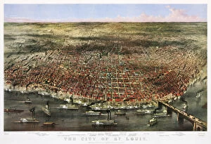
Background imageAmericas Collection: The city of St. Louis, c. 1874 (colour lithograph)

The city of St. Louis, c. 1874 (colour lithograph)
3710025 The city of St. Louis, c.1874 (colour lithograph) by Currier, N. (1813-88) and Ives, J.M. (1824-95); Private Collection; (add.info.: Bird s-eye view of St)

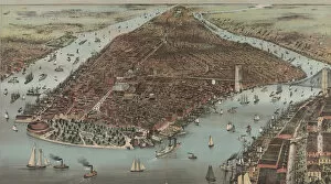
Background imageAmericas Collection: The City of New York, 1883 (colour lithograph)

The City of New York, 1883 (colour lithograph)
3710008 The City of New York, 1883 (colour lithograph) by Currier, N. (1813-88) and Ives, J.M. (1824-95); Private Collection; (add.info)

Background imageAmericas Collection: Columbus Cleveland and his mutinous crew - 'This ship shall not turn back

Columbus Cleveland and his mutinous crew - "This ship shall not turn back
1065645 Columbus Cleveland and his mutinous crew - " This ship shall not turn back!" 1885 (colour litho) by Gillam

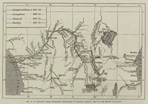
Background imageAmericas Collection: Mr H M Stanleys Anglo-American Expedition for the Exploration of Central Africa

Mr H M Stanleys Anglo-American Expedition for the Exploration of Central Africa, Map of the Region Explored (engraving)
1049911 Mr H M Stanleys Anglo-American Expedition for the Exploration of Central Africa, Map of the Region Explored (engraving) by English School

Background imageAmericas Collection: The War in South America, the Capture of Arica (engraving)

The War in South America, the Capture of Arica (engraving)
1060180 The War in South America, the Capture of Arica (engraving) by English School, (19th century); Private Collection; (add.info.: The War in South America, the Capture of Arica)

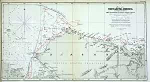
Background imageAmericas Collection: Map of West Arctic America showing the tracks of HMS Enterprise

Map of West Arctic America showing the tracks of HMS Enterprise
939906 Map of West Arctic America showing the tracks of HMS Enterprise and Investigator in 1850-1854 (colour litho) by English School

Background imageAmericas Collection: Gallery from the Cathedral of Limoges (b / w photo)

Gallery from the Cathedral of Limoges (b / w photo)
958538 Gallery from the Cathedral of Limoges (b/w photo) by American Photographer (19th century) (after); Private Collection; (add.info.: Gallery from the Cathedral of Limoges)

Background imageAmericas Collection: Europe, 1871 (colour litho)

Europe, 1871 (colour litho)
955446 Europe, 1871 (colour litho) by American School, (19th century); length: 46 cm; New York Public Library, USA; (add.info.: Published by Asher & Adams.); American, out of copyright

Background imageAmericas Collection: Map showing the Position of the Island of San Juan (engraving)

Map showing the Position of the Island of San Juan (engraving)
1098289 Map showing the Position of the Island of San Juan (engraving) by English School, (19th century); Private Collection; (add.info.: Map showing the Position of the Island of San Juan)

Background imageAmericas Collection: Map of the city of New York, made under the direction of the Commissioners of

Map of the city of New York, made under the direction of the Commissioners of
1079258 Map of the city of New York, made under the direction of the Commissioners of the Metropolitan Fire Department, showing the location of buildings in the possession

Background imageAmericas Collection: Map of the City of New York [as far north as East 53rd Street], 1885 (black ink

Map of the City of New York [as far north as East 53rd Street], 1885 (black ink
1079236 Map of the City of New York [as far north as East 53rd Street], 1885 (black ink, with hand-colouring, on paper) by Hooker

Background imageAmericas Collection: Topographical map of New York, showing watercourses and made land, 1865, 1865 (black ink

Topographical map of New York, showing watercourses and made land, 1865, 1865 (black ink
1079229 Topographical map of New York, showing watercourses and made land, 1865, 1865 (black ink, with colour wash, on paper backed with cloth) by American School

Background imageAmericas Collection: Hookers new pocket plan of the city of New York, compiled & surveyed by William

Hookers new pocket plan of the city of New York, compiled & surveyed by William
1079269 Hookers new pocket plan of the city of New York, compiled & surveyed by William Hooker, 1842 (black ink with colour wash additions on paper, backed with cloth) by American School

Background imageAmericas Collection: A New & Accurate Plan of the City of New York in the State of New York in North America

A New & Accurate Plan of the City of New York in the State of New York in North America
1079247 A New & Accurate Plan of the City of New York in the State of New York in North America, Published in 1797, 1797 (black and colour ink on paper, backed with cloth) by American School

Background imageAmericas Collection: The City of New York, as laid out by the Commissioners with the Surrounding COuntry

The City of New York, as laid out by the Commissioners with the Surrounding COuntry
1079213 The City of New York, as laid out by the Commissioners with the Surrounding COuntry, by their Secretary and Surveyor John Randel, Jr

Background imageAmericas Collection: A double-page map of the Atlantic Ocean, showing the east coast of North

A double-page map of the Atlantic Ocean, showing the east coast of North
985950 A double-page map of the Atlantic Ocean, showing the east coast of North and South America, 1544 (illuminated manuscript on vellum) by Agnese

Background imageAmericas Collection: A Plan of the Town and Harbour of Boston and the Country adjacent

A Plan of the Town and Harbour of Boston and the Country adjacent
985758 A Plan of the Town and Harbour of Boston and the Country adjacent (with locations of the battles of Concord and Lexington, 19th April, 1775)

Background imageAmericas Collection: Folding map of the North American Atlantic coast, 1714 (engraving)

Folding map of the North American Atlantic coast, 1714 (engraving)
985754 Folding map of the North American Atlantic coast, 1714 (engraving) by French School, (18th century); Private Collection; (add.info.: Folding map of the North American Atlantic coast)

Background imageAmericas Collection: R. W. L. Rasin & Co. Chemical Fertilizer Works, Baltimore, Maryland

R. W. L. Rasin & Co. Chemical Fertilizer Works, Baltimore, Maryland
3077397 R.W.L. Rasin & Co. Chemical Fertilizer Works, Baltimore, Maryland, Hexamer General Surveys, 1880 (colour litho) by Hexamer

Background imageAmericas Collection: McCulloughs Iron Co. Northeast Creek, Maryland, Hexamer General Surveys (colour litho)

McCulloughs Iron Co. Northeast Creek, Maryland, Hexamer General Surveys (colour litho)
3077381 McCulloughs Iron Co. Northeast Creek, Maryland, Hexamer General Surveys (colour litho) by Hexamer, Ernest (1827-1912); Free Library of Philadelphia; (add.info.: Hexamer General Surveys)

Background imageAmericas Collection: Commissioners Map of Manhattan, 1811 (b / w engraving)

Commissioners Map of Manhattan, 1811 (b / w engraving)
3034969 Commissioners Map of Manhattan, 1811 (b/w engraving) by American School, (19th century); (add.info.: The Commissioners Map of Manhattan)

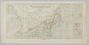
Background imageAmericas Collection: The Lake Frontier of Canada and the United States (coloured engraving)

The Lake Frontier of Canada and the United States (coloured engraving)
3062955 The Lake Frontier of Canada and the United States (coloured engraving) by English School, (19th century); National Army Museum

Background imageAmericas Collection: Map of Philadelphia County, 1819 (colour litho)

Map of Philadelphia County, 1819 (colour litho)
3058567 Map of Philadelphia County, 1819 (colour litho) by American School, (19th century); Free Library of Philadelphia; eFree Library of Philadelphia; American, out of copyright

Background imageAmericas Collection: Woman of the Snake-Tribe, Woman of the Cree-Tribe

Woman of the Snake-Tribe, Woman of the Cree-Tribe
3673682 Woman of the Snake-Tribe, Woman of the Cree-Tribe by Bodmer, Karl (1809-93); Newberry Library, Chicago, Illinois, USA; (add.info.: Travels in the interior of North America / by Maximilian)

Background imageAmericas Collection: Moennitarri Warrior in the Costume of the Dog Dance. Pehriska-Ruhpa

Moennitarri Warrior in the Costume of the Dog Dance. Pehriska-Ruhpa
3673648 Moennitarri Warrior in the Costume of the Dog Dance. Pehriska-Ruhpa by Bodmer, Karl (1809-93); Newberry Library, Chicago, Illinois

Background imageAmericas Collection: Pehriska-Ruhpa, A Minatarree or big-bellied Indian

Pehriska-Ruhpa, A Minatarree or big-bellied Indian
3673631 Pehriska-Ruhpa, A Minatarree or big-bellied Indian by Bodmer, Karl (1809-93); Newberry Library, Chicago, Illinois, USA; (add.info.: Travels in the interior of North America / by Maximilian)


All Professionally Made to Order for Quick Shipping


-

Americas Collection

"Americas " refers to a collection of maps and charts that depict the geography, topography, climate, demographics, and other aspects of North America, Central America, South America, and the Caribbean. These maps and charts are used for educational purposes in schools and universities as well as by researchers studying various topics related to the Americas. They provide valuable information about landforms such as mountains, rivers, lakes; political boundaries between countries; population density; natural resources distribution; transportation networks; weather patterns among others. The use of these maps has helped people understand the complex nature of this vast region better.
+

Our beautiful Wall Art and Photo Gifts include Framed Prints, Photo Prints, Poster Prints, Canvas Prints, Jigsaw Puzzles, Metal Prints and so much more

The Americas collection from Media Storehouse is a stunning assortment of wall art and framed prints that showcase the beauty and diversity of North, Central, and South America. Our collection features an extensive range of maps and charts that depict various regions, cities, countries, oceans, mountains, rivers, lakes as well as historical events such as explorations and discoveries. The artwork is available in different sizes to suit any space or decor style. Our collection offers a unique opportunity to explore the rich cultural heritage of the Americas through visually striking images. Whether you are looking for vintage maps or contemporary designs with bold colors or intricate details - our collection has something for everyone. These high-quality prints are perfect for home decoration or office spaces. The Americas collection from Media Storehouse provides an excellent way to appreciate the natural beauty and history of this vast continent while adding a touch of sophistication to your living space.
+

What are Americas (Maps and Charts) art prints?

America's Maps and Charts art prints are a collection of stunningly detailed, high-quality reproductions of historical maps and charts from the United States. These prints showcase the rich history and geography of America, featuring intricate details such as coastlines, rivers, mountains, cities, and landmarks. From antique maps dating back to the 18th century to modern-day topographical charts, this collection offers a wide range of styles and subjects for any decor or interest. Whether you're looking for a vintage map of your hometown or an artistic rendering of the Grand Canyon, there is something for everyone in this extensive collection. Each print is carefully crafted using state-of-the-art printing technology to ensure that every detail is captured with precision and accuracy. They are printed on high-quality paper stock that will last for years to come. America's Maps and Charts art prints make excellent gifts for history buffs or anyone who appreciates fine art. They can be framed or displayed as-is to add a touch of sophistication to any room in your home or office.
+

What Americas (Maps and Charts) art prints can I buy from Media Storehouse?

We offer a wide range of America's maps and charts art prints that you can buy. These include vintage maps, antique charts, historical diagrams, and contemporary cartography designs. You can choose from various sizes and formats such as framed or unframed prints, canvas wraps, or photographic prints. Some of the popular America's maps and charts art prints available at Media Storehouse are the Vintage Map of United States by John Melish (1816), Antique Chart of New York Harbor (1855), Historical Diagram Showing the Growth of American Railroads (1860-1890), Contemporary Map Artwork of Manhattan Island in New York City by Michael Tompsett, among others. Whether you're looking for a unique wall decor for your home or office space or searching for a special gift for someone who loves geography or history, we have plenty to offer when it comes to America's maps and charts art prints.
+

How do I buy Americas (Maps and Charts) art prints?

To buy America's maps and charts art prints from Media Storehouse, you can browse our extensive collection of high-quality images online. Once you have found the artwork that you want to purchase, simply select the size and format that suits your needs. You can choose from a range of options including canvas prints, framed prints, or unframed prints. When making your purchase, be sure to provide accurate shipping information so that your order is delivered promptly and securely. We offer a variety of payment options for your convenience. Whether you are looking for historical maps or contemporary chart art, we have something to suit every taste and budget. Their vast selection of fine art prints ensures that there is always something new to discover in their collection. So if you're looking to add some beautiful map or chart artwork to your home or office decor, look no further than Media Storehouse.
+

How much do Americas (Maps and Charts) art prints cost?

We offer a wide range of America-themed art prints including maps and charts. The cost of our art prints varies depending on the size, material, and framing options chosen by the customer. We provide high-quality paper or canvas options for our customers to choose from. Our America-themed art prints are perfect for those who love history, geography or simply want to add some unique decor to their homes or offices. Our collection includes vintage maps and charts that showcase different regions in America such as New York City, California, Florida among others. We take pride in offering affordable prices without compromising on quality. Our team ensures that every print is produced with precision and care so that you can enjoy it for years to come. If you're looking for beautiful America-themed art prints at reasonable prices then look no further than Media Storehouse.
+

How will my Americas (Maps and Charts) art prints be delivered to me?

We take pride in delivering your Americas art prints with utmost care. We use high-quality packaging materials to ensure that your print arrives in perfect condition. Depending on the size of the print you have ordered, it will be either rolled or flat-packed for delivery. For smaller prints, we use a sturdy cardboard envelope to protect them during transit. Larger prints are carefully wrapped in acid-free tissue paper before being placed inside a strong postal tube. This ensures that they remain safe and secure throughout their journey. We work with trusted courier partners who offer reliable delivery services across the world. Once your order has been dispatched, you will receive an email notification containing tracking information so that you can keep track of its progress. At Media Storehouse, our priority is to deliver your Americas art prints safely and efficiently so that they arrive at your doorstep ready to be enjoyed for years to come.