Fraud Blocker Skip to main content

Home > Maps and Charts > Americas

Americas Collection (page 63)

"Americas " refers to a collection of maps and charts that depict the geography, topography, climate, demographics, and other aspects of North America

3,930 items

Background imageAmericas Collection: Boston and Bunker Hill, 1781 (litho)

Boston and Bunker Hill, 1781 (litho)
PNP332815 Boston and Bunker Hill, 1781 (litho) by American School, (18th century); Private Collection; (add.info.: British victory at Battle of Bunker Hill, 17 June 1775)

Background imageAmericas Collection: Map of the New World 1587 (litho)

Map of the New World 1587 (litho)
PNP351117 Map of the New World 1587 (litho) by Hakluyt, Richard (c.1552/3-1616) (after); Private Collection; Peter Newark American Pictures; English, out of copyright

Background imageAmericas Collection: Frontispiece of Dutch Chart Atlas showing a group of cartographers and instruments, c

Frontispiece of Dutch Chart Atlas showing a group of cartographers and instruments, c
PNP351110 Frontispiece of Dutch Chart Atlas showing a group of cartographers and instruments, c.1710 (colour litho) by Dutch School

Background imageAmericas Collection: Map of the Pacific, China and America, 1589 by Abrahamus Ortelius (l527-98

Map of the Pacific, China and America, 1589 by Abrahamus Ortelius (l527-98
OPT18634 Map of the Pacific, China and America, 1589 by Abrahamus Ortelius (l527-98) (for detail see 84597) by Ortelius, Abraham (1527-98); Private Collection; Flemish, out of copyright

Background imageAmericas Collection: Birds eye view of that portion of the 23rd and 24th wards of the city of New York

Birds eye view of that portion of the 23rd and 24th wards of the city of New York
6256736 Birds eye view of that portion of the 23rd and 24th wards of the city of New York, lying westerly of the New York and Harlem Railroad

Background imageAmericas Collection: The Backstaff, from The Narrative and Critical History of America

The Backstaff, from The Narrative and Critical History of America
BAL111014 The Backstaff, from The Narrative and Critical History of America, edited by Justin Winsor, London, 1886 (woodcut) by English School

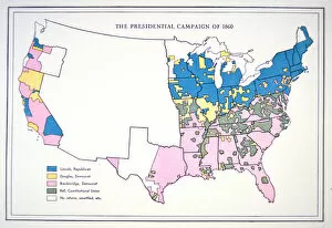
Background imageAmericas Collection: Presidential election campaign map, 1860 (colour litho)

Presidential election campaign map, 1860 (colour litho)
PNP258551 Presidential election campaign map, 1860 (colour litho) by American School, (19th century); Private Collection; (add.info)

Background imageAmericas Collection: Map depicting North America as Divided by the European Powers, 1774 (litho)

Map depicting North America as Divided by the European Powers, 1774 (litho)
AQS256873 Map depicting North America as Divided by the European Powers, 1774 (litho) by American School, (18th century); American Antiquarian Society, Worcester, Massachusetts, USA; eCourtesy

Background imageAmericas Collection: Portrait of Amerigo Vespucci (1452-1512) 1816 (oil on canvas)

Portrait of Amerigo Vespucci (1452-1512) 1816 (oil on canvas)
AKM202292 Portrait of Amerigo Vespucci (1452-1512) 1816 (oil on canvas) by Peale, Charles Willson (1741-1827); 59x48.8 cm; Philadelphia History Museum at the Atwater Kent; (add.info)

Background imageAmericas Collection: A new map of the United States of America, from the latest authorities

A new map of the United States of America, from the latest authorities
2629438 A new map of the United States of America, from the latest authorities, 1806 (coloured engraving) by Cary, John (c.1754-1835) (after); New York Public Library

Background imageAmericas Collection: Map of the Dominions of Great Britain in North America, 1711 (litho)

Map of the Dominions of Great Britain in North America, 1711 (litho)
AQS254867 Map of the Dominions of Great Britain in North America, 1711 (litho) by Moll, Hermann (fl.1678-1732) (after); American Antiquarian Society, Worcester, Massachusetts, USA; eCourtesy

Background imageAmericas Collection: Iroquois Village, 1651 (engraving)

Iroquois Village, 1651 (engraving)
PNP246105 Iroquois Village, 1651 (engraving) by Visscher, Nicolaes (Claes) Jansz (1586-1652); Private Collection; Peter Newark American Pictures; Dutch, out of copyright

Background imageAmericas Collection: Emigrants guide to Pikes Peak, 1859 (litho)

Emigrants guide to Pikes Peak, 1859 (litho)
PNP246272 Emigrants guide to Pikes Peak, 1859 (litho) by American School, (19th century); Private Collection; Peter Newark American Pictures; American, out of copyright

Background imageAmericas Collection: Map of New Belgium and New England, pub. in Amsterdam c. 1640 (coloured engraving)

Map of New Belgium and New England, pub. in Amsterdam c. 1640 (coloured engraving)
STC93602 Map of New Belgium and New England, pub. in Amsterdam c.1640 (coloured engraving) by Blaeu, Joan (1596-1673); Private Collection; The Stapleton Collection; Dutch, out of copyright

Background imageAmericas Collection: Amerigo Vespucci (1452-1512) (oil on canvas)

Amerigo Vespucci (1452-1512) (oil on canvas)
NYH154501 Amerigo Vespucci (1452-1512) (oil on canvas) by American School; 71.1x55.2 cm; Collection of the New-York Historical Society

Background imageAmericas Collection: City of New York, 1876 (colour litho)

City of New York, 1876 (colour litho)
NYH188423 City of New York, 1876 (colour litho) by Currier, N. (1813-88) & Ives, J.M.(1824-95) (after); Collection of the New-York Historical Society, USA; eNew York Historical Society; American

Background imageAmericas Collection: Map of America, from the Mercator Atlas, pub. by Jodocus Hondius (1563-1612)

Map of America, from the Mercator Atlas, pub. by Jodocus Hondius (1563-1612)
STC126923 Map of America, from the Mercator Atlas, pub. by Jodocus Hondius (1563-1612), Amsterdam, 1606 (engraving) by Dutch School

Background imageAmericas Collection: The City of New York, pub. by Currier and Ives, 1870 (colour litho)

The City of New York, pub. by Currier and Ives, 1870 (colour litho)
STC95258 The City of New York, pub. by Currier and Ives, 1870 (colour litho) by American School, (19th century); Private Collection; The Stapleton Collection; American, out of copyright

Background imageAmericas Collection: City of New York, 1856 (colour litho)

City of New York, 1856 (colour litho)
NYH188129 City of New York, 1856 (colour litho) by American School, (19th century); Collection of the New-York Historical Society, USA; eNew York Historical Society; American, out of copyright

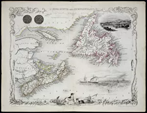
Background imageAmericas Collection: Nova Scotia and Newfoundland, from a Series of World Maps published by John Tallis & Co

Nova Scotia and Newfoundland, from a Series of World Maps published by John Tallis & Co
STC190610 Nova Scotia and Newfoundland, from a Series of World Maps published by John Tallis & Co. New York & London, 1850s (engraving) by Rapkin

Background imageAmericas Collection: Map of the City of New York as Laid Out by the Commissioners, 1814

Map of the City of New York as Laid Out by the Commissioners, 1814
NYH192080 Map of the City of New York as Laid Out by the Commissioners, 1814 by Randel, John Jr. (fl.c.1807-14); Collection of the New-York Historical Society

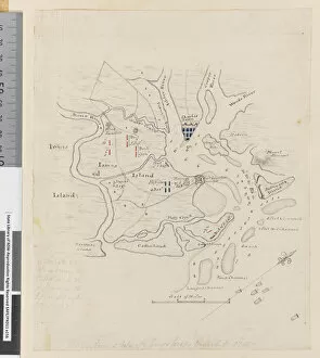
Background imageAmericas Collection: Page 37b Map of Charlestown and state of the Kings troops, March 11 1780 (pencil

Page 37b Map of Charlestown and state of the Kings troops, March 11 1780 (pencil
5670303 Page 37b Map of Charlestown and state of the Kings troops, March 11 1780 (pencil, pen & ink) by Hodges, William (1744-97); Mitchell Library

Background imageAmericas Collection: ia. A Plan of the Harbour of St Johns in Newfoundland, 1760s (pen & ink and wash)

ia. A Plan of the Harbour of St Johns in Newfoundland, 1760s (pen & ink and wash)
5670245 ia. A Plan of the Harbour of St Johns in Newfoundland, 1760s (pen & ink and wash) by Cook, James (1728-79); Mitchell Library, State Library of New South Wales; (add.info.: Original Sketches)

Background imageAmericas Collection: Map of the Arabian Peninsula, with wind rose and details of ports and sea coasts

Map of the Arabian Peninsula, with wind rose and details of ports and sea coasts
AIS5334416 Map of the Arabian Peninsula, with wind rose and details of ports and sea coasts, in Atlas de Joan Martines, 1587 (manuscript) by Martines, Joan (1556-1590); Biblioteca Nacional, Madrid

Background imageAmericas Collection: Map of Atlantis, with its islands and connecting ridges, from deep sea soundings (engraving)

Map of Atlantis, with its islands and connecting ridges, from deep sea soundings (engraving)
6002735 Map of Atlantis, with its islands and connecting ridges, from deep sea soundings (engraving) by American School, (19th century); Private Collection; (add.info.: Map of Atlantis)

Background imageAmericas Collection: South America in the 16th century, map of the Spanish conquests and colonies (litho)

South America in the 16th century, map of the Spanish conquests and colonies (litho)
6004944 South America in the 16th century, map of the Spanish conquests and colonies (litho) by English School, (20th century); Private Collection; (add.info.: South America in the 16th century)

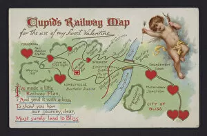
Background imageAmericas Collection: Cupids Railway Map (colour litho)

Cupids Railway Map (colour litho)
6032858 Cupids Railway Map (colour litho) by American School, (19th century); Private Collection; (add.info.: Cupids Railway Map. Trade card.); Look and Learn / Barbara Loe Collection

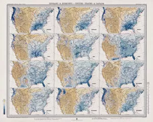
Background imageAmericas Collection: Isobars and Isohyets, United States and Canada (colour litho)

Isobars and Isohyets, United States and Canada (colour litho)
6015865 Isobars and Isohyets, United States and Canada (colour litho) by English School, (19th century); Private Collection; (add.info.: Isobars and Isohyets, United States and Canada)

Background imageAmericas Collection: Shanghae and its Vicinity, showing the Relative Positions of the Forces (and Places)

Shanghae and its Vicinity, showing the Relative Positions of the Forces (and Places), on 4 April 1854 (engraving)
1619111 Shanghae and its Vicinity, showing the Relative Positions of the Forces (and Places), on 4 April 1854 (engraving) by English School

Background imageAmericas Collection: Upper California (engraving)

Upper California (engraving)
1617871 Upper California (engraving) by English School, (19th century); Private Collection; (add.info.: Upper California. Illustration for The Illustrated London News, 13 January 1849)

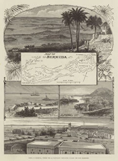
Background imageAmericas Collection: Views in Bermuda, where the 2nd Battalion Grenadier Guards are now stationed (engraving)

Views in Bermuda, where the 2nd Battalion Grenadier Guards are now stationed (engraving)
1596566 Views in Bermuda, where the 2nd Battalion Grenadier Guards are now stationed (engraving) by English School, (19th century); Private Collection; (add.info.: Views in Bermuda)

Background imageAmericas Collection: Americas first national map, 1784 (hand-coloured engraving)

Americas first national map, 1784 (hand-coloured engraving)
1268148 Americas first national map, 1784 (hand-coloured engraving) by Buell, Abel (1742-1822); 115.2x128.6 cm; Private Collection; (add.info)

Background imageAmericas Collection: Map of New England, from Historia Mundi: or Mercators Atlas, London

Map of New England, from Historia Mundi: or Mercators Atlas, London
3964030 Map of New England, from Historia Mundi: or Mercators Atlas, London, 1635 (engraving) by Mercator, Gerardus (1512-94)

Background imageAmericas Collection: Frontispiece map from A Journal of Captain Cook

Frontispiece map from A Journal of Captain Cook
1547209 Frontispiece map from A Journal of Captain Cooks Last Voyage to the Pacific Ocean and in Quest of a North-West Passage Between Asia and America by John Ledyard

Background imageAmericas Collection: Map of Korea at the end of the Russian-Japanese conflict (1904-1905)

Map of Korea at the end of the Russian-Japanese conflict (1904-1905)
LSE4322815 Map of Korea at the end of the Russian-Japanese conflict (1904-1905). Illustration, in " Russia and Japan and a complete history of the war in the far east"

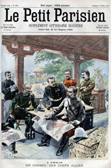
Background imageAmericas Collection: Revolt des Boxers: Un conseil des chefs allied (French, Russian, American, English

Revolt des Boxers: Un conseil des chefs allied (French, Russian, American, English
XEE4408301 Revolt des Boxers: Un conseil des chefs allied (French, Russian, American, English, Japanese) (ALLIED COUNCIL OF WAR) - in " Le Petit Parisien"

Background imageAmericas Collection: Map of the Gulf of Mexico and the Caribbean, 18th century

Map of the Gulf of Mexico and the Caribbean, 18th century
LSE4097795 Map of the Gulf of Mexico and the Caribbean, 18th century by Unknown artist, (18th century); Private Collection; Photo eLeonard de Selva; out of copyright

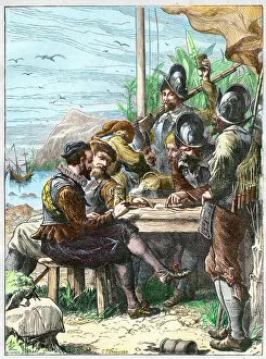
Background imageAmericas Collection: Sir Walter Raleigh at Trinidad, getting Information from the Spanish Soldiers regarding

Sir Walter Raleigh at Trinidad, getting Information from the Spanish Soldiers regarding
XEE4153633 Sir Walter Raleigh at Trinidad, getting Information from the Spanish Soldiers regarding Guiana, 1595. - Expedition by Walter Raleigh (1554-1618)

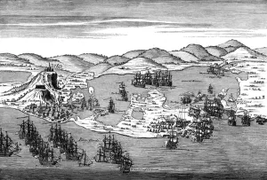
Background imageAmericas Collection: Action at Carthagena, Colombia, 1741

Action at Carthagena, Colombia, 1741
3781934 Action at Carthagena, Colombia, 1741 by Gravelot, Hubert Francois (1699-1773); (add.info.: Action at Carthagena, Colombia, 1741. Engraving from drawing by Gravelot)

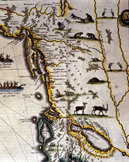
Background imageAmericas Collection: Geographic map of the 17th century Dutch Atlas by Wilhelm Blaeu (1571-1638

Geographic map of the 17th century Dutch Atlas by Wilhelm Blaeu (1571-1638
GIA4790968 Geographic map of the 17th century Dutch Atlas by Wilhelm Blaeu (1571-1638) showing American and Canadian territories fur animal peoples. The North is below according to medieval custom

Background imageAmericas Collection: Sebastiano Caboto (Sebastien Cabot) represents on the cartridge of a navigation map with

Sebastiano Caboto (Sebastien Cabot) represents on the cartridge of a navigation map with
GIA4776629 Sebastiano Caboto (Sebastien Cabot) represents on the cartridge of a navigation map with other navigators. The beginning of the 17th century

Background imageAmericas Collection: Map of Meridionale America (South America or Latin America

Map of Meridionale America (South America or Latin America
GIA4805221 Map of Meridionale America (South America or Latin America) from a Spanish volume of trips from the beginning of the 17th century

Background imageAmericas Collection: Geographic map of the world. Map of the Dutch school from the projection of Gerard

Geographic map of the world. Map of the Dutch school from the projection of Gerard
JLJ4588728 Geographic map of the world. Map of the Dutch school from the projection of Gerard Mercator (1512-1594), 17th century. Paris, B.N

Background imageAmericas Collection: Map of the Magellans Detroit, c. 1567. (mural painting)

Map of the Magellans Detroit, c. 1567. (mural painting)
LRI4595632 Map of the Magellans Detroit, c.1567. (mural painting) by Danti, Egnazio (1536-86); Palazzo Vecchio, Florence, Italy; (add.info)

Background imageAmericas Collection: World map of the navigator Sebastiano Caboto (Sebastien Cabot) (1476-1557) 1544. Paris, B

World map of the navigator Sebastiano Caboto (Sebastien Cabot) (1476-1557) 1544. Paris, B
JLJ4595111 World map of the navigator Sebastiano Caboto (Sebastien Cabot) (1476-1557) 1544. Paris, B.N. by Unknown Artist, (16th century); Bibliotheque Nationale, Paris

Background imageAmericas Collection: Marine chart of Juan de la Cosa (1460-1510), cartographer companion of navigator

Marine chart of Juan de la Cosa (1460-1510), cartographer companion of navigator
JLJ4595109 Marine chart of Juan de la Cosa (1460-1510), cartographer companion of navigator Christopher Columbus (1451-1506), 1492 Dim. 0, 7x 1, 1 m Paris, B.N

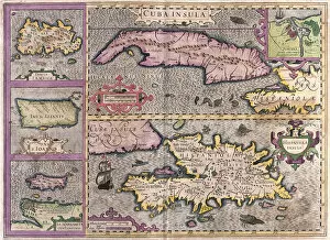
Background imageAmericas Collection: Cuba, Jamaica, Haiti, Puerto Rico (Caribbean) (engraving, 1596)

Cuba, Jamaica, Haiti, Puerto Rico (Caribbean) (engraving, 1596)
LRI4718854 Cuba, Jamaica, Haiti, Puerto Rico (Caribbean) (engraving, 1596) by Mercator, Gerardus (1512-94); Private Collection; (add.info.: Cuba insula, Iamaica, S. Joannis, Is)

Background imageAmericas Collection: Straits of Magellan (engraving, 1596)

Straits of Magellan (engraving, 1596)
LRI4718899 Straits of Magellan (engraving, 1596) by Mercator, Gerardus (1512-94); Private Collection; (add.info.: Exquisita & magno aliquot mensium pericolo lustrata et am retecta freti Magellanici)


All Professionally Made to Order for Quick Shipping


-

Americas Collection

"Americas " refers to a collection of maps and charts that depict the geography, topography, climate, demographics, and other aspects of North America, Central America, South America, and the Caribbean. These maps and charts are used for educational purposes in schools and universities as well as by researchers studying various topics related to the Americas. They provide valuable information about landforms such as mountains, rivers, lakes; political boundaries between countries; population density; natural resources distribution; transportation networks; weather patterns among others. The use of these maps has helped people understand the complex nature of this vast region better.
+

Our beautiful Wall Art and Photo Gifts include Framed Prints, Photo Prints, Poster Prints, Canvas Prints, Jigsaw Puzzles, Metal Prints and so much more

The Americas collection from Media Storehouse is a stunning assortment of wall art and framed prints that showcase the beauty and diversity of North, Central, and South America. Our collection features an extensive range of maps and charts that depict various regions, cities, countries, oceans, mountains, rivers, lakes as well as historical events such as explorations and discoveries. The artwork is available in different sizes to suit any space or decor style. Our collection offers a unique opportunity to explore the rich cultural heritage of the Americas through visually striking images. Whether you are looking for vintage maps or contemporary designs with bold colors or intricate details - our collection has something for everyone. These high-quality prints are perfect for home decoration or office spaces. The Americas collection from Media Storehouse provides an excellent way to appreciate the natural beauty and history of this vast continent while adding a touch of sophistication to your living space.
+

What are Americas (Maps and Charts) art prints?

America's Maps and Charts art prints are a collection of stunningly detailed, high-quality reproductions of historical maps and charts from the United States. These prints showcase the rich history and geography of America, featuring intricate details such as coastlines, rivers, mountains, cities, and landmarks. From antique maps dating back to the 18th century to modern-day topographical charts, this collection offers a wide range of styles and subjects for any decor or interest. Whether you're looking for a vintage map of your hometown or an artistic rendering of the Grand Canyon, there is something for everyone in this extensive collection. Each print is carefully crafted using state-of-the-art printing technology to ensure that every detail is captured with precision and accuracy. They are printed on high-quality paper stock that will last for years to come. America's Maps and Charts art prints make excellent gifts for history buffs or anyone who appreciates fine art. They can be framed or displayed as-is to add a touch of sophistication to any room in your home or office.
+

What Americas (Maps and Charts) art prints can I buy from Media Storehouse?

We offer a wide range of America's maps and charts art prints that you can buy. These include vintage maps, antique charts, historical diagrams, and contemporary cartography designs. You can choose from various sizes and formats such as framed or unframed prints, canvas wraps, or photographic prints. Some of the popular America's maps and charts art prints available at Media Storehouse are the Vintage Map of United States by John Melish (1816), Antique Chart of New York Harbor (1855), Historical Diagram Showing the Growth of American Railroads (1860-1890), Contemporary Map Artwork of Manhattan Island in New York City by Michael Tompsett, among others. Whether you're looking for a unique wall decor for your home or office space or searching for a special gift for someone who loves geography or history, we have plenty to offer when it comes to America's maps and charts art prints.
+

How do I buy Americas (Maps and Charts) art prints?

To buy America's maps and charts art prints from Media Storehouse, you can browse our extensive collection of high-quality images online. Once you have found the artwork that you want to purchase, simply select the size and format that suits your needs. You can choose from a range of options including canvas prints, framed prints, or unframed prints. When making your purchase, be sure to provide accurate shipping information so that your order is delivered promptly and securely. We offer a variety of payment options for your convenience. Whether you are looking for historical maps or contemporary chart art, we have something to suit every taste and budget. Their vast selection of fine art prints ensures that there is always something new to discover in their collection. So if you're looking to add some beautiful map or chart artwork to your home or office decor, look no further than Media Storehouse.
+

How much do Americas (Maps and Charts) art prints cost?

We offer a wide range of America-themed art prints including maps and charts. The cost of our art prints varies depending on the size, material, and framing options chosen by the customer. We provide high-quality paper or canvas options for our customers to choose from. Our America-themed art prints are perfect for those who love history, geography or simply want to add some unique decor to their homes or offices. Our collection includes vintage maps and charts that showcase different regions in America such as New York City, California, Florida among others. We take pride in offering affordable prices without compromising on quality. Our team ensures that every print is produced with precision and care so that you can enjoy it for years to come. If you're looking for beautiful America-themed art prints at reasonable prices then look no further than Media Storehouse.
+

How will my Americas (Maps and Charts) art prints be delivered to me?

We take pride in delivering your Americas art prints with utmost care. We use high-quality packaging materials to ensure that your print arrives in perfect condition. Depending on the size of the print you have ordered, it will be either rolled or flat-packed for delivery. For smaller prints, we use a sturdy cardboard envelope to protect them during transit. Larger prints are carefully wrapped in acid-free tissue paper before being placed inside a strong postal tube. This ensures that they remain safe and secure throughout their journey. We work with trusted courier partners who offer reliable delivery services across the world. Once your order has been dispatched, you will receive an email notification containing tracking information so that you can keep track of its progress. At Media Storehouse, our priority is to deliver your Americas art prints safely and efficiently so that they arrive at your doorstep ready to be enjoyed for years to come.