Fraud Blocker Skip to main content

Home > Maps and Charts > Americas

Americas Collection (page 62)

"Americas " refers to a collection of maps and charts that depict the geography, topography, climate, demographics, and other aspects of North America

3,930 items

Background imageAmericas Collection: Mato-Tope, A Mandan Chief

Mato-Tope, A Mandan Chief
3673617 Mato-Tope, A Mandan Chief by Bodmer, Karl (1809-93); Newberry Library, Chicago, Illinois, USA; (add.info.: Travels in the interior of North America / by Maximilian)

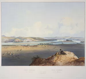
Background imageAmericas Collection: Fort Pierre on the Missouri

Fort Pierre on the Missouri
3673607 Fort Pierre on the Missouri by Bodmer, Karl (1809-93); Newberry Library, Chicago, Illinois, USA; (add.info.: Travels in the interior of North America / by Maximilian)

Background imageAmericas Collection: Dakota Woman and Assiniboin Girl

Dakota Woman and Assiniboin Girl
3673603 Dakota Woman and Assiniboin Girl by Bodmer, Karl (1809-93); Newberry Library, Chicago, Illinois, USA; (add.info.: Travels in the interior of North America / by Maximilian)

Background imageAmericas Collection: Utah, USA (chromolitho)

Utah, USA (chromolitho)
3656916 Utah, USA (chromolitho) by American School, (19th century); Private Collection; (add.info.: Utah, USA. Illustration for trade card)

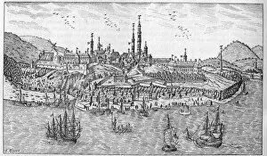
Background imageAmericas Collection: View of Quebec City in Canada (late 17th century): A. Jardin du fort. B. The fort. C

View of Quebec City in Canada (late 17th century): A. Jardin du fort. B. The fort. C
XEE4134580 View of Quebec City in Canada (late 17th century): A. Jardin du fort. B. The fort. C. Powder store. D. Les Recollets. E. Ursulines. F. The Jesuites. G. The cathedrale. H. The seminar. I

Background imageAmericas Collection: Map of Denver, Colorado, 1874

Map of Denver, Colorado, 1874
XEE4113870 Map of Denver, Colorado, 1874. by Unknown Artist, (19th century); Private Collection; (add.info.: Map of Denver, Colorado, 1874.); Stefano Bianchetti; out of copyright

Background imageAmericas Collection: Cartagena in Colombia from the Atlas of W. Blaeu, 17th century

Cartagena in Colombia from the Atlas of W. Blaeu, 17th century
GIA4730348 Cartagena in Colombia from the Atlas of W. Blaeu, 17th century. by Blaeu, Willem (1571-1638); Private Collection; (add.info.: Cartagena in Colombia from the Atlas of W)

Background imageAmericas Collection: Representation of the island of Jamaica. Isolario (map of islands) by Benedetto Bordone

Representation of the island of Jamaica. Isolario (map of islands) by Benedetto Bordone
GIA4784066 Representation of the island of Jamaica. Isolario (map of islands) by Benedetto Bordone. Venice 1547 by Italian School

Background imageAmericas Collection: The Caribbean Sea: you can see the Bermuda triangle between the Bermuda Archipelago

The Caribbean Sea: you can see the Bermuda triangle between the Bermuda Archipelago
GIA4764548 The Caribbean Sea: you can see the Bermuda triangle between the Bermuda Archipelago, Miami and Puerto Rico. According to Wilhelm Blaeus Atlas, 1650

Background imageAmericas Collection: View of Cartagena in Colombia (South America). Detail of a map of the Atlas '

View of Cartagena in Colombia (South America). Detail of a map of the Atlas "
GIA4805226 View of Cartagena in Colombia (South America). Detail of a map of the Atlas " Le Theatre du Monde" by Willem Janszoon Blaeu (1571-1638), 1645

Background imageAmericas Collection: Discovery of America - in 'Admirante Narratio Americae'

Discovery of America - in "Admirante Narratio Americae"
LSE4401723 Discovery of America - in " Admirante Narratio Americae" by Theodore de Bry, 1562-1563 by Bry, Theodore de (1528-98); Private Collection; (add.info)

Background imageAmericas Collection: Map of Mexico (manuscrit, 1555)

Map of Mexico (manuscrit, 1555)
LRI4648563 Map of Mexico (manuscrit, 1555) by Santa Cruz, Alonso de (1505-67); University Library, Uppsala, Sweden; (add.info.: Mexico Map made by Alonso de Santa Cruz (1505-1567) 1555 Uppsala

Background imageAmericas Collection: Maps of the Caribbean Islands (Guadeloupe, Marie Galante, Dominica, Martinique

Maps of the Caribbean Islands (Guadeloupe, Marie Galante, Dominica, Martinique
LRI4707035 Maps of the Caribbean Islands (Guadeloupe, Marie Galante, Dominica, Martinique, Saint Lucia, Saint Vincent, Barbados, Grenadines and Grenada) (etching, 1730) by Delisle

Background imageAmericas Collection: The debarkment of the Spanish conquistadors Francisco Pizarro (Francois Pizarre

The debarkment of the Spanish conquistadors Francisco Pizarro (Francois Pizarre
GIA4707040 The debarkment of the Spanish conquistadors Francisco Pizarro (Francois Pizarre, 1475-1541) and Diego de Almagro (1480-1538) in Peru

Background imageAmericas Collection: Planisphere World (etching, 1730)

Planisphere World (etching, 1730)
LRI4706277 Planisphere World (etching, 1730) by Delisle, Guillaume (1675-1726); Private Collection; (add.info.: Planisphere World - Strong water extracted from the " Atlas Nouveau containing all)

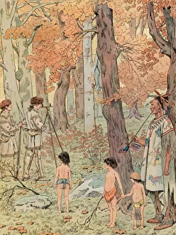
Background imageAmericas Collection: Jacques Marie Gaston Onfroy de Breville dit JOB (1858-1931) - At the age of sixteen

Jacques Marie Gaston Onfroy de Breville dit JOB (1858-1931) - At the age of sixteen
JLJ4640369 Jacques Marie Gaston Onfroy de Breville dit JOB (1858-1931) - At the age of sixteen, George Washington became a surveyor and mapping the lands west of the Blue Ridge Mountains

Background imageAmericas Collection: Francisco Pizarro (in fr. Francois Pizarre) represented on a map of Peru. 17th century

Francisco Pizarro (in fr. Francois Pizarre) represented on a map of Peru. 17th century
GIA4711351 Francisco Pizarro (in fr. Francois Pizarre) represented on a map of Peru. 17th century. by Unknown Artist, (17th century); Private Collection; (add.info.: Francisco Pizarro (in fr)

Background imageAmericas Collection: Map of Central America. 16th century

Map of Central America. 16th century
GIA4711220 Map of Central America. 16th century. by Unknown Artist, (16th century); Private Collection; (add.info.: Map of Central America. 16th century.); eGiancarlo Costa; out of copyright

Background imageAmericas Collection: Map of the southern hemisphere of the world, 1708 (etching, 1717)

Map of the southern hemisphere of the world, 1708 (etching, 1717)
LRI4711137 Map of the southern hemisphere of the world, 1708 (etching, 1717) by Nolin, Jean-Baptiste (c.1657-1708); Private Collection; (add.info.: Map of the southern hemisphere of the world)

Background imageAmericas Collection: Virginia and Florida (engraving, 1596)

Virginia and Florida (engraving, 1596)
LRI4718867 Virginia and Florida (engraving, 1596) by Mercator, Gerardus (1512-94); Private Collection; (add.info.: Virginiae item and Floridae)

Background imageAmericas Collection: Christopher Columbus, in the Sala del Mappamondo (fresco)

Christopher Columbus, in the Sala del Mappamondo (fresco)
808747 Christopher Columbus, in the Sala del Mappamondo (fresco) by Italian School, (16th century); Villa Farnese, Caprarola, Voterbo, Lazio

Background imageAmericas Collection: Plan of the city and suburbs of New Orleans, 1817 (hand-coloured engraving)

Plan of the city and suburbs of New Orleans, 1817 (hand-coloured engraving)
876803 Plan of the city and suburbs of New Orleans, 1817 (hand-coloured engraving) by Rollinson, William (1762-1842); 47.3x77.4 cm; New York Public Library

Background imageAmericas Collection: Map of part of Boston, Massachusetts, from Bonners map, 1722 (engraving)

Map of part of Boston, Massachusetts, from Bonners map, 1722 (engraving)
3626305 Map of part of Boston, Massachusetts, from Bonners map, 1722 (engraving) by American School, (19th century); Private Collection; (add.info.: Map of part of Boston, Massachusetts)

Background imageAmericas Collection: Map showing the voyages of Christopher Columbus, 1492-1504 (coloured engraving)

Map showing the voyages of Christopher Columbus, 1492-1504 (coloured engraving)
3646171 Map showing the voyages of Christopher Columbus, 1492-1504 (coloured engraving) by German School, (19th century); Private Collection; (add.info)

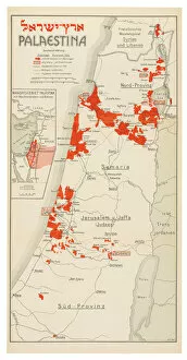
Background imageAmericas Collection: Map of Palestine, 1926 (colour litho)

Map of Palestine, 1926 (colour litho)
3482908 Map of Palestine, 1926 (colour litho) by Trietsch, Davis (1870-1935); Private Collection; (add.info.: PalAastina-Wirtschafts-Atlas. Berlin: Orient-Verlag, [1926])

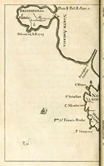
Background imageAmericas Collection: Map showing location of Brobdingnag from first edition of

Map showing location of Brobdingnag from first edition of
3514776 Map showing location of Brobdingnag from first edition of Travels into Several Remote Nations of the World better know as Gullivers Travels by Jonathan Swift by English School

Background imageAmericas Collection: Land of Outagamie, Mascoutin, Illinois Indians and part of the Six Nations, engraving by G

Land of Outagamie, Mascoutin, Illinois Indians and part of the Six Nations, engraving by G
3572554 Land of Outagamie, Mascoutin, Illinois Indians and part of the Six Nations, engraving by G. Zuliani taken from Tome I of the " Newest Atlas" published in Venice in 1778 by Antonio

Background imageAmericas Collection: Land of the Cherokees with the western part of North Carolina and Virginia, engraving by G

Land of the Cherokees with the western part of North Carolina and Virginia, engraving by G
3572557 Land of the Cherokees with the western part of North Carolina and Virginia, engraving by G. Zuliani taken from Tome I of the " Newest Atlas" published in Venice in 1778 by Antonio

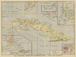
Background imageAmericas Collection: The Spanish-American War - map of Spanish colonies (colour litho)

The Spanish-American War - map of Spanish colonies (colour litho)
2818875 The Spanish-American War - map of Spanish colonies (colour litho) by French School, (19th century); Private Collection; (add.info.: The Spanish-American War - map of Spanish colonies)

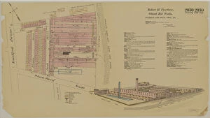
Background imageAmericas Collection: Frankford Ave. and Wheatsheaf Lane, Hexamer General Surveys, 1895 (colour litho)

Frankford Ave. and Wheatsheaf Lane, Hexamer General Surveys, 1895 (colour litho)
2630791 Frankford Ave. and Wheatsheaf Lane, Hexamer General Surveys, 1895 (colour litho) by Hexamer, Ernest (1827-1912); Free Library of Philadelphia; (add.info.: Hexamer General Surveys)

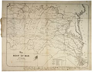
Background imageAmericas Collection: Map of the Seat of War, made in Savannah, Georgia, 1861 (litho)

Map of the Seat of War, made in Savannah, Georgia, 1861 (litho)
696120 Map of the Seat of War, made in Savannah, Georgia, 1861 (litho) by Grant, M. B. (fl.1861); 47.5x60.5 cm; Gilder Lehrman Collection, New York, USA; (add.info.: Compiled and drawn by M. B)

Background imageAmericas Collection: Manuscript Civil War map of General Shermans Atlanta campaign, c. 1864 (litho)

Manuscript Civil War map of General Shermans Atlanta campaign, c. 1864 (litho)
696117 Manuscript Civil War map of General Shermans Atlanta campaign, c.1864 (litho) by Stevens, Asbury L. (1843-c.1890) and Snell, J.P

Background imageAmericas Collection: Map of Yorktown, Virginia, October 1781 (litho)

Map of Yorktown, Virginia, October 1781 (litho)
696028 Map of Yorktown, Virginia, October 1781 (litho) by British School, (18th Century); 28.3x37.5 cm; Gilder Lehrman Collection, New York, USA; (add.info.: Drawn map of Yorktown, Virginia)

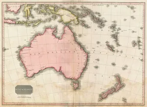
Background imageAmericas Collection: John Pinkertons map of Australia and the South West Pacific, 1818 (colour engraving)

John Pinkertons map of Australia and the South West Pacific, 1818 (colour engraving)
696806 John Pinkertons map of Australia and the South West Pacific, 1818 (colour engraving) by Pinkerton, E. J. (fl.1844); Private Collection; (add.info)

Background imageAmericas Collection: City of New York, printed and published by N. Currier, 1856 (colour litho)

City of New York, printed and published by N. Currier, 1856 (colour litho)
PNP382186 City of New York, printed and published by N. Currier, 1856 (colour litho) by Parsons, Charles (1821-1910); Private Collection; Peter Newark American Pictures; American, out of copyright

Background imageAmericas Collection: Map of the United States, 1816 (engraving)

Map of the United States, 1816 (engraving)
497563 Map of the United States, 1816 (engraving) by Melish, John (1771-1822); Gilder Lehrman Collection, New York, USA; eGilder Lehrman Institute of American History; American, out of copyright

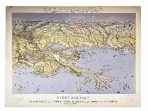
Background imageAmericas Collection: Panorama of the Seat of War: Birds Eye View Of Louisiana, Mississippi

Panorama of the Seat of War: Birds Eye View Of Louisiana, Mississippi
497533 Panorama of the Seat of War: Birds Eye View Of Louisiana, Mississippi, Alabama And Part Of Florida, 1861 (colour litho) by Bachmann, John (fl.1850-77); 58x77 cm; Gilder Lehrman Collection

Background imageAmericas Collection: Hexamer General Survey; volume 1, plate 21, 1866 (hand-coloured engraving)

Hexamer General Survey; volume 1, plate 21, 1866 (hand-coloured engraving)
486270 Hexamer General Survey; volume 1, plate 21, 1866 (hand-coloured engraving) by Hexamer, Ernest (1827-1912); 44x50 cm; Free Library of Philadelphia; eFree Library of Philadelphia; Map

Background imageAmericas Collection: Map of Boston : Dec. 1, 1908 (litho)

Map of Boston : Dec. 1, 1908 (litho)
6256297 Map of Boston : Dec. 1, 1908 (litho) by American School, (20th century); 84x124 cm; Boston Public Library, Boston, Massachusetts

Background imageAmericas Collection: Official map of Boston, c. 1895 (colour litho)

Official map of Boston, c. 1895 (colour litho)
6256296 Official map of Boston, c.1895 (colour litho) by American School, (19th century); 70x92 cm; Boston Public Library, Boston, Massachusetts, USA; (add.info.: Creator: Geo. H)

Background imageAmericas Collection: Indexed map of Boston, 1900 (colour litho)

Indexed map of Boston, 1900 (colour litho)
6256298 Indexed map of Boston, 1900 (colour litho) by American School, (20th century); 70x49 cm; Boston Public Library, Boston, Massachusetts, USA; (add.info.: Geo. H)

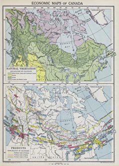
Background imageAmericas Collection: Economic maps of Canada (colour litho)

Economic maps of Canada (colour litho)
6025443 Economic maps of Canada (colour litho) by English School, (20th century); Private Collection; (add.info.: Economic maps of Canada)

Background imageAmericas Collection: A new map of the United States with the additional territories on an improved plan, c

A new map of the United States with the additional territories on an improved plan, c
AQS332006 A new map of the United States with the additional territories on an improved plan, c.1828 (litho) by American School, (19th century); 28.3x32.7 cm; American Antiquarian Society, Worcester

Background imageAmericas Collection: New York in the middle of the 18th century (litho)

New York in the middle of the 18th century (litho)
PNP329793 New York in the middle of the 18th century (litho) by American School, (18th century); Private Collection; Peter Newark Pictures; American, out of copyright

Background imageAmericas Collection: Map of New York and the Vicinity (litho)

Map of New York and the Vicinity (litho)
PNP329791 Map of New York and the Vicinity (litho) by American School, (18th century); Private Collection; (add.info.: drawn in 1776; ); Peter Newark Pictures; American, out of copyright

Background imageAmericas Collection: Map of New York (litho)

Map of New York (litho)
PNP329790 Map of New York (litho) by American School, (18th century); Private Collection; (add.info.: surveyed in 1782 and drawn in 1785 by John Hills; ); Peter Newark American Pictures; American

Background imageAmericas Collection: View of New Amsterdam, Costello Plan, 1660 (w / c on paper)

View of New Amsterdam, Costello Plan, 1660 (w / c on paper)
MNY90528 View of New Amsterdam, Costello Plan, 1660 (w/c on paper) by Cortelyou, Jacques (17th century); 59.7x80 cm; Museum of the City of New York, USA; eMuseum of the City of New York; American

Background imageAmericas Collection: Scotts great snake, published in Cincinnati, 1861 (litho)

Scotts great snake, published in Cincinnati, 1861 (litho)
AQS336692 Scotts great snake, published in Cincinnati, 1861 (litho) by Elliott, J. B. (fl.1861); 35.1x42.8 cm; American Antiquarian Society, Worcester, Massachusetts


All Professionally Made to Order for Quick Shipping


-

Americas Collection

"Americas " refers to a collection of maps and charts that depict the geography, topography, climate, demographics, and other aspects of North America, Central America, South America, and the Caribbean. These maps and charts are used for educational purposes in schools and universities as well as by researchers studying various topics related to the Americas. They provide valuable information about landforms such as mountains, rivers, lakes; political boundaries between countries; population density; natural resources distribution; transportation networks; weather patterns among others. The use of these maps has helped people understand the complex nature of this vast region better.
+

Our beautiful Wall Art and Photo Gifts include Framed Prints, Photo Prints, Poster Prints, Canvas Prints, Jigsaw Puzzles, Metal Prints and so much more

The Americas collection from Media Storehouse is a stunning assortment of wall art and framed prints that showcase the beauty and diversity of North, Central, and South America. Our collection features an extensive range of maps and charts that depict various regions, cities, countries, oceans, mountains, rivers, lakes as well as historical events such as explorations and discoveries. The artwork is available in different sizes to suit any space or decor style. Our collection offers a unique opportunity to explore the rich cultural heritage of the Americas through visually striking images. Whether you are looking for vintage maps or contemporary designs with bold colors or intricate details - our collection has something for everyone. These high-quality prints are perfect for home decoration or office spaces. The Americas collection from Media Storehouse provides an excellent way to appreciate the natural beauty and history of this vast continent while adding a touch of sophistication to your living space.
+

What are Americas (Maps and Charts) art prints?

America's Maps and Charts art prints are a collection of stunningly detailed, high-quality reproductions of historical maps and charts from the United States. These prints showcase the rich history and geography of America, featuring intricate details such as coastlines, rivers, mountains, cities, and landmarks. From antique maps dating back to the 18th century to modern-day topographical charts, this collection offers a wide range of styles and subjects for any decor or interest. Whether you're looking for a vintage map of your hometown or an artistic rendering of the Grand Canyon, there is something for everyone in this extensive collection. Each print is carefully crafted using state-of-the-art printing technology to ensure that every detail is captured with precision and accuracy. They are printed on high-quality paper stock that will last for years to come. America's Maps and Charts art prints make excellent gifts for history buffs or anyone who appreciates fine art. They can be framed or displayed as-is to add a touch of sophistication to any room in your home or office.
+

What Americas (Maps and Charts) art prints can I buy from Media Storehouse?

We offer a wide range of America's maps and charts art prints that you can buy. These include vintage maps, antique charts, historical diagrams, and contemporary cartography designs. You can choose from various sizes and formats such as framed or unframed prints, canvas wraps, or photographic prints. Some of the popular America's maps and charts art prints available at Media Storehouse are the Vintage Map of United States by John Melish (1816), Antique Chart of New York Harbor (1855), Historical Diagram Showing the Growth of American Railroads (1860-1890), Contemporary Map Artwork of Manhattan Island in New York City by Michael Tompsett, among others. Whether you're looking for a unique wall decor for your home or office space or searching for a special gift for someone who loves geography or history, we have plenty to offer when it comes to America's maps and charts art prints.
+

How do I buy Americas (Maps and Charts) art prints?

To buy America's maps and charts art prints from Media Storehouse, you can browse our extensive collection of high-quality images online. Once you have found the artwork that you want to purchase, simply select the size and format that suits your needs. You can choose from a range of options including canvas prints, framed prints, or unframed prints. When making your purchase, be sure to provide accurate shipping information so that your order is delivered promptly and securely. We offer a variety of payment options for your convenience. Whether you are looking for historical maps or contemporary chart art, we have something to suit every taste and budget. Their vast selection of fine art prints ensures that there is always something new to discover in their collection. So if you're looking to add some beautiful map or chart artwork to your home or office decor, look no further than Media Storehouse.
+

How much do Americas (Maps and Charts) art prints cost?

We offer a wide range of America-themed art prints including maps and charts. The cost of our art prints varies depending on the size, material, and framing options chosen by the customer. We provide high-quality paper or canvas options for our customers to choose from. Our America-themed art prints are perfect for those who love history, geography or simply want to add some unique decor to their homes or offices. Our collection includes vintage maps and charts that showcase different regions in America such as New York City, California, Florida among others. We take pride in offering affordable prices without compromising on quality. Our team ensures that every print is produced with precision and care so that you can enjoy it for years to come. If you're looking for beautiful America-themed art prints at reasonable prices then look no further than Media Storehouse.
+

How will my Americas (Maps and Charts) art prints be delivered to me?

We take pride in delivering your Americas art prints with utmost care. We use high-quality packaging materials to ensure that your print arrives in perfect condition. Depending on the size of the print you have ordered, it will be either rolled or flat-packed for delivery. For smaller prints, we use a sturdy cardboard envelope to protect them during transit. Larger prints are carefully wrapped in acid-free tissue paper before being placed inside a strong postal tube. This ensures that they remain safe and secure throughout their journey. We work with trusted courier partners who offer reliable delivery services across the world. Once your order has been dispatched, you will receive an email notification containing tracking information so that you can keep track of its progress. At Media Storehouse, our priority is to deliver your Americas art prints safely and efficiently so that they arrive at your doorstep ready to be enjoyed for years to come.