Fraud Blocker Skip to main content

Home > Maps and Charts > Americas

Americas Collection (page 64)

"Americas " refers to a collection of maps and charts that depict the geography, topography, climate, demographics, and other aspects of North America

3,930 items

Background imageAmericas Collection: South America (engraving, 1596)

South America (engraving, 1596)
LRI4718893 South America (engraving, 1596) by Mercator, Gerardus (1512-94); Private Collection; (add.info.: America meridionalis)

Background imageAmericas Collection: Portrait of Louis XIV, flying over a terrestrial globe, title page (Engraving, 1717)

Portrait of Louis XIV, flying over a terrestrial globe, title page (Engraving, 1717)
LRI4713054 Portrait of Louis XIV, flying over a terrestrial globe, title page (Engraving, 1717) by Nolin, Jean-Baptiste (c.1657-1708); Private Collection; (add.info)

Background imageAmericas Collection: Brazil. Cannibals depicting a man with an axe. Detail of a map of the Atlas of W

Brazil. Cannibals depicting a man with an axe. Detail of a map of the Atlas of W
GIA4727564 Brazil. Cannibals depicting a man with an axe. Detail of a map of the Atlas of W. Blaeu, 1650 - 1655. by Blaeu, Willem (1571-1638); Private Collection; (add.info.: Brazil)

Background imageAmericas Collection: Planisphere of Cantino: Map of Alberto Cantino from 1502 representing the boundary line

Planisphere of Cantino: Map of Alberto Cantino from 1502 representing the boundary line
GIA4725719 Planisphere of Cantino: Map of Alberto Cantino from 1502 representing the boundary line imposed by the Treaty of Tordesillas (1494) between Portuguese and Spanish America

Background imageAmericas Collection: Map of Canada and Greenland (etching, 1730)

Map of Canada and Greenland (etching, 1730)
LRI4706965 Map of Canada and Greenland (etching, 1730) by Delisle, Guillaume (1675-1726); Private Collection; (add.info.: Map of Canada)

Background imageAmericas Collection: War against the peoples of the north led by Yacanex; the death of Chiconquauthli

War against the peoples of the north led by Yacanex; the death of Chiconquauthli
JLJ4657834 War against the peoples of the north led by Yacanex; the death of Chiconquauthli, chief Acolhua, of Xolotl, to which Nopaltzin, of Achitometl, king of Colhuacan succeeded

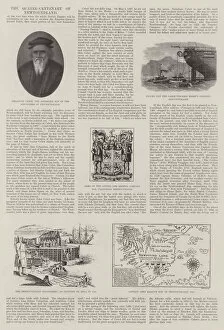
Background imageAmericas Collection: The Quater-Centenary of Newfoundland (engraving)

The Quater-Centenary of Newfoundland (engraving)
1597540 The Quater-Centenary of Newfoundland (engraving) by English School, (19th century); Private Collection; (add.info.: The Quater-Centenary of Newfoundland)

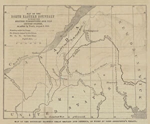
Background imageAmericas Collection: Map of the Boundary between Great Britain and America, as fixed by Lord Ashburtons Treaty

Map of the Boundary between Great Britain and America, as fixed by Lord Ashburtons Treaty (engraving)
1587010 Map of the Boundary between Great Britain and America, as fixed by Lord Ashburtons Treaty (engraving) by English School

Background imageAmericas Collection: The Spanish-American War, Map illustrating the Relative Positions of the Two Countries (engraving)

The Spanish-American War, Map illustrating the Relative Positions of the Two Countries (engraving)
1615519 The Spanish-American War, Map illustrating the Relative Positions of the Two Countries (engraving) by English School, (19th century); Private Collection; (add.info.: The Spanish-American War)

Background imageAmericas Collection: Map illustrating General Shermans March through Georgia from Atlanta to Savannah

Map illustrating General Shermans March through Georgia from Atlanta to Savannah
1610097 Map illustrating General Shermans March through Georgia from Atlanta to Savannah, November and December 1864 (engraving) by Dower

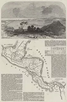
Background imageAmericas Collection: The Union of the Pacific and the Atlantic (engraving)

The Union of the Pacific and the Atlantic (engraving)
1607290 The Union of the Pacific and the Atlantic (engraving) by English School, (19th century); Private Collection; (add.info.: The Union of the Pacific and the Atlantic)

Background imageAmericas Collection: Map of Athens and its Vicinity; The Acropolis (colour litho)

Map of Athens and its Vicinity; The Acropolis (colour litho)
971149 Map of Athens and its Vicinity; The Acropolis (colour litho) by American School, (19th century) (after); Private Collection; (add.info.: Map of Athens and its Vicinity; The Acropolis)

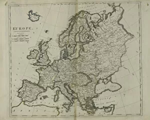
Background imageAmericas Collection: Europe, 1814 (litho)

Europe, 1814 (litho)
955444 Europe, 1814 (litho) by Bower, John (fl.1810-19); New York Public Library, USA; (add.info.: Published by Mathew Carey (1760-1839)); American, out of copyright

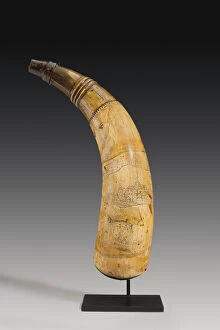
Background imageAmericas Collection: Powder horn, engraved with a map of the St. Lawrence River in the area of Quebec, c

Powder horn, engraved with a map of the St. Lawrence River in the area of Quebec, c
997377 Powder horn, engraved with a map of the St. Lawrence River in the area of Quebec, c.1759 (horn) (see also 997378-80) by Canadian School

Background imageAmericas Collection: Map of the Races and Civilizations of America (colour litho)

Map of the Races and Civilizations of America (colour litho)
3649829 Map of the Races and Civilizations of America (colour litho) by European School, (19th century); Private Collection; (add.info.: Map of the Races and Civilizations of America)

Background imageAmericas Collection: Gold, mining countries (colour litho)

Gold, mining countries (colour litho)
3648659 Gold, mining countries (colour litho) by English School, (20th century); Private Collection; (add.info.: Gold, mining countries)

Background imageAmericas Collection: Mexico or New Spain containing New Mexico, California with a portion of adjacent countries

Mexico or New Spain containing New Mexico, California with a portion of adjacent countries
3658102 Mexico or New Spain containing New Mexico, California with a portion of adjacent countries, from Tome IV of the " New Atlas", engraved by G

Background imageAmericas Collection: Australia (chromolitho)

Australia (chromolitho)
3656913 Australia (chromolitho) by American School, (19th century); Private Collection; (add.info.: Australia. Illustration for trade card)

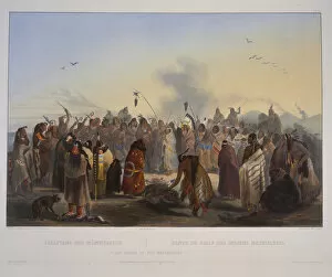
Background imageAmericas Collection: Scalp Dance of the Minatarres

Scalp Dance of the Minatarres
3673661 Scalp Dance of the Minatarres by Bodmer, Karl (1809-93); Newberry Library, Chicago, Illinois, USA; (add.info.: Travels in the interior of North America / by Maximilian)

Background imageAmericas Collection: Idols of the Mandan Indians

Idols of the Mandan Indians
3673655 Idols of the Mandan Indians by Bodmer, Karl (1809-93); Newberry Library, Chicago, Illinois, USA; (add.info.: Travels in the interior of North America / by Maximilian)

Background imageAmericas Collection: Indian Utensils and arms

Indian Utensils and arms
3673641 Indian Utensils and arms by Bodmer, Karl (1809-93); Newberry Library, Chicago, Illinois, USA; (add.info.: Travels in the interior of North America / by Maximilian)

Background imageAmericas Collection: Bison Dance of the Mandan Indians in front of their medicine lodge

Bison Dance of the Mandan Indians in front of their medicine lodge
3673634 Bison Dance of the Mandan Indians in front of their medicine lodge. by Bodmer, Karl (1809-93); Newberry Library, Chicago, Illinois

Background imageAmericas Collection: Mih-Tutta-Hangkusch. A Mandan village

Mih-Tutta-Hangkusch. A Mandan village
3673626 Mih-Tutta-Hangkusch. A Mandan village by Bodmer, Karl (1809-93); Newberry Library, Chicago, Illinois, USA; (add.info.: Travels in the interior of North America / by Maximilian)

Background imageAmericas Collection: Wahk-ta-Ge-Li. A Sioux Warrior

Wahk-ta-Ge-Li. A Sioux Warrior
3673601 Wahk-ta-Ge-Li. A Sioux Warrior by Bodmer, Karl (1809-93); Newberry Library, Chicago, Illinois, USA; (add.info.: Travels in the interior of North America / by Maximilian)

Background imageAmericas Collection: Mouth of Fox River (Indiana)

Mouth of Fox River (Indiana)
3673594 Mouth of Fox River (Indiana) by Bodmer, Karl (1809-93); Newberry Library, Chicago, Illinois, USA; (add.info.: Travels in the interior of North America / by Maximilian)

Background imageAmericas Collection: The Steamer Yellowstone

The Steamer Yellowstone
3673590 The Steamer Yellowstone by Bodmer, Karl (1809-93); Newberry Library, Chicago, Illinois, USA; (add.info.: Travels in the interior of North America / by Maximilian)

Background imageAmericas Collection: New Harmony on the Wabash

New Harmony on the Wabash
3673588 New Harmony on the Wabash by Bodmer, Karl (1809-93); Newberry Library, Chicago, Illinois, USA; (add.info.: Travels in the interior of North America / by Maximilian)

Background imageAmericas Collection: The City of New York (detail), 1883 (colour lithograph)

The City of New York (detail), 1883 (colour lithograph)
3710005 The City of New York (detail), 1883 (colour lithograph) by Currier, N. (1813-88) and Ives, J.M. (1824-95); Private Collection; (add.info)

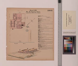
Background imageAmericas Collection: Record Mill, Elkton, Maryland, Hexamer General Surveys, 1884 (colour litho)

Record Mill, Elkton, Maryland, Hexamer General Surveys, 1884 (colour litho)
3077396 Record Mill, Elkton, Maryland, Hexamer General Surveys, 1884 (colour litho) by Hexamer, Ernest (1827-1912); Free Library of Philadelphia; eFree Library of Philadelphia; American

Background imageAmericas Collection: Schlosser Tannery, England and Bryan Tannery Station, Maryland, Hexamer General Surveys

Schlosser Tannery, England and Bryan Tannery Station, Maryland, Hexamer General Surveys
3077392 Schlosser Tannery, England and Bryan Tannery Station, Maryland, Hexamer General Surveys, 1880 (colour litho) by Hexamer

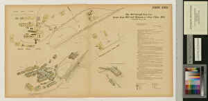
Background imageAmericas Collection: North East Mill and Shannon or Stone Chase Mill, Maryland, Hexamer General Surveys

North East Mill and Shannon or Stone Chase Mill, Maryland, Hexamer General Surveys
3077387 North East Mill and Shannon or Stone Chase Mill, Maryland, Hexamer General Surveys, 1880 (colour litho) by Hexamer

Background imageAmericas Collection: Marley Mill, Little Elkton Creek, Maryland, Hexamer General Surveys, 1867 (colour litho)

Marley Mill, Little Elkton Creek, Maryland, Hexamer General Surveys, 1867 (colour litho)
3077384 Marley Mill, Little Elkton Creek, Maryland, Hexamer General Surveys, 1867 (colour litho) by Hexamer, Ernest (1827-1912); Free Library of Philadelphia; (add.info.: Hexamer General Surveys)

Background imageAmericas Collection: Map of Florida and Cuba by Jacques Le Moyne, 1591 (engraving)

Map of Florida and Cuba by Jacques Le Moyne, 1591 (engraving)
3036188 Map of Florida and Cuba by Jacques Le Moyne, 1591 (engraving) by Le Moyne, Jacques (de Morgues) (1533-88); (add.info.: Map of Florida and Cuba by Jacques Le Moyne (French, c)

Background imageAmericas Collection: Tourist Map of Florida, 1956 (screen print)

Tourist Map of Florida, 1956 (screen print)
3034761 Tourist Map of Florida, 1956 (screen print) by American School, (20th century); (add.info.: Vintage tourist map of Florida; screen print, 1956.); Photo eGraphicaArtis; American

Background imageAmericas Collection: The Boxer Rebellion: a meeting of Allied commanders in Beijing (colour litho)

The Boxer Rebellion: a meeting of Allied commanders in Beijing (colour litho)
3099174 The Boxer Rebellion: a meeting of Allied commanders in Beijing (colour litho) by Meaulle, Fortune Louis (1844-1901); Private Collection; (add.info.: The Boxer Rebellion)

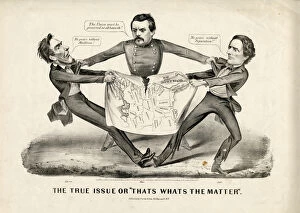
Background imageAmericas Collection: The True Issue or 'Thats Whats the Matter', 1864 (litho)

The True Issue or "Thats Whats the Matter", 1864 (litho)
1078607 The True Issue or " Thats Whats the Matter", 1864 (litho) by Currier, N. (1813-88) and Ives, J.M. (1824-95); Collection of the New-York Historical Society

Background imageAmericas Collection: Map showing the high and low water mark and the original city grants of land under water

Map showing the high and low water mark and the original city grants of land under water
1079256 Map showing the high and low water mark and the original city grants of land under water made to various parties from 1686 to 1873, extending from Battery to Fifty-first Street

Background imageAmericas Collection: Bridgmans new map of the City of New York divided in boroughs with its environs

Bridgmans new map of the City of New York divided in boroughs with its environs
1079246 Bridgmans new map of the City of New York divided in boroughs with its environs, 1898 (black and colour ink on paper, backed with cloth) by American School

Background imageAmericas Collection: Map of the City of New York: prepared expressely for Smith Brother s

Map of the City of New York: prepared expressely for Smith Brother s
1079244 Map of the City of New York: prepared expressely for Smith BrotherA s, one price clothing warehouse... / prepared by J.H. Colton & Co

Background imageAmericas Collection: Map of Kings County, New York, 1879, 1879 (black ink on paper, backed with cloth)

Map of Kings County, New York, 1879, 1879 (black ink on paper, backed with cloth)
1079239 Map of Kings County, New York, 1879, 1879 (black ink on paper, backed with cloth) by American School, (19th century); 74x55 cm; Collection of the New-York Historical Society

Background imageAmericas Collection: Map of the City of New York, for 'New York as it is in 1834'

Map of the City of New York, for "New York as it is in 1834"
1079220 Map of the City of New York, for " New York as it is in 1834", 1834 (coloured engraving) by Burr, David (fl.1835); 30x25 cm; Collection of the New-York Historical Society

Background imageAmericas Collection: Novi Belgii, 1651 (colour litho)

Novi Belgii, 1651 (colour litho)
1079217 Novi Belgii, 1651 (colour litho) by Visscher, Cornelis (c.1629-58); Collection of the New-York Historical Society, USA; eNew York Historical Society; Dutch, out of copyright

Background imageAmericas Collection: Plan of the Bombardment of Valparaiso (engraving)

Plan of the Bombardment of Valparaiso (engraving)
1099175 Plan of the Bombardment of Valparaiso (engraving) by English School, (19th century); Private Collection; (add.info.: Plan of the Bombardment of Valparaiso)

Background imageAmericas Collection: Map illustrating General Lees Advance into Pennsylvania (engraving)

Map illustrating General Lees Advance into Pennsylvania (engraving)
1102652 Map illustrating General Lees Advance into Pennsylvania (engraving) by Dower, John (fl.c.1845-55); Private Collection; (add.info.: Map illustrating General Lees Advance into Pennsylvania)

Background imageAmericas Collection: Map of the City of New York, 1850 (black ink, with colour wash, on paper)

Map of the City of New York, 1850 (black ink, with colour wash, on paper)
1079278 Map of the City of New York, 1850 (black ink, with colour wash, on paper) by American School, (19th century); 39x49 cm; Collection of the New-York Historical Society

Background imageAmericas Collection: Map of the new Croton Aqueduct, old aqueduct and Bronx River pipeline also the watersheds

Map of the new Croton Aqueduct, old aqueduct and Bronx River pipeline also the watersheds
1079267 Map of the new Croton Aqueduct, old aqueduct and Bronx River pipeline also the watersheds of the Croton, Bronx, 1906 (black and colour ink on paper) by American School

Background imageAmericas Collection: Map of New York Island with the adjacent rocks and other remarkable parts of Hell-Gate

Map of New York Island with the adjacent rocks and other remarkable parts of Hell-Gate
1079262 Map of New York Island with the adjacent rocks and other remarkable parts of Hell-Gate. 1778 (black ink on paper) by American School

Background imageAmericas Collection: A map of Manhattanville Situated on York Island / surveyed

A map of Manhattanville Situated on York Island / surveyed
1079250 A map of Manhattanville Situated on York Island / surveyed and laid out into lots by Adolphus Loss; copied R.J. Dodge


All Professionally Made to Order for Quick Shipping


-

Americas Collection

"Americas " refers to a collection of maps and charts that depict the geography, topography, climate, demographics, and other aspects of North America, Central America, South America, and the Caribbean. These maps and charts are used for educational purposes in schools and universities as well as by researchers studying various topics related to the Americas. They provide valuable information about landforms such as mountains, rivers, lakes; political boundaries between countries; population density; natural resources distribution; transportation networks; weather patterns among others. The use of these maps has helped people understand the complex nature of this vast region better.
+

Our beautiful Wall Art and Photo Gifts include Framed Prints, Photo Prints, Poster Prints, Canvas Prints, Jigsaw Puzzles, Metal Prints and so much more

The Americas collection from Media Storehouse is a stunning assortment of wall art and framed prints that showcase the beauty and diversity of North, Central, and South America. Our collection features an extensive range of maps and charts that depict various regions, cities, countries, oceans, mountains, rivers, lakes as well as historical events such as explorations and discoveries. The artwork is available in different sizes to suit any space or decor style. Our collection offers a unique opportunity to explore the rich cultural heritage of the Americas through visually striking images. Whether you are looking for vintage maps or contemporary designs with bold colors or intricate details - our collection has something for everyone. These high-quality prints are perfect for home decoration or office spaces. The Americas collection from Media Storehouse provides an excellent way to appreciate the natural beauty and history of this vast continent while adding a touch of sophistication to your living space.
+

What are Americas (Maps and Charts) art prints?

America's Maps and Charts art prints are a collection of stunningly detailed, high-quality reproductions of historical maps and charts from the United States. These prints showcase the rich history and geography of America, featuring intricate details such as coastlines, rivers, mountains, cities, and landmarks. From antique maps dating back to the 18th century to modern-day topographical charts, this collection offers a wide range of styles and subjects for any decor or interest. Whether you're looking for a vintage map of your hometown or an artistic rendering of the Grand Canyon, there is something for everyone in this extensive collection. Each print is carefully crafted using state-of-the-art printing technology to ensure that every detail is captured with precision and accuracy. They are printed on high-quality paper stock that will last for years to come. America's Maps and Charts art prints make excellent gifts for history buffs or anyone who appreciates fine art. They can be framed or displayed as-is to add a touch of sophistication to any room in your home or office.
+

What Americas (Maps and Charts) art prints can I buy from Media Storehouse?

We offer a wide range of America's maps and charts art prints that you can buy. These include vintage maps, antique charts, historical diagrams, and contemporary cartography designs. You can choose from various sizes and formats such as framed or unframed prints, canvas wraps, or photographic prints. Some of the popular America's maps and charts art prints available at Media Storehouse are the Vintage Map of United States by John Melish (1816), Antique Chart of New York Harbor (1855), Historical Diagram Showing the Growth of American Railroads (1860-1890), Contemporary Map Artwork of Manhattan Island in New York City by Michael Tompsett, among others. Whether you're looking for a unique wall decor for your home or office space or searching for a special gift for someone who loves geography or history, we have plenty to offer when it comes to America's maps and charts art prints.
+

How do I buy Americas (Maps and Charts) art prints?

To buy America's maps and charts art prints from Media Storehouse, you can browse our extensive collection of high-quality images online. Once you have found the artwork that you want to purchase, simply select the size and format that suits your needs. You can choose from a range of options including canvas prints, framed prints, or unframed prints. When making your purchase, be sure to provide accurate shipping information so that your order is delivered promptly and securely. We offer a variety of payment options for your convenience. Whether you are looking for historical maps or contemporary chart art, we have something to suit every taste and budget. Their vast selection of fine art prints ensures that there is always something new to discover in their collection. So if you're looking to add some beautiful map or chart artwork to your home or office decor, look no further than Media Storehouse.
+

How much do Americas (Maps and Charts) art prints cost?

We offer a wide range of America-themed art prints including maps and charts. The cost of our art prints varies depending on the size, material, and framing options chosen by the customer. We provide high-quality paper or canvas options for our customers to choose from. Our America-themed art prints are perfect for those who love history, geography or simply want to add some unique decor to their homes or offices. Our collection includes vintage maps and charts that showcase different regions in America such as New York City, California, Florida among others. We take pride in offering affordable prices without compromising on quality. Our team ensures that every print is produced with precision and care so that you can enjoy it for years to come. If you're looking for beautiful America-themed art prints at reasonable prices then look no further than Media Storehouse.
+

How will my Americas (Maps and Charts) art prints be delivered to me?

We take pride in delivering your Americas art prints with utmost care. We use high-quality packaging materials to ensure that your print arrives in perfect condition. Depending on the size of the print you have ordered, it will be either rolled or flat-packed for delivery. For smaller prints, we use a sturdy cardboard envelope to protect them during transit. Larger prints are carefully wrapped in acid-free tissue paper before being placed inside a strong postal tube. This ensures that they remain safe and secure throughout their journey. We work with trusted courier partners who offer reliable delivery services across the world. Once your order has been dispatched, you will receive an email notification containing tracking information so that you can keep track of its progress. At Media Storehouse, our priority is to deliver your Americas art prints safely and efficiently so that they arrive at your doorstep ready to be enjoyed for years to come.