Fraud Blocker Skip to main content

Home > Maps and Charts > Americas

Americas Collection (page 65)

"Americas " refers to a collection of maps and charts that depict the geography, topography, climate, demographics, and other aspects of North America

3,930 items

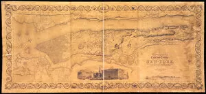
Background imageAmericas Collection: Topographical map of the City and County of New-York, and the adjacent country

Topographical map of the City and County of New-York, and the adjacent country
1079224 Topographical map of the City and County of New-York, and the adjacent country :Awith views in the border of the principal buildings

Background imageAmericas Collection: Commissioner Plan, A Map of the City of New York, by the Commissioners appointed by an

Commissioner Plan, A Map of the City of New York, by the Commissioners appointed by an
1079212 Commissioner Plan, A Map of the City of New York, by the Commissioners appointed by an act of legislature passed April 3, 1807, engraved by P

Background imageAmericas Collection: A Map of the World, 1511 (woodcut, red and black ink)

A Map of the World, 1511 (woodcut, red and black ink)
985939 A Map of the World, 1511 (woodcut, red and black ink) by Italian School, (16th century); 42.5x28.5 cm; Private Collection; (add.info.: A Map of the World)

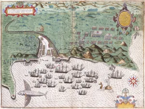
Background imageAmericas Collection: View-Plan of Santiago, Cape Verde Islands, Showing Sir Francis Drake

View-Plan of Santiago, Cape Verde Islands, Showing Sir Francis Drake
985736 View-Plan of Santiago, Cape Verde Islands, Showing Sir Francis Drakes Attack on the Spanish Fort on November 17, 1585, c.1588-9 (hand-coloured engraving) by Boazio

Background imageAmericas Collection: Oregon - Salmon Fisheries (chromolitho)

Oregon - Salmon Fisheries (chromolitho)
961407 Oregon - Salmon Fisheries (chromolitho) by American School, (19th century) (after); Private Collection; (add.info.: Oregon - Salmon Fisheries. Area in square miles 96, 030)

Background imageAmericas Collection: Plan of the Siege of Savannah, 1796. Creator: Charles Balthazar Julien Fé

Plan of the Siege of Savannah, 1796. Creator: Charles Balthazar Julien Fé
Plan of the Siege of Savannah, 1796

Background imageAmericas Collection: Program from the March on Washington, August 28, 1963. Creator: Unknown

Program from the March on Washington, August 28, 1963. Creator: Unknown
The purpose of the 1963 March on Washington for Jobs and Freedom was to advocate for the civil and economic rights of African Americans

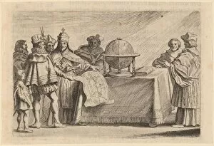
Background imageAmericas Collection: The Partitioning of the Globe between Spain and Portugal, 1634. Creator: Willem Basse

The Partitioning of the Globe between Spain and Portugal, 1634. Creator: Willem Basse
The Partitioning of the Globe between Spain and Portugal, 1634

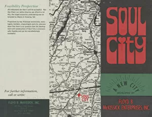
Background imageAmericas Collection: Promotional pamphlet for Soul City, 1971. Creator: Unknown

Promotional pamphlet for Soul City, 1971. Creator: Unknown
The pamphlet is black with red letters and green banner across the bottom. The words [SOUL / CITY] are in red bubble letters. The rest of the cover reads [A NEW CITY/ DEVELOPED BY / FLOYD B

Background imageAmericas Collection: Headquarters Ninth Airforce, England. Officers of one of the Bulldozer battalions

Headquarters Ninth Airforce, England. Officers of one of the Bulldozer battalions of the ninth engineer Command which built the American Energy landing strip on the content pause on one of

Background imageAmericas Collection: Map of the world, laid out in concrete in the grounds of Audley Park school

Map of the world, laid out in concrete in the grounds of Audley Park school, Torquay in 1939. The map is figurative with the Americas on the right

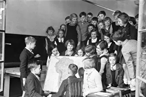
Background imageAmericas Collection: Pupils at the newly opened Latchmere Road School, Kingston Upon Thames seen here having a

Pupils at the newly opened Latchmere Road School, Kingston Upon Thames seen here having a geography lesson, Circa October 1936

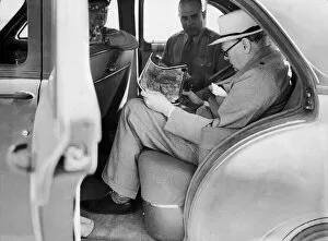
Background imageAmericas Collection: British Prime Minister Winston Churchill with American officers studying aerial

British Prime Minister Winston Churchill with American officers studying aerial surveillance photographs during the Second World War. Circa 1942

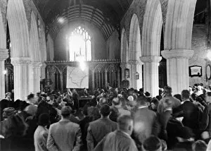
Background imageAmericas Collection: Church meeting before villagers evacuate to allow American army manouvres

Church meeting before villagers evacuate to allow American army manouvres. War Office representative points out the area on a large map on the altar. 14th November 1943

Background imageAmericas Collection: American Eighth Army Air Force crew members of the B17 Flying Fortress looking at a map

American Eighth Army Air Force crew members of the B17 Flying Fortress looking at a map of Germany as they arrive back at their base in England after a raid on Leipzig

Background imageAmericas Collection: Ulysses S. Grant, 1865. Creator: Ole Peter Hansen Balling

Ulysses S. Grant, 1865. Creator: Ole Peter Hansen Balling
Ulysses S. Grant, 1865

Background imageAmericas Collection: Joseph Stalin, 1937. Creator: Samuel Johnson Woolf

Joseph Stalin, 1937. Creator: Samuel Johnson Woolf
Joseph Stalin, 1937

Background imageAmericas Collection: Columbus before the Queen, 1841. Creator: Peter Frederick Rothermel

Columbus before the Queen, 1841. Creator: Peter Frederick Rothermel
Columbus before the Queen, 1841

Background imageAmericas Collection: Eastern Central States of the United States of America Antique Victorian Engraved Colored

Eastern Central States of the United States of America Antique Victorian Engraved Colored
Very Rare, Beautifully Illustrated Antique Victorian Engraved Colored Map of Eastern Central States of the United States of America, Published in 1899. Source: Original edition from my own archives

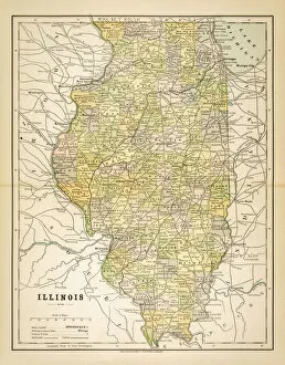
Background imageAmericas Collection: Map of Illinois 1883

Map of Illinois 1883
Map of the state of Illinois

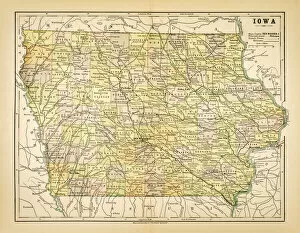
Background imageAmericas Collection: Map of Iowa 1883

Map of Iowa 1883
Map of the state of Iowa

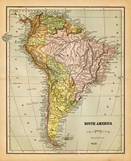
Background imageAmericas Collection: Map of South America 1881

Map of South America 1881
Appletons American Standard Geographies - New York 1881 - d. Appleton and Company

Background imageAmericas Collection: Map of Virginia and West Virginia 1883

Map of Virginia and West Virginia 1883
Map of Virginia and West Virginia

Background imageAmericas Collection: south america 1883

south america 1883
an old south american map (1883)

Background imageAmericas Collection: Map of Burgundy 1881

Map of Burgundy 1881
Appletons American Standard Geographies - New York 1881 - d. Appleton and Company

Background imageAmericas Collection: Map of South America 1868

Map of South America 1868
Guyots The Earth Common School Geography - 1868

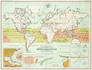
Background imageAmericas Collection: Winds - Map of the world 1861

Winds - Map of the world 1861
Map of the world - Winds over the globe - storms and hurricanes

Background imageAmericas Collection: the world 1877

the world 1877
antique map of the world - 1877

Background imageAmericas Collection: map of the world 1814

map of the world 1814
antique map showing the world with all the latest discovery of 1814

Background imageAmericas Collection: Commercial Map of the World 1881

Commercial Map of the World 1881
Appletons American Standard Geography 1881

Background imageAmericas Collection: map of the world 1867

map of the world 1867
meteorological map of the world 1867 - showing isothermal lines

Background imageAmericas Collection: Map of the world 1861

Map of the world 1861
Map of the world - The distribution of Earthquakes and Volcanoes over the globe

Background imageAmericas Collection: Animals - Map of the world 1861

Animals - Map of the world 1861
Map of the world - The distributions of animals

Background imageAmericas Collection: map of the world 1873

map of the world 1873
antique map of the world - from a french atlas - 1872

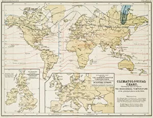
Background imageAmericas Collection: Climate map of the world 1861

Climate map of the world 1861
Map of the world - Climatological Chart

Background imageAmericas Collection: map of the world 1855

map of the world 1855
map of the world illustrating the principal features of the land and the co-tidal lines - 1855

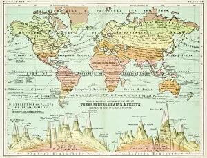
Background imageAmericas Collection: Agricultural Map of the world 1861

Agricultural Map of the world 1861
map of the world showing the distribution of the most important Tress, Shrubs, Grains and Fruits according to zones of climate and moisture plants

Background imageAmericas Collection: USAF - United States Air Force - Boeing B-17G

USAF - United States Air Force - Boeing B-17G
United States Army Air Force - United States Air Force - Boeing B-17G, seen, presumably, at Shaw Field or a satellite field

Background imageAmericas Collection: United States Air Force - North American AT-28D 51-3681

United States Air Force - North American AT-28D 51-3681 (msn 174-219), in storage at the Sacramento Air Materiel Area (SMaR), McClellan AFB, CA

Background imageAmericas Collection: South America, river and mountains map

South America, river and mountains map
Illustrator of a South America, river and mountains map

Background imageAmericas Collection: Antique map: South America

Antique map: South America

Background imageAmericas Collection: Antique map: North America

Antique map: North America

Background imageAmericas Collection: Antique map: South America

Antique map: South America

Background imageAmericas Collection: Antique map: Mexico and Central America

Antique map: Mexico and Central America

Background imageAmericas Collection: Map Massachusetts, Connecticut, Rhode Island 1881

Map Massachusetts, Connecticut, Rhode Island 1881
Appletons American Standard Geography 1881

Background imageAmericas Collection: New York and Vicinity Map 1881

New York and Vicinity Map 1881
Appletons American Standard Geography 1881

Background imageAmericas Collection: Engraved Antique, Physical Map of South America Engraving Antique Illustration

Engraved Antique, Physical Map of South America Engraving Antique Illustration
Physical Map of South America Engraving Antique Illustration, Published 1851. Source: Original edition from my own archives. Copyright has expired on this artwork. Digitally restored

Background imageAmericas Collection: South America map 1898

South America map 1898
Map from Physical Geography by R. S. Tarr - The MacMillan Company - London 1898


All Professionally Made to Order for Quick Shipping


-

Americas Collection

"Americas " refers to a collection of maps and charts that depict the geography, topography, climate, demographics, and other aspects of North America, Central America, South America, and the Caribbean. These maps and charts are used for educational purposes in schools and universities as well as by researchers studying various topics related to the Americas. They provide valuable information about landforms such as mountains, rivers, lakes; political boundaries between countries; population density; natural resources distribution; transportation networks; weather patterns among others. The use of these maps has helped people understand the complex nature of this vast region better.
+

Our beautiful Wall Art and Photo Gifts include Framed Prints, Photo Prints, Poster Prints, Canvas Prints, Jigsaw Puzzles, Metal Prints and so much more

The Americas collection from Media Storehouse is a stunning assortment of wall art and framed prints that showcase the beauty and diversity of North, Central, and South America. Our collection features an extensive range of maps and charts that depict various regions, cities, countries, oceans, mountains, rivers, lakes as well as historical events such as explorations and discoveries. The artwork is available in different sizes to suit any space or decor style. Our collection offers a unique opportunity to explore the rich cultural heritage of the Americas through visually striking images. Whether you are looking for vintage maps or contemporary designs with bold colors or intricate details - our collection has something for everyone. These high-quality prints are perfect for home decoration or office spaces. The Americas collection from Media Storehouse provides an excellent way to appreciate the natural beauty and history of this vast continent while adding a touch of sophistication to your living space.
+

What are Americas (Maps and Charts) art prints?

America's Maps and Charts art prints are a collection of stunningly detailed, high-quality reproductions of historical maps and charts from the United States. These prints showcase the rich history and geography of America, featuring intricate details such as coastlines, rivers, mountains, cities, and landmarks. From antique maps dating back to the 18th century to modern-day topographical charts, this collection offers a wide range of styles and subjects for any decor or interest. Whether you're looking for a vintage map of your hometown or an artistic rendering of the Grand Canyon, there is something for everyone in this extensive collection. Each print is carefully crafted using state-of-the-art printing technology to ensure that every detail is captured with precision and accuracy. They are printed on high-quality paper stock that will last for years to come. America's Maps and Charts art prints make excellent gifts for history buffs or anyone who appreciates fine art. They can be framed or displayed as-is to add a touch of sophistication to any room in your home or office.
+

What Americas (Maps and Charts) art prints can I buy from Media Storehouse?

We offer a wide range of America's maps and charts art prints that you can buy. These include vintage maps, antique charts, historical diagrams, and contemporary cartography designs. You can choose from various sizes and formats such as framed or unframed prints, canvas wraps, or photographic prints. Some of the popular America's maps and charts art prints available at Media Storehouse are the Vintage Map of United States by John Melish (1816), Antique Chart of New York Harbor (1855), Historical Diagram Showing the Growth of American Railroads (1860-1890), Contemporary Map Artwork of Manhattan Island in New York City by Michael Tompsett, among others. Whether you're looking for a unique wall decor for your home or office space or searching for a special gift for someone who loves geography or history, we have plenty to offer when it comes to America's maps and charts art prints.
+

How do I buy Americas (Maps and Charts) art prints?

To buy America's maps and charts art prints from Media Storehouse, you can browse our extensive collection of high-quality images online. Once you have found the artwork that you want to purchase, simply select the size and format that suits your needs. You can choose from a range of options including canvas prints, framed prints, or unframed prints. When making your purchase, be sure to provide accurate shipping information so that your order is delivered promptly and securely. We offer a variety of payment options for your convenience. Whether you are looking for historical maps or contemporary chart art, we have something to suit every taste and budget. Their vast selection of fine art prints ensures that there is always something new to discover in their collection. So if you're looking to add some beautiful map or chart artwork to your home or office decor, look no further than Media Storehouse.
+

How much do Americas (Maps and Charts) art prints cost?

We offer a wide range of America-themed art prints including maps and charts. The cost of our art prints varies depending on the size, material, and framing options chosen by the customer. We provide high-quality paper or canvas options for our customers to choose from. Our America-themed art prints are perfect for those who love history, geography or simply want to add some unique decor to their homes or offices. Our collection includes vintage maps and charts that showcase different regions in America such as New York City, California, Florida among others. We take pride in offering affordable prices without compromising on quality. Our team ensures that every print is produced with precision and care so that you can enjoy it for years to come. If you're looking for beautiful America-themed art prints at reasonable prices then look no further than Media Storehouse.
+

How will my Americas (Maps and Charts) art prints be delivered to me?

We take pride in delivering your Americas art prints with utmost care. We use high-quality packaging materials to ensure that your print arrives in perfect condition. Depending on the size of the print you have ordered, it will be either rolled or flat-packed for delivery. For smaller prints, we use a sturdy cardboard envelope to protect them during transit. Larger prints are carefully wrapped in acid-free tissue paper before being placed inside a strong postal tube. This ensures that they remain safe and secure throughout their journey. We work with trusted courier partners who offer reliable delivery services across the world. Once your order has been dispatched, you will receive an email notification containing tracking information so that you can keep track of its progress. At Media Storehouse, our priority is to deliver your Americas art prints safely and efficiently so that they arrive at your doorstep ready to be enjoyed for years to come.