Fraud Blocker Skip to main content

Home > Maps and Charts > Americas

Americas Collection (page 8)

"Americas " refers to a collection of maps and charts that depict the geography, topography, climate, demographics, and other aspects of North America

7,012 items

Background imageAmericas Collection: Geography: Map of Saint Kitts and Nevis Island in the West Indies

Geography: Map of Saint Kitts and Nevis Island in the West Indies. Map from an Atlas by Bryan Edwards (1743-1800)
VEN5031320 Geography: Map of Saint Kitts and Nevis Island in the West Indies. Map from an Atlas by Bryan Edwards (1743-1800) from 1791

Background imageAmericas Collection: Geography: map showing the Gulf of Mexico, the Caribbean Islands, Central America (Mexico)

Geography: map showing the Gulf of Mexico, the Caribbean Islands, Central America (Mexico, Yucatan, Salvador, Honduras)
VEN5031242 Geography: map showing the Gulf of Mexico, the Caribbean Islands, Central America (Mexico, Yucatan, Salvador, Honduras, Nicaragua, Costarica) and northern South America (Venezuela)

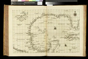
Background imageAmericas Collection: Geography map: representation of the Bay of Mexico, South Florida

Geography map: representation of the Bay of Mexico, South Florida and Yucatan in North America from an Atlas made by
VEN5030467 Geography map: representation of the Bay of Mexico, South Florida and Yucatan in North America from an Atlas made by the Italian cartographer Antonio Francesco Lucini (born 1605)

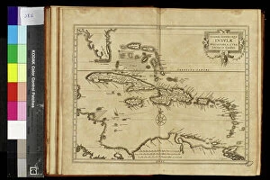
Background imageAmericas Collection: Geography map: representation of the islands of the Greater Antilles (Cuba, Hispaniola)

Geography map: representation of the islands of the Greater Antilles (Cuba, Hispaniola)
VEN5030434 Geography map: representation of the islands of the Greater Antilles (Cuba, Hispaniola, Jamaica and Puerto Rico) and the Lesser Antilles in the Caribbean Sea

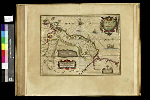
Background imageAmericas Collection: Geography map: representation of Guyana in the Amazon in South America from an Atlas made by

Geography map: representation of Guyana in the Amazon in South America from an Atlas made by cartographer Willem
VEN5030358 Geography map: representation of Guyana in the Amazon in South America from an Atlas made by cartographer Willem Janszoon Blaeu (1571-1638), approximately 1630

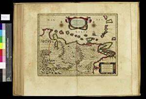
Background imageAmericas Collection: Geography map: representation of Venezuela in South America from an Atlas made by cartographer

Geography map: representation of Venezuela in South America from an Atlas made by cartographer Willem Janszoon Blaeu
VEN5030346 Geography map: representation of Venezuela in South America from an Atlas made by cartographer Willem Janszoon Blaeu (1571-1638), approximately 1630 Biblioteca Angelica

Background imageAmericas Collection: Geography map: representation of the region of Virginia where the Powhatans Indians lived in North

Geography map: representation of the region of Virginia where the Powhatans Indians lived in North America from an
VEN5030339 Geography map: representation of the region of Virginia where the Powhatans Indians lived in North America from an Atlas from the melted workshops by the cartographer Willem Janszoon Blaeu

Background imageAmericas Collection: Geography map: representation of the North of South America including the New Kingdom of Granada

Geography map: representation of the North of South America including the New Kingdom of Granada
VEN5030325 Geography map: representation of the North of South America including the New Kingdom of Granada (corresponding to present-day Colombia, Guatemala)

Background imageAmericas Collection: Geography map: view of the bay of C (Sao Salvador da Bahia de Todos os Santos)

Geography map: view of the bay of C (Sao Salvador da Bahia de Todos os Santos)
VEN5030306 Geography map: view of the bay of C (Sao Salvador da Bahia de Todos os Santos) from an Atlas (probably by Willem Janszoon Blaeu, 1571-1638) 17th century, Biblioteca Angelica

Background imageAmericas Collection: Geography map: world map representing the southern hemisphere and the boreal hemisphere

Geography map: world map representing the southern hemisphere and the boreal hemisphere. 17th or 18th century
VEN5030300 Geography map: world map representing the southern hemisphere and the boreal hemisphere. 17th or 18th century. Biblioteca Angelica

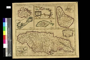
Background imageAmericas Collection: Geography map: representation of the main British islands of the Caribbean Sea (Antigua, Barbados)

Geography map: representation of the main British islands of the Caribbean Sea (Antigua, Barbados, Jamaican, Bermuda)
VEN5030269 Geography map: representation of the main British islands of the Caribbean Sea (Antigua, Barbados, Jamaican, Bermuda, St. Christopher Island or St)

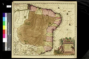
Background imageAmericas Collection: Geography map: representation of Brazil, made by Dutch cartographer Johannes Blaeu (1598-1673)

Geography map: representation of Brazil, made by Dutch cartographer Johannes Blaeu (1598-1673), 17th century
VEN5030254 Geography map: representation of Brazil, made by Dutch cartographer Johannes Blaeu (1598-1673), 17th century. Biblioteca Angelica

Background imageAmericas Collection: Geography map: representation of the northern part of South America (Brazil, Venezuela)

Geography map: representation of the northern part of South America (Brazil, Venezuela)
VEN5030250 Geography map: representation of the northern part of South America (Brazil, Venezuela, Peru) from the Atlas " Amerique meridionale" by French cartographer Jean-Baptiste

Background imageAmericas Collection: Geography map: representation of Cartagena Bay (Cartagena) in Colombia

Geography map: representation of Cartagena Bay (Cartagena) in Colombia, made by Dutch cartographer Gerard van Keulen
VEN5030220 Geography map: representation of Cartagena Bay (Cartagena) in Colombia, made by Dutch cartographer Gerard van Keulen (1678-1726) 1709-1713

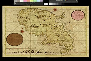
Background imageAmericas Collection: Geography map: representation of the island of Martinique in the small Antilles

Geography map: representation of the island of Martinique in the small Antilles
VEN5030213 Geography map: representation of the island of Martinique in the small Antilles, made by Dutch cartographer Gerard van Keulen (1678-1726) 1709-1713

Background imageAmericas Collection: Geography map: representation of part of the archipelago of the small Antilles

Geography map: representation of part of the archipelago of the small Antilles (island of Saint Lucia, Martinique)
VEN5030211 Geography map: representation of part of the archipelago of the small Antilles (island of Saint Lucia, Martinique, Dominica, Ile des Saintes, Guadeloupe, Montserrat, Antigua, Barbuda)

Background imageAmericas Collection: Geography map: representation of the coasts of Surinam (Suriname) in South America

Geography map: representation of the coasts of Surinam (Suriname) in South America
VEN5030152 Geography map: representation of the coasts of Surinam (Suriname) in South America, made by Dutch cartographer Gerard van Keulen (1678-1726) 1709-1713

Background imageAmericas Collection: Geography map: representation of the Orenoque River in Venezuela, the Gulf of Paria

Geography map: representation of the Orenoque River in Venezuela, the Gulf of Paria, the islands of Tobago
VEN5030093 Geography map: representation of the Orenoque River in Venezuela, the Gulf of Paria, the islands of Tobago, Trinidad (Trinidad)

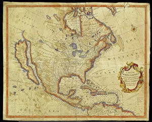
Background imageAmericas Collection: Geography Atlas: representation of North America and the Caribbean Sea region, Caribbean (Cuba)

Geography Atlas: representation of North America and the Caribbean Sea region, Caribbean (Cuba, Jamaica, Hispaniola)
VEN5030056 Geography Atlas: representation of North America and the Caribbean Sea region, Caribbean (Cuba, Jamaica, Hispaniola, Jamaica). Map from an Atlas of 1785

Background imageAmericas Collection: Geography Atlas: representation of South America and the Caribbean Sea region, Caribbean (Cuba)

Geography Atlas: representation of South America and the Caribbean Sea region, Caribbean (Cuba, Jamaica, Hispaniola)
VEN5030051 Geography Atlas: representation of South America and the Caribbean Sea region, Caribbean (Cuba, Jamaica, Hispaniola)

Background imageAmericas Collection: Geography Atlas: representation of the island of Jamaica in the Caribbean archipelago

Geography Atlas: representation of the island of Jamaica in the Caribbean archipelago
VEN5029993 Geography Atlas: representation of the island of Jamaica in the Caribbean archipelago. Map taken from "The west indian atlas or general description of west indies" by Thomas

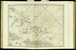
Background imageAmericas Collection: Geography Atlas: representation of the Bahamas islands, northern Hispaniola (Santo Domingo)

Geography Atlas: representation of the Bahamas islands, northern Hispaniola (Santo Domingo)
VEN5029631 Geography Atlas: representation of the Bahamas islands, northern Hispaniola (Santo Domingo) and the Leewind Passage between Cuba and Hispaniola in the West Indies

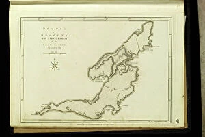
Background imageAmericas Collection: Geography Atlas: representation of the Bequia or Becouya Islands in the North of the Grenadines in

Geography Atlas: representation of the Bequia or Becouya Islands in the North of the Grenadines in the Caribbean Sea
VEN5029628 Geography Atlas: representation of the Bequia or Becouya Islands in the North of the Grenadines in the Caribbean Sea

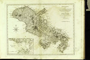
Background imageAmericas Collection: Geography Atlas: representation of the island of Martinique in the West Indies

Geography Atlas: representation of the island of Martinique in the West Indies
VEN5029597 Geography Atlas: representation of the island of Martinique in the West Indies. Map taken from "The west indian atlas or general description of west indies" by Thomas Jefferys

Background imageAmericas Collection: Map of New France and Canada, 1597. 19th century coloring engraving

Map of New France and Canada, 1597. 19th century coloring engraving
NWI4851909 Map of New France and Canada, 1597. 19th century coloring engraving.; (add.info.: Map of New France and Canada, 1597. 19th century coloring engraving.); Photo © North Wind Pictures

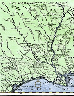
Background imageAmericas Collection: The western itinerary of the expedition to Louisiana (United States)

The western itinerary of the expedition to Louisiana (United States) of 1539 by Hernando De Soto (1500-1542)
NWI4852599 The western itinerary of the expedition to Louisiana (United States) of 1539 by Hernando De Soto (1500-1542, Spanish conquistador), based on the map of Guillaume Delisle (1675-1726)

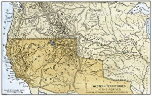
Background imageAmericas Collection: Map of the western territories of North America, showing the borders between Mexico

Map of the western territories of North America, showing the borders between Mexico and the United States
NWI4853139 Map of the western territories of North America, showing the borders between Mexico and the United States, in the 1840s

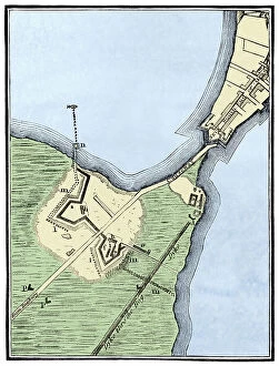
Background imageAmericas Collection: Map of British Fortifications in Boston (Massachusetts, USA) 1775-1776

Map of British Fortifications in Boston (Massachusetts, USA) 1775-1776. (War of Independence of the United States)
NWI4843691 Map of British Fortifications in Boston (Massachusetts, USA) 1775-1776. (War of Independence of the United States, 1776-1783)

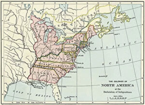
Background imageAmericas Collection: War of Independence of the United States of America (1775-1783)

War of Independence of the United States of America (1775-1783): English colony of North America in 1776
NWI4842561 War of Independence of the United States of America (1775-1783): English colony of North America in 1776. Color lithography.; (add.info)

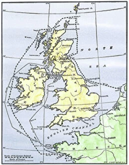
Background imageAmericas Collection: United States of America Independence War (1775-1783): Route of American ships 'Ranger'

United States of America Independence War (1775-1783): Route of American ships "Ranger"
NWI4842352 United States of America Independence War (1775-1783): Route of American ships "Ranger" and "Bonhomme Richard" near the British islands during the war

Background imageAmericas Collection: Map of the Isthmus of Panama (Republic of Panama), from the general history of voyages, 1754

Map of the Isthmus of Panama (Republic of Panama), from the general history of voyages, 1754
NWI4846857 Map of the Isthmus of Panama (Republic of Panama), from the general history of voyages, 1754, by Antoine Francois Prevost, dit d'Exiles (1697-1763) or Abbe Prevost - Colorisee engraving

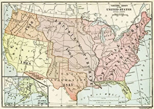
Background imageAmericas Collection: Map showing the growth of the United States territories from 1783-1867

Map showing the growth of the United States territories from 1783-1867. Colouring engraving of the 19th century
NWI4846482 Map showing the growth of the United States territories from 1783-1867. Colouring engraving of the 19th century.; (add.info)

Background imageAmericas Collection: Christopher Columbus studies a map in his office in Spain, 15th century

Christopher Columbus studies a map in his office in Spain, 15th century. Colouring engraving of the 19th century
NWI4846345 Christopher Columbus studies a map in his office in Spain, 15th century. Colouring engraving of the 19th century.; (add.info.: Christopher Columbus (Cristoforo Colombo)

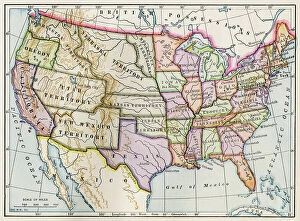
Background imageAmericas Collection: Map of the United States of America in 1860: description of territories at the beginning of

Map of the United States of America in 1860: description of territories at the beginning of the Civil War or Secession
NWI4846231 Map of the United States of America in 1860: description of territories at the beginning of the Civil War or Secession War (1861-1865)

Background imageAmericas Collection: Description of the eastern part of the itinerary of Hernando De Soto (1500-1542)

Description of the eastern part of the itinerary of Hernando De Soto (1500-1542)
NWI4850452 Description of the eastern part of the itinerary of Hernando De Soto (1500-1542, Spanish conquistador and explorer) through the south east of North America, illustration 1593

Background imageAmericas Collection: The still Indian village of Hochelaga, site of Montreal, Canada

The still Indian village of Hochelaga, site of Montreal, Canada. Map of Marc Lescarbot (1570-1641), 1609
NWI4850311 The still Indian village of Hochelaga, site of Montreal, Canada. Map of Marc Lescarbot (1570-1641), 1609. Colouring engraving of the 19th century.; (add.info)

Background imageAmericas Collection: Map of Arctic trips by Henry Hudson, English explorer (1570-1611) published in 1612 in ' Voyages'

Map of Arctic trips by Henry Hudson, English explorer (1570-1611) published in 1612 in " Voyages"
NWI4849415 Map of Arctic trips by Henry Hudson, English explorer (1570-1611) published in 1612 in " Voyages". Colouring engraving of the 19th century.; (add.info)

Background imageAmericas Collection: Geographic map: Route of Zebulon Montgomery Pike, American explorer (1779-1813)

Geographic map: Route of Zebulon Montgomery Pike, American explorer (1779-1813)
NWI4848376 Geographic map: Route of Zebulon Montgomery Pike, American explorer (1779-1813) through the western territories to explore the region of Colorado (1805-1806)

Background imageAmericas Collection: Geographic map of the new world made by a geographer in 1540

Geographic map of the new world made by a geographer in 1540. Colouring engraving of the 19th century
NWI4848357 Geographic map of the new world made by a geographer in 1540. Colouring engraving of the 19th century.; (add.info.: Geographic map of the new world made by a geographer in 1540)

Background imageAmericas Collection: Geographic map showing the sites of occupation (Vinland) of Viking explorers in the Cape Code

Geographic map showing the sites of occupation (Vinland) of Viking explorers in the Cape Code (Massachusetts)
NWI4847828 Geographic map showing the sites of occupation (Vinland) of Viking explorers in the Cape Code (Massachusetts, U.S.A.) in the 10th-11th century, as described by Charles Rafn in 1829

Background imageAmericas Collection: American Civil War, 1861-1865: Map showing the territories occupied by the State of Confederates

American Civil War, 1861-1865: Map showing the territories occupied by the State of Confederates in the late 1861
NWI4830140 American Civil War, 1861-1865: Map showing the territories occupied by the State of Confederates in the late 1861 years

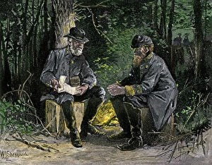
Background imageAmericas Collection: The American Secession War or American Civil War, 1861-1865: Generals of the American Confederate

The American Secession War or American Civil War, 1861-1865: Generals of the American Confederate Confederates Robert
NWI4830126 The American Secession War or American Civil War, 1861-1865: Generals of the American Confederate Confederates Robert E

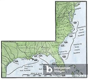
Background imageAmericas Collection: US Civil War, 1861-1865: geographic map showing the blockade of the coastal coasts of

US Civil War, 1861-1865: geographic map showing the blockade of the coastal coasts of the Confederate states
NWI4829891 US Civil War, 1861-1865: geographic map showing the blockade of the coastal coasts of the Confederate states. Colour engraving of the 19th century.; (add.info.: US Civil War)

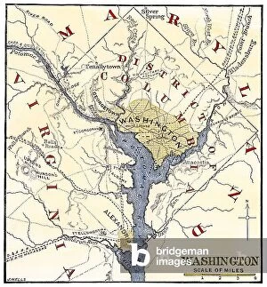
Background imageAmericas Collection: American Civil War, 1861-1865: Map of the vicinity of Washington DC at the end of the war

American Civil War, 1861-1865: Map of the vicinity of Washington DC at the end of the war
NWI4830156 American Civil War, 1861-1865: Map of the vicinity of Washington DC at the end of the war. Colour engraving of the 19th century.; (add.info.: American Civil War)

Background imageAmericas Collection: United States of America Independence War (1775-1783): Map of Benedict Arnold's road (1741-1801)

United States of America Independence War (1775-1783): Map of Benedict Arnold's road (1741-1801)
NWI4840149 United States of America Independence War (1775-1783): Map of Benedict Arnold's road (1741-1801) to invade Quebec in 1775

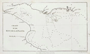
Background imageAmericas Collection: Chart of the Rio de la Plata (river Plate), 1806 (engraving)

Chart of the Rio de la Plata (river Plate), 1806 (engraving)
7342111 Chart of the Rio de la Plata (river Plate), 1806 (engraving) by Arrowsmith (19th century); 14.2x23.1 cm; National Maritime Museum, London

Background imageAmericas Collection: (Wind chart, showing winds for the four quarters of the year) Cape Horn (1)

(Wind chart, showing winds for the four quarters of the year) Cape Horn (1) eastern vicinity (sold by J.D Potter, 31)
7342743 (Wind chart, showing winds for the four quarters of the year) Cape Horn (1) eastern vicinity (sold by J.D Potter, 31, poultry, price one shilling, 1855 (print) by British School

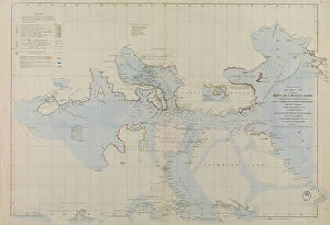
Background imageAmericas Collection: Enlarged plan of Erebus and Terror Bay - The winter quarters of Sir John Franklin

Enlarged plan of Erebus and Terror Bay - The winter quarters of Sir John Franklin, 1851 (technical drawing)
7295644 Enlarged plan of Erebus and Terror Bay - The winter quarters of Sir John Franklin, 1851 (technical drawing) by Arrowsmith, John (1790-1873); 45.5x67.5 cm; National Maritime Museum, London


All Professionally Made to Order for Quick Shipping


-

Americas Collection

"Americas " refers to a collection of maps and charts that depict the geography, topography, climate, demographics, and other aspects of North America, Central America, South America, and the Caribbean. These maps and charts are used for educational purposes in schools and universities as well as by researchers studying various topics related to the Americas. They provide valuable information about landforms such as mountains, rivers, lakes; political boundaries between countries; population density; natural resources distribution; transportation networks; weather patterns among others. The use of these maps has helped people understand the complex nature of this vast region better.
+

Our beautiful pictures are available as Framed Prints, Photos, Wall Art and Photo Gifts

The Americas collection from Media Storehouse is a stunning assortment of wall art and framed prints that showcase the beauty and diversity of North, Central, and South America. Our collection features an extensive range of maps and charts that depict various regions, cities, countries, oceans, mountains, rivers, lakes as well as historical events such as explorations and discoveries. The artwork is available in different sizes to suit any space or decor style. Our collection offers a unique opportunity to explore the rich cultural heritage of the Americas through visually striking images. Whether you are looking for vintage maps or contemporary designs with bold colors or intricate details - our collection has something for everyone. These high-quality prints are perfect for home decoration or office spaces. The Americas collection from Media Storehouse provides an excellent way to appreciate the natural beauty and history of this vast continent while adding a touch of sophistication to your living space.
+

What are Americas (Maps and Charts) art prints?

America's Maps and Charts art prints are a collection of stunningly detailed, high-quality reproductions of historical maps and charts from the United States. These prints showcase the rich history and geography of America, featuring intricate details such as coastlines, rivers, mountains, cities, and landmarks. From antique maps dating back to the 18th century to modern-day topographical charts, this collection offers a wide range of styles and subjects for any decor or interest. Whether you're looking for a vintage map of your hometown or an artistic rendering of the Grand Canyon, there is something for everyone in this extensive collection. Each print is carefully crafted using state-of-the-art printing technology to ensure that every detail is captured with precision and accuracy. They are printed on high-quality paper stock that will last for years to come. America's Maps and Charts art prints make excellent gifts for history buffs or anyone who appreciates fine art. They can be framed or displayed as-is to add a touch of sophistication to any room in your home or office.
+

What Americas (Maps and Charts) art prints can I buy from Media Storehouse?

We offer a wide range of America's maps and charts art prints that you can buy. These include vintage maps, antique charts, historical diagrams, and contemporary cartography designs. You can choose from various sizes and formats such as framed or unframed prints, canvas wraps, or photographic prints. Some of the popular America's maps and charts art prints available at Media Storehouse are the Vintage Map of United States by John Melish (1816), Antique Chart of New York Harbor (1855), Historical Diagram Showing the Growth of American Railroads (1860-1890), Contemporary Map Artwork of Manhattan Island in New York City by Michael Tompsett, among others. Whether you're looking for a unique wall decor for your home or office space or searching for a special gift for someone who loves geography or history, we have plenty to offer when it comes to America's maps and charts art prints.
+

How do I buy Americas (Maps and Charts) art prints?

To buy America's maps and charts art prints from Media Storehouse, you can browse our extensive collection of high-quality images online. Once you have found the artwork that you want to purchase, simply select the size and format that suits your needs. You can choose from a range of options including canvas prints, framed prints, or unframed prints. When making your purchase, be sure to provide accurate shipping information so that your order is delivered promptly and securely. We offer a variety of payment options for your convenience. Whether you are looking for historical maps or contemporary chart art, we have something to suit every taste and budget. Their vast selection of fine art prints ensures that there is always something new to discover in their collection. So if you're looking to add some beautiful map or chart artwork to your home or office decor, look no further than Media Storehouse.
+

How much do Americas (Maps and Charts) art prints cost?

We offer a wide range of America-themed art prints including maps and charts. The cost of our art prints varies depending on the size, material, and framing options chosen by the customer. We provide high-quality paper or canvas options for our customers to choose from. Our America-themed art prints are perfect for those who love history, geography or simply want to add some unique decor to their homes or offices. Our collection includes vintage maps and charts that showcase different regions in America such as New York City, California, Florida among others. We take pride in offering affordable prices without compromising on quality. Our team ensures that every print is produced with precision and care so that you can enjoy it for years to come. If you're looking for beautiful America-themed art prints at reasonable prices then look no further than Media Storehouse.
+

How will my Americas (Maps and Charts) art prints be delivered to me?

We take pride in delivering your Americas art prints with utmost care. We use high-quality packaging materials to ensure that your print arrives in perfect condition. Depending on the size of the print you have ordered, it will be either rolled or flat-packed for delivery. For smaller prints, we use a sturdy cardboard envelope to protect them during transit. Larger prints are carefully wrapped in acid-free tissue paper before being placed inside a strong postal tube. This ensures that they remain safe and secure throughout their journey. We work with trusted courier partners who offer reliable delivery services across the world. Once your order has been dispatched, you will receive an email notification containing tracking information so that you can keep track of its progress. At Media Storehouse, our priority is to deliver your Americas art prints safely and efficiently so that they arrive at your doorstep ready to be enjoyed for years to come.