
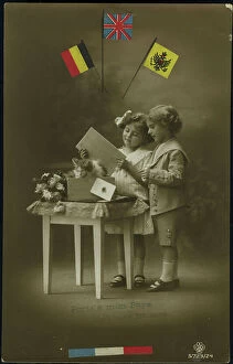
Belgium Collection
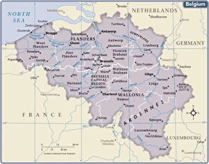
Belgium is a small country located in Western Europe, bordered by France, Germany
Choose a picture from our Belgium Collection for your Wall Art and Photo Gifts
825 items


All Professionally Made to Order for Quick Shipping
-
Belgium Collection
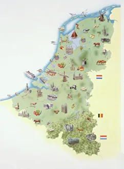
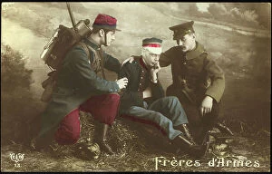
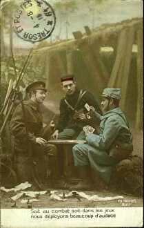
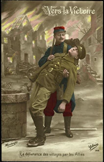
Belgium is a small country located in Western Europe, bordered by France, Germany, Luxembourg and the Netherlands and has a population of approximately 11 million people and covers an area of 30,528 square kilometers. The capital city is Brussels which also serves as the headquarters for the European Union. Belgium is known for its chocolate, beer and waffles but it's also home to several important institutions such as NATO and the European Parliament. Its economy relies heavily on exports with major industries including chemicals, machinery and equipment manufacturing. The country has three official languages: Dutch (Flemish), French and German with each region having its own distinct culture.
+
Our beautiful pictures are available as Framed Prints, Photos, Wall Art and Photo Gifts
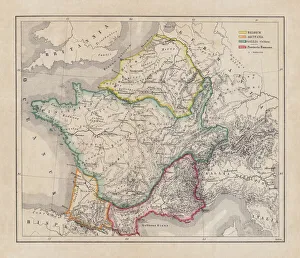
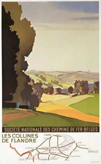
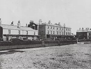
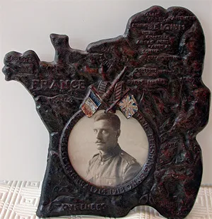
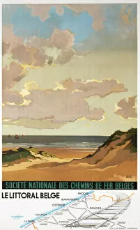
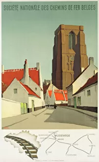
The Belgium collection from Media Storehouse is a stunning array of wall art and framed prints that showcase the beauty, history, and culture of this European country. Our collection features an extensive range of maps and charts that highlight the geography, topography, landmarks, cities, towns, rivers, lakes, forests, mountains and other natural wonders of Belgium. These high-quality prints are perfect for anyone who loves to explore new places or has a fascination with cartography. Our collection also includes vintage posters that depict iconic Belgian landmarks such as the Atomium in Brussels or the medieval city of Bruges. These posters offer a glimpse into the past while capturing the timeless charm of these popular tourist destinations. Whether you're looking to decorate your home or office space with beautiful artwork inspired by Belgium's rich cultural heritage or simply want to add some unique pieces to your art collection - our Belgium collection has something for everyone.
+
What are Belgium (Maps and Charts) art prints?
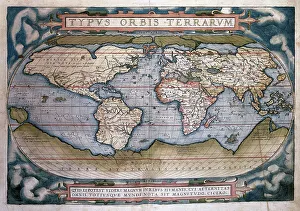
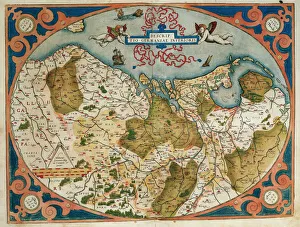
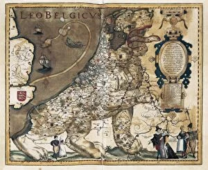
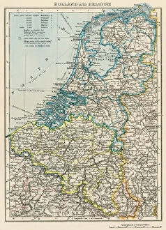
Belgium art prints are a collection of high-quality reproductions of antique maps and charts that depict the geography, topography, and history of Belgium. These prints showcase the intricate details and artistic styles used in creating these historical documents, making them perfect for collectors or anyone interested in Belgian history. The collection includes various types of maps such as political maps, physical maps, road maps, city plans, railway networks as well as nautical charts. The artwork is printed on premium quality paper using advanced printing techniques to ensure that every detail is captured with precision. These art prints serve not only as decorative pieces but also as educational resources for students studying geography or history. They can be framed or mounted to create an eye-catching display in homes or offices. Belgium art prints offer a unique way to explore the rich cultural heritage of this European country through stunning visual representations that have stood the test of time.
+
What Belgium (Maps and Charts) art prints can I buy from Media Storehouse?
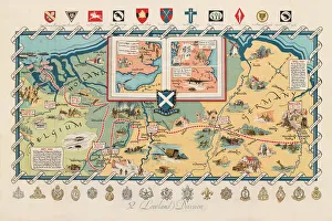
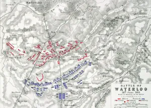
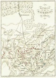
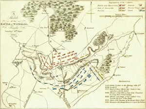
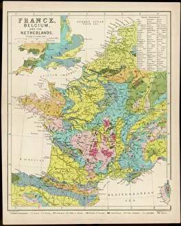
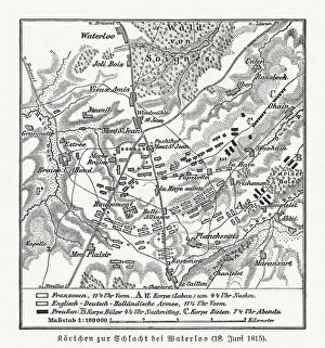
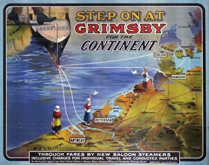
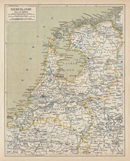
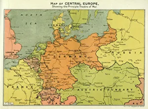
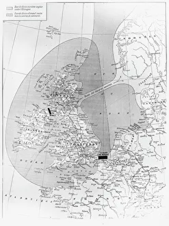
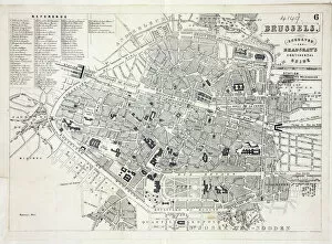
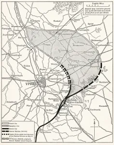
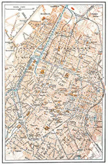
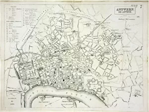
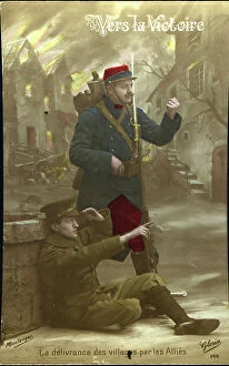
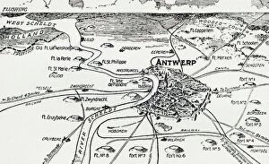
We offer a wide range of Belgium maps and charts art prints that you can purchase. These art prints are perfect for those who love to travel or have an interest in geography. The collection includes antique maps, city plans, topographical maps, and more. One popular option is the vintage map of Brussels from 1905 which showcases the layout of the city during that time period. Another great choice is the detailed topographical map of Belgium which highlights its diverse landscape including forests, rivers, and mountains. For those interested in history, Media Storehouse also offers a selection of World War I battlefield maps depicting key locations such as Ypres and Passchendaele. All art prints are available in various sizes to suit your needs and come on high-quality paper or canvas material. With so many options to choose from, there's sure to be a Belgium map or chart print that will fit perfectly into your home decor.
+
How do I buy Belgium (Maps and Charts) art prints?
To buy Belgium art prints from Media Storehouse, you can browse our extensive collection of high-quality images online. Simply search for "Belgium Maps and Charts" in the search bar on our website to find a range of options. Once you have found the print that you like, select your preferred size and framing option if available, add it to your cart, and proceed to checkout. We offer a variety of payment methods including credit card, PayPal or Amazon Pay. We also offer worldwide shipping with various delivery options available depending on your location. Their prints are produced using high-quality printing techniques ensuring that each print is vibrant and long-lasting. Whether you're looking for a vintage map or contemporary chart design, we have something for everyone. Buying Belgium art prints from Media Storehouse is an easy process that allows you to bring beautiful artwork into your home or office space.
+
How much do Belgium (Maps and Charts) art prints cost?
Belgium art prints are available for purchase at Media Storehouse. The cost of these prints varies depending on the size, material, and framing options selected by the customer. However, you can be assured that they will receive high-quality prints that showcase the beauty of Belgium's maps and charts. We offer a wide range of print sizes to choose from, allowing customers to find the perfect fit for their space. Additionally, there are various materials to select from such as canvas or paper which can affect pricing. Customers also have the option to add frames or mountings if desired. We provide an affordable way for individuals to own beautiful pieces of artwork featuring Belgium's maps and charts without breaking their budget. With so many options available at different price points, anyone can find something they love within their budget range.
+
How will my Belgium (Maps and Charts) art prints be delivered to me?
Your Belgium art prints will be delivered to you in a safe and secure manner. We take great care in packaging your artwork so that it arrives at your doorstep undamaged. Your prints will be carefully rolled up and placed inside a sturdy tube, which is then sealed with protective caps on both ends. This ensures that your artwork stays flat during transit and prevents any creases or bends from occurring. We work with trusted shipping partners who provide reliable delivery services worldwide. Depending on your location, we offer various delivery options to suit your needs, including standard shipping or express delivery for urgent orders. Once your order has been dispatched, you will receive an email notification containing tracking information so that you can monitor the progress of your shipment. If you have any questions about the delivery of your Belgium art prints, please don't hesitate to contact our friendly customer service team who are always happy to help.