Fraud Blocker Skip to main content

Home > Maps and Charts > France

France Collection (page 22)

France is a country located in Western Europe and has a total area of 643,801 square kilometers and a population of approximately 67 million people

11,167 items

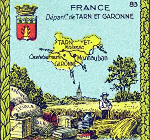
Background imageFrance Collection: Universal Geography: French Department of Tarn and Garonne (82)

Universal Geography: French Department of Tarn and Garonne (82). Advertising images edited for the brand Louit
DUV4218025 Universal Geography: French Department of Tarn and Garonne (82). Advertising images edited for the brand Louit. Debut 20th century. (lithograph); 9.5x6.5 cm; Photo © Duvallon

Background imageFrance Collection: First World War 1914-1918 (14-18): Victory of the Battle of the Marne by the marechal of France

First World War 1914-1918 (14-18): Victory of the Battle of the Marne by the marechal of France
DUV4201495 First World War 1914-1918 (14-18): Victory of the Battle of the Marne by the marechal of France, Joseph Joffre (1852-1931)

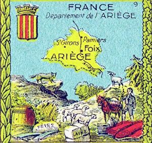
Background imageFrance Collection: Universal Geography: French Department of Ariege (09). Advertising images edited for the brand Louit

Universal Geography: French Department of Ariege (09). Advertising images edited for the brand Louit
DUV4218134 Universal Geography: French Department of Ariege (09). Advertising images edited for the brand Louit. Debut 20th century. (lithograph); 9.5x6.5 cm; Photo © Duvallon

Background imageFrance Collection: Universal Geography: French Department of Ille-et-Vilaine (35)

Universal Geography: French Department of Ille-et-Vilaine (35). Advertising images edited for the brand Louit
DUV4218111 Universal Geography: French Department of Ille-et-Vilaine (35). Advertising images edited for the brand Louit. Debut 20th century. (lithograph); 9.5x6.5 cm; Photo © Duvallon

Background imageFrance Collection: Universal Geography: French Department of Mayenne (53). Advertising images edited for the brand

Universal Geography: French Department of Mayenne (53). Advertising images edited for the brand Louit
DUV4218092 Universal Geography: French Department of Mayenne (53). Advertising images edited for the brand Louit. Debut 20th century. (lithograph); 9.5x6.5 cm; Photo © Duvallon

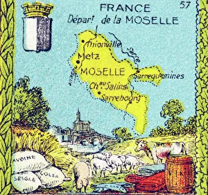
Background imageFrance Collection: Universal Geography: French Department of the Moselle (57). Advertising images edited for

Universal Geography: French Department of the Moselle (57). Advertising images edited for the brand Louit
DUV4218071 Universal Geography: French Department of the Moselle (57). Advertising images edited for the brand Louit. Debut 20th century. (lithograph); 9.5x6.5 cm; Photo © Duvallon

Background imageFrance Collection: Universal Geography: French department of the Bases Pyrenees (present-day Pyrenees Atlantiques, 64)

Universal Geography: French department of the Bases Pyrenees (present-day Pyrenees Atlantiques, 64)
DUV4218056 Universal Geography: French department of the Bases Pyrenees (present-day Pyrenees Atlantiques, 64). Advertising images edited for the brand Louit. Early 20th century

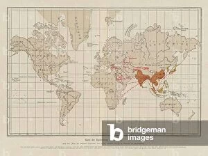
Background imageFrance Collection: World map showing the spread of cholera (colour litho)

World map showing the spread of cholera (colour litho)
8663633 World map showing the spread of cholera (colour litho) by French School, (20th century); Private Collection; (add.info.: World map showing the spread of cholera)

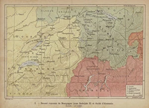
Background imageFrance Collection: Duchies of Burgundy and Alamannia, early 10th Century (coloured engraving)

Duchies of Burgundy and Alamannia, early 10th Century (coloured engraving)
8673045 Duchies of Burgundy and Alamannia, early 10th Century (coloured engraving) by Swiss School, (19th Century); Private Collection; (add.info.: Map of the Duchies of Burgundy and Alamannia)

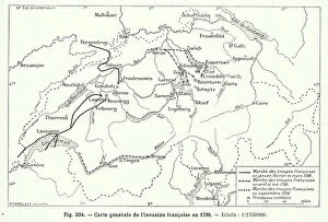
Background imageFrance Collection: French invasion of Switzerland, 1798 (engraving)

French invasion of Switzerland, 1798 (engraving)
8673036 French invasion of Switzerland, 1798 (engraving) by Swiss School, (19th Century); Private Collection; (add.info.: Map of the French invasion of Switzerland, 1798)

Background imageFrance Collection: Plan of the Battle of Grandson, Switzerland, 1476 (engraving)

Plan of the Battle of Grandson, Switzerland, 1476 (engraving)
8673011 Plan of the Battle of Grandson, Switzerland, 1476 (engraving) by Swiss School, (19th Century); Private Collection; (add.info.: Plan of the Battle of Grandson, Switzerland, 1476)

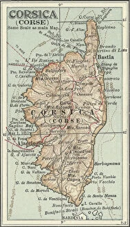
Background imageFrance Collection: Map of Corsica, c.1900 (engraving)

Map of Corsica, c.1900 (engraving)
533290 Map of Corsica, c.1900 (engraving); (add.info.: Map of Corsica, France, circa 1902, from the 10th edition of Encyclopaedia Britannica.); Encyclopaedia Britannica/UIG

Background imageFrance Collection: Map of Madagascar and Comoro Islands, c.1900 (engraving)

Map of Madagascar and Comoro Islands, c.1900 (engraving)
533398 Map of Madagascar and Comoro Islands, c.1900 (engraving); (add.info.: Map of Madagascar and Comoro Islands, circa 1902)

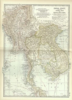
Background imageFrance Collection: Map of Eastern India, c.1900 (engraving)

Map of Eastern India, c.1900 (engraving)
533022 Map of Eastern India, c.1900 (engraving); (add.info.: Map showing historical boundaries of eastern India, Burma, Siam and French Indo-China, circa 1902)

Background imageFrance Collection: Map of France, c.1900 (engraving)

Map of France, c.1900 (engraving)
532946 Map of France, c.1900 (engraving); (add.info.: Map of France with inset map of Vicinity of Marseille and the Mediterranean Coast of France, and Corsica, circa 1902)

Background imageFrance Collection: Muhammad al-Idrisi. Paris transcript of V-4. The map displays: the northern shoreline of Marmara Sea

Muhammad al-Idrisi. Paris transcript of V-4. The map displays: the northern shoreline of Marmara Sea
529625 Muhammad al-Idrisi. Paris transcript of V-4. The map displays: the northern shoreline of Marmara Sea, Gallipoli Peninsula

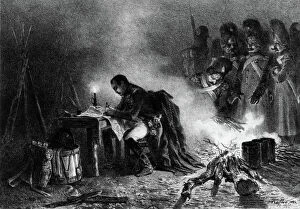
Background imageFrance Collection: French emperor Napoleon 1st looking maps and elaborating strategy during Bautzen battle (Germany)

French emperor Napoleon 1st looking maps and elaborating strategy during Bautzen battle (Germany)
1758562 French emperor Napoleon 1st looking maps and elaborating strategy during Bautzen battle (Germany) in the night from may 20, 1813 to may 21, 1913

Background imageFrance Collection: Map of the Theatre des Champs Elysees in Paris built in 1913 by Auguste Perret

Map of the Theatre des Champs Elysees in Paris built in 1913 by Auguste Perret
1759791 Map of the Theatre des Champs Elysees in Paris built in 1913 by Auguste Perret; (add.info.: Map of the Theatre des Champs Elysees in Paris built in 1913 by Auguste Perret); Photo: Tallandier

Background imageFrance Collection: map the New-France (Virginia estate) in America, dedicated to Colbert (French king's adviser)

map the New-France (Virginia estate) in America, dedicated to Colbert (French king's adviser)
1748394 map the New-France (Virginia estate) in America, dedicated to Colbert (French king's adviser), engraving by Franquelin, 1688; (add.info.: map the New-France (Virginia estate) in America

Background imageFrance Collection: Map Port-Royal monastery in Paris founded in 1625, map dating 17th century at the time of

Map Port-Royal monastery in Paris founded in 1625, map dating 17th century at the time of the building
1747449 Map Port-Royal monastery in Paris founded in 1625, map dating 17th century at the time of the building; (add.info.: Map Port-Royal monastery in Paris founded in 1625)

Background imageFrance Collection: Map of Paris by Turgot, 1734 : with Cite island on Seine river, engraving

Map of Paris by Turgot, 1734 : with Cite island on Seine river, engraving
1747341 Map of Paris by Turgot, 1734 : with Cite island on Seine river, engraving; (add.info.: Map of Paris by Turgot, 1734 : with Cite island on Seine river, engraving); Photo: Tallandier

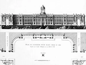
Background imageFrance Collection: project of square and town hall on Malaquet bank along the Seine river in Paris

project of square and town hall on Malaquet bank along the Seine river in Paris, map by architect Patte 18th century
1749414 project of square and town hall on Malaquet bank along the Seine river in Paris, map by architect Patte 18th century; (add.info)

Background imageFrance Collection: Map of the new Royal Palace, Paris, c.1742 (engraving)

Map of the new Royal Palace, Paris, c.1742 (engraving)
1968557 Map of the new Royal Palace, Paris, c.1742 (engraving); Musee de la Ville de Paris, Musee Carnavalet, Paris, France; (add.info.: Plan of the new Royal Palace (development of the gardens)

Background imageFrance Collection: Map of rivers in south of France for building of Southern Canal, 1666

Map of rivers in south of France for building of Southern Canal, 1666
1743933 Map of rivers in south of France for building of Southern Canal, 1666; (add.info.: Map of rivers in south of France for building of Southern Canal, 1666); Photo: Tallandier

Background imageFrance Collection: Map of Arc et Senans saltworks, France, built by Claude Nicolas Ledoux in 1774-1779, engraving

Map of Arc et Senans saltworks, France, built by Claude Nicolas Ledoux in 1774-1779, engraving
1744226 Map of Arc et Senans saltworks, France, built by Claude Nicolas Ledoux in 1774-1779, engraving; (add.info.: Map of Arc et Senans saltworks, France)

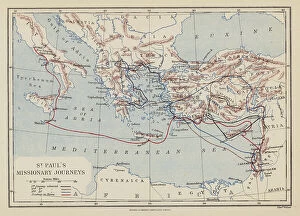
Background imageFrance Collection: St Paul's Missionary Journeys (colour litho)

St Paul's Missionary Journeys (colour litho)
8663065 St Paul's Missionary Journeys (colour litho) by English School, (19th century); Private Collection; (add.info.: St Paul's Missionary Journeys)

Background imageFrance Collection: Balzac's Catherine de Medici (litho)

Balzac's Catherine de Medici (litho)
8652510 Balzac's Catherine de Medici (litho) by Bartholomew, John George (1860-1920) ; Private Collection; (add.info.: Balzac's Catherine de Medici)

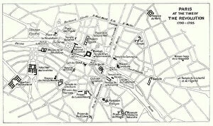
Background imageFrance Collection: Paris at the Time of the Revolution, 1790-1795 (litho)

Paris at the Time of the Revolution, 1790-1795 (litho)
8652504 Paris at the Time of the Revolution, 1790-1795 (litho) by Bartholomew, John George (1860-1920) ; Private Collection; (add.info.: Paris at the Time of the Revolution, 1790-1795)

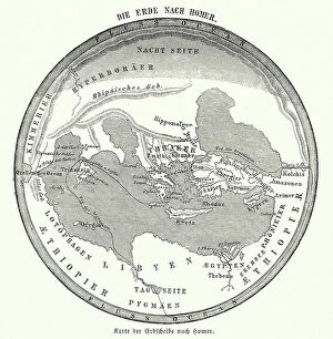
Background imageFrance Collection: Map of the Earth according to Homer (engraving)

Map of the Earth according to Homer (engraving)
8635074 Map of the Earth according to Homer (engraving) by German School, (19th century) (after); Private Collection; (add.info.: Map of the Earth according to the ancient Greek poet Homer)

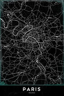
Background imageFrance Collection: PARIS

PARIS
StudioSix

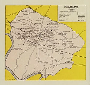
Background imageFrance Collection: L'Atlas des Vins de France: St Emilion (b/w photo)

L'Atlas des Vins de France: St Emilion (b/w photo)
8675265 L'Atlas des Vins de France: St Emilion (b/w photo) by French Photographer, (20th century); Private Collection; (add.info.: St Emilion)

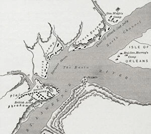
Background imageFrance Collection: Map of Quebec, Canada during the siege of 1759 during the French and Indian War

Map of Quebec, Canada during the siege of 1759 during the French and Indian War
UIG5419265 Map of Quebec, Canada during the siege of 1759 during the French and Indian War. From The History of Our Country, published 1900 ©UIG/Leemage

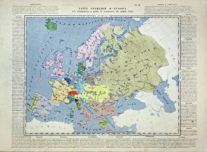
Background imageFrance Collection: Primary cities of Europe, their population and degree of trade of individual states (print)

Primary cities of Europe, their population and degree of trade of individual states (print)
6202957 Primary cities of Europe, their population and degree of trade of individual states (print; (add.info.: CARTOGRAPHY "Primary cities of Europe)

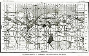
Background imageFrance Collection: Geographic map of the planet Mars from the work L'astronomy des dames by Camille Flammarion 1903

Geographic map of the planet Mars from the work L'astronomy des dames by Camille Flammarion 1903
5980597 Geographic map of the planet Mars from the work L'astronomy des dames by Camille Flammarion 1903; Private Collection; (add.info)

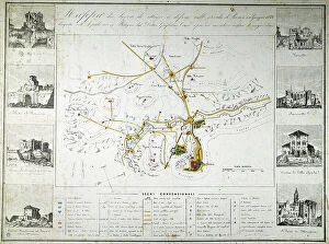
Background imageFrance Collection: Risorgimento: map of attack and defense works at the time of the siege of Rome by the French of

Risorgimento: map of attack and defense works at the time of the siege of Rome by the French of Oudinot in June 1849
BEN5479528 Risorgimento: map of attack and defense works at the time of the siege of Rome by the French of Oudinot in June 1849

Background imageFrance Collection: Map showing Britain, France and Spain in America, 1750, 1936

Map showing Britain, France and Spain in America, 1750, 1936
7125156 Map showing Britain, France and Spain in America, 1750, 1936; (add.info.: Map showing Britain, France and Spain in America, 1750)

Background imageFrance Collection: Map of Asia Minor, showing the expedition of Cyrus the Younger and retreat of the Ten Thousand

Map of Asia Minor, showing the expedition of Cyrus the Younger and retreat of the Ten Thousand
6867235 Map of Asia Minor, showing the expedition of Cyrus the Younger and retreat of the Ten Thousand. From Cassell's Universal History

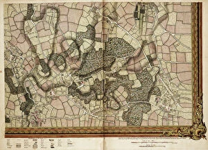
Background imageFrance Collection: Map of Willesden and Hampstead, 1746 (coloured engraving)

Map of Willesden and Hampstead, 1746 (coloured engraving)
7340515 Map of Willesden and Hampstead, 1746 (coloured engraving) by Rocque, John (c.1704-d.1762); 51x67 cm; National Maritime Museum, London

Background imageFrance Collection: Map of Acton, Paddington, Hyde Park and Kensington, 1746 (coloured engraving)

Map of Acton, Paddington, Hyde Park and Kensington, 1746 (coloured engraving)
7340514 Map of Acton, Paddington, Hyde Park and Kensington, 1746 (coloured engraving) by Rocque, John (c.1704-d.1762); 51x67 cm; National Maritime Museum, London

Background imageFrance Collection: Map of Hackney, Waltham and Wanstead, 1746 (coloured engraving)

Map of Hackney, Waltham and Wanstead, 1746 (coloured engraving)
7340505 Map of Hackney, Waltham and Wanstead, 1746 (coloured engraving) by Rocque, John (c.1704-d.1762); 51x67 cm; National Maritime Museum, London

Background imageFrance Collection: Map of Mottingham, Bromley and Chislehurst, 1746 (coloured engraving)

Map of Mottingham, Bromley and Chislehurst, 1746 (coloured engraving)
7340504 Map of Mottingham, Bromley and Chislehurst, 1746 (coloured engraving) by Rocque, John (c.1704-d.1762); 51x67 cm; National Maritime Museum, London

Background imageFrance Collection: A Mediterranean chart showing the North East Atlantic, 1486 (Vellum)

A Mediterranean chart showing the North East Atlantic, 1486 (Vellum)
7340471 A Mediterranean chart showing the North East Atlantic, 1486 (Vellum) by Domenech, Arnaldus (fl.1486); 62x91 cm; National Maritime Museum, London

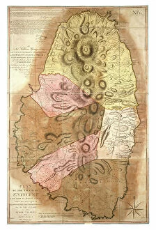
Background imageFrance Collection: Plan of the Island of St Vincent laid down by actual survey, 1776 (paper)

Plan of the Island of St Vincent laid down by actual survey, 1776 (paper)
7340448 Plan of the Island of St Vincent laid down by actual survey, 1776 (paper) by Bayly, John (fl.c.1754-1806); National Maritime Museum, London, UK; (add.info.: Creator: John Byres; J)

Background imageFrance Collection: A plan of Quebec and environs with its defences, c.1781 (coloured engraving)

A plan of Quebec and environs with its defences, c.1781 (coloured engraving)
7340433 A plan of Quebec and environs with its defences, c.1781 (coloured engraving) by DesBarres, Joseph Frederick Wallet (1721-1824); 75x52 cm; National Maritime Museum, London

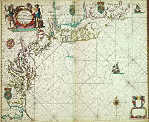
Background imageFrance Collection: A chart of the sea coasts of new England, New Jersey, Virginia

A chart of the sea coasts of new England, New Jersey, Virginia, Maryland and Carolina from Cape Cod to Cape Hatteras
7340051 A chart of the sea coasts of new England, New Jersey, Virginia, Maryland and Carolina from Cape Cod to Cape Hatteras, 1675 (print) by Seller

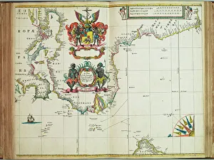
Background imageFrance Collection: A chart of the seacoasts from the Landsend of England to Cape Bona Esperanca, 1675 (engraving)

A chart of the seacoasts from the Landsend of England to Cape Bona Esperanca, 1675 (engraving)
7340048 A chart of the seacoasts from the Landsend of England to Cape Bona Esperanca, 1675 (engraving) by Seller, John (1632-97); 45x55.5 cm; National Maritime Museum, London

Background imageFrance Collection: Map of The pursuit to Calais, 4 - 6 August 1588, 1590 (technical drawing)

Map of The pursuit to Calais, 4 - 6 August 1588, 1590 (technical drawing)
7340033 Map of The pursuit to Calais, 4 - 6 August 1588, 1590 (technical drawing) by Adams, Robert (1540-95) (after); 43x53.5 cm; National Maritime Museum, London

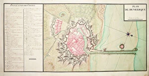
Background imageFrance Collection: Map of Dunkirk, 1724 (drawing)

Map of Dunkirk, 1724 (drawing)
7339801 Map of Dunkirk, 1724 (drawing) by Unknown artist, (18th century); 39x61 cm; National Maritime Museum, London, UK; (add.info.: Creator: unknown Plan de Dunkerque)


All Professionally Made to Order for Quick Shipping


-

France Collection

France is a country located in Western Europe and has a total area of 643,801 square kilometers and a population of approximately 67 million people. The capital city is Paris, which is also the largest city in the country. France is known for its rich history, culture, cuisine, fashion and art and has diverse landscapes ranging from mountains to beaches and forests to vineyards. The economy is one of the largest in the world with major industries including tourism, agriculture, aerospace and technology. The country also has an extensive transportation network consisting of highways, railways and airports connecting it to other parts of Europe and beyond.
+

Our beautiful Wall Art and Photo Gifts include Framed Prints, Photo Prints, Poster Prints, Canvas Prints, Jigsaw Puzzles, Metal Prints and so much more

The France collection from Media Storehouse is a stunning array of wall art and framed prints featuring maps and charts of various regions in France. Our collection showcases the beauty of French geography, highlighting its diverse landscapes, cities, rivers, mountains, and coastlines. From vintage maps to contemporary designs, our collection offers a wide range of styles to suit any taste or decor. Each print is expertly crafted using high-quality materials that ensure longevity and durability. The prints are available in different sizes to fit any space or wall size. Whether you're looking for an eye-catching focal point for your living room or office or want to add some French charm to your bedroom or kitchen walls, the France collection has something for everyone. Our collection is perfect for anyone who loves France's rich history and culture or wants to bring a touch of French elegance into their home.
+

What are France (Maps and Charts) art prints?

France art prints are high-quality reproductions of historical maps and charts depicting various regions of France. These prints showcase the intricate details and artistic styles of cartographers from different eras, providing a unique glimpse into the country's rich history. These art prints are perfect for those who appreciate vintage aesthetics or have an interest in geography, history, or French culture. They can be used to decorate homes, offices, classrooms, or any space that could benefit from a touch of sophistication and intellectual curiosity. We offer a wide selection of France art prints in various sizes and formats to suit different preferences. You can choose between framed or unframed options depending on their needs. With our commitment to quality printing techniques using archival materials ensures that these art prints will last for years without fading or deteriorating over time.
+

What France (Maps and Charts) art prints can I buy from Media Storehouse?

We offer a wide variety of France Maps and Charts art prints that are perfect for adding a touch of sophistication to any room. These art prints feature detailed maps and charts depicting the geography, history, culture, and landmarks of France. Whether you're looking for vintage or contemporary designs, we have something to suit every taste. Some popular options include antique maps of Paris, historical charts detailing the French Revolution, colorful illustrations showcasing famous French cities like Marseille or Lyon, and intricate topographical maps highlighting the diverse landscapes of France. These high-quality art prints are available in various sizes and formats such as canvas prints or framed prints. They make great gifts for anyone who loves travel or is interested in French culture. With so many beautiful options to choose from at Media Storehouse, you're sure to find the perfect addition to your home decor collection.
+

How do I buy France (Maps and Charts) art prints?

To buy France art prints from Media Storehouse, you can browse our extensive collection of artwork online. Once you have found the print that you would like to purchase, simply add it to your cart and proceed to checkout. During the checkout process, you will be prompted to enter your shipping information and payment details. We offer a range of sizes for their art prints, so make sure to select the size that best fits your needs. Additionally, we offer various framing options if you would like your print framed before delivery. Once your order has been placed, Media Storehouse will carefully package and ship your artwork directly to you. Their high-quality printing process ensures that each print is produced with vibrant colors and sharp detail. Whether as a gift or for personal use in decorating your home or office space, buying France art prints from Media Storehouse is an easy way to add beautiful artwork inspired by French culture into any setting.
+

How much do France (Maps and Charts) art prints cost?

We offer a wide range of France art prints at varying prices. Our collection includes vintage maps, antique charts, and contemporary illustrations that capture the beauty and history of France. The cost of our art prints depends on various factors such as size, framing options, and printing materials. We use high-quality paper stock to ensure that our art prints are long-lasting and retain their vibrant colors for years to come. Our you can choose from different sizes ranging from small to large formats depending on their preferences. Our France art prints make great gifts for friends or family members who love travel or have an interest in geography. They also add character to any living space or office setting with their unique designs. The cost of our France art prints is reasonable considering the quality of our products. We strive to provide affordable yet exceptional artwork that meets the needs of all our customers without compromising on quality.
+

How will my France (Maps and Charts) art prints be delivered to me?

We take great care in ensuring that your France art prints are delivered to you safely and securely. We use high-quality packaging materials to protect your artwork during transit, so you can be sure that it will arrive in pristine condition. All of our art prints are carefully rolled and placed into a sturdy cardboard tube for shipping. This ensures that the print is protected from any damage or creases during transportation. The tube is then sealed with tape to prevent any moisture or dust from entering. Once your order has been dispatched, you will receive an email notification with tracking information so you can keep track of its progress. Our delivery partners are reliable and experienced in handling delicate items like art prints, so you can rest assured that your order is in good hands. We strive to provide a seamless delivery experience for all our customers, ensuring their satisfaction with every purchase they make through us.