Fraud Blocker Skip to main content

Home > Maps and Charts > France

France Collection (page 27)

France is a country located in Western Europe and has a total area of 643,801 square kilometers and a population of approximately 67 million people

11,167 items

Background imageFrance Collection: First World War: France, Patriotic Map showing a hairy imberb offering a sheaf of flower has his

First World War: France, Patriotic Map showing a hairy imberb offering a sheaf of flower has his fiance saying
LUX4740390 First World War: France, Patriotic Map showing a hairy imberb offering a sheaf of flower has his fiance saying: Your dear hairy almost imberb offers you with joy this sheaf

Background imageFrance Collection: First World War: France, Patriotic Map showing soldier in a trench with his studio machine gun

First World War: France, Patriotic Map showing soldier in a trench with his studio machine gun
LUX4743003 First World War: France, Patriotic Map showing soldier in a trench with his studio machine gun and a German helmet as decoration saying " we will hold said the machine gun pierking

Background imageFrance Collection: First World War: France, Patriotic Map showing a young and beautiful nurse preparing medicaments

First World War: France, Patriotic Map showing a young and beautiful nurse preparing medicaments for the wounded, 1915
LUX4741732 First World War: France, Patriotic Map showing a young and beautiful nurse preparing medicaments for the wounded, 1915, entitled: the guardian angel

Background imageFrance Collection: First World War: Patriotic map showing a class in Alsace where the teacher a French soldier points

First World War: Patriotic map showing a class in Alsace where the teacher a French soldier points finger on a map
LUX4744873 First World War: Patriotic map showing a class in Alsace where the teacher a French soldier points finger on a map their new homeland, 1915

Background imageFrance Collection: First World War: Patriotic map showing three French soldiers eating

First World War: Patriotic map showing three French soldiers eating and drinking while talking about a pot titled A la
LUX4744829 First World War: Patriotic map showing three French soldiers eating and drinking while talking about a pot titled A la France

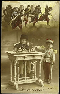
Background imageFrance Collection: First World War: Patriotic map showing two children in uniform playing soldier with shot

First World War: Patriotic map showing two children in uniform playing soldier with shot figurines, 1915
LUX4745360 First World War: Patriotic map showing two children in uniform playing soldier with shot figurines, 1915, Long live the soldiers

Background imageFrance Collection: Morant Map of 1548

Morant Map of 1548
JEB4749179 Morant Map of 1548; © Jean Bernard. All rights reserved 2023

Background imageFrance Collection: Atlas or collection of geographic maps established on the new observations of gentlemen of

Atlas or collection of geographic maps established on the new observations of gentlemen of the Royal Academy of
JEB4874666 Atlas or collection of geographic maps established on the new observations of gentlemen of the Royal Academy of Sciences

Background imageFrance Collection: Nice on the Mediterranean, 1700

Nice on the Mediterranean, 1700
2900900 Nice on the Mediterranean, 1700; (add.info.: Throughout the ages the town changed hands many times. Its strategic location and port significantly contributed to its maritime strength)

Background imageFrance Collection: Floor Plan Of The 13Th Century Ogive Style Notre Dame Cathedral In Rouen

Floor Plan Of The 13Th Century Ogive Style Notre Dame Cathedral In Rouen, France From Les Artes Au Moyen Age
UIG5420223 Floor Plan Of The 13Th Century Ogive Style Notre Dame Cathedral In Rouen, France From Les Artes Au Moyen Age, Published Paris 1873 ©UIG/Leemage

Background imageFrance Collection: A Panoramic View of the Position now occupied by the Allied Armies before Sebastopol

A Panoramic View of the Position now occupied by the Allied Armies before Sebastopol, in 1855 (litho)
XND70150 A Panoramic View of the Position now occupied by the Allied Armies before Sebastopol, in 1855 (litho); Private Collection; (add.info)

Background imageFrance Collection: The map of Samuel de Champlain (1567-1635) of the colony of Tadoussac (Quebec) in 1613, on the St

The map of Samuel de Champlain (1567-1635) of the colony of Tadoussac (Quebec) in 1613, on the St
NWI4849766 The map of Samuel de Champlain (1567-1635) of the colony of Tadoussac (Quebec) in 1613, on the St. Lawrence River and the Saguenay River, New France (Canada)

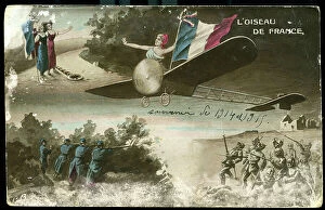
Background imageFrance Collection: First World War: France, Drawing map showing the bird of France: a plane Bleriot, 1915

First World War: France, Drawing map showing the bird of France: a plane Bleriot, 1915
LUX4735285 First World War: France, Drawing map showing the bird of France: a plane Bleriot, 1915; (add.info.: World War I - War 14-18 (1914-1918) - World War I (WWI or WW1): France

Background imageFrance Collection: First World War: France, Patriotic Map showing Joan of Arc in armor protecting France against her

First World War: France, Patriotic Map showing Joan of Arc in armor protecting France against her German barbarians
LUX4739154 First World War: France, Patriotic Map showing Joan of Arc in armor protecting France against her German barbarians with her sword, entitled Go T'en

Background imageFrance Collection: Patriotic map showing France claiming guns and ammunition behind an accumulation of weapons, 1914

Patriotic map showing France claiming guns and ammunition behind an accumulation of weapons, 1914
LUX4743684 Patriotic map showing France claiming guns and ammunition behind an accumulation of weapons, 1914; (add.info.: Patriotic map showing France claiming guns)

Background imageFrance Collection: Patriotic map showing a child writing a letter to his father lying on the forehead on a crew of

Patriotic map showing a child writing a letter to his father lying on the forehead on a crew of horses firing a cannon
LUX4743389 Patriotic map showing a child writing a letter to his father lying on the forehead on a crew of horses firing a cannon and titled "Letter to Papa Cherie"

Background imageFrance Collection: First World War: Patriotic map showing a German soldier in uniform with his legendary clocks

First World War: Patriotic map showing a German soldier in uniform with his legendary clocks
LUX4745417 First World War: Patriotic map showing a German soldier in uniform with his legendary clocks and his tip helmet deception contemplating an empty barrel of sauerkraut and declaring

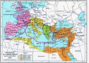
Background imageFrance Collection: Plate extracted from a historical Atlas by Vidal Lablache, beg of 20th century (print)

Plate extracted from a historical Atlas by Vidal Lablache, beg of 20th century (print)
PCT4292088 Plate extracted from a historical Atlas by Vidal Lablache, beg of 20th century (print); (add.info.: Plate extracted from a historical Atlas by Vidal Lablache (Vidal-Lablache)

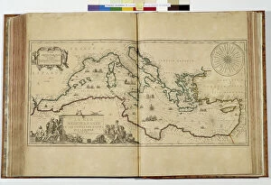
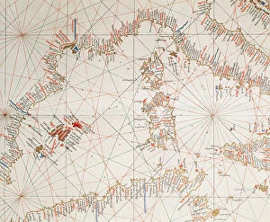
Background imageFrance Collection: Map of Western Mediterran Sea

Map of Western Mediterran Sea
3499621 Map of Western Mediterran Sea; (add.info.: Map of Western Mediterran Sea. European coast from Cartagena (Spain) until the southof Naples. Corsica and Sardinia islands. North African coast

Background imageFrance Collection: 4th map of Paris at time of Philippe Auguste (1165-1223), engraving

4th map of Paris at time of Philippe Auguste (1165-1223), engraving
1758000 4th map of Paris at time of Philippe Auguste (1165-1223), engraving; (add.info.: 4th map of Paris at time of Philippe Auguste (1165-1223), engraving); Photo: Tallandier

Background imageFrance Collection: Map of Aix-en-Provence, 1741, engraving

Map of Aix-en-Provence, 1741, engraving
1744344 Map of Aix-en-Provence, 1741, engraving; (add.info.: Map of Aix-en-Provence, 1741, engraving); Photo: Tallandier

Background imageFrance Collection: World map, 18th century. (print)

World map, 18th century. (print)
7419942 World map, 18th century. (print); (add.info.: Map of the World. Religions are indicated by colour. After a work dated 1761 of French cartographer Gilles Robert de Vaugondy)

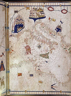
Background imageFrance Collection: Portulan representing the Mediterranean basin (the coasts of Italy)

Portulan representing the Mediterranean basin (the coasts of Italy, southern France and northern Africa)
VEN5027752 Portulan representing the Mediterranean basin (the coasts of Italy, southern France and northern Africa). The city of Venice, Marseille and Budva (= Budua)

Background imageFrance Collection: Map of the United States of 1803 showing the partition of the state (Kentucky, Tennessee, Georgia)

Map of the United States of 1803 showing the partition of the state (Kentucky, Tennessee, Georgia, Florida, Carolina)
NWI4901249 Map of the United States of 1803 showing the partition of the state (Kentucky, Tennessee, Georgia, Florida, Carolina, Virginia, Massachusetts, Indian territories)

Background imageFrance Collection: Geographic map of Europe in the 1870s. 19th century colour lithography

Geographic map of Europe in the 1870s. 19th century colour lithography
NWI4868470 Geographic map of Europe in the 1870s. 19th century colour lithography; (add.info.: Geographic map of Europe in the 1870s. 19th century colour lithography); Photo © North Wind Pictures

Background imageFrance Collection: Map of the United States: Map of the Explorer Louis Hennepin (1626-1705)

Map of the United States: Map of the Explorer Louis Hennepin (1626-1705) of the Mississippi and the Great Lakes
NWI4902208 Map of the United States: Map of the Explorer Louis Hennepin (1626-1705) of the Mississippi and the Great Lakes (part of New France, 1697). Engraving

Background imageFrance Collection: First World War: France, Patriotic map showing a little girl in Phrygian hat

First World War: France, Patriotic map showing a little girl in Phrygian hat
LUX4738308 First World War: France, Patriotic map showing a little girl in Phrygian hat and a little boy in kepi holding a French flag next to a cart wheel or a rooster

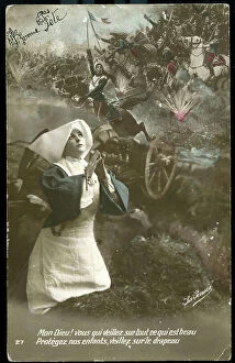
Background imageFrance Collection: First World War: France, Patriotic Map showing a good sister on the battlefield praying to God to

First World War: France, Patriotic Map showing a good sister on the battlefield praying to God to watch over
LUX4740104 First World War: France, Patriotic Map showing a good sister on the battlefield praying to God to watch over the soldier and the flag

Background imageFrance Collection: First World War: France, Patriotic Map showing in a bucolic and flowery decor General Joffre

First World War: France, Patriotic Map showing in a bucolic and flowery decor General Joffre consulting a map of staff
LUX4739743 First World War: France, Patriotic Map showing in a bucolic and flowery decor General Joffre consulting a map of staff entitled: Glory to Genie Victorious

Background imageFrance Collection: First World War: France, Patriotic Map showing A French soldier in uniform with his rifle

First World War: France, Patriotic Map showing A French soldier in uniform with his rifle, in a bucolic trench
LUX4739155 First World War: France, Patriotic Map showing A French soldier in uniform with his rifle, in a bucolic trench, kissing a sword stretched by Joan of Arc in armor

Background imageFrance Collection: First World War: France, Patriotic Map showing an officer training soldiers in combat with his

First World War: France, Patriotic Map showing an officer training soldiers in combat with his slag, 1916
LUX4742376 First World War: France, Patriotic Map showing an officer training soldiers in combat with his slag, 1916; (add.info.: First World War - War 14-18 (1914-1918) - World War I (WWI or WW1)

Background imageFrance Collection: First World War: France, Patriotic Map showing a soldier sending his best wishes from the trench

First World War: France, Patriotic Map showing a soldier sending his best wishes from the trench, 1917, Happy Year
LUX4741302 First World War: France, Patriotic Map showing a soldier sending his best wishes from the trench, 1917, Happy Year; (add.info)

Background imageFrance Collection: First World War: France, Patriotic Map showing a French soldier in uniform holding his rifle

First World War: France, Patriotic Map showing a French soldier in uniform holding his rifle
LUX4740262 First World War: France, Patriotic Map showing a French soldier in uniform holding his rifle and the French flag he defends, entitled The Defense of the Drapeau

Background imageFrance Collection: First World War: France, Patriotic Map showing French soldiers coming to drink with Joffre

First World War: France, Patriotic Map showing French soldiers coming to drink with Joffre
LUX4739302 First World War: France, Patriotic Map showing French soldiers coming to drink with Joffre, titled: J'offre a mes brave soldiers du 1914 et J'offre aux laches teutons du 75

Background imageFrance Collection: English - French Possessions in North America, 1763

English - French Possessions in North America, 1763
2902793 English - French Possessions in North America, 1763; (add.info.: English - French Possessions in North America, 1763.); Buyenlarge Archive/UIG

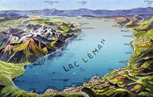
Background imageFrance Collection: map showing the cities on the banks of Lake Leman, postcard, early 20th century

map showing the cities on the banks of Lake Leman, postcard, early 20th century
1792396 map showing the cities on the banks of Lake Leman, postcard, early 20th century; (add.info.: map showing the various cities on the banks of Lake Leman between Switzerland and France (Savoy)

Background imageFrance Collection: Map of Europe in 1810. 19th century (engraving from a history book)

Map of Europe in 1810. 19th century (engraving from a history book)
ELD4913301 Map of Europe in 1810. 19th century (engraving from a history book); Private Collection; Photo © The Holbarn Archive

Background imageFrance Collection: First World War: Patriotic map showing Napoleon shaking hand to a French soldier telling him your

First World War: Patriotic map showing Napoleon shaking hand to a French soldier telling him your hand comrade
LUX4745007 First World War: Patriotic map showing Napoleon shaking hand to a French soldier telling him your hand comrade grenadiers didn't do better

Background imageFrance Collection: First World War: France, Patriotic Map showing a soldier in uniform looking thoughtful arms to his

First World War: France, Patriotic Map showing a soldier in uniform looking thoughtful arms to his studio machine gun
LUX4743020 First World War: France, Patriotic Map showing a soldier in uniform looking thoughtful arms to his studio machine gun

Background imageFrance Collection: First World War: Patriotic map showing a scene of reunion between a Permisonary and his fiance

First World War: Patriotic map showing a scene of reunion between a Permisonary and his fiance
LUX4745415 First World War: Patriotic map showing a scene of reunion between a Permisonary and his fiance, titled: Rest well earned

Background imageFrance Collection: New map of the French empire in 1811 with 130 administratives departments

New map of the French empire in 1811 with 130 administratives departments
1751817 New map of the French empire in 1811 with 130 administratives departments; (add.info.: New map of the French empire in 1811 with 130 administratives departments); Photo: Tallandier

Background imageFrance Collection: Map of fortifications of Neuf Brisach (Alsace, France) built in 1699 by Vauban

Map of fortifications of Neuf Brisach (Alsace, France) built in 1699 by Vauban
1758365 Map of fortifications of Neuf Brisach (Alsace, France) built in 1699 by Vauban; (add.info.: Map of fortifications of Neuf Brisach (Alsace, France) built in 1699 by Vauban); Photo: Tallandier

Background imageFrance Collection: Alsace : Map showing on r old Brisach and on l Neuf-Brisach built in 1699 by Vauban

Alsace : Map showing on r old Brisach and on l Neuf-Brisach built in 1699 by Vauban
1758364 Alsace : Map showing on r old Brisach and on l Neuf-Brisach built in 1699 by Vauban; (add.info.: Alsace : Map showing on r old Brisach and on l Neuf-Brisach built in 1699 by Vauban); Photo

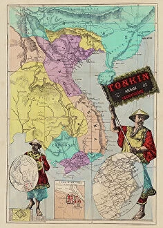
Background imageFrance Collection: Map of Tonkin, Annam, Cochinchine (coloured engraving)

Map of Tonkin, Annam, Cochinchine (coloured engraving)
8651484 Map of Tonkin, Annam, Cochinchine (coloured engraving) by French School, (19th century) (after); Private Collection; (add.info.: Map of Tonkin, Annam, Cochinchine)

Background imageFrance Collection: First World War: France, Patriotic Map showing in a flowery and bucolic trench two soldiers in

First World War: France, Patriotic Map showing in a flowery and bucolic trench two soldiers in toasting uniforms
LUX4738781 First World War: France, Patriotic Map showing in a flowery and bucolic trench two soldiers in toasting uniforms surrounded by good bottles, titled: in the trench, 1915

Background imageFrance Collection: Map of the march of emperor Napoleon 1st towards Paris when he came back from Elbe island in march

Map of the march of emperor Napoleon 1st towards Paris when he came back from Elbe island in march 1815
1754553 Map of the march of emperor Napoleon 1st towards Paris when he came back from Elbe island in march 1815; (add.info)

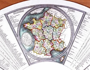
Background imageFrance Collection: Map of France, 1790 (print)

Map of France, 1790 (print)
1801429 Map of France, 1790 (print); (add.info.: Map of France divided into 9 regions, 10 major cities and 83 departements, 1790 fan); Photo © CCI

Background imageFrance Collection: Plate extracted from a historical Atlas by Vidal Lablache beg of 20th century (print)

Plate extracted from a historical Atlas by Vidal Lablache beg of 20th century (print)
PCT4284009 Plate extracted from a historical Atlas by Vidal Lablache beg of 20th century (print); (add.info.: Plate extracted from a historical Atlas by Vidal Lablache (Vidal-Lablache)


All Professionally Made to Order for Quick Shipping


-

France Collection

France is a country located in Western Europe and has a total area of 643,801 square kilometers and a population of approximately 67 million people. The capital city is Paris, which is also the largest city in the country. France is known for its rich history, culture, cuisine, fashion and art and has diverse landscapes ranging from mountains to beaches and forests to vineyards. The economy is one of the largest in the world with major industries including tourism, agriculture, aerospace and technology. The country also has an extensive transportation network consisting of highways, railways and airports connecting it to other parts of Europe and beyond.
+

Our beautiful Wall Art and Photo Gifts include Framed Prints, Photo Prints, Poster Prints, Canvas Prints, Jigsaw Puzzles, Metal Prints and so much more

The France collection from Media Storehouse is a stunning array of wall art and framed prints featuring maps and charts of various regions in France. Our collection showcases the beauty of French geography, highlighting its diverse landscapes, cities, rivers, mountains, and coastlines. From vintage maps to contemporary designs, our collection offers a wide range of styles to suit any taste or decor. Each print is expertly crafted using high-quality materials that ensure longevity and durability. The prints are available in different sizes to fit any space or wall size. Whether you're looking for an eye-catching focal point for your living room or office or want to add some French charm to your bedroom or kitchen walls, the France collection has something for everyone. Our collection is perfect for anyone who loves France's rich history and culture or wants to bring a touch of French elegance into their home.
+

What are France (Maps and Charts) art prints?

France art prints are high-quality reproductions of historical maps and charts depicting various regions of France. These prints showcase the intricate details and artistic styles of cartographers from different eras, providing a unique glimpse into the country's rich history. These art prints are perfect for those who appreciate vintage aesthetics or have an interest in geography, history, or French culture. They can be used to decorate homes, offices, classrooms, or any space that could benefit from a touch of sophistication and intellectual curiosity. We offer a wide selection of France art prints in various sizes and formats to suit different preferences. You can choose between framed or unframed options depending on their needs. With our commitment to quality printing techniques using archival materials ensures that these art prints will last for years without fading or deteriorating over time.
+

What France (Maps and Charts) art prints can I buy from Media Storehouse?

We offer a wide variety of France Maps and Charts art prints that are perfect for adding a touch of sophistication to any room. These art prints feature detailed maps and charts depicting the geography, history, culture, and landmarks of France. Whether you're looking for vintage or contemporary designs, we have something to suit every taste. Some popular options include antique maps of Paris, historical charts detailing the French Revolution, colorful illustrations showcasing famous French cities like Marseille or Lyon, and intricate topographical maps highlighting the diverse landscapes of France. These high-quality art prints are available in various sizes and formats such as canvas prints or framed prints. They make great gifts for anyone who loves travel or is interested in French culture. With so many beautiful options to choose from at Media Storehouse, you're sure to find the perfect addition to your home decor collection.
+

How do I buy France (Maps and Charts) art prints?

To buy France art prints from Media Storehouse, you can browse our extensive collection of artwork online. Once you have found the print that you would like to purchase, simply add it to your cart and proceed to checkout. During the checkout process, you will be prompted to enter your shipping information and payment details. We offer a range of sizes for their art prints, so make sure to select the size that best fits your needs. Additionally, we offer various framing options if you would like your print framed before delivery. Once your order has been placed, Media Storehouse will carefully package and ship your artwork directly to you. Their high-quality printing process ensures that each print is produced with vibrant colors and sharp detail. Whether as a gift or for personal use in decorating your home or office space, buying France art prints from Media Storehouse is an easy way to add beautiful artwork inspired by French culture into any setting.
+

How much do France (Maps and Charts) art prints cost?

We offer a wide range of France art prints at varying prices. Our collection includes vintage maps, antique charts, and contemporary illustrations that capture the beauty and history of France. The cost of our art prints depends on various factors such as size, framing options, and printing materials. We use high-quality paper stock to ensure that our art prints are long-lasting and retain their vibrant colors for years to come. Our you can choose from different sizes ranging from small to large formats depending on their preferences. Our France art prints make great gifts for friends or family members who love travel or have an interest in geography. They also add character to any living space or office setting with their unique designs. The cost of our France art prints is reasonable considering the quality of our products. We strive to provide affordable yet exceptional artwork that meets the needs of all our customers without compromising on quality.
+

How will my France (Maps and Charts) art prints be delivered to me?

We take great care in ensuring that your France art prints are delivered to you safely and securely. We use high-quality packaging materials to protect your artwork during transit, so you can be sure that it will arrive in pristine condition. All of our art prints are carefully rolled and placed into a sturdy cardboard tube for shipping. This ensures that the print is protected from any damage or creases during transportation. The tube is then sealed with tape to prevent any moisture or dust from entering. Once your order has been dispatched, you will receive an email notification with tracking information so you can keep track of its progress. Our delivery partners are reliable and experienced in handling delicate items like art prints, so you can rest assured that your order is in good hands. We strive to provide a seamless delivery experience for all our customers, ensuring their satisfaction with every purchase they make through us.