Home > Historic > World War I and II > Naval warfare
Map of Dardanelles with HMS Bacchante, WW1

![]()
Wall Art and Photo Gifts from Mary Evans Picture Library
Map of Dardanelles with HMS Bacchante, WW1
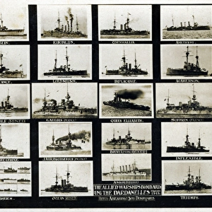
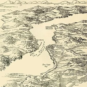
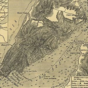
Map of the Dardanelles with an inset image of HMS Bacchante, British Cressy-class armoured cruiser.
1915
Mary Evans Picture Library makes available wonderful images created for people to enjoy over the centuries
Media ID 14171040
© Mary Evans / Pharcide
Aegean Armoured Bacchante Cressy Cruiser Cruisers Dardanelles Gallipoli Inset Maps Narrows Straits
FEATURES IN THESE COLLECTIONS
> Historic
> World War I and II
> Naval warfare
> Maps and Charts
> World
> Services
> Royal Navy
EDITORS COMMENTS
This print showcases a map of the Dardanelles and the Aegean Sea during the tumultuous year of 1915, during the First World War. The strategic location of the Dardanelles Straits, connecting the European and Asian continents, was a crucial point of contention between the Allied Powers and the Ottoman Empire. The map highlights the narrowest section of the Dardanelles, known as the Dardanelles Narrows, where the Allied forces attempted to force their way through with the naval operation known as the Dardanelles Campaign. An inset image on the map features the HMS Bacchante, a Cressy-class armoured cruiser of the British Royal Navy. The HMS Bacchante was one of several British warships that took part in the ill-fated attempt to break through the Dardanelles Narrows and reach the Black Sea. The ship, named after the Greek goddess of wine and revelry, was commissioned in 1913 and was armed with a formidable battery of twelve 6-inch guns. The map provides a fascinating glimpse into the complex geopolitical situation of the time, as well as the naval strategies and tactics employed by the various powers. The image of the HMS Bacchante adds a personal touch to the map, allowing us to connect with the human stories of the brave sailors who served aboard these ships during the war. This print is an essential addition to any collection focused on military history, naval warfare, or the history of the First World War.
MADE IN AUSTRALIA
Safe Shipping with 30 Day Money Back Guarantee
FREE PERSONALISATION*
We are proud to offer a range of customisation features including Personalised Captions, Color Filters and Picture Zoom Tools
SECURE PAYMENTS
We happily accept a wide range of payment options so you can pay for the things you need in the way that is most convenient for you
* Options may vary by product and licensing agreement. Zoomed Pictures can be adjusted in the Cart.