Fraud Blocker Skip to main content

Home > North America > Haiti > Related Images

Related Images Collection (page 2)

419 items

Background imageRelated Images Collection: Santo Domingo, 1796

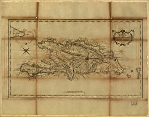
Santo Domingo, 1796
2902892 Santo Domingo, 1796; (add.info.: Santo Domingo, Dominican Republic, 1796.); Buyenlarge Archive/UIG

Background imageRelated Images Collection: West Indies, 1849

West Indies, 1849
2902888 West Indies, 1849; (add.info.: West Indies, 1849.); Buyenlarge Archive/UIG

Background imageRelated Images Collection: The Begon of China. Chinese begonia, Begonia species. Preying mantis. Named for Michel Begon

The Begon of China. Chinese begonia, Begonia species. Preying mantis. Named for Michel Begon
FLO4596790 The Begon of China. Chinese begonia, Begonia species. Preying mantis. Named for Michel Begon, governor of the French colony of Saint-Domingue (now Haiti)

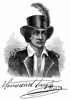
Background imageRelated Images Collection: Portrait and signature of Francois Dominique Toussaint dit 'Toussaint-Louverture'

Portrait and signature of Francois Dominique Toussaint dit "Toussaint-Louverture" (Toussaint Louverture)
PCT4272266 Portrait and signature of Francois Dominique Toussaint dit "Toussaint-Louverture" (Toussaint Louverture, 1743-1803), a Haitian statesman

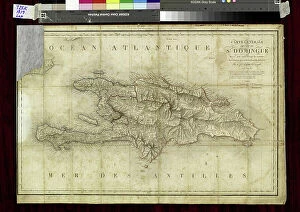
Background imageRelated Images Collection: Map of the island of Hispaniola (Santo Domingo or Haiti), Caribbean Sea

Map of the island of Hispaniola (Santo Domingo or Haiti), Caribbean Sea, circa 1870 - Lithograph 19th century
NWI4866878 Map of the island of Hispaniola (Santo Domingo or Haiti), Caribbean Sea, circa 1870 - Lithograph 19th century (Map of Hispaniola, including Haiti and Santo Domingo, 1870s)

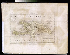
Background imageRelated Images Collection: Geography Atlas: representation of the island of Hispaniola (which includes Santo Domingo and Haiti)

Geography Atlas: representation of the island of Hispaniola (which includes Santo Domingo and Haiti)
VEN5031366 Geography Atlas: representation of the island of Hispaniola (which includes Santo Domingo and Haiti) in the Caribbean archipelago. Map by the Knight Lapie, 1819

Background imageRelated Images Collection: Geography Atlas: representation of the island of Santo Domingo

Geography Atlas: representation of the island of Santo Domingo, the Bahamas of Puerto Rico to the West Indies
VEN5031345 Geography Atlas: representation of the island of Santo Domingo, the Bahamas of Puerto Rico to the West Indies. Map from an atlas of 1867

Background imageRelated Images Collection: Geography Atlas: representation of the island of Hispaniola (which includes Santo Domingo and Haiti)

Geography Atlas: representation of the island of Hispaniola (which includes Santo Domingo and Haiti)
VEN5030030 Geography Atlas: representation of the island of Hispaniola (which includes Santo Domingo and Haiti) in the Caribbean archipelago

Background imageRelated Images Collection: jean-Claude Charles

jean-Claude Charles
2690313 jean-Claude Charles; (add.info.: 0526N- The Haitian writer, Jean-Claude Charles in 2003 holding in hand a collection of which he prefaced); © Estate of Gerald Bloncourt

Background imageRelated Images Collection: Francois-Dominique Toussaint Louverture. Portrait. (print)

Francois-Dominique Toussaint Louverture. Portrait. (print)
7419897 Francois-Dominique Toussaint Louverture. Portrait. (print); Photo © Ken Welsh. All rights reserved 2024

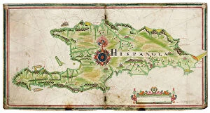
Background imageRelated Images Collection: Map of Hispaniola, 1653 (manuscript)

Map of Hispaniola, 1653 (manuscript)
7340470 Map of Hispaniola, 1653 (manuscript) by Comberford, Nicholas (d.1673); 47x45 cm; National Maritime Museum, London

Background imageRelated Images Collection: Jean Vilbrun Guillaume Sam

Jean Vilbrun Guillaume Sam
1835101 Jean Vilbrun Guillaume Sam; (add.info.: 1472N- Jean Vilbrun Guillaume Sam president d'Haiti en 1915); © Estate of Gerald Bloncourt. All Rights Reserved 2024

Background imageRelated Images Collection: Haiti in the 19th century : haitian officers and a white woman

Haiti in the 19th century : haitian officers and a white woman
1748180 Haiti in the 19th century : haitian officers and a white woman; (add.info.: Haiti in the 19th century : haitian officers and a white woman); Photo: Tallandier

Background imageRelated Images Collection: Elisabeth Adelina Derival Leveque

Elisabeth Adelina Derival Leveque
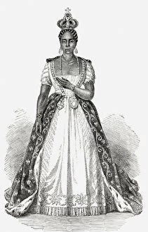
7261233 Elisabeth Adelina Derival Leveque; Private Collection; (add.info.: Elisabeth Adelina Derival Leveque or Adelina Soulouque, 1820-1878, nee Elisabeth Anne Justine Leveque)

Background imageRelated Images Collection: Taino, inhabitant of the Hispaniola Mountains (Haiti and Dominican Republic)

Taino, inhabitant of the Hispaniola Mountains (Haiti and Dominican Republic)
NWI4853761 Taino, inhabitant of the Hispaniola Mountains (Haiti and Dominican Republic) as described by the first explorers of the New World - Colorised engraving

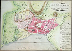
Background imageRelated Images Collection: Plan of Jacmel town with fortifications, 1799 (drawing)

Plan of Jacmel town with fortifications, 1799 (drawing)
7339492 Plan of Jacmel town with fortifications, 1799 (drawing) by Rivieres, Antoine Francois Sorrel des (1737-1830); 38x53 cm; National Maritime Museum, London

Background imageRelated Images Collection: Toussaint Louverture

Toussaint Louverture
3118610 Toussaint Louverture; (add.info.: Portrait of Toussaint Louverture (1743-1803) leader of the Haitian Revolution and President for Life. Dated 18th Century.); Universal History Archive/UIG

Background imageRelated Images Collection: Guy-Joseph Bonnet (engraving)

Guy-Joseph Bonnet (engraving)
2497740 Guy-Joseph Bonnet (engraving); (add.info.: Guy-Joseph Bonnet (1773Ð1843), historian and officer of the army of Haiti.); © Estate of Gerald Bloncourt. All Rights Reserved 2024

Background imageRelated Images Collection: Luce Tournament

Luce Tournament
2690503 Luce Tournament; (add.info.: Luce TURNIER 16 years old - now a famous painter - HAITI); © Estate of Gerald Bloncourt. All Rights Reserved 2024

Background imageRelated Images Collection: Haiti The ancient fortifications of Petity Goave (postcard)

Haiti The ancient fortifications of Petity Goave (postcard)
2721253 Haiti The ancient fortifications of Petity Goave (postcard); (add.info.: 19368N Haiti The ancient fortifications of Petity Goave in Haiti? Collection); © Estate of Gerald Bloncourt

Background imageRelated Images Collection: Anthology of contemporary Haitian poetry

Anthology of contemporary Haitian poetry
2690501 Anthology of contemporary Haitian poetry; (add.info.: Cover of the book Anthologie de poesie haitienne contemporaine); © Estate of Gerald Bloncourt. All Rights Reserved 2024

Background imageRelated Images Collection: Map of the Caribbean Sea with the island of Cuba, Jamaica, Haiti

Map of the Caribbean Sea with the island of Cuba, Jamaica, Haiti, Central America (detail of the Panama Canal)
1761635 Map of the Caribbean Sea with the island of Cuba, Jamaica, Haiti, Central America (detail of the Panama Canal) and North South America

Background imageRelated Images Collection: Fabre Nicholas Geffrard

Fabre Nicholas Geffrard
1835096 Fabre Nicholas Geffrard; (add.info.: 1452N- Fabre Nicholas Geffrard president d'HaIti - Janvier 1959/mars 1867); © Estate of Gerald Bloncourt. All Rights Reserved 2024

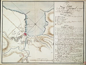
Background imageRelated Images Collection: Vicinity of Jacmel, used to indicate lines and positions occupied during the blockade

Vicinity of Jacmel, used to indicate lines and positions occupied during the blockade
7339490 Vicinity of Jacmel, used to indicate lines and positions occupied during the blockade and the batteries established in order to build the besieged defences

Background imageRelated Images Collection: French legionnaire soldiers from France. switzerland. Russia. Germany. Poland. Haiti. Turkey

French legionnaire soldiers from France. switzerland. Russia. Germany. Poland. Haiti. Turkey. Morocco. Hungary
5305170 French legionnaire soldiers from France. switzerland. Russia. Germany. Poland. Haiti. Turkey. Morocco. Hungary. Belgium and Italy on parade in Sidi Bel Abbes, Algeria

Background imageRelated Images Collection: Geography Atlas: representation of the island of Santo Domingo in the West Indies

Geography Atlas: representation of the island of Santo Domingo in the West Indies
VEN5031371 Geography Atlas: representation of the island of Santo Domingo in the West Indies. Map from an atlas by Antonio del Monte y Tejada (1783-1861), 1860

Background imageRelated Images Collection: Geography Atlas: representation of the island of Santo Domingo in the West Indies

Geography Atlas: representation of the island of Santo Domingo in the West Indies. Map from an atlas by J. B
VEN5031350 Geography Atlas: representation of the island of Santo Domingo in the West Indies. Map from an atlas by J. B. Poirson (1761-1831), French geographer, 1803

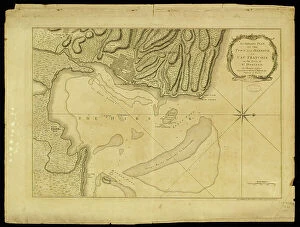
Background imageRelated Images Collection: Geography Atlas: representation of Cape Francais (Cap de la Republique)

Geography Atlas: representation of Cape Francais (Cap de la Republique) in Santo Domingo in the West Indies
VEN5031342 Geography Atlas: representation of Cape Francais (Cap de la Republique) in Santo Domingo in the West Indies. Map from an atlas by Thomas Jefferys, geographer of the Prince of Wales, 1760

Background imageRelated Images Collection: Geography map: representation of the island of Hispaniola grouping the present-day Haiti

Geography map: representation of the island of Hispaniola grouping the present-day Haiti
VEN5030177 Geography map: representation of the island of Hispaniola grouping the present-day Haiti and Santo Domingo in the West Indies

Background imageRelated Images Collection: Haiti, Port au Prince: Portrait of a young creole with a lace bodice, 1900

Haiti, Port au Prince: Portrait of a young creole with a lace bodice, 1900
LUX4712729 Haiti, Port au Prince: Portrait of a young creole with a lace bodice, 1900; (add.info.: Haiti, Port au Prince: Portrait of a young creole with a lace bodice, 1900); Photo © Lux-in-Fine

Background imageRelated Images Collection: Flags of forty countries, circa 1890. Colour lithography, 19th century

Flags of forty countries, circa 1890. Colour lithography, 19th century
NWI4851551 Flags of forty countries, circa 1890. Colour lithography, 19th century.; (add.info.: Flags of forty countries, circa 1890)

Background imageRelated Images Collection: Max Bourjoly

Max Bourjoly
2690318 Max Bourjoly; (add.info.: Max Bourjoly, haitian politician, he was one of the leaders of haitian communist party and one of political prisoner jailed in Fort-Dimanche under Duvalier)

Background imageRelated Images Collection: Toussaint Louverture

Toussaint Louverture
3586035 Toussaint Louverture; (add.info.: Portrait of Toussaint Louverture (1743-1803) leader of the Haitian Revolution. Dated 19th Century.); Universal History Archive/UIG

Background imageRelated Images Collection: The city of Bombarde (Haiti). Lithography for the book: ' Galerie complete en tableaux fideles des

The city of Bombarde (Haiti). Lithography for the book: " Galerie complete en tableaux fideles des peuples
FLO4635962 The city of Bombarde (Haiti). Lithography for the book: " Galerie complete en tableaux fideles des peuples d'Amerique et d'Australie" by Friedrich Wilhelm Goedsche (1785-1863)

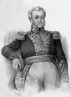
Background imageRelated Images Collection: Lysius Salomon

Lysius Salomon
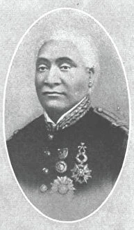
1835092 Lysius Salomon; (add.info.: 1466N- Lysius Salomon President of Haiti - October 1879/August 1888); © Estate of Gerald Bloncourt. All Rights Reserved 2024

Background imageRelated Images Collection: Portrait of Jean Jacques Dessalines (1758-1806), Jacques I Emperor of Haiti

Portrait of Jean Jacques Dessalines (1758-1806), Jacques I Emperor of Haiti
NWI4924167 Portrait of Jean Jacques Dessalines (1758-1806), Jacques I Emperor of Haiti. He was one of the leaders of the revolt of Haiti and the first emperor of the First Black Republic in 1804

Background imageRelated Images Collection: Geographic map of the New World, 1513, admiral map of the Caribbean and unknown lands of North

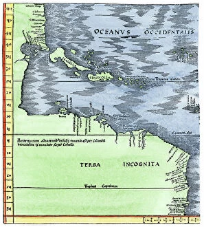
Geographic map of the New World, 1513, admiral map of the Caribbean and unknown lands of North and South America
NWI4846079 Geographic map of the New World, 1513, admiral map of the Caribbean and unknown lands of North and South America

Background imageRelated Images Collection: Sinking of the Caravelle Santa Maria' ship of Christopher Columbus on the coasts of Hispaniola

Sinking of the Caravelle Santa Maria' ship of Christopher Columbus on the coasts of Hispaniola
NWI4901055 Sinking of the Caravelle Santa Maria' ship of Christopher Columbus on the coasts of Hispaniola (Dominican Republic and Haiti) in 1492. Engraving

Background imageRelated Images Collection: Geographic map of Central America (one distinguishes Puerto Rico, Haiti, Jamaica and Cuba)

Geographic map of Central America (one distinguishes Puerto Rico, Haiti, Jamaica and Cuba)
XEE5027156 Geographic map of Central America (one distinguishes Puerto Rico, Haiti, Jamaica and Cuba) - 17th or 18th century - Museum of America

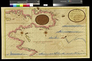
Background imageRelated Images Collection: Geography map: double page of an Atlas showing maps and descriptive texts of the islands of

Geography map: double page of an Atlas showing maps and descriptive texts of the islands of Hispagnola
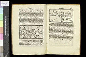
VEN5030442 Geography map: double page of an Atlas showing maps and descriptive texts of the islands of Hispagnola (Santo Domingo and Haiti) and the small Antilles in the Caribbean Sea

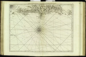
Background imageRelated Images Collection: Geography map: representation of the coasts of the island of Hispaniola (Santo Domingo and Haiti)

Geography map: representation of the coasts of the island of Hispaniola (Santo Domingo and Haiti) in the West Indies
VEN5030191 Geography map: representation of the coasts of the island of Hispaniola (Santo Domingo and Haiti) in the West Indies, made by Dutch cartographer Gerard van Keulen (1678-1726) 1709-1713

Background imageRelated Images Collection: Geography map: representation of the coasts of Florida, the Bahamas Islands

Geography map: representation of the coasts of Florida, the Bahamas Islands
VEN5030120 Geography map: representation of the coasts of Florida, the Bahamas Islands, the island of Cuba and part of the island of Hispaniola (Santo Domingo and Haiti)

Background imageRelated Images Collection: Geography Atlas: representation of the island of Hispaniola (Haiti and Santo Domingo)

Geography Atlas: representation of the island of Hispaniola (Haiti and Santo Domingo)
VEN5030000 Geography Atlas: representation of the island of Hispaniola (Haiti and Santo Domingo) and the passage of the Winds (or Under-wind) in the Caribbean archipelago. Below is a Wind Rose

Background imageRelated Images Collection: Geography Atlas: representation of the island of Santo Domingo in the West Indies

Geography Atlas: representation of the island of Santo Domingo in the West Indies
VEN5031364 Geography Atlas: representation of the island of Santo Domingo in the West Indies. Map taken from an atlas by Antonio del Monte y Tejada (1783-1861) with portraits of Christopher Columbus

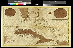
Background imageRelated Images Collection: Geography: map of the island of Cuba, the island of Hispaniola (Santo Domingo and Haiti)

Geography: map of the island of Cuba, the island of Hispaniola (Santo Domingo and Haiti), the island of Jamaica
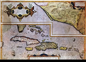
VEN5031283 Geography: map of the island of Cuba, the island of Hispaniola (Santo Domingo and Haiti), the island of Jamaica, the island of Margarita (Margarita) and the island of Saint John

Background imageRelated Images Collection: map of Haiti, Santo Domingo - Hispaniola, 18th century (engraving)

map of Haiti, Santo Domingo - Hispaniola, 18th century (engraving)
2902890 map of Haiti, Santo Domingo - Hispaniola, 18th century (engraving); Buyenlarge Archive/UIG

Background imageRelated Images Collection: Prise du Cap Francais

Prise du Cap Francais
2690890 Prise du Cap Francais; (add.info.: 1607N- The Capture of Cap Francais by General Leclerc during the Toussaint Louverture Revolte - Haiti); © Estate of Gerald Bloncourt

Background imageRelated Images Collection: Guy Joseph Bonnet (engraving)

Guy Joseph Bonnet (engraving)
2690588 Guy Joseph Bonnet (engraving); (add.info.: Guy-Joseph Bonnet (1773-1843), historian and officer of the weapon of Haiti. Guy-Joseph Bonnet made a military career. On 27 Aug


All Professionally Made to Order for Quick Shipping


-

Why Choose Us?

We are a leading provider of Art Prints and Photo Gifts since 2003, working in partnership with a range of Sporting Clubs, Charities, Museums and Picture Libraries. A large share of profits from any of their images will go directly towards supporting that charity or club. Our archive of images is carefully curated to bring you a wide range of subjects, including landscapes, wildlife, architecture, and more. We ship from our partner labs in the UK, USA, EU (Netherlands) and Australia.
+

How do I place an order?

Ordering is quick & easy - Just follow 5 Simple Steps:
  1. Find your image: Use our search box or browse our online photo Collections to find the image you want.

  2. Choose your print format: Select your desired product and add it to your cart.

  3. Enter your details: If you're a returning customer, simply enter your email address and password, and we'll fill in your billing and shipping address details. All personal details are held securely and are fully GDPR compliant. As standard, we remove all Personally Identifiable Information after 12 months.

  4. Pay for your purchase: We use state-of-the-art security for online shopping and do not have access to your card details.

  5. Sit back and relax: We'll email you confirmation of your order and when it's dispatched. Registered customers can also track orders in the 'My Account' area.

+

How do I pay for an order?

You can pay for your order with most of the major credit and debit cards, or PayPal. For added security, major financial institutions process payment details separately and securely on our behalf. We do not have access to your online payment card details. Online payments are preferred however we do take phone orders. For UK customers only we accept cheques issued against a UK bank.
+

Is my data safe?

We take data security very seriously. We do not have access to your full card details and all payments are requested over a fully secure connection. Additionally, we fully comply with current European and GDPR legislation, and automatically remove all personal data after at most 12 months (unless you have an account with us and have signed in recently). We also have a strict opt-in policy and would never sell your personal details. Your data is only used to fulfill your order promptly and efficiently.
+

Is wall art ready to hang?

For quick and easy installation all wall art, including framed prints, canvas prints and metal prints are supplied with a ready to hang solution on the back. Generally, saw tooth hangers are applied as they allow wall art to hang flush against the wall. The serrated edge of the hanger prevents the frame from shifting or tilting when hung.
+

Are the photo prints fade resistant?

Yes, we use archival quality photo paper photographic paper for vivid reproduction Prints are an accurate representations of the original artwork, which is preserved for artistic character and authenticity. We guarantee they match previews shown on our web site