Photo Mug > Asia > South Korea > Maps
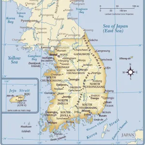
Photo Mug : South Korea, Relief Map with Border and Mask


![]()
Home Decor from Universal Images Group (UIG)
South Korea, Relief Map with Border and Mask
Relief map of South Korea (with border and mask). This image was compiled from data acquired by landsat 5 & 7 satellites combined with elevation data
Universal Images Group (UIG) manages distribution for many leading specialist agencies worldwide
Media ID 9619241
© Planet Observer/UIG
Coastline Korean Peninsula Relief Map Seoul Shore South Korea Satellite View
Photo Mug
Bring a piece of South Korea's unique beauty into your daily routine with our Media Storehouse Photo Mugs. Featuring an intricately detailed relief map of the country, complete with its borders and a protective mask, this mug showcases the stunning topography of South Korea as seen from space. Compiled using data from Landsat 5 & 7 satellites, this high-resolution image is a testament to the power of aerial photography. Perfect for tea or coffee, this mug makes an excellent gift for travel enthusiasts, geography buffs, or anyone who appreciates the wonders of our planet. Embrace the essence of South Korea every morning with a steaming hot beverage in hand and our Photo Mug.
A personalised photo mug blends sentimentality with functionality, making an ideal gift for cherished loved ones, close friends, or valued colleagues. Preview may show both sides of the same mug.
Elevate your coffee or tea experience with our premium white ceramic mug. Its wide, comfortable handle makes drinking easy, and you can rely on it to be both microwave and dishwasher safe. Sold in single units, preview may show both sides of the same mug so you can see how the picture wraps around.
Mug Size is 9.6cm high x 8.1cm diameter (3.8" x 3.2")
These are individually made so all sizes are approximate
FEATURES IN THESE COLLECTIONS
> Asia
> South Korea
> Maps
> Asia
> South Korea
> Related Images
> Asia
> South Korea
> Seoul
> Maps and Charts
> Related Images
> Universal Images Group (UIG)
> Universal Images Group
> Satellite and Aerial
> Planet Observer 4
EDITORS COMMENTS
This print showcases the stunning relief map of South Korea, adorned with a distinct border and mask. Created using data acquired by landsat 5 & 7 satellites, combined with elevation data, this image offers a unique perspective on the physical geography of South Korea. The intricate details captured in this photograph highlight the diverse topography of the region. From its picturesque coastline to its majestic mountain ranges, every element is beautifully depicted in vibrant colors. Seoul, the bustling capital city, stands out as a prominent feature on this map. The vertical composition adds depth and dimension to the image, allowing viewers to immerse themselves in South Korea's natural beauty. This satellite view provides an invaluable tool for cartographers and geographers studying the Korean Peninsula. It offers valuable insights into landforms and geographical features that shape South Korea's landscape. With no people present in this photograph, it allows us to focus solely on appreciating nature's artistry. Universal Images Group (UIG) has once again captured a remarkable moment through their lens. This print not only serves as an aesthetic masterpiece but also as an educational resource for those interested in exploring South Korea's physical terrain
MADE IN AUSTRALIA
Safe Shipping with 30 Day Money Back Guarantee
FREE PERSONALISATION*
We are proud to offer a range of customisation features including Personalised Captions, Color Filters and Picture Zoom Tools
SECURE PAYMENTS
We happily accept a wide range of payment options so you can pay for the things you need in the way that is most convenient for you
* Options may vary by product and licensing agreement. Zoomed Pictures can be adjusted in the Cart.