Poster Print > Aerial Photography > Related Images
Poster Print : Tacoma Washington US City Street Map


![]()
Poster Prints from Fine Art Storehouse
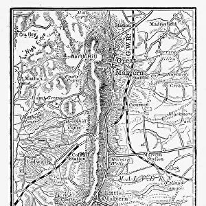
Tacoma Washington US City Street Map
Vector Illustration of a City Street Map of Tacoma, Washington, USA. Scale 1:60, 000.
All source data is in the public domain.
U.S. Geological Survey, US Topo
Used Layers:
USGS The National Map: National Hydrography Dataset (NHD)
USGS The National Map: National Transportation Dataset (NTD)
Unleash your creativity and transform your space into a visual masterpiece!
Frank Ramspott
Media ID 15054995
© Frank Ramspott, all rights reserved
Aerial View City Map Computer Graphic Directly Above Downtown District Gray Road Map Text Washington State Digitally Generated Image Green Color Tacoma White Color
A3 (42 x 29.7cm) Poster Print
Discover the charm of Tacoma, Washington with our stunningly detailed City Street Map print from Frank Ramspott's Media Storehouse collection. This exquisite vector illustration offers a captivating representation of the city at a 1:60,000 scale, making it an ideal addition to your home or office decor. With all source data in the public domain and hailing from the Fine Art Storehouse, you can trust the authenticity and quality of this impressive piece. Delve into the rich history and vibrant culture of Tacoma with a glance at this beautifully designed, large format City Street Map print.
Premium quality poster prints are printed on luxurious semi-gloss satin 270 gsm paper. Our meticulously crafted poster prints offer an affordable option for decorating any space, making them ideal for living rooms, bedrooms, offices and beyond. To ensure your poster arrives in good condition, we roll and send them in strong mailing tubes.
Poster prints are budget friendly enlarged prints in standard poster paper sizes (A0, A1, A2, A3 etc). Whilst poster paper is sometimes thinner and less durable than our other paper types, they are still ok for framing and should last many years. Our Archival Quality Photo Prints and Fine Art Paper Prints are printed on higher quality paper and the choice of which largely depends on your budget.
Estimated Product Size is 30.6cm x 42.6cm (12" x 16.8")
These are individually made so all sizes are approximate
Artwork printed orientated as per the preview above, with landscape (horizontal) or portrait (vertical) orientation to match the source image.
FEATURES IN THESE COLLECTIONS
> Fine Art Storehouse
> Map
> Street Maps
> Fine Art Storehouse
> Map
> USA Maps
> Aerial Photography
> Related Images
> Animals
> Insects
> Hemiptera
> Green Scale
> Arts
> Contemporary art
> Digital artwork
> Street art
> Arts
> Landscape paintings
> Waterfall and river artworks
> River artworks
> Arts
> Portraits
> Pop art gallery
> Street art portraits
> Arts
> Street art graffiti
> Digital art
> Digital paintings
> Arts
> Street art graffiti
> Digital art
> Vector illustrations
> Maps and Charts
> Geological Map
> Maps and Charts
> Related Images
> North America
> United States of America
> Lakes
> Related Images
EDITORS COMMENTS
This print showcases the intricate details of Tacoma, Washington's city street map. With a scale of 1:60,000, this vector illustration provides an accurate representation of the city's layout. The image is a result of combining various layers from publicly available data sources such as USGS The National Map: National Hydrography Dataset (NHD) and USGS The National Map: National Transportation Dataset (NTD). The print encompasses key features like the Puyallup River, downtown district, lakes, rivers, streets, and roads that make up this vibrant cityscape. Its design is digitally generated with no people present in order to focus solely on the physical geography and cartography. From an aerial view directly above Tacoma, this visually striking image captures the essence of the city with its textural elements in shades of gray and pops of blue and white colors representing water bodies. The green color signifies lush landscapes while adding a touch of vibrancy to the overall composition. Created by Frank Ramspott for Fine Art Storehouse using freely available source data from U. S. Geological Survey (USGS), this print beautifully encapsulates Tacoma's urban charm while serving as both an informative tool and a stunning piece of art for any admirer or resident alike.
MADE IN AUSTRALIA
Safe Shipping with 30 Day Money Back Guarantee
FREE PERSONALISATION*
We are proud to offer a range of customisation features including Personalised Captions, Color Filters and Picture Zoom Tools
SECURE PAYMENTS
We happily accept a wide range of payment options so you can pay for the things you need in the way that is most convenient for you
* Options may vary by product and licensing agreement. Zoomed Pictures can be adjusted in the Cart.