Home > North America > United States of America > New York > New York > Maps
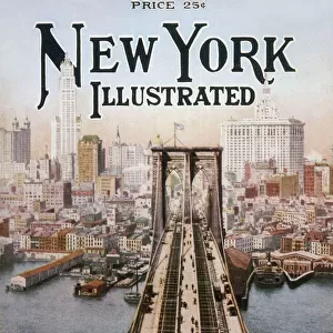
1862 Johnson Map Of New York City And Brooklyn

![]()
Wall Art and Photo Gifts from Universal Images Group (UIG)
1862 Johnson Map Of New York City And Brooklyn
1862, Johnson Map of New York City and Brooklyn
Universal Images Group (UIG) manages distribution for many leading specialist agencies worldwide
Media ID 38551552
© Artokoloro Quint Lox Limited
1862 Antique Map Latitude Longitude Mappa Mundi Old Antique Plan Old Antique View Ols Antique Map Rare Old Maps Topo
FEATURES IN THESE COLLECTIONS
> Europe
> France
> Canton
> Landes
> Historic
> Space exploration
> Maps and Charts
> Early Maps
> Maps and Charts
> Related Images
> Maps and Charts
> World
> North America
> United States of America
> New York
> New York
> Brooklyn
> Related Images
> North America
> United States of America
> New York
> New York
> Maps
> North America
> United States of America
> New York
> Related Images
> Universal Images Group (UIG)
> History
> Historical Maps
EDITORS COMMENTS
Step back in time to 1862 with this stunning print of the Johnson Map of New York City and Brooklyn. This vintage map is a treasure trove of geographic and historical significance, offering a unique glimpse into the urban landscape of one of the world's most iconic cities.
The map, created by William A. J. Armstrong for Johnson's Illustrated Edition of Mitchell's New General Atlas, showcases the rapidly growing metropolis in remarkable detail. From the bustling streets and buildings to the surrounding waterways and parks, every aspect of New York City and Brooklyn is meticulously depicted.
Notice how the city's grid-like layout is still taking shape, with many streets yet to be built or named. The map also highlights key landmarks such as Central Park, which was still under construction at this time, as well as major transportation hubs like ferries and railroads.
This beautiful print not only serves as a fascinating piece of cartography but also provides a window into the past for anyone interested in history, geography, or architecture. It's a must-have for collectors and enthusiasts alike!
MADE IN AUSTRALIA
Safe Shipping with 30 Day Money Back Guarantee
FREE PERSONALISATION*
We are proud to offer a range of customisation features including Personalised Captions, Color Filters and Picture Zoom Tools
SECURE PAYMENTS
We happily accept a wide range of payment options so you can pay for the things you need in the way that is most convenient for you
* Options may vary by product and licensing agreement. Zoomed Pictures can be adjusted in the Cart.