Fraud Blocker Skip to main content

Home > Europe > France > Maps

Maps Collection (page 44)

Maps of France Europe are essential tools for travelers and tourists who want to explore the continent

11,167 items

Background imageMaps Collection: Old chromolithograph map of Paris, capital and most populous city of France

Old chromolithograph map of Paris, capital and most populous city of France
Antique Illustration, Copyright has expired on this artwork. From my own archives, digitally restored

Background imageMaps Collection: Map of Nancy, from Civitates Orbis Terrarum by Georg Braun (1541-1622)

Map of Nancy, from Civitates Orbis Terrarum by Georg Braun (1541-1622) and Frans Hogenberg (1535-90) c
STC138946 Map of Nancy, from Civitates Orbis Terrarum by Georg Braun (1541-1622) and Frans Hogenberg (1535-90) c.1572-1617 (coloured engraving) by Hoefnagel

Background imageMaps Collection: Emperor Albert I of Habsburg (1255-1308) studying the map of France at the time of the conflict

Emperor Albert I of Habsburg (1255-1308) studying the map of France at the time of the conflict between Pope Boniface
ELD4931939 Emperor Albert I of Habsburg (1255-1308) studying the map of France at the time of the conflict between Pope Boniface VIII and King Philip IV of France

Background imageMaps Collection: Universal hydrographic map. Manuscript by Jean Guerard, French geographer. 1734. paris, B. N
Universal hydrographic map. Manuscript by Jean Guerard, French geographer. 1734. paris, B. N
JLJ4592059 Universal hydrographic map. Manuscript by Jean Guerard, French geographer. 1734. paris, B.N. by Guerard, Jean (active 1612-1634); Bibliotheque Nationale, Paris

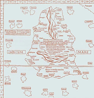
Background imageMaps Collection: Map of Taprobana island, Reduced facsimile of a map in Ptolemy's Geography

Map of Taprobana island, Reduced facsimile of a map in Ptolemy's Geography, in the Latin Edition of 1492
3661329 Map of Taprobana island, Reduced facsimile of a map in Ptolemy's Geography, in the Latin Edition of 1492, from Science and Literature in The Middle Ages by Paul Lacroix pub

Background imageMaps Collection: Representation of a geographic map of France at the end of the 19th century with areas

Representation of a geographic map of France at the end of the 19th century with areas corresponding to diseases
ELD4948341 Representation of a geographic map of France at the end of the 19th century with areas corresponding to diseases (scrofule, phtisia, malaria, goiter and cretinism, pellagre, moth)

Background imageMaps Collection: Old chromolithograph map of France - Northeast part

Old chromolithograph map of France - Northeast part
Antique Illustration, Copyright has expired on this artwork. From my own archives, digitally restored

Background imageMaps Collection: Old chromolithograph map of France - Treaty of Luneville (or Peace of Luneville) - 9 February 1801

Old chromolithograph map of France - Treaty of Luneville (or Peace of Luneville) - 9 February 1801
Antique Illustration, Copyright has expired on this artwork. From my own archives, digitally restored

Background imageMaps Collection: Old chromolithograph map of France after the Treaty of Bretigny

Old chromolithograph map of France after the Treaty of Bretigny and France at the death of Edward III
Antique Illustration, Copyright has expired on this artwork. From my own archives, digitally restored

Background imageMaps Collection: Old chromolithograph map of France under Charles VIII

Old chromolithograph map of France under Charles VIII
Antique Illustration, Copyright has expired on this artwork. From my own archives, digitally restored

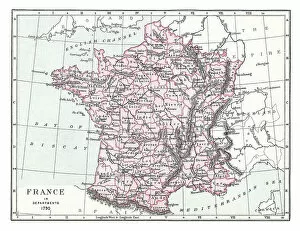
Background imageMaps Collection: Old chromolithograph map of France in Departments, 1790

Old chromolithograph map of France in Departments, 1790
Antique Illustration, Copyright has expired on this artwork. From my own archives, digitally restored

Background imageMaps Collection: Old chromolithograph map of France in Provinces (1769-1789)

Old chromolithograph map of France in Provinces (1769-1789)
Antique Illustration, Copyright has expired on this artwork. From my own archives, digitally restored

Background imageMaps Collection: Old chromolithograph map of France of the accession of Louis XI - 1461

Old chromolithograph map of France of the accession of Louis XI - 1461
Antique Illustration, Copyright has expired on this artwork. From my own archives, digitally restored

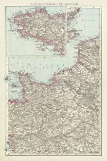
Background imageMaps Collection: Old chromolithograph map of France - Northwest part

Old chromolithograph map of France - Northwest part
Antique Illustration, Copyright has expired on this artwork. From my own archives, digitally restored

Background imageMaps Collection: Old chromolithograph map of France

Old chromolithograph map of France
Antique Illustration, Copyright has expired on this artwork. From my own archives, digitally restored

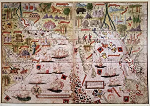
Background imageMaps Collection: The Indes Portuguese nautical atlas. Page of the Atlas Miller manuscript made in 1519 by Pierre

The Indes Portuguese nautical atlas. Page of the Atlas Miller manuscript made in 1519 by Pierre and Georges Reinel
JLJ4595288 The Indes Portuguese nautical atlas. Page of the Atlas Miller manuscript made in 1519 by Pierre and Georges Reinel, Lopo Homem (cartographers) and Antoine de Hollande (miniaturist)

Background imageMaps Collection: Map of the Island of Taprobana

Map of the Island of Taprobana
3786002 Map of the Island of Taprobana by French School, (19th century); (add.info.: Map of the Island of Taprobana - from reduced fac-simile of map in Ptolemy's Georgraphy, Latin edition, 1492)

Background imageMaps Collection: First World War - War 14-18 (1914-1918) - World War I (WWI or WW1): France

First World War - War 14-18 (1914-1918) - World War I (WWI or WW1): France
LUX4740403 First World War - War 14-18 (1914-1918) - World War I (WWI or WW1): France, Patriotic Map showing a drawing of a soldier in a trench watching the front line, titled: listening, 1915

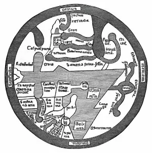
Background imageMaps Collection: Map of the Roman World

Map of the Roman World
3785954 Map of the Roman World by French School, (19th century); (add.info.: Map of the Roman World - from Liber Guidonis, manuscript of 1119)

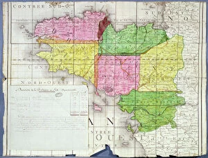
Background imageMaps Collection: Division of Brittany into Six Departments, c. 1789-90 (colour litho)

Division of Brittany into Six Departments, c. 1789-90 (colour litho)
ARH207437 Division of Brittany into Six Departments, c.1789-90 (colour litho) by French School, (18th century); Centre Historique des Archives Nationales, Paris, France; © Archives Charmet

Background imageMaps Collection: Map of Gaul - fragment

Map of Gaul - fragment
3785945 Map of Gaul - fragment by French School, (19th century); (add.info.: Map of Gaul - fragment. From reduced fac-simile of Pentinger's map in 13th century manuscript. (Imperial Library, Vienna)

Background imageMaps Collection: Map of the North Atlantic Ocean, 16th century (miniature)

Map of the North Atlantic Ocean, 16th century (miniature)
JLJ4592290 Map of the North Atlantic Ocean, 16th century (miniature) by Hollande, Antoine de (active c.1519); Bibliotheque Nationale, Paris, France; (add.info.: Map of the North Atlantic Ocean)

Background imageMaps Collection: Map of South America

Map of South America
3785948 Map of South America by French School, (19th century); (add.info.: Map of South America - from reduced reproduction of map in Spanish atlas by Joan Martines at Messina, 1582)

Background imageMaps Collection: Map of South America 19th Century

Map of South America 19th Century
Vintage map of South America from the 19th Century

Background imageMaps Collection: Kingdom of France Divided into its Governments

Kingdom of France Divided into its Governments
Maps, TR002309

Background imageMaps Collection: Benito Mussolini seizes power in Italy, 1922 (illustration)

Benito Mussolini seizes power in Italy, 1922 (illustration)
7343427 Benito Mussolini seizes power in Italy, 1922 (illustration) by Lecoultre, Marcel (1867-1942); (add.info.: Benito Mussolini (1883-1945), leader of fascism

Background imageMaps Collection: Michelin man. (illustration, circa 1930)

Michelin man. (illustration, circa 1930)
5975666 Michelin man. (illustration, circa 1930) by Rossillon, Marius (O'Galop) (1867-1946); Private Collection; (add.info.: Geography. France)

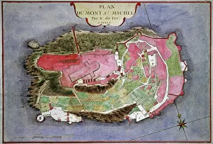
Background imageMaps Collection: Mont Saint Michel

Mont Saint Michel
1837115 Mont Saint Michel by Fer, Nicolas de (1646-1720); (add.info.: The Mont-Saint-Michel (Normandy, France) : map by Nicolas de Fer, France, 1703); Photo © CCI

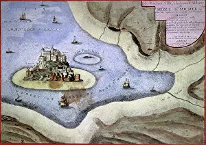
Background imageMaps Collection: Mont Saint Michel

Mont Saint Michel
1841258 Mont Saint Michel by Fer, Nicolas de (1646-1720); (add.info.: The Mont-Saint-Michel (Normandy, France) : map by Nicolas de Fer, France, 1703); Photo © CCI

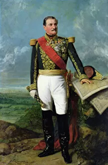
Background imageMaps Collection: Elie-Frederic Forey (1804-1872), Empire Marshall, 1865 (oil on canvas)

Elie-Frederic Forey (1804-1872), Empire Marshall, 1865 (oil on canvas)
904775 Elie-Frederic Forey (1804-1872), Empire Marshall, 1865 (oil on canvas) by Lariviere, Charles-Philippe (1798-1876); Chateau de Versailles

Background imageMaps Collection: 'Around the world with family' by Lady Brassey, 1887 (illustration)

"Around the world with family" by Lady Brassey, 1887 (illustration)
7311787 "Around the world with family" by Lady Brassey, 1887 (illustration) by Souze, Auguste (b.1829 - fl.1860s); Private Collection; (add.info)

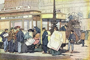
Background imageMaps Collection: The tram, in Imagier de l'enfance, c. 1900 (engraving)

The tram, in Imagier de l'enfance, c. 1900 (engraving)
DUV4206167 The tram, in Imagier de l enfance, c.1900 (engraving) by Raffin, Ferdinand (1870?-1948); 14.5 x 18.5 cm; Private Collection; (add.info.: The tram)

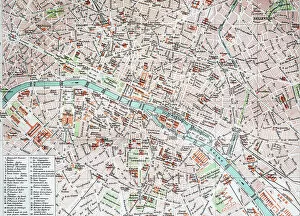
Background imageMaps Collection: Street Map of Paris, 1890, France, Historic, digitally restored reproduction of an original 19th

Street Map of Paris, 1890, France, Historic, digitally restored reproduction of an original 19th century original
7279590 Street Map of Paris, 1890, France, Historic, digitally restored reproduction of an original 19th century original, Europe by Unknown Artist

Background imageMaps Collection: The Tour de France of a Little Parisian by Constant Amero, circa 1880 - 1885 (illustration)

The Tour de France of a Little Parisian by Constant Amero, circa 1880 - 1885 (illustration)
7298984 The Tour de France of a Little Parisian by Constant Amero, circa 1880 - 1885 (illustration) by Souze, Auguste (b.1829 - fl.1860s); (add.info)

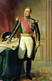
Background imageMaps Collection: French marshal Armand Jacques Achille Leroy de Saint Arnaud (1796-1854), 1854 (oil on canvas)

French marshal Armand Jacques Achille Leroy de Saint Arnaud (1796-1854), 1854 (oil on canvas)
904763 French marshal Armand Jacques Achille Leroy de Saint Arnaud (1796-1854), 1854 (oil on canvas) by Lariviere, Charles-Philippe (1798-1876); 219x144 cm; Chateau de Versailles

Background imageMaps Collection: Traditional Japanese theatre: an actor threatens an actress with a sword, 1900 (illustration)

Traditional Japanese theatre: an actor threatens an actress with a sword, 1900 (illustration)
7202903 Traditional Japanese theatre: an actor threatens an actress with a sword, 1900 (illustration) by Arai, Yoshimune (1873-1945); Private Collection; (add.info)

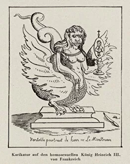
Background imageMaps Collection: Caricature depicting King Henry III of France as a homosexual monster (engraving)

Caricature depicting King Henry III of France as a homosexual monster (engraving)
7186160 Caricature depicting King Henry III of France as a homosexual monster (engraving) by French School, (16th century) (after); Private Collection; (add.info)

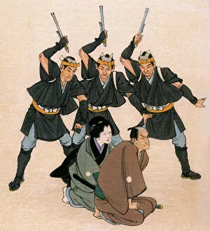
Background imageMaps Collection: Traditional Japanese theatre: three men-at-arms threaten a male and a female character

Traditional Japanese theatre: three men-at-arms threaten a male and a female character, 1900 (illustration)
7202904 Traditional Japanese theatre: three men-at-arms threaten a male and a female character, 1900 (illustration) by Arai

Background imageMaps Collection: Old engraved map of Battle of Neerwinden (29. 07. 1693) - battle between the French, British

Old engraved map of Battle of Neerwinden (29. 07. 1693) - battle between the French, British, and Dutch
Copyright has expired on this artwork. From my own archives, digitally restored

Background imageMaps Collection: Map of Hochelaga, New France (Canada) - from 'Navigazioni e viaggi', by Ramusio, 1565

Map of Hochelaga, New France (Canada) - from "Navigazioni e viaggi", by Ramusio, 1565
XRX4751510 Map of Hochelaga, New France (Canada) - from " Navigazioni e viaggi", by Ramusio, 1565 by Italian School, (16th century) (after); (add.info.: Map of Hochelaga)

Background imageMaps Collection: Map of East Prussia. from Le Theatre du Monde or Nouvel Atlas, 1645 (coloured engraving)

Map of East Prussia. from Le Theatre du Monde or Nouvel Atlas, 1645 (coloured engraving)
CHT211402 Map of East Prussia. from Le Theatre du Monde or Nouvel Atlas, 1645 (coloured engraving) by Blaeu, Joan (1596-1673); Bibliotheque des Arts Decoratifs, Paris, France; © Archives Charmet

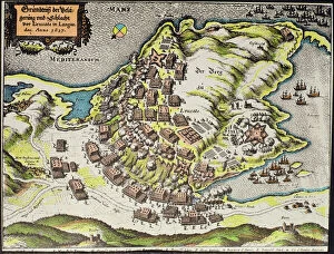
Background imageMaps Collection: Site of the Battle of the Castle of Cape Leucate during the war over Roussillon

Site of the Battle of the Castle of Cape Leucate during the war over Roussillon, 1635-39 (coloured engraving)
354839 Site of the Battle of the Castle of Cape Leucate during the war over Roussillon, 1635-39 (coloured engraving) by German School, (17th century) (after); Private Collection; Index Fototeca

Background imageMaps Collection: Le Vocabulaire Illustre: Rixe; Affray; Handgemenge (engraving)

Le Vocabulaire Illustre: Rixe; Affray; Handgemenge (engraving)
7197403 Le Vocabulaire Illustre: Rixe; Affray; Handgemenge (engraving) by European School, (19th century); Private Collection; (add.info.: Rixe; Affray; Handgemenge)

Background imageMaps Collection: Le Vocabulaire Illustre: Cadavre; Corpse; Leiche (engraving)

Le Vocabulaire Illustre: Cadavre; Corpse; Leiche (engraving)
7195106 Le Vocabulaire Illustre: Cadavre; Corpse; Leiche (engraving) by European School, (19th century); Private Collection; (add.info.: Cadavre; Corpse; Leiche)

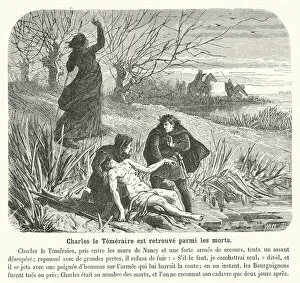
Background imageMaps Collection: Charles le Temeraire est retrouve parmi les morts (engraving)

Charles le Temeraire est retrouve parmi les morts (engraving)
7194127 Charles le Temeraire est retrouve parmi les morts (engraving) by French School, (19th century); Private Collection; (add.info.: Charles le Temeraire est retrouve parmi les morts)

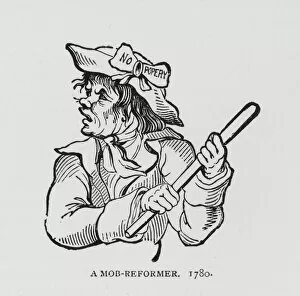
Background imageMaps Collection: A Mob-Reformer, 1780 (engraving)

A Mob-Reformer, 1780 (engraving)
7148353 A Mob-Reformer, 1780 (engraving) by English School, (18th century); Private Collection; (add.info.: A Mob-Reformer, 1780)

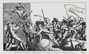
Background imageMaps Collection: The Hustings at Brentford, Middlesex Election, 1768. Serjeant Glynn and Sir W Beauchamp Proctor

The Hustings at Brentford, Middlesex Election, 1768. Serjeant Glynn and Sir W Beauchamp Proctor (engraving)
7148322 The Hustings at Brentford, Middlesex Election, 1768. Serjeant Glynn and Sir W Beauchamp Proctor (engraving) by English School

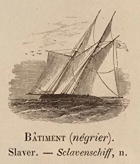
Background imageMaps Collection: Le Vocabulaire Illustre: Batiment (negrier); Slaver; Sclavenschiff (engraving)

Le Vocabulaire Illustre: Batiment (negrier); Slaver; Sclavenschiff (engraving)
7194878 Le Vocabulaire Illustre: Batiment (negrier); Slaver; Sclavenschiff (engraving) by European School, (19th century); Private Collection; (add.info.: Batiment (negrier); Slaver; Sclavenschiff


All Professionally Made to Order for Quick Shipping


-

Maps Collection

Maps of France Europe are essential tools for travelers and tourists who want to explore the continent. They provide an overview of the country, its major cities, and its attractions and are show roads, rivers, mountains, lakes, and other natural features that make up the landscape. Additionally, they often include information about local customs and culture as well as points of interest such as museums or monuments, and are be found in bookstores or online in various formats including paper maps or digital versions that can be accessed on mobile devices. With a map of France Europe in hand travelers will have no trouble navigating their way around this beautiful country.
+

Our beautiful pictures are available as Framed Prints, Photos, Wall Art and Photo Gifts

The Maps of France Europe collection is a stunning assortment of wall art and framed prints that showcase the beauty and diversity of France. Our collection features an extensive range of maps, including antique maps dating back to the 16th century, as well as modern-day maps highlighting the country's cities, regions, and landmarks. Each print in our collection has been carefully curated by Media Storehouse to provide customers with a unique glimpse into French history and culture. From detailed depictions of Parisian streets to panoramic views of the Alps, these prints are sure to captivate anyone who loves France or European geography. Whether you're looking for a beautiful piece of artwork for your home or office or want to give someone special a thoughtful gift, Maps of France Europe offers something for everyone. With its high-quality printing techniques and durable framing options, our collection is sure to impress even the most discerning art enthusiasts.
+

What are Maps of France Europe art prints?

Maps of France Europe art prints are high-quality reproductions of vintage and contemporary maps showcasing the geography, topography, and landmarks of France and its neighboring European countries. These prints are perfect for those who love history, travel, or simply appreciate the beauty of cartography. The collection includes a wide range of styles, from antique maps dating back to the 16th century to modern designs featuring vibrant colors and intricate details. Some prints focus on specific regions or cities within France or Europe while others provide an overview of the entire continent. These art prints can be used to decorate any room in your home or office, adding a touch of sophistication and elegance to your space. They also make great gifts for anyone with an interest in geography or history. Whether you're looking for a unique piece to add to your personal collection or want to give someone special a thoughtful gift they'll treasure forever, Maps of France Europe art prints from Media Storehouse are sure to impress.
+

What Maps of France Europe art prints can I buy from Media Storehouse?

We offer a wide range of Maps of France Europe art prints that are perfect for those who love to travel or have an interest in geography. These maps come in various styles and designs, including vintage, antique, and modern versions. You can choose from different sizes and formats such as canvas prints, framed prints, posters or photographic prints. Some popular options include the Antique Map of France by John Speed which dates back to 1626; the Vintage Map of Paris which showcases the city's famous landmarks; and the Modern Map of Europe which highlights all major cities across the continent. Whether you're looking for a decorative piece for your home or office space or want to gift it to someone who loves history or geography- Media Storehouse has got you covered with their vast collection of Maps of France Europe art prints.
+

How do I buy Maps of France Europe art prints?

To buy Maps of France Europe art prints from Media Storehouse, you can browse through our extensive collection of maps and select the ones that interest you. Once you have made your selection, add them to your cart and proceed to checkout. You will be prompted to enter your shipping and payment information before completing the purchase. We offer a variety of sizes for their art prints, so make sure to choose the one that best fits your needs. The maps are printed on high-quality paper using state-of-the-art printing technology, ensuring that they look great in any setting. If you have any questions or concerns about purchasing Maps of France Europe art prints from Media Storehouse, our customer service team is available to assist you. They can provide additional information about the products or help with any issues that may arise during the ordering process.
+

How much do Maps of France Europe art prints cost?

We offer a wide range of Maps of France Europe art prints at varying prices. The cost of these prints depends on several factors such as the size, quality, and type of print you choose. Our standard paper prints are more affordable than our premium canvas or framed options. Additionally, some maps may be more intricate and detailed than others which can also impact the price. We strive to provide high-quality products at reasonable prices for all customers. Our Maps of France Europe art prints make great additions to any home or office decor and are perfect for history buffs or those who love travel. With a variety of sizes and styles available, there is something for everyone's taste and budget. We encourage customers to browse our selection online to find the perfect map print that fits their needs and preferences without breaking the bank.
+

How will my Maps of France Europe art prints be delivered to me?

We take great care in delivering your Maps of France Europe art prints to you. We use high-quality packaging materials to ensure that your artwork arrives in pristine condition. Your print will be carefully rolled and placed inside a sturdy tube for protection during transit. We work with trusted shipping partners who offer reliable delivery services. Once your order has been dispatched, you will receive an email notification with tracking information so that you can monitor the progress of your shipment. Our team is dedicated to providing excellent customer service, and we are always available to answer any questions or concerns you may have about the delivery process. If there are any issues with your order upon arrival, please contact us immediately so that we can resolve them as quickly as possible. You can trust Media Storehouse to deliver your Maps of France Europe art prints safely and efficiently straight to your doorstep.