Fraud Blocker Skip to main content

Home > Europe > France > Maps

Maps Collection (page 45)

Maps of France Europe are essential tools for travelers and tourists who want to explore the continent

11,159 items

Background imageMaps Collection: The Huguenots led by Gaspard de Coligny demanding religious toleration for Protestants, France

The Huguenots led by Gaspard de Coligny demanding religious toleration for Protestants, France, 1560 (engraving)
7149537 The Huguenots led by Gaspard de Coligny demanding religious toleration for Protestants, France, 1560 (engraving) by French School

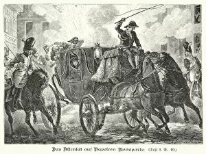
Background imageMaps Collection: Assassination attempt against Napoleon, Paris, 1800 (engraving)

Assassination attempt against Napoleon, Paris, 1800 (engraving)
7173335 Assassination attempt against Napoleon, Paris, 1800 (engraving) by German School, (19th century); Private Collection; (add.info.: Assassination attempt against Napoleon, Paris, 1800)

Background imageMaps Collection: Die Albigenser, poem by Nikolaus Lenau (colour litho)

Die Albigenser, poem by Nikolaus Lenau (colour litho)
7172611 Die Albigenser, poem by Nikolaus Lenau (colour litho) by Kutzer, E. (20th century); Private Collection; (add.info.: Die Albigenser, poem by Austrian poet Nikolaus Lenau)

Background imageMaps Collection: Triumph of Death (woodcut)

Triumph of Death (woodcut)
7201701 Triumph of Death (woodcut) by Tory, Geoffroy (1480-1533); Private Collection; (add.info.: Triumph of Death. Illustration from Visages de l Ile-de-France, by Jean de la Monneraye)

Background imageMaps Collection: Le Vocabulaire Illustre: Brutal; Brute; Brutale Mensch (engraving)

Le Vocabulaire Illustre: Brutal; Brute; Brutale Mensch (engraving)
7195072 Le Vocabulaire Illustre: Brutal; Brute; Brutale Mensch (engraving) by European School, (19th century); Private Collection; (add.info.: Brutal; Brute; Brutale Mensch)

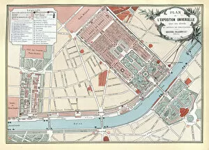
Background imageMaps Collection: Map, Plan of the Paris Exposition Universelle of 1889, France

Map, Plan of the Paris Exposition Universelle of 1889, France
Vintage illustration, Map, Plan of the Paris Exposition Universelle of 1889, France

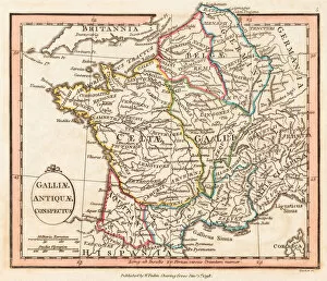
Background imageMaps Collection: Ancient Gaul. Map

Ancient Gaul. Map
7269217 Ancient Gaul. Map. by Faden, William (1750-1836); Private Collection; (add.info.: Galliae antiquae conspectus. A View of Ancient Gaul)

Background imageMaps Collection: Ancient Italy. Map

Ancient Italy. Map
7269206 Ancient Italy. Map. by Faden, William (1750-1836); Private Collection; (add.info.: Italiae veteris delineatio. Ancient Italy. 1798 map by cartographer William Faden, engraved by Hatchett)

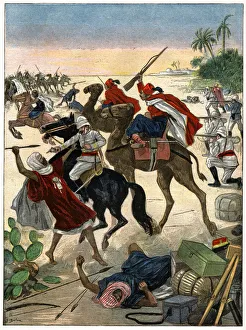
Background imageMaps Collection: Battle in Sahara, 1900

Battle in Sahara, 1900
7143097 Battle in Sahara, 1900 by Belon, Jose (d.1927); Private Collection; (add.info.: History. Algeria. Battle between french troops and tuaregs near In Salah, Sahara)

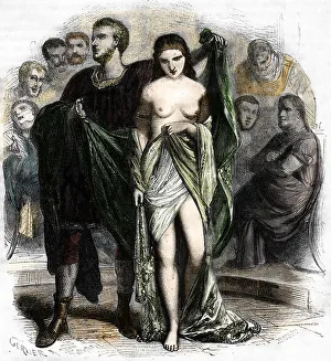
Background imageMaps Collection: The Greek hetarius and courtesan Phryne (Phrynee) tried before the aeropagus for impiety

The Greek hetarius and courtesan Phryne (Phrynee) tried before the aeropagus for impiety, 19th century (engraving)
7203439 The Greek hetarius and courtesan Phryne (Phrynee) tried before the aeropagus for impiety, 19th century (engraving) by French School

Background imageMaps Collection: Map of Paris. (Illustration, circa 1930)

Map of Paris. (Illustration, circa 1930)
5975932 Map of Paris. (Illustration, circa 1930) by Rossillon, Marius (O Galop) (1867-1946); Private Collection; (add.info.: Geography. France. Map of outings from Paris)

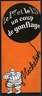
Background imageMaps Collection: Michelin Bibendum. (Illustration, circa 1930)

Michelin Bibendum. (Illustration, circa 1930)
5975934 Michelin Bibendum. (Illustration, circa 1930) by Rossillon, Marius (O Galop) (1867-1946); Private Collection; (add.info.: Transport. Automotive. Inflate your tires properly twice a month)

Background imageMaps Collection: The taking of La Rochelle from the Protestants, 1628 by Cardinal Richelieu (1585-1642)

The taking of La Rochelle from the Protestants, 1628 by Cardinal Richelieu (1585-1642)
STC169298 The taking of La Rochelle from the Protestants, 1628 by Cardinal Richelieu (1585-1642), engraved by Jean Baptiste Morret (fl.1790-1820), 1790 (colour engraving) by Swebach

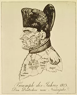
Background imageMaps Collection: Triumph des Jahres 1813, portrait of Napoleon composed of corpses (engraving)

Triumph des Jahres 1813, portrait of Napoleon composed of corpses (engraving)
884401 Triumph des Jahres 1813, portrait of Napoleon composed of corpses (engraving) by Voltz, Johann Michael (1784-1858); Private Collection; (add.info.: Napoleon compose de cadavres)

Background imageMaps Collection: The King of Pigs, Plate No. 4 in the series The Museum of Horrors, 1900 (litho)

The King of Pigs, Plate No. 4 in the series The Museum of Horrors, 1900 (litho)
884363 The King of Pigs, Plate No. 4 in the series The Museum of Horrors, 1900 (litho) by Lenepveu, Jules Eugene (1819-98); Private Collection; (add.info.: Le Roi des Porcs)

Background imageMaps Collection: Cabalistic drawing (engraving)

Cabalistic drawing (engraving)
7185755 Cabalistic drawing (engraving) by French School, (19th century); Private Collection; (add.info.: Cabalistic drawing)

Background imageMaps Collection: Map of the Paris World Fair, 1937 (litho)

Map of the Paris World Fair, 1937 (litho)
1729068 Map of the Paris World Fair, 1937 (litho) by French School, (20th century); (add.info.: Map of the world fair, Paris, 1937)

Background imageMaps Collection: Catalan Atlas, Sheet 10, 1375 (pen with coloured inks on parchment)

Catalan Atlas, Sheet 10, 1375 (pen with coloured inks on parchment)
5054670 Catalan Atlas, Sheet 10, 1375 (pen with coloured inks on parchment) by Cresques, Abraham (1325-87); Bibliotheque Nationale, Paris, France; (add.info.: World map made in Majorca)

Background imageMaps Collection: POLAR STAR, 1813 (engraving)

POLAR STAR, 1813 (engraving)
7262218 POLAR STAR, 1813 (engraving) by Dubois, Frederic (fl.1780-1815); Bromley Museum, Orpington, UK; (add.info.: POLAR STAR Oct 1813 cat: 11708 Star Brilliant, immense, it illuminates)

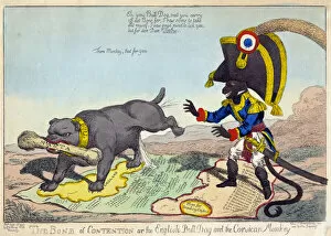
Background imageMaps Collection: THE BONE OF CONTENTION OR THE ENGLISH BULLDOG AND THE CORSICAN MONKEY, 1803 (engraving)

THE BONE OF CONTENTION OR THE ENGLISH BULLDOG AND THE CORSICAN MONKEY, 1803 (engraving)
7262217 THE BONE OF CONTENTION OR THE ENGLISH BULLDOG AND THE CORSICAN MONKEY, 1803 (engraving) by Williams, C. (19th century); Bromley Museum, Orpington

Background imageMaps Collection: Napoleon gallops on Ambition, a horse with wings on its feet over the globe, 1814 (engraving)

Napoleon gallops on Ambition, a horse with wings on its feet over the globe, 1814 (engraving)
7262245 Napoleon gallops on Ambition, a horse with wings on its feet over the globe, 1814 (engraving) by Heath, William (1795-1840); Bromley Museum, Orpington

Background imageMaps Collection: The land of Cocagne, ideal and imaginary country, 19th century (epinal print)

The land of Cocagne, ideal and imaginary country, 19th century (epinal print)
ELD4836064 The land of Cocagne, ideal and imaginary country, 19th century (epinal print) by French School, (19th century); Private Collection; (add.info.: The land of Cocagne)

Background imageMaps Collection: The land of Cocagne, ideal and imaginary country, 19th century (epinal print)

The land of Cocagne, ideal and imaginary country, 19th century (epinal print)
ELD4836011 The land of Cocagne, ideal and imaginary country, 19th century (epinal print) by French School, (19th century); Private Collection; (add.info.: The land of Cocagne)

Background imageMaps Collection: The arenas, plan of the underground floor, of the ground and of the first in Arles

The arenas, plan of the underground floor, of the ground and of the first in Arles. Arbaud Museum, Aix en Provence
JEB4863422 The arenas, plan of the underground floor, of the ground and of the first in Arles. Arbaud Museum, Aix en Provence by Questel (19th century); (add.info.: The arenas)

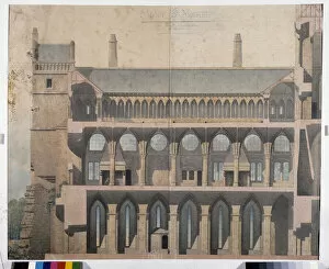
Background imageMaps Collection: Abbey of Thoronet, section and exterior view of the church. Arbaud Museum, Aix en Provence

Abbey of Thoronet, section and exterior view of the church. Arbaud Museum, Aix en Provence
JEB4862856 Abbey of Thoronet, section and exterior view of the church. Arbaud Museum, Aix en Provence by Sauvageot, Claude (1832-85); (add.info.: Abbey of Thoronet)

Background imageMaps Collection: Cup of Mont Saint Michel representing the restoration project. Drawing by Emile Sagot

Cup of Mont Saint Michel representing the restoration project. Drawing by Emile Sagot
JEB4960564 Cup of Mont Saint Michel representing the restoration project. Drawing by Emile Sagot. Municipal Museum of Avranches (Manche) by Sagot

Background imageMaps Collection: Western cup of the abbey. Mont Saint Michel. Municipal museum of the city of Avranches (Manche)

Western cup of the abbey. Mont Saint Michel. Municipal museum of the city of Avranches (Manche)
JEB4960372 Western cup of the abbey. Mont Saint Michel. Municipal museum of the city of Avranches (Manche) by Sagot, Emile (1805-1890); (add.info.: Western cup of the abbey. Mont Saint Michel)

Background imageMaps Collection: Geographic map of Gauls showing the borders with Germany and Italy

Geographic map of Gauls showing the borders with Germany and Italy. Realised by cartographer Jean Jolivet (16th century)
JLJ4571925 Geographic map of Gauls showing the borders with Germany and Italy. Realised by cartographer Jean Jolivet (16th century), 1578

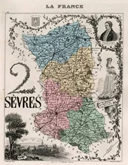
Background imageMaps Collection: Les Deux Sevres (Deux-Sevres, 79), Poitou Charentes (Poitou-Charentes) - France and its Colonies

Les Deux Sevres (Deux-Sevres, 79), Poitou Charentes (Poitou-Charentes) - France and its Colonies
XEE4144439 Les Deux Sevres (Deux-Sevres, 79), Poitou Charentes (Poitou-Charentes) - France and its Colonies. Atlas illustrates one hundred and five maps from the maps of the depot of war

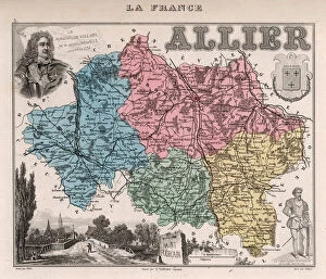
Background imageMaps Collection: Department of Allier (03), Auvergne - France and its Colonies. Atlas illustrates one hundred

Department of Allier (03), Auvergne - France and its Colonies. Atlas illustrates one hundred
XEE4144657 Department of Allier (03), Auvergne - France and its Colonies. Atlas illustrates one hundred and five maps from the maps of the depot of war, bridges and footwear and the Navy by M

Background imageMaps Collection: Le Cantal (15), Auvergne - France and its Colonies. Atlas illustrates one hundred

Le Cantal (15), Auvergne - France and its Colonies. Atlas illustrates one hundred
XEE4144621 Le Cantal (15), Auvergne - France and its Colonies. Atlas illustrates one hundred and five maps from the maps of the depot of war, bridges and footwear and the Navy by M. VUILLEMIN. 1876

Background imageMaps Collection: Corsica including South Corsica (2A) and Haute Corsica (2B) - France and its Colonies

Corsica including South Corsica (2A) and Haute Corsica (2B) - France and its Colonies
XEE4144608 Corsica including South Corsica (2A) and Haute Corsica (2B) - France and its Colonies. Atlas illustrates one hundred and five maps drawn from the maps of the depot of war

Background imageMaps Collection: Le Gers (32), Midi-Pyrenees (Midi Pyrenees) - France and its Colonies. Atlas illustrates one hundred

Le Gers (32), Midi-Pyrenees (Midi Pyrenees) - France and its Colonies. Atlas illustrates one hundred
XEE4144568 Le Gers (32), Midi-Pyrenees (Midi Pyrenees) - France and its Colonies. Atlas illustrates one hundred and five maps from the maps of the depot of war

Background imageMaps Collection: Le Morbihan (56), Brittany - France and its Colonies. Atlas illustrates one hundred

Le Morbihan (56), Brittany - France and its Colonies. Atlas illustrates one hundred
XEE4144496 Le Morbihan (56), Brittany - France and its Colonies. Atlas illustrates one hundred and five maps from the maps of the depot of war, bridges and footwear and the Navy by M. VUILLEMIN

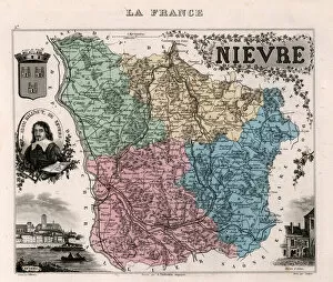
Background imageMaps Collection: La Nievre (58), Burgundy - France and its Colonies. Atlas illustrates one hundred

La Nievre (58), Burgundy - France and its Colonies. Atlas illustrates one hundred
XEE4144487 La Nievre (58), Burgundy - France and its Colonies. Atlas illustrates one hundred and five maps from the maps of the depot of war, bridges and footwear and the Navy by M. VUILLEMIN. 1876

Background imageMaps Collection: Le Nord (59), Nord Pas De Calais (Nord-Pas-de-Calais) - France and its Colonies

Le Nord (59), Nord Pas De Calais (Nord-Pas-de-Calais) - France and its Colonies
XEE4144486 Le Nord (59), Nord Pas De Calais (Nord-Pas-de-Calais) - France and its Colonies. Atlas illustrates one hundred and five maps from the maps of the depot of war

Background imageMaps Collection: Tarn (Tarn, 81), Midi-Pyrenees (Midi Pyrenees) - France and its Colonies

Tarn (Tarn, 81), Midi-Pyrenees (Midi Pyrenees) - France and its Colonies. Atlas illustrates one hundred
XEE4144429 Tarn (Tarn, 81), Midi-Pyrenees (Midi Pyrenees) - France and its Colonies. Atlas illustrates one hundred and five maps from the maps of the depot of war

Background imageMaps Collection: La Vendee (85), Pays de la Loire, - France and its Colonies. Atlas illustrates one hundred

La Vendee (85), Pays de la Loire, - France and its Colonies. Atlas illustrates one hundred
XEE4144421 La Vendee (85), Pays de la Loire, - France and its Colonies. Atlas illustrates one hundred and five maps from the maps of the depot of war, bridges and footwear and the Navy by M

Background imageMaps Collection: Map of the city of Paris in 1876. - France and its Colonies. Atlas illustrates one hundred

Map of the city of Paris in 1876. - France and its Colonies. Atlas illustrates one hundred
XEE4144404 Map of the city of Paris in 1876. - France and its Colonies. Atlas illustrates one hundred and five maps drawn from the maps of the depot of war, bridges and footwear and the Navy by M

Background imageMaps Collection: Paris: Chantilly, Park (b / w photo)

Paris: Chantilly, Park (b / w photo)
7163073 Paris: Chantilly, Park (b/w photo) by Bucovich, Mario (1884-1947); Private Collection; (add.info.: Chantilly, Park)

Background imageMaps Collection: Paris: Versailles, Detail de la Colonnade (b / w photo)

Paris: Versailles, Detail de la Colonnade (b / w photo)
7163071 Paris: Versailles, Detail de la Colonnade (b/w photo) by Bucovich, Mario (1884-1947); Private Collection; (add.info.: Versailles, Detail de la Colonnade)

Background imageMaps Collection: Paris: St Cloud, Autos pour le Transport des Chevaux de Course (b / w photo)

Paris: St Cloud, Autos pour le Transport des Chevaux de Course (b / w photo)
7163069 Paris: St Cloud, Autos pour le Transport des Chevaux de Course (b/w photo) by Bucovich, Mario (1884-1947); Private Collection; (add.info.: St Cloud)

Background imageMaps Collection: Paris: Fabrication de Matelas (b / w photo)

Paris: Fabrication de Matelas (b / w photo)
7163062 Paris: Fabrication de Matelas (b/w photo) by Bucovich, Mario (1884-1947); Private Collection; (add.info.: Fabrication de Matelas)

Background imageMaps Collection: Paris: Pecheurs a la ligne (b / w photo)

Paris: Pecheurs a la ligne (b / w photo)
7163050 Paris: Pecheurs a la ligne (b/w photo) by Bucovich, Mario (1884-1947); Private Collection; (add.info.: Pecheurs a la ligne)

Background imageMaps Collection: Paris: Musee Carnavalet (b / w photo)

Paris: Musee Carnavalet (b / w photo)
7163045 Paris: Musee Carnavalet (b/w photo) by Bucovich, Mario (1884-1947); Private Collection; (add.info.: Musee Carnavalet)

Background imageMaps Collection: Paris: Palais de Justice et Prefecture vus du Pont Neuf (b / w photo)

Paris: Palais de Justice et Prefecture vus du Pont Neuf (b / w photo)
7163038 Paris: Palais de Justice et Prefecture vus du Pont Neuf (b/w photo) by Bucovich, Mario (1884-1947); Private Collection; (add.info.: Palais de Justice et Prefecture vus du Pont Neuf)

Background imageMaps Collection: Paris: La Bourse (b / w photo)

Paris: La Bourse (b / w photo)
7163031 Paris: La Bourse (b/w photo) by Bucovich, Mario (1884-1947); Private Collection; (add.info.: La Bourse. Illustration for Paris with photographs by Mario v Bucovich (Albertus-Verlag)

Background imageMaps Collection: Paris: Tombeau du Soldat Inconnu (b / w photo)

Paris: Tombeau du Soldat Inconnu (b / w photo)
7163030 Paris: Tombeau du Soldat Inconnu (b/w photo) by Bucovich, Mario (1884-1947); Private Collection; (add.info.: Tombeau du Soldat Inconnu)


All Professionally Made to Order for Quick Shipping


-

Maps Collection

Maps of France Europe are essential tools for travelers and tourists who want to explore the continent. They provide an overview of the country, its major cities, and its attractions and are show roads, rivers, mountains, lakes, and other natural features that make up the landscape. Additionally, they often include information about local customs and culture as well as points of interest such as museums or monuments, and are be found in bookstores or online in various formats including paper maps or digital versions that can be accessed on mobile devices. With a map of France Europe in hand travelers will have no trouble navigating their way around this beautiful country.
+

Our beautiful Wall Art and Photo Gifts include Framed Prints, Photo Prints, Poster Prints, Canvas Prints, Jigsaw Puzzles, Metal Prints and so much more

The Maps of France Europe collection is a stunning assortment of wall art and framed prints that showcase the beauty and diversity of France. Our collection features an extensive range of maps, including antique maps dating back to the 16th century, as well as modern-day maps highlighting the country's cities, regions, and landmarks. Each print in our collection has been carefully curated by Media Storehouse to provide customers with a unique glimpse into French history and culture. From detailed depictions of Parisian streets to panoramic views of the Alps, these prints are sure to captivate anyone who loves France or European geography. Whether you're looking for a beautiful piece of artwork for your home or office or want to give someone special a thoughtful gift, Maps of France Europe offers something for everyone. With its high-quality printing techniques and durable framing options, our collection is sure to impress even the most discerning art enthusiasts.
+

What are Maps of France Europe art prints?

Maps of France Europe art prints are high-quality reproductions of vintage and contemporary maps showcasing the geography, topography, and landmarks of France and its neighboring European countries. These prints are perfect for those who love history, travel, or simply appreciate the beauty of cartography. The collection includes a wide range of styles, from antique maps dating back to the 16th century to modern designs featuring vibrant colors and intricate details. Some prints focus on specific regions or cities within France or Europe while others provide an overview of the entire continent. These art prints can be used to decorate any room in your home or office, adding a touch of sophistication and elegance to your space. They also make great gifts for anyone with an interest in geography or history. Whether you're looking for a unique piece to add to your personal collection or want to give someone special a thoughtful gift they'll treasure forever, Maps of France Europe art prints from Media Storehouse are sure to impress.
+

What Maps of France Europe art prints can I buy from Media Storehouse?

We offer a wide range of Maps of France Europe art prints that are perfect for those who love to travel or have an interest in geography. These maps come in various styles and designs, including vintage, antique, and modern versions. You can choose from different sizes and formats such as canvas prints, framed prints, posters or photographic prints. Some popular options include the Antique Map of France by John Speed which dates back to 1626; the Vintage Map of Paris which showcases the city's famous landmarks; and the Modern Map of Europe which highlights all major cities across the continent. Whether you're looking for a decorative piece for your home or office space or want to gift it to someone who loves history or geography- Media Storehouse has got you covered with their vast collection of Maps of France Europe art prints.
+

How do I buy Maps of France Europe art prints?

To buy Maps of France Europe art prints from Media Storehouse, you can browse through our extensive collection of maps and select the ones that interest you. Once you have made your selection, add them to your cart and proceed to checkout. You will be prompted to enter your shipping and payment information before completing the purchase. We offer a variety of sizes for their art prints, so make sure to choose the one that best fits your needs. The maps are printed on high-quality paper using state-of-the-art printing technology, ensuring that they look great in any setting. If you have any questions or concerns about purchasing Maps of France Europe art prints from Media Storehouse, our customer service team is available to assist you. They can provide additional information about the products or help with any issues that may arise during the ordering process.
+

How much do Maps of France Europe art prints cost?

We offer a wide range of Maps of France Europe art prints at varying prices. The cost of these prints depends on several factors such as the size, quality, and type of print you choose. Our standard paper prints are more affordable than our premium canvas or framed options. Additionally, some maps may be more intricate and detailed than others which can also impact the price. We strive to provide high-quality products at reasonable prices for all customers. Our Maps of France Europe art prints make great additions to any home or office decor and are perfect for history buffs or those who love travel. With a variety of sizes and styles available, there is something for everyone's taste and budget. We encourage customers to browse our selection online to find the perfect map print that fits their needs and preferences without breaking the bank.
+

How will my Maps of France Europe art prints be delivered to me?

We take great care in delivering your Maps of France Europe art prints to you. We use high-quality packaging materials to ensure that your artwork arrives in pristine condition. Your print will be carefully rolled and placed inside a sturdy tube for protection during transit. We work with trusted shipping partners who offer reliable delivery services. Once your order has been dispatched, you will receive an email notification with tracking information so that you can monitor the progress of your shipment. Our team is dedicated to providing excellent customer service, and we are always available to answer any questions or concerns you may have about the delivery process. If there are any issues with your order upon arrival, please contact us immediately so that we can resolve them as quickly as possible. You can trust Media Storehouse to deliver your Maps of France Europe art prints safely and efficiently straight to your doorstep.