Fraud Blocker Skip to main content

Home > Europe > France > Maps

Maps Collection (page 46)

Maps of France Europe are essential tools for travelers and tourists who want to explore the continent

11,159 items

Background imageMaps Collection: Indian soldiers attacking a German position, France, World War I, 1914 (litho)

Indian soldiers attacking a German position, France, World War I, 1914 (litho)
7157197 Indian soldiers attacking a German position, France, World War I, 1914 (litho) by Prater, Ernest (1864-1950) (after); Private Collection; (add.info)

Background imageMaps Collection: London: Henry V after Agincourt (litho)

London: Henry V after Agincourt (litho)
7155945 London: Henry V after Agincourt (litho) by Fenn, William Amor (1863-1933); Private Collection; (add.info.: Henry V after Agincourt)

Background imageMaps Collection: Romanesque chapel Saint-Etienne de Vaissiere in Azille (photograph)

Romanesque chapel Saint-Etienne de Vaissiere in Azille (photograph)
6434335 Romanesque chapel Saint-Etienne de Vaissiere in Azille (photograph) by Romanesque, (11th century); (add.info.: Romanesque chapel amidst vineyards in the French countryside)

Background imageMaps Collection: Q. Quarreller

Q. Quarreller
6523709 Q. Quarreller by Henreaux, Lucien L. (pseudonym LSH) (active 1904); Private Collection; (add.info.: in " Silhouettes -- Alphabet. Publisher unknown, 1904 (legal depot BNF)

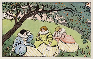
Background imageMaps Collection: U (letter shown by two women in clothes)

U (letter shown by two women in clothes)
6523523 U (letter shown by two women in clothes) by Appel, Francois Antoine (1821-1882); Private Collection; (add.info.: in " Alphabet Figure Call. G. Lecocq, publisher, Amiens (Somme), s. d

Background imageMaps Collection: S (letter shown by a crocodile terrace by savages)

S (letter shown by a crocodile terrace by savages)
6523521s (letter shown by a crocodile terrace by savages) by Appel, Francois Antoine (1821-1882); Private Collection; (add.info.: in " Alphabet Figure Call. G)

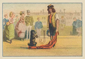
Background imageMaps Collection: J (letter shown by a saltimbank and his learned dog)

J (letter shown by a saltimbank and his learned dog)
6523512 J (letter shown by a saltimbank and his learned dog) by Appel, Francois Antoine (1821-1882); Private Collection; (add.info.: in " Alphabet Figure Call. G)

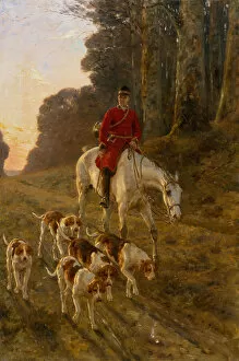
Background imageMaps Collection: A Huntsman with his Hounds (oil on canvas)

A Huntsman with his Hounds (oil on canvas)
7064102 A Huntsman with his Hounds (oil on canvas) by Tavernier, Paul (1852-1943); Private Collection

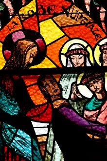
Background imageMaps Collection: Parable of the wedding dress. Annecy. France

Parable of the wedding dress. Annecy. France
7136494 Parable of the wedding dress. Annecy. France. by Bellot, Dom Paul (1876-1944); © Pascal Deloche/Godong

Background imageMaps Collection: Illustration for Madame Bovary by Gustave Flaubert (litho)

Illustration for Madame Bovary by Gustave Flaubert (litho)
7144861 Illustration for Madame Bovary by Gustave Flaubert (litho) by Austen, John (1886-1948); Private Collection; (add.info.: Illustration for Madame Bovary, A Story of Provincial Life)

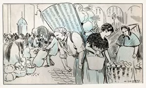
Background imageMaps Collection: Food market in Paris, ca 1930

Food market in Paris, ca 1930
7143784 Food market in Paris, ca 1930 by Delierre, Auguste (1829-1891); Private Collection; (add.info.: Food and Beverage. A market in Paris. Illustration by A)

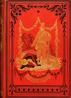
Background imageMaps Collection: Friday bows down at the feet of Robinson Crusoe, 1842 (illustration)

Friday bows down at the feet of Robinson Crusoe, 1842 (illustration)
7211521 Friday bows down at the feet of Robinson Crusoe, 1842 (illustration) by Souze, Auguste (b.1829 - fl.1860s); (add.info.: Cover of a volume of the adventures of Robinson Crusoe)

Background imageMaps Collection: Portrait of a student of the Ecole Polytechnique, early twentieth century (b / w photo)

Portrait of a student of the Ecole Polytechnique, early twentieth century (b / w photo)
7211483 Portrait of a student of the Ecole Polytechnique, early twentieth century (b/w photo) by Gerschel, Charles (1871-1948); (add.info)

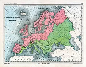
Background imageMaps Collection: Map of Physical Europe, 1867 (print)

Map of Physical Europe, 1867 (print)
7211492 Map of Physical Europe, 1867 (print) by Vuillemin, Alexandre (1812-1886); (add.info.: Map of Physical Europe drawn up under the direction of E. Cortambert in 1867 and drawn by A)

Background imageMaps Collection: Map of Italy in 1836

Map of Italy in 1836
6339873 Map of Italy in 1836 by Borghi, Bartolomeo (fl.c.1836); (add.info.: Map of Italy in 1836. Showing the kingdoms of Sardinia, Lombardy, Venice, Rome, Tuscany, Parma, Naples and Corsica)

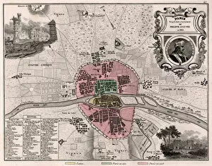
Background imageMaps Collection: The city of Paris as it was in the future of Philippe Auguste in 1180. - France and its Colonies

The city of Paris as it was in the future of Philippe Auguste in 1180. - France and its Colonies
XEE4144408 The city of Paris as it was in the future of Philippe Auguste in 1180. - France and its Colonies. Atlas illustrates one hundred and five maps from the maps of the depot of war

Background imageMaps Collection: Africa Francaise, Senegal - France and its Colonies. Atlas illustrates one hundred

Africa Francaise, Senegal - France and its Colonies. Atlas illustrates one hundred
XEE4144393 Africa Francaise, Senegal - France and its Colonies. Atlas illustrates one hundred and five maps from the maps of the depot of war, bridges and footwear and the Navy by M. VUILLEMIN. 1876

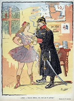
Background imageMaps Collection: A kiel - A German officer in uniform, with helmet pointed on his head, personification of Germany

A kiel - A German officer in uniform, with helmet pointed on his head, personification of Germany
XEE4156781 A kiel - A German officer in uniform, with helmet pointed on his head, personification of Germany, courts and kisses Marianne, the personification of France, wearing a dance dress

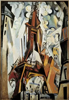
Background imageMaps Collection: The Eiffel Tower Painting by Robert Delaunay (1885-1941) 1910

The Eiffel Tower Painting by Robert Delaunay (1885-1941) 1910
JLJ4569149 The Eiffel Tower Painting by Robert Delaunay (1885-1941) 1910. by Delaunay, Robert (1885-1941); Musee des Beaux-Arts, Tours

Background imageMaps Collection: L Assiette au Beurre, number 183, Satirical in Colors, 1904_10_8

L Assiette au Beurre, number 183, Satirical in Colors, 1904_10_8
ICA4892969 L Assiette au Beurre, number 183, Satirical in Colors, 1904_10_8 by Camara, Leal de (1877-1948); (add.info.: Europe, China, Geographic Maps)

Background imageMaps Collection: Cover of Les Hommes d aujourd hui, number 279, , illustration by Emile Courtet dit Cohl (1857-1938)

Cover of Les Hommes d aujourd hui, number 279, , illustration by Emile Courtet dit Cohl (1857-1938): Armee
ICA4842037 Cover of Les Hommes d aujourd hui, number 279, , illustration by Emile Courtet dit Cohl (1857-1938): Armee, Lille - Billot Jean-Baptiste (Jean Baptiste) (1828-1907) by Cohl (Emile Courtet)

Background imageMaps Collection: Simultaneous Windows on the City, 1912 (oil on canvas)

Simultaneous Windows on the City, 1912 (oil on canvas)
XKH463057 Simultaneous Windows on the City, 1912 (oil on canvas) by Delaunay, Robert (1885-1941); Hamburger Kunsthalle, Hamburg, Germany; French, out of copyright

Background imageMaps Collection: 17th century map of France with decoupage of different regions

17th century map of France with decoupage of different regions. Table ebene Napoleon III supporting a mosaic top of
JLJ4563917 17th century map of France with decoupage of different regions. Table ebene Napoleon III supporting a mosaic top of hard stones, marble and albatre representing France around 1684

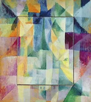
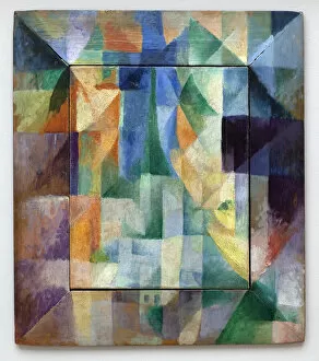
Background imageMaps Collection: A window or design for three windows. Painting by Robert Delaunay (1885-1941), 1912, 1. 11 x 0

A window or design for three windows. Painting by Robert Delaunay (1885-1941), 1912, 1. 11 x 0. 9 m. Oil on canvas
JLJ4576189 A window or design for three windows. Painting by Robert Delaunay (1885-1941), 1912, 1.11 x 0.9 m. Oil on canvas. Paris, musee national d art moderne - A window or study for three windows

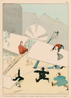
Background imageMaps Collection: It is scarcely probable that this new mode of travelling will replace taxi-cabs in the streets of

It is scarcely probable that this new mode of travelling will replace taxi-cabs in the streets of the capital
7181024 It is scarcely probable that this new mode of travelling will replace taxi-cabs in the streets of the capital (colour litho) by Echau

Background imageMaps Collection: Chansons de France: La danse des gorets (colour litho)

Chansons de France: La danse des gorets (colour litho)
7183319 Chansons de France: La danse des gorets (colour litho) by Renault, Emile Auguste (1870-1938); Private Collection; (add.info.: La danse des gorets)

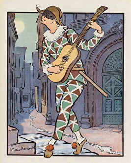
Background imageMaps Collection: Chansons de France: Au clair de la lune (colour litho)

Chansons de France: Au clair de la lune (colour litho)
7183318 Chansons de France: Au clair de la lune (colour litho) by Renault, Emile Auguste (1870-1938); Private Collection; (add.info.: Au clair de la lune)

Background imageMaps Collection: Chansons de France: Derriere chez mon pere (colour litho)

Chansons de France: Derriere chez mon pere (colour litho)
7183316 Chansons de France: Derriere chez mon pere (colour litho) by Renault, Emile Auguste (1870-1938); Private Collection; (add.info.: Derriere chez mon pere)

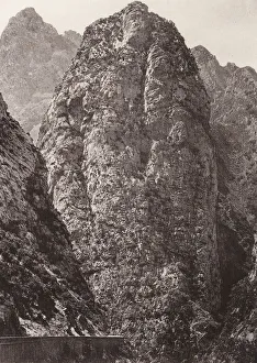
Background imageMaps Collection: Chabet el Akhra Gorges, Algeria (b / w photo)

Chabet el Akhra Gorges, Algeria (b / w photo)
7202074 Chabet el Akhra Gorges, Algeria (b/w photo) by Geiser, Jean (1848-1923); Private Collection; (add.info.: Chabet el Akhra Gorges, Algeria)

Background imageMaps Collection: Jean le Bon, ALPHABET OF THE HISTORY OF FRANCE, circa 1830 (engraving)

Jean le Bon, ALPHABET OF THE HISTORY OF FRANCE, circa 1830 (engraving)
7206868 Jean le Bon, ALPHABET OF THE HISTORY OF FRANCE, circa 1830 (engraving) by Hocquart, Edouard (1789-1870); 34, 5x53 cm; Private Collection; (add.info.: J)

Background imageMaps Collection: Henri IV, ALPHABET OF THE HISTORY OF FRANCE, circa 1830 (engraving)

Henri IV, ALPHABET OF THE HISTORY OF FRANCE, circa 1830 (engraving)
7206866 Henri IV, ALPHABET OF THE HISTORY OF FRANCE, circa 1830 (engraving) by Hocquart, Edouard (1789-1870); 34, 5x53 cm; Private Collection; (add.info.: H: Henry IV (1553-1610) 62nd king 1580

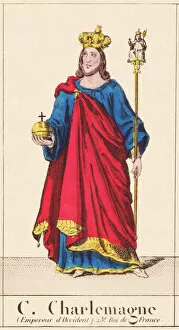
Background imageMaps Collection: Charlemagne, ALPHABET OF THE HISTORY OF FRANCE, circa 1830 (engraving)

Charlemagne, ALPHABET OF THE HISTORY OF FRANCE, circa 1830 (engraving)
7206861 Charlemagne, ALPHABET OF THE HISTORY OF FRANCE, circa 1830 (engraving) by Hocquart, Edouard (1789-1870); 34, 5x53 cm; Private Collection; (add.info.: C)

Background imageMaps Collection: ABC OF BABAR (cover), 1939 (illustration)

ABC OF BABAR (cover), 1939 (illustration)
7206789 ABC OF BABAR (cover), 1939 (illustration) by Brunhoff, Jean de (1899-1937); 22x16, 5 cm; Private Collection; (add.info.: Blanket, ABC DE BABAR - Lid); Photo © Duvallon

Background imageMaps Collection: ABC OF BABAR B, 1939 (illustration)

ABC OF BABAR B, 1939 (illustration)
7206787 ABC OF BABAR B, 1939 (illustration) by Brunhoff, Jean de (1899-1937); 22x16, 5 cm; Private Collection; (add.info.: B: 38 words to find: bath, bathtub, brush, boat, nanny, earrings, brooch)

Background imageMaps Collection: ALPHABET B. RABIER T, 1932 (illustration)

ALPHABET B. RABIER T, 1932 (illustration)
7206855 ALPHABET B. RABIER T, 1932 (illustration) by Rabier, Benjamin (1869-1939); 30, 5x23 cm; Private Collection; (add.info.: T: teapot, drum, turtle, table, roof, spinning top, tower, thermometer)

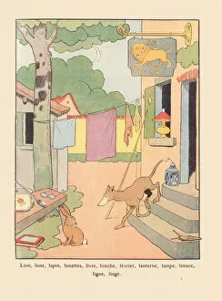
Background imageMaps Collection: ALPHABET B. RABIER L, 1932 (illustration)

ALPHABET B. RABIER L, 1932 (illustration)
7206846 ALPHABET B. RABIER L, 1932 (illustration) by Rabier, Benjamin (1869-1939); 30, 5x23 cm; Private Collection; (add.info.: L: lion, moon, rabbit, glasses, book, ladle, greyhound, lantern, lamp)

Background imageMaps Collection: ALPHABET B. RABIER I J K, 1932 (illustration)

ALPHABET B. RABIER I J K, 1932 (illustration)
7206845 ALPHABET B. RABIER I J K, 1932 (illustration) by Rabier, Benjamin (1869-1939); 30, 5x23 cm; Private Collection; (add.info.: I J K: ibis, jaguar, milestone, binoculars, bowls, kakatoes, kiosk)

Background imageMaps Collection: ALPHABET B. RABIER (frontispiece), 1932 (illustration)

ALPHABET B. RABIER (frontispiece), 1932 (illustration)
7206842 ALPHABET B. RABIER (frontispiece), 1932 (illustration) by Rabier, Benjamin (1869-1939); 30, 5x23 cm; Private Collection; (add.info.: Frontispiece, ALPHABET B)

Background imageMaps Collection: ABC of Babar IJ, 1939 (illustration)

ABC of Babar IJ, 1939 (illustration)
7206795 ABC of Babar IJ, 1939 (illustration) by Brunhoff, Jean de (1899-1937); 22x16, 5 cm; Private Collection; (add.info.: I: 6 words to find: yews, indians, iris, invalid, island)

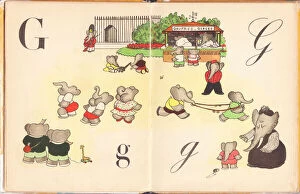
Background imageMaps Collection: ABC OF BABAR G, 1939 (illustration)

ABC OF BABAR G, 1939 (illustration)
7206793 ABC OF BABAR G, 1939 (illustration) by Brunhoff, Jean de (1899-1937); 22x16, 5 cm; Private Collection; (add.info.: G: 21 words to find: pomegranate, gaiters, grid, daisy, grass, geraniums)

Background imageMaps Collection: The greatest speakers of 1911 (litho)

The greatest speakers of 1911 (litho)
7201327 The greatest speakers of 1911 (litho) by Trier, Walter (1890-1951); Private Collection; (add.info.: The greatest speakers of 1911)

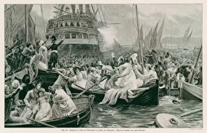
Background imageMaps Collection: Napoleon arriving in Plymouth harbour on board HMS Bellerophon, 1815 (litho)

Napoleon arriving in Plymouth harbour on board HMS Bellerophon, 1815 (litho)
7172607 Napoleon arriving in Plymouth harbour on board HMS Bellerophon, 1815 (litho) by Girardet, Jules (1856-1938); Private Collection; (add.info)

Background imageMaps Collection: Map of Acadia (Canada) c. 1760 (engraving)

Map of Acadia (Canada) c. 1760 (engraving)
1721743 Map of Acadia (Canada) c. 1760 (engraving) by French School, (19th century); (add.info.: Map of Acadia (Canada) c. 1760, engraving)

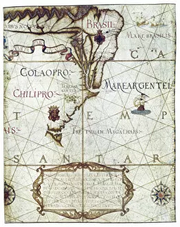
Background imageMaps Collection: Map of South America, in Universa ac Navigabilis Totius Terrarum Orbis Descriptio 1559

Map of South America, in Universa ac Navigabilis Totius Terrarum Orbis Descriptio 1559 (colour manuscript)
AIS5334419 Map of South America, in Universa ac Navigabilis Totius Terrarum Orbis Descriptio 1559 (colour manuscript) by Homem, Andre (16th century); Bibliotheque Nationale, Paris

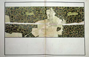
Background imageMaps Collection: Map of the Orleans Forest. Realised by Daniel Trudaine (1703-1769), 1750 Paris, archives nationales

Map of the Orleans Forest. Realised by Daniel Trudaine (1703-1769), 1750 Paris, archives nationales
JLJ4682922 Map of the Orleans Forest. Realised by Daniel Trudaine (1703-1769), 1750 Paris, archives nationales by Trudaine, Daniel (1703-1769); Centre Historique des Archives Nationales, Paris

Background imageMaps Collection: Simultaneous windows on the city. Part 1, second pattern, first replica

Simultaneous windows on the city. Part 1, second pattern, first replica. Painting by Robert Delaunay (1885-1941)
LSE4315438 Simultaneous windows on the city. Part 1, second pattern, first replica. Painting by Robert Delaunay (1885-1941), Oil On Canvas, 1912. Art francais 20th century

Background imageMaps Collection: The party in the country. Painting by Robert Delaunay (1885-1941), Oil On Canvas, 1905

The party in the country. Painting by Robert Delaunay (1885-1941), Oil On Canvas, 1905. Musee des Beaux Arts de Rennes
LSE4313010 The party in the country. Painting by Robert Delaunay (1885-1941), Oil On Canvas, 1905. Musee des Beaux Arts de Rennes

Background imageMaps Collection: Fountain of the Girondins

Fountain of the Girondins
7128406 Fountain of the Girondins by Dumilatre, Alphonse Achille (1844-1928) & Rich, Victor (1847-1932); (add.info.: Monumental fountain of the Monument to the Girondins)


All Professionally Made to Order for Quick Shipping


-

Maps Collection

Maps of France Europe are essential tools for travelers and tourists who want to explore the continent. They provide an overview of the country, its major cities, and its attractions and are show roads, rivers, mountains, lakes, and other natural features that make up the landscape. Additionally, they often include information about local customs and culture as well as points of interest such as museums or monuments, and are be found in bookstores or online in various formats including paper maps or digital versions that can be accessed on mobile devices. With a map of France Europe in hand travelers will have no trouble navigating their way around this beautiful country.
+

Our beautiful Wall Art and Photo Gifts include Framed Prints, Photo Prints, Poster Prints, Canvas Prints, Jigsaw Puzzles, Metal Prints and so much more

The Maps of France Europe collection is a stunning assortment of wall art and framed prints that showcase the beauty and diversity of France. Our collection features an extensive range of maps, including antique maps dating back to the 16th century, as well as modern-day maps highlighting the country's cities, regions, and landmarks. Each print in our collection has been carefully curated by Media Storehouse to provide customers with a unique glimpse into French history and culture. From detailed depictions of Parisian streets to panoramic views of the Alps, these prints are sure to captivate anyone who loves France or European geography. Whether you're looking for a beautiful piece of artwork for your home or office or want to give someone special a thoughtful gift, Maps of France Europe offers something for everyone. With its high-quality printing techniques and durable framing options, our collection is sure to impress even the most discerning art enthusiasts.
+

What are Maps of France Europe art prints?

Maps of France Europe art prints are high-quality reproductions of vintage and contemporary maps showcasing the geography, topography, and landmarks of France and its neighboring European countries. These prints are perfect for those who love history, travel, or simply appreciate the beauty of cartography. The collection includes a wide range of styles, from antique maps dating back to the 16th century to modern designs featuring vibrant colors and intricate details. Some prints focus on specific regions or cities within France or Europe while others provide an overview of the entire continent. These art prints can be used to decorate any room in your home or office, adding a touch of sophistication and elegance to your space. They also make great gifts for anyone with an interest in geography or history. Whether you're looking for a unique piece to add to your personal collection or want to give someone special a thoughtful gift they'll treasure forever, Maps of France Europe art prints from Media Storehouse are sure to impress.
+

What Maps of France Europe art prints can I buy from Media Storehouse?

We offer a wide range of Maps of France Europe art prints that are perfect for those who love to travel or have an interest in geography. These maps come in various styles and designs, including vintage, antique, and modern versions. You can choose from different sizes and formats such as canvas prints, framed prints, posters or photographic prints. Some popular options include the Antique Map of France by John Speed which dates back to 1626; the Vintage Map of Paris which showcases the city's famous landmarks; and the Modern Map of Europe which highlights all major cities across the continent. Whether you're looking for a decorative piece for your home or office space or want to gift it to someone who loves history or geography- Media Storehouse has got you covered with their vast collection of Maps of France Europe art prints.
+

How do I buy Maps of France Europe art prints?

To buy Maps of France Europe art prints from Media Storehouse, you can browse through our extensive collection of maps and select the ones that interest you. Once you have made your selection, add them to your cart and proceed to checkout. You will be prompted to enter your shipping and payment information before completing the purchase. We offer a variety of sizes for their art prints, so make sure to choose the one that best fits your needs. The maps are printed on high-quality paper using state-of-the-art printing technology, ensuring that they look great in any setting. If you have any questions or concerns about purchasing Maps of France Europe art prints from Media Storehouse, our customer service team is available to assist you. They can provide additional information about the products or help with any issues that may arise during the ordering process.
+

How much do Maps of France Europe art prints cost?

We offer a wide range of Maps of France Europe art prints at varying prices. The cost of these prints depends on several factors such as the size, quality, and type of print you choose. Our standard paper prints are more affordable than our premium canvas or framed options. Additionally, some maps may be more intricate and detailed than others which can also impact the price. We strive to provide high-quality products at reasonable prices for all customers. Our Maps of France Europe art prints make great additions to any home or office decor and are perfect for history buffs or those who love travel. With a variety of sizes and styles available, there is something for everyone's taste and budget. We encourage customers to browse our selection online to find the perfect map print that fits their needs and preferences without breaking the bank.
+

How will my Maps of France Europe art prints be delivered to me?

We take great care in delivering your Maps of France Europe art prints to you. We use high-quality packaging materials to ensure that your artwork arrives in pristine condition. Your print will be carefully rolled and placed inside a sturdy tube for protection during transit. We work with trusted shipping partners who offer reliable delivery services. Once your order has been dispatched, you will receive an email notification with tracking information so that you can monitor the progress of your shipment. Our team is dedicated to providing excellent customer service, and we are always available to answer any questions or concerns you may have about the delivery process. If there are any issues with your order upon arrival, please contact us immediately so that we can resolve them as quickly as possible. You can trust Media Storehouse to deliver your Maps of France Europe art prints safely and efficiently straight to your doorstep.